|
The following tables list post offices in the occupied territories administered by the PNA from 1994 and the regular and special datestamps used. So far less attention could be afforded to special handstamps and dated and undated cachets. These listings should be taken as preliminirary and not comprehensive; new material is added constantly. You can see the latest additions here.
As there is no authoritative transliteration scheme for Arabic script, pretty much any source (official, unofficial, websites, maps) I have consulted gives differing spellings for Palestinian place names, therefore I note variants wherever feasable. You can enlarge the postmark images by clicking on them. These images are in the most at 600dpi quality, though some early scans were made with 300dpi only. The measurements (diameter) are to the nearest 1/10 or 1/4 of a millimeter and measure the inner boundaries. Where an opening date (prior to 1994) is given it refers to offices without any long gap in service since then. Most of that particular information is based on the official list of post offices issued by the Ministry of Telecom & Information Technology. Some opening dates on the MTIT list refer only to offices (not agencies) and some data is not in line with other sources (eg. Wallach). In some instances I have made necessary corrections. Information on Ottoman, Mandate, Jordan/Egyptian, and Israeli military occupation post offices are taken from aricles in philatlic journals on these topics, and further publications. This data is not yet complete and further study is needed.
| |||||
The Schubert-Zywietz ClassificationThomas Schubert, upon studying hundreds of covers, has developed a systematic classification of PNA datestamps. I have slightly amended Thomas' system and we now propose the following scheme. The scans bewlow are from my and Thomas' collection, complemented by contributions from Paul Phillips, Jan R. Blok, and others. Further images were obtained from the MTIT website (denoted by green borders, sometimes apparently not to scale) and websites like Ebay.
The classification ist still under active consideration. Changes may be made where necessary. | |||||


Post Offices and Postmarks
 |
Name مكان Alternative names and spellings |
Population Governorate Opening Date PO Number PO Code Postcode | |||||||||
| Geographical Coordinates OpenStreetMap Google Maps Wikipedia |
Short description of the place with population data from the last and previous censuses, surrounding other post offices, and information on postal facilities under Ottoman, British, Jordanian or Egyptian rule, and Israeli military occupation. Where possible the location of the current office is noted as well. | ||||||||||
| |||||||||||
 Abssan © OpenStreetMap contributors, CC-BY-SA") | Abssan عبسان Abasan Alkabira, Abssan Elkabira, 'Abasan al Kabira, Absan Al-Kabeer, Abasan al-Kabera | Pop.: 19,037 Govern.: Kha Opened: 1.07.1995 Postcode: 940 | |||||||||
| 31�19' N, 34�20' E OpenStreetMap Google Maps Wikipedia | Town in the Khan Yunis governorate with a population of 19,037 (2006 mid-year estimates). The office serves also 'Abasan al-Jadida ('Abasan al-Saghir) with 5,600 inhabitants and neighbouring villages. Nearest other offices are Bani Suheula to the NW and Khuzaa to the SE. A post office (Abassan Camp) under control of the Israeli military occupation forces existed from 10.09.1973. | ||||||||||
| |||||||||||
 abssan1_020214")
") ") | |||||||||||
 Abu Dis © OpenStreetMap contributors, CC-BY-SA") | Abu Dis أبو ديس Abu Deis, Abu Dies | Pop.: 10,782 Govern.: Jer Opened: 13.11.2014 PO Number: 109 Postcode: 144 | |||||||||
| 31�45' N, 35�16' E OpenStreetMap Google Maps Wikipedia | City in Jerusalem governorate with 10,782 inhabitants (Census 2007) directly E of the Palestinian capital Jerusalem. It serves the al-Aizariya, as-Sawahira ash-Sharqiya and ash-Sheikh Sa'd areas with over 60,000 people. It replaces the PO al-Aizariya just to the N which closed on 26.08.2014. Duties were unofficialy performed from 27.08.2014 at Abu Dis. The official opening on 13.11.2014 was attended by minister Dr. Allam Moussa, the Prime Minister Rami Hamdallah, as well as postal and local officials. The post office is in the new adminsitrative centre (Interior Department). | ||||||||||
| |||||||||||
| |||||||||||
 abudiesP1_141228_0475")
 abudiesP2_141118_0476")
") ") | |||||||||||
 Abwein © OpenStreetMap contributors, CC-BY-SA") | Abwein عبوين Ebwin, 'Abwein (Bani Zeid ash Sharqiya), Abewin | Pop.: 3,119 Govern.: Ram Opened: 18.06.1997 PO Number: 210 Postcode: 668 | |||||||||
| 32�01' N, 35�11' E OpenStreetMap Google Maps Wikipedia | Agricultural village in the Ramallah & al-Bireh governorate, 14 km N of Ramallah, with a population of 3,119 (Census 2007). Jordanian authorities operated a postal agency between 13.01.1966 and 4.06.1967. Nearest other offices are Bani Zeid ash Sharqiya to the W, Sinjil to the E and Bir Zeit to the S. The PNA post office is situated near the local health centre. | ||||||||||
| |||||||||||
| |||||||||||
| |||||||||||
 abwein1_020107")
 abwein1_110628_0175")
 abwein210_110920_0352")
 Al Aizariya © OpenStreetMap contributors, CC-BY-SA") | Al Aizariya العيزرية Al Aizaria, El-Eizariya, Al 'Eizariya, Al-Ezariyah | Pop.: 17,606 Govern.: Jer Opened: 15.04.1992 PO Number: 102 Postcode: 140 | |||||||||
| 31�46' N, 35�16' E OpenStreetMap Google Maps Wikipedia | The second largest city in Jerusalem governorate with 17,606 inhabitants (Census 2007) just NE of Abu Dis, regarded as the biblical site Bethany. It was situated on Kupsa Square. Nearest other offices are Anata to the N and al-'Ubeidiya to the S. Jordanian authorities operated a postal agency between 6.08.1962 and 28.05.1967. Amn additional postal agency in the West of the city was opened in February 2012. The PO closed on 26.08.2014 with duties transferred to the new Abu Dis PO. | ||||||||||
| |||||||||||
| |||||||||||
 aizarya1_011230")
 aizarya102_110704_0336")
 1")  2") | |||||||||||
 Al Aizariya, Nazareen © OpenStreetMap contributors, CC-BY-SA") | Al Aizariya, Nazareen العيزرية Al Aizaria, El-Eizariya, Al 'Eizariya, Al-Ezariyah | Pop.: 17,606 Govern.: Jer Opened: 8.02.2012 PO Number: 107 Postcode: 140 | |||||||||
| 31�46' N, 35�15' E OpenStreetMap Google Maps Wikipedia | The second largest city in Jerusalem governorate with 17,606 inhabitants (Census 2007) just NE of Abu Dis, regarded as the biblical site Bethany. Nearest other offices are Aizariyah PO, Anata to the N and al-'Ubeidiya to the S. The creation of this Postal Agency, situated on Jericho Street in the Nazareen neighbourhood was announced in November 2011. The official opening on 8.02.2012 was attended by the minister Abu Daqqa, the Governor of Jerusalem al-Husseini, and other postal and local officials. The postmaster is Mohammed Suleiman Abu Zayyad. | ||||||||||
| |||||||||||
 aizariyaNazareen_20120208_0374")
 Ajja © OpenStreetMap contributors, CC-BY-SA") | Ajja عجة Ejja, Ageh | Pop.: 5,055 Govern.: Jen Opened: 11.10.2003 PO Number: 711 Postcode: 278 | |||||||||
| 32�22' N, 35�12' E OpenStreetMap Google Maps Wikipedia | Agricultural village in the Jenin governorate, 19 km SW of the capital, with a population of 5,055 (Census 2007; 1945: 890, 1982:1,300). Nearest other offices are Kafr Rai to the W, Arraba to the N, Seilet el-Thaher to the S, and Meithalun to the E. Jordanian authorities operated a postal agency from 15.07.1963. | ||||||||||
| |||||||||||
| |||||||||||
 ajja_040511")
 ajja1_980504")
| Al Amel – حى الامل - مخيم خان يونس | Khan Yunes, al-Amel (120) | |
 Anabta © OpenStreetMap contributors, CC-BY-SA") | Anabta عنبتا Anabta | Pop.: 7,329 Govern.: Tul Opened: 1.01.1955 PO Number: 803 Postcode: 320 | |||||||||
| 32�18' N, 35�07' E OpenStreetMap Google Maps Wikipedia | Agricultural town in Tulkarm Governorate, just S of Bala'a, and 20km E of Tulkarm itself. Population 7,329 (Census 2007, 1997: 5,435). Jordanian authorities operated a post office (upgrade from a postal agency on 26.03.1965) from 1.1.1955. A post office under control of the Israeli military occupation forces existed from 29.08.1967. | ||||||||||
| |||||||||||
| |||||||||||
| |||||||||||
| |||||||||||
| |||||||||||
 anabta_981022")
 anabta1_150316_0322")
 anabta1_051220")
 anabta1_070305")
 anabta803_120927_0404")
 Anata © OpenStreetMap contributors, CC-BY-SA") | Anata عناتا 'Anata | Pop.: 12,049 Govern.: Jer Opened: 2009 Postcode: 130 | |||||||||
| 31�49' N, 35�16' E OpenStreetMap Google Maps Wikipedia | Town in the J2 area of Jerusalem Governorate, SE to Beit Hanina and just E to the Shuafat refugee camp. Between the 1997 and 2007 census, its population grew from 7,112 to 12,049. Jordanian authorities operated a postal agency between 6.10.1960 and 5.06.1967. The PNA office was supposedly operned in 2009, but no evidence it ever operated has appeared so far. The nearest PNA office is al-Aizariya. | ||||||||||
| |||||||||||
 x")
 Arraba © OpenStreetMap contributors, CC-BY-SA") | Arraba عرّابة Arraba, Arrabah, Arrabeh | Pop.: 9,920 Govern.: Jen Opened: 1972 PO Number: 705 Postcode: 260 | |||||||||
| 32�24' N, 35�12' E OpenStreetMap Google Maps Wikipedia | Agricultural town, 13km SW of the Governorate capital Jenin, with a population of 9,920 (Census 2007, 1945: 3,810, 1997: 7,453). Within a few kilometres the town is surrounded by (clockwise): Yaabad, Al Kafreyat, Bruqin, Qabatya, Ajja , and Kafr Rai. Jordanian authorities operated a post office (upgraded from a postal agency on 24.10.1966) from 19.12.1959. A post office under control of the Israeli military occupation forces existed from 17.04.1968. | ||||||||||
| |||||||||||
| |||||||||||
| |||||||||||
| |||||||||||
| |||||||||||
 arraba_991024")
 arraba1_050327")
 arraba1_100104")
 arraba1_110711_0338")
 arraba705_140326_0446")
 Asira ash-Shamaliya © OpenStreetMap contributors, CC-BY-SA") | Asira ash-Shamaliya عصيرة الشمالية Asira Ashamaliya, 'Asira ash Shamaliya | Pop.: 7,556 Govern.: Nab Opened: 2005 PO Number: 308 PO Code: ASS Postcode: 430 | |||||||||
| 32�15' N, 35�16' E OpenStreetMap Google Maps Wikipedia | Small town just 6 km N of Nablus with 7,556 inhabitants (Census 2007, 1997: 5,794). Jordanian authorities operated a postal agency from 26.01.1963. | ||||||||||
| |||||||||||
| |||||||||||
| |||||||||||
 asiraashamaliyaPO_050726")
 asiraashamaliyaPO_141112_0481")
 asiraashamaliya803_110710_0330")
 Attil © OpenStreetMap contributors, CC-BY-SA") | Attil عتيل Atil | Pop.: 9,038 Govern.: Tul Opened: 1956 PO Number: 805 Postcode: 310 | |||||||||
| 32�22' N, 35�04' E OpenStreetMap Google Maps Wikipedia | Town about 12 km NE of the Governorate captital Tulkarm, with Baqa esh Sharqiyah to the N, Illar to the E, and Deir al Gusun to the S. The municiplatiy's population grew from 7,760 in 1997 to 3,038 in the 2007 Census. Jordanian authorities operated a post office (upgraded from a postal agency on 1.10.1965) from 3.6.1963. A post office under control of the Israeli military occupation forces existed from 29.08.1967. The current office is next to town hall. | ||||||||||
| |||||||||||
| |||||||||||
| |||||||||||
| |||||||||||
 atil_020110")
 attil1_960317_0010")
 attil1_100112")
 attil805_120103_0325")
| Al Awda – العودة | Gaza, al-Awda (6) | |
 Azun © OpenStreetMap contributors, CC-BY-SA") | Azun عزون Azzon, Azzun | Pop.: 7,821 Govern.: Qal Opened: 1956 PO Number: 806 Postcode: 350 | |||||||||
| 32�11' N, 35�03' E OpenStreetMap Google Maps Wikipedia | Agricultural village 8 km E of Qalqilya with 7,821 residents (2007 Census, 1997: 5,867), the second largest municipaliry of Qalqilya Governorate. Nearest other PNA offices are Jayyus to the N and Kafr Thulth to the S. Jordanian authorities operated a post office (upgraded from a postal agency on 6.06.1966) from 1956(exact date?) . A post office under control of the Israeli military occupation forces existed from 5.09.1968. The PNA office is next to the Youth Center. | ||||||||||
| |||||||||||
| |||||||||||
| |||||||||||
| |||||||||||
 azun_970612")
 azun1_981022")
 azun1_150311_0425")
 azun806_110703_0323")
 Bala'a © OpenStreetMap contributors, CC-BY-SA") | Bala'a بلعا Balaa, Bal'a | Pop.: 6,604 Govern.: Tul Opened: 19.05.1998 PO Number: 810 Postcode: 322 | |||||||||
| 32�20' N, 35�07' E OpenStreetMap Google Maps Wikipedia | Agricultural town 8 km E of Tulkarm with Deir al Gusun to the NW and Anabta to the SE. Its population grew from 34,00 in 1967 and 5,453 in 1997 to 7,329 in the 2007 Census. Jordanian authorities operated a postal agency from 2.01.1963. The PNA office opened in 1998. | ||||||||||
| |||||||||||
| |||||||||||
| |||||||||||
| |||||||||||
| |||||||||||
 bala'a1_991027")
 bala'a1_980519")
 bala'a1_060116")
 bala'aP1_141112_0480")
 bala'aPO_020220")
") | |||||||||||
 Bani Naim © OpenStreetMap contributors, CC-BY-SA") | Bani Naim بني نعيم Bani Naem, Bani Na'im, Bani Na'eem | Pop.: 20,084 Govern.: Heb Opened: 15.03.2003 PO Number: 408 Postcode: 734 | |||||||||
| 31�31' N, 35�10' E OpenStreetMap Google Maps Wikipedia | Large town about 8km E of Hebron. Ppoluation: 4,271 1967), 13,535 (1997), 20,084 (2007 Census). Jordanian authorities operated a postal agency between 3.01.1963 and 27.05.1967. The post office is situated next to Amro town hall. | ||||||||||
| |||||||||||
| |||||||||||
| |||||||||||
| |||||||||||
 baninaim_050903")
 baninaim_120626_0375")
 baninaim1_990403")
 baninaim408_110829_0333")
 Bani Suheyla © OpenStreetMap contributors, CC-BY-SA") | Bani Suheyla بني سهيله Bani Sehaela, Bani Suheila, Bani Suhayleh, Bani Suhayla | Pop.: 32,773 Govern.: Kha Opened: 1982 Postcode: 940 | |||||||||
| 31�21' N, 34�20' E OpenStreetMap Google Maps Wikipedia | City about 2 km E of Khan Yunis towards Abssan with a population of 32,773 (2006 estimate, 1997 Census: 23,016). The post office is situated on Al-Awda street near the Hamza mosque. A post office under control of the Israeli military occupation forces existed from 8.02.1968. | ||||||||||
| |||||||||||
| |||||||||||
| |||||||||||
| |||||||||||
| |||||||||||
 banisuheyla_950101a")
 banisuheyla_020113")
 banisuheyla_120124_0366")
 banisuheyla_130226_0421")
 banisuheyla_131107_0460")
") | |||||||||||
 Bani Zaid © OpenStreetMap contributors, CC-BY-SA") | Bani Zaid بني زيد Babi Zaed, Bani Zeid, Bani Zeid al-Gharbiyeh (Beit Rima, Deir Ghassaneh), Bani Zeit Algarbiyah | Pop.: 5,515 Govern.: Ram Opened: 17.08.2002 PO Number: 213 Postcode: 677 | |||||||||
| 32�02' N, 35�06' E OpenStreetMap Google Maps Wikipedia | Town in Ramallah Governorate, 6 km SW of Salfit, created by the merger of villages Deir Ghassaneh and Beit Rima, widely known as Bani Zeid al-Gharbiyeh. The municipality's population rose from 3,626 in 1961 to 4,351 in 1997, and to 5,515 in the 2007 Census. Jordanian authorities operated a postal agency in Beit Rima between 19.10.1963 ans 23.01.1967 and in Deir Ghassaneh between 19.04.1963 and 1964 (?- 16 5.1964)##. The PNA post office is situated near the police station in Beit Rima, nearest other offices are (clockwise): Bruqin, Salfit, Bani Zeid ash Sharqiya, and Bir Zeit. | ||||||||||
| |||||||||||
| |||||||||||
 banizaid_050917")
 banizaid_100105")
") | |||||||||||
 Bani Zeid ash Sharqiya © OpenStreetMap contributors, CC-BY-SA") | Bani Zeid ash Sharqiya بني زيد الشرقية Bani Zeid al-Sharqiya ('Arura, Mazari al-Nubani), Bani Zaid Alsharqiyah, Bani Zeid al-Sharqia | Pop.: 5,083 Govern.: Ram Opened: 2009 PO Number: 215 Postcode: 660 | |||||||||
| 32�03' N, 35�10' E OpenStreetMap Google Maps Wikipedia | Town in Ramallah Governorate, 4 km S of Salfit and 20 km N of Ramallah. The municipality was created in 2005 by the merger of villages 'Arura and Mazari al-Nubani with a population of 5,083 (Census 2007, 1997: 3,863, 1945: 1,750). Jordanian authorities operated a postal agency in 'Arura between 13.01.1966 and 4.06.1967. The PNA office, is on Masqat Street, next to Masqat health centre in 'Arura; nearest other offices are Bani Zeid al-Gharbiyeh to the W, Abwein to the E, and Bir Zeit to the S. | ||||||||||
| |||||||||||
| |||||||||||
 banizeidalsharqia_110704_0293")
 banizeidalsharqia218_140115_0505")
 Baqa esh Sharqiyah © OpenStreetMap contributors, CC-BY-SA") | Baqa esh Sharqiyah باقة الشرقية Baga Shargeia, Baqa Asharqya, Baqa ash Sharqiyam, Baqyehshrqiyah | Pop.: 4,101 Govern.: Tul Opened: 13.09.1997 PO Number: 807 Postcode: 316 | |||||||||
| 32�25' N, 35�04' E OpenStreetMap Google Maps Wikipedia | Municipality 16 km N of Tulkarm, its sister village Baqa al-Gharbiyeh (since 1949 under Israeli administration) lies about 3 km to the W. Population: 4,101 (Census 2007, 1997: 3,054). Adjacent offices are in Illar & Attil to the S and SE, and Qafen to the N. Jordanian authorities operated a postal agency from 11.11.1965. | ||||||||||
| |||||||||||
| |||||||||||
| |||||||||||
 baqaeshsharqiyah1_990401")
 baqaeshsharqiyah1_051224")
 baqaeshsharqiyahP1_141110_0479")
")  2") | |||||||||||
") | |||||||||||
 Beit 'Awwa © OpenStreetMap contributors, CC-BY-SA") | Beit 'Awwa بيت عوّا Beit Awa, Beit Awwa | Pop.: 8,064 Govern.: Heb Opened: 2009? PO Number: 412 Postcode: 766 | |||||||||
| 31�30' N, 34�57' E OpenStreetMap Google Maps Wikipedia | Town in Hebron Governorate, about 13 km SW of Hebron and 7 km W of Dura, nearest offices are Idhna and the aforementioned Hebron and Dura. | ||||||||||
| |||||||||||
| |||||||||||
 beitawwa_141120_0376")
 beitawwa_110804_0309")
 Beit Hanun © OpenStreetMap contributors, CC-BY-SA") | Beit Hanun بيت حانون Beit Hanoun | Pop.: 32,187 Govern.: Gzn Opened: 1995 Postcode: 810 | |||||||||
| 31�32' N, 34�32' E OpenStreetMap Google Maps Wikipedia | City in the East of North Gaza Governorate, 5 km NE of Jabalya. There were 3,876 inhabitants in 1961, 20,780 in the 1997 Census, the 2006 midyear estimate is 32,187. Nearest other PNA post offices are in Jabalya Camp and Beit Lahia. A post office under control of the Israeli military occupation forces existed from 3.06.1973. The office moved to a newbuilt facility on 19.06.2011 (see MTIT) | ||||||||||
| |||||||||||
| |||||||||||
| |||||||||||
| |||||||||||
| |||||||||||
 beithanun_950101")
 beithanun_980212")
 beithanun_130206_0423")
 beithanun1_140330_0465")
 beithanun2_131107_0463")
") | |||||||||||
") ") | |||||||||||
 Beit Jala © OpenStreetMap contributors, CC-BY-SA") | Beit Jala بيت جالا Beit Jala | Pop.: 11,758 Govern.: Bet Opened: 1910 PO Number: 502 Postcode: 160 | |||||||||
| 31�43' N, 35�11' E OpenStreetMap Google Maps Wikipedia | Largely christian town just NW of Bethlehem, about 10 km S of Jerusalem, with some 12,000 inhabitants (1997 Census: 11,957, 2007 Census: 11,758. Nearest other office is Bethlehem. An Egyptian office worked between 24.12.1948 and (?)## .Jordanian authorities operated a post office between 1949(?) and 5.06.1967. A post office under control of the Israeli military occupation forces existed from 23.08.1967. The PNA post office is on Tujjar street. | ||||||||||
| |||||||||||
| |||||||||||
| |||||||||||
| |||||||||||
| |||||||||||
| |||||||||||
| |||||||||||
| |||||||||||
| |||||||||||
| |||||||||||
| |||||||||||
 beitjala_981013")
 beetjala_020115")
 beetjala_070305")
 beetjala_110703_0206")
 beetjalaPO_120626_0390")
 beetjalaPO_160223_0503")
 beitjala1_991219")
 beitjala_001109")
 beitjala_010711")
 beitjala1_080928")
 beitjala502_120927_0371")
 Beit Lahia © OpenStreetMap contributors, CC-BY-SA") | Beit Lahia بيت لاهيا Beit Lahya, Beit Lahiya | Pop.: 59,540 Govern.: Gzn Opened: - Postcode: 800 | |||||||||
| 31�33' N, 34�30' E OpenStreetMap Google Maps Wikipedia | City in North Gaza Governorate, about 3 km NE of Jabalya and next to Jabalya Camp. There were 38,441 inhabitants in the 1997 Census, the 2006 midyear estimate is 59,540. Nearest other PNA post offices are in Jabalya Camp and Beit Hanun. A post office under control of the Israeli military occupation forces existed from 3.06.1973. | ||||||||||
| |||||||||||
| |||||||||||
| |||||||||||
| |||||||||||
 beitlahia_950101")
 beitlahia_110609_0382")
 beitlahia_950607")
 beitlahia1_140330_0469")
 Beit Lid © OpenStreetMap contributors, CC-BY-SA") | Beit Lid بيت ليد Bied Lid | Pop.: 4,994 Govern.: Tul Opened: 2005 PO Number: 813 Postcode: 330 | |||||||||
| 32�15' N, 35�08' E OpenStreetMap Google Maps Wikipedia | Agricultural municipality in Tulkarm Governorate, about 10 km SE of Tulkarm, and 12 km NW of Nablus. Population: 4,994 (Census 2007, 1997: 4,410). The PNA office is situated near town hall. Nearest other office is Anabta to the N. Jordanian authorities operated a postal agency from 2.01.1963. | ||||||||||
| |||||||||||
| |||||||||||
 beitlid_050619")
 beitlid_120930_0399")
") ") | |||||||||||
 Beit Liqya © OpenStreetMap contributors, CC-BY-SA") | Beit Liqya بيت لقيا Beit Liqya, Beit liqya, Beit Ligya | Pop.: 7,710 Govern.: Ram Opened: 2005 PO Number: 214 Postcode: 690 | |||||||||
| 32�52' N, 35�04' E OpenStreetMap Google Maps Wikipedia | Town about 14 km W of Ramallah. Its population rose from 5,706 in the 1997 Census to 7,710 in the 2007 Census. Nearest offices are Beitunya and Biddu to the E. The Post Office is oppsite the municipality and Abu al-Kukh Mosque. Jordanian authorities operated a postal agency between 9.10.1965 and 5.06.1967. | ||||||||||
| |||||||||||
| |||||||||||
 beitliqyaPO_050813")
 beitliqyaP_141123_0482")
") | |||||||||||
") ") | |||||||||||
") | |||||||||||
 Beit Sahur © OpenStreetMap contributors, CC-BY-SA") | Beit Sahur بيت ساحور Beit Sahoor, Beit Sahour | Pop.: 12,367 Govern.: Bet Opened: 15.11.1951 PO Number: 503 Postcode: 180 | |||||||||
| 31�42' N, 35�13' E OpenStreetMap Google Maps Wikipedia | Christian city just E of Bethlehem with 12,367 residents (Census 2007, 1997: 11,250). Jordanian authorities operated a post office (upgraded from a postal agency on 15.01.1953) between 17.11.1951 and 5.06.1967. A post office under control of the Israeli military occupation forces existed from 23.08.1967. The PNA office is near the main mosque, on al-Nejma (Star) street, on the corner of al-Merkez and al-Jame' streets. | ||||||||||
| |||||||||||
| |||||||||||
| |||||||||||
| |||||||||||
| |||||||||||
 beitsahur_990403")
 beitsahur1_020127")
 beitsahur1_080928")
 beitsahur1_050811")
 beitsahur503_110630_0327")
") | |||||||||||
 Beit Ula © OpenStreetMap contributors, CC-BY-SA") | Beit Ula بيت أُولا Beit Ula | Pop.: 10,885 Govern.: Heb Opened: 2005 PO Number: 215 Postcode: 756 | |||||||||
| 31�36' N, 35�02' E OpenStreetMap Google Maps Wikipedia | Municipality 2 km N of Tarqumya and about 9 km NW of Hebron. Its population rose between the 1997 and 2007 Censuses from 6,809 to 10,885. The PNA office is on Sallam street (main street) next to Beit Ula Girls School. | ||||||||||
| |||||||||||
| |||||||||||
 beitula_051011")
 beitula415_110706_0337")
") | |||||||||||
") ") | |||||||||||
 Beit Ummar © OpenStreetMap contributors, CC-BY-SA") | Beit Ummar بيت أُمّر Beit Ommer, Bet Ommar | Pop.: 13,548 Govern.: Heb Opened: 1.06.1986 PO Number: 407 Postcode: 746 | |||||||||
| 31�37' N, 35�06' E OpenStreetMap Google Maps Wikipedia | Agricultural town, widely known for grapes and fruits, about 10 km N of Hebron, and some 4 km inbetween Sourief to the N and Halhul to the S. There were 13,548 inhabitants in the 2007 Census (1997: 9,079). Jordanian authorities operated a postal agency between 24.01.1960 and 4.06.1967. A post office under control of the Israeli military occupation forces existed from 19.07.1973. The current PNA office is in the Municipality buildung, just off the main road towards Sourief. | ||||||||||
| |||||||||||
| |||||||||||
| |||||||||||
 beitummar_990809")
 beitummar1_020211")
 beitummar1_070325")
 Beit Umrin © OpenStreetMap contributors, CC-BY-SA") | Beit Umrin بيت إمرين Beit Amraen, Beit Imrin, Bet Umrin | Pop.: 2,821 Govern.: Nab Opened: 17.11.1997 PO Number: 306 Postcode: 442 | |||||||||
| 32�18' N, 35�13' E OpenStreetMap Google Maps Wikipedia | Village 18km NW of Nablus with a pupulation of 2,821 (2007 Census, 1997: 2,149). Geographically nearest PNA offices are Burqa to the W and Asira ash-Shamaliya to the SE. The office serves several villages incl. Sabastiya, Naqura, Ijnisina, and Yasid. The PNA post office is on the first floor of the village coucil buildung. Jordanian authorities operated a postal agency from 21.12.1965. | ||||||||||
| |||||||||||
| |||||||||||
| |||||||||||
| |||||||||||
 beitumrinP_141221_0489")
 beitumrin1_971231")
 beitumrin1_050925")
 beitumrin306_110704_0328")
") | |||||||||||
 Beitunya © OpenStreetMap contributors, CC-BY-SA") | Beitunya بيتونيا Betonia, Beituniya, Beitunia | Pop.: 19,761 Govern.: Ram Opened: 14.04.1963 PO Number: 203 Postcode: 630 | |||||||||
| 31�53' N, 35�10' E OpenStreetMap Google Maps Wikipedia | City about 3 km W of Ramallah with 19,761 inhabitants (2007 Census, 1997: 9,371). Jordanian authorities operated a post office (upgraded fronm a postal agency on 11.09.1965) between 14.04.1963 and 5.06.1967. A post office under control of the Israeli military occupation forces existed from 17.04.1968. The PNA office is next to the police station off Eissa Aleraqi street, just to the S of city hall. | ||||||||||
| |||||||||||
| |||||||||||
| |||||||||||
 beitunya1_020204")
 beitunya1_100124")
 beitunya203_140331a_0445")
") | |||||||||||
 Ber Nabala © OpenStreetMap contributors, CC-BY-SA") | Ber Nabala بيرنبالا Beir Nbala, Bir Nabala, Beer Nabala | Pop.: 4,817 Govern.: Jer Opened: 22.09.2001 PO Number: 107 Postcode: 121 | |||||||||
| 31�51' N, 35�12' E OpenStreetMap Google Maps Wikipedia | Municipality in the J1 area of Jerusalem Governorate, right inbetween Biddu and al-Ram, just S of Qalandia. The village has 4,817 inhabitants according to the 2007 Census (1997: 4,499, 1987: 1,385, 1961: 580). Jordanian authorities operated a postal agency between 13.01.1966 and 1.06.1967. The current post office is in town hall (a post box is opposite, a new building is planned since 2008) and serves also the surrounding villages al-Jib, Judeira, Qalandia, and Beit Hanina. In March 2012 is was announced that the post office and its staff would transfer to the control of the municipal council and change status to a postal agency. The Postal Agency opened on 25.02.2013. As of 9.05.2013, the agency has temporarily been closed,. | ||||||||||
| |||||||||||
| |||||||||||
| |||||||||||
 bernabala_060129")
 bernabala107_110701_0329")
 bernabalaPA_130225_0418")
| |||||||||||||||
 Bethlehem © OpenStreetMap contributors, CC-BY-SA") | Bethlehem بيت لحم Beth Lehem, Beit Lahm | Pop.: 25,266 Govern.: Bet Opened: 1870 PO Number: 501 Postcode: 150 | |||||||||||||
| 31�42' N, 35�12' E OpenStreetMap Google Maps Wikipedia | Governorate capital with 25,266 inhabitants (Census 2007, 1997: 21,673) and a large Christian minority, dominated by tourism and trading. The post office is inbetween the municpal offices and Cairo-Amman Bank on the west side of Manger Square. The first post office in the city was opened by the Ottoaman authorities in 1870. An Egyptian office worked between 10.06.1948 and 11.10.1948. Jordanian authorities operated a post office (district main PO) between November 1948(exact date?) and 5.06.1967. A post office under control of the Israeli military occupation forces existed from 10.07.1967. | ||||||||||||||
| |||||||||||||||
| |||||||||||||||
| |||||||||||||||
| |||||||||||||||
| |||||||||||||||
| |||||||||||||||
| |||||||||||||||
| |||||||||||||||
| |||||||||||||||
| |||||||||||||||
| |||||||||||||||
| |||||||||||||||
| |||||||||||||||
| |||||||||||||||
| |||||||||||||||
| |||||||||||||||
| |||||||||||||||
| |||||||||||||||
| |||||||||||||||
| |||||||||||||||
| |||||||||||||||
| |||||||||||||||
 2006")
 2008")
 2008")
 April 2010")
 April 2010")
")
")
")
")

 bethlP_140323_0453")
 bethl1_960403")
 bethl1_010329")
 bethl1_070304")
 bethlPO1_100419")
 bethlPO1_120701_0391")
 bethl2_001214")
 bethl2_000926")
 bethlPO2_120415_0387")
 bethlPO2_121118_0408")
 bethlPO2_140323_0413")
 bethlPO2_150330_0498")
 bethl3_000326")
 bethl3_010415")
 bethl3_070304")
 bethlPO3_100111")
 bethl4_970224_0199")
 bethl4_010621")
 bethl4_060309")
 bethlPO4_120612_0389")
 bethlPO4_120930_0367")
 bethl501_110704_0335")
") ") | |||||||||||
 Biddu © OpenStreetMap contributors, CC-BY-SA") | Biddu بدّو Biddu | Pop.: 6,798 Govern.: Jer Opened: 22.06.2005 PO Number: 105 Postcode: 110 | |||||||||
| 31�50' N, 35�09' E OpenStreetMap Google Maps Wikipedia | Municipality in the J1 area of Jerusalem Governorate, W of Ber Nabala. Population figures: 1,444 (1961), 4,704 (1997), 6,798 (Census 2007). The office serves also Beit Duqqu, Beit 'Inan, Beit Surik, Qatanna, al-Qubeibah, Beit Ijaz, and al-Tira. Geographically nearest other PNA offices are Beitunya, Beit Liqya, and Ber Nabala. Jordanian authorities operated a postal agency between 27.06.1963 and (?)##. | ||||||||||
| |||||||||||
| |||||||||||
 BidduPO_120809_0191")
 BidduP_150913_0488")
") | |||||||||||
 Bidya © OpenStreetMap contributors, CC-BY-SA") | Bidya بديا Bedia, Biddya, Biddia | Pop.: 8,064 Govern.: Sal Opened: 27.05.1995 PO Number: 808 Postcode: 380 | |||||||||
| 32�07' N, 35�05' E OpenStreetMap Google Maps Wikipedia | The second largest city of Salfit Governorate with 8,064 (Census 2007, 1997: 6,058) residents; about 10 km NW of Salfit and 13 km SW of Nablus. Nearest other post offices are Bruqin to the S, Kafr Thulth and Azun to the N, Kufel Haris and Deir Istiya to the E. Jordanian authorities operated a postal agency from 16.10.1963. | ||||||||||
| |||||||||||
| |||||||||||
| |||||||||||
| |||||||||||
| |||||||||||
 bidya_080417")
 bidya_100120")
 bidyaP_160301_0502")
 bidya_981029")
 bidya808_110819_0506")
| |||||||||||
") ") | |||||||||||
") | |||||||||||
 Al Bireh © OpenStreetMap contributors, CC-BY-SA") | Al Bireh البيرة Al Biera, Al Bira, El Bira | Pop.: 38,202 Govern.: Ram Opened: 6.07.1952 PO Number: 202 Postcode: 610 | |||||||||
| 31�54' N, 35�13' E OpenStreetMap Google Maps Wikipedia | The largest city and capital of Ramallah & al-Bireh Governorate, just E of Ramallah itself, forming one contiguous conurbation. Population in Census 2007 was 38,202 (1997: 27,856, 1982: 13,037, 1945: ca. 3,000). The post office is in the "Palestine Post Building" (Directorate General of MTIT) on al-Muntazah street. An Ottoman office was first opened in 1910 . Jordanian authorities operated a post office (upgraded from a postal agency on 16.02.1956) between 6.07.1952 and 5.06.1967. A post office under control of the Israeli military occupation forces existed from 27.08.1967. | ||||||||||
| |||||||||||
| |||||||||||
| |||||||||||
| |||||||||||
| |||||||||||
| |||||||||||
| |||||||||||
| |||||||||||
 2009")
 2009")
 bireh_990818")
 bireh1_001217")
 bireh-1_050807")
 bireh1_001007")
 bireh-1_070224")
 bireh-2_100127")
 bireh202_140328a_0457")
 birehPO_PP_140325_0484")
| |||||||||||
") ") | |||||||||||
 Bir Zeit © OpenStreetMap contributors, CC-BY-SA") | Bir Zeit بيرزيت Beir Zate | Pop.: 4,529 Govern.: Ram Opened: 24.06.1957 PO Number: 204 Postcode: 627 | |||||||||
| 31�58' N, 35�12' E OpenStreetMap Google Maps Wikipedia | University town about 7 km N of Ramallah/al-Bireh with 4,529 residents (Census 2007, 1997: 4,659). About 8,000 students are inscribed at Bir Zeit University. Nearest other offices are (clockwise) both West & East Bani Zeid, Mazra aesh Sharqiya, Silwad, al-Bireh, and Ramallah. Jordanian authorities operated a post office (upgraded from a postal agency on 20.11.1962) between 26.08.1957 and 7.06.1967. A post office under control of the Israeli military occupation forces existed from 27.08.1967. | ||||||||||
| |||||||||||
| |||||||||||
| |||||||||||
 April 2010")
 April 2010")
 birzeit_970421")
 birzeit_990401")
 birzeit1_070414")
") | |||||||||||
 Bruqin © OpenStreetMap contributors, CC-BY-SA") | Bruqin بروقين Bruqin, Buruqin, Broqeen | Pop.: 3,236 Govern.: Sal Opened: 2008 PO Number: 310 Postcode: 398 | |||||||||
| 32�04' N, 35�06' E OpenStreetMap Google Maps Wikipedia | Agricultural municipality about 8 km W of the Governorate capital Salfit. Population: 2,658 (1997), 3,236 (2007). The office serves villages as far W as Deir Ballut. Nearest other PNA post offices are Bidya to the N, and Salfit to the E, with West Bani Zaid further to the S. The Post Offce in on School Street, just off Main Street. Jordanian authorities operated a postal agency from 14.03.1966. | ||||||||||
| |||||||||||
 bruqin1_100615_0294")
 Al Buraij © OpenStreetMap contributors, CC-BY-SA") | Al Buraij البريج Al Burage, El-Buraij, Al Bureij Camp, Al-Braij Camp, Elburaij | Pop.: 36,272 Govern.: Deb Opened: 1.10.1994 Postcode: 909 | |||||||||
| 32�26' N, 34�24' E OpenStreetMap Google Maps Wikipedia | Refugee camp in Deir al-Balah Governorate, just SE of al-Nuseirat, with 25,158 residents in 1997 Census, and 36,272 in the 2006 mid-year estimate; about 31,000 refugees are registered with UNWRA. To the SW is al-Mughazi. A post office under control of the Israeli military occupation forces existed from 17.06.1973. | ||||||||||
| |||||||||||
| |||||||||||
 buraij_950101")
 buraij_020217")
 Burqa © OpenStreetMap contributors, CC-BY-SA") | Burqa برقة Burqa | Pop.: 3,670 Govern.: Nab Opened: 2005 Postcode: 440 | |||||||||
| 32�18' N, 35�12' E OpenStreetMap Google Maps Wikipedia | Village about 10 km NW of Nablus with 3,670 inhabitants (2007 Census, 1997: 3,009). Seilet el Thaher, Beit Umrin, Anabta, and Beit Lid are the surrounding offices. Jordanian authorities operated a postal agency from 13.06.1955. | ||||||||||
| |||||||||||
 burqa_050915")
") | |||||||||||
 Al Dahrya © OpenStreetMap contributors, CC-BY-SA") | Al Dahrya الظاهرية Al Thaherria, Adh Dhahiriya, Dahrya, ad-Dhahiriya, az-Zahiriya | Pop.: 28,776 Govern.: Heb Opened: 2.01.1971 PO Number: 404 Postcode: 790 | |||||||||
| 31�24' N, 34�58' E OpenStreetMap Google Maps Wikipedia | The third largest city in Hebron Governorate with 28,776 residents (Census 2007, 1997: 20,521), about 18 km SW of Hebron. Yatta to the E and Dura to the N are nearest other PNA offices. Jordanian authorities operated a postal agency between 13.02.1960 and 31.05.1967. A post office under control of the Israeli military occupation forces existed from 11.06.1974. | ||||||||||
| |||||||||||
| |||||||||||
| |||||||||||
| |||||||||||
| |||||||||||
 dahrya_970319")
 dahrya1_020207")
 dahrya1_120219_0192")
 dahryaPO1_140325_0455")
 dahrya404_121002_0403")
 Deir al Gusun © OpenStreetMap contributors, CC-BY-SA") | Deir al Gusun ديرالغصون Deir Alghesoon, Deir al-Ghusun | Pop.: 8,242 Govern.: Tul Opened: 1.06.1959 PO Number: 804 Postcode: 324 | |||||||||
| 32�21' N, 35�05' E OpenStreetMap Google Maps Wikipedia | Agricultural municipality in Tulkarm Governorate, 6 km NE of the muhfaza, with 8,424 inhabitants (Census 2007, 1997: 7055). Surrounding offices are Attil, Illar, Bala'a, and Tulkarm. Jordanian authorities operated a postal agency from 1.6.1959. A post office under control of the Israeli military occupation forces existed from 29.08.1967. | ||||||||||
| |||||||||||
| |||||||||||
| |||||||||||
| |||||||||||
| |||||||||||
 deiralgusun_980504")
 deiralgusun1_951116")
 deiralgusun1_060213")
 deiralgusun1_120626_0462")
") ") | |||||||||||
") ") | |||||||||||
 Deir Debwan © OpenStreetMap contributors, CC-BY-SA") | Deir Debwan ديردبوان Deir Dibwan | Pop.: 5,252 Govern.: Ram Opened: 12.12.1960 PO Number: 205 PO Code: DRD Postcode: 640 | |||||||||
| 31�55' N, 35�16' E OpenStreetMap Google Maps Wikipedia | Trade-dominated city 7 km E of Ramallah. Population: 5,252 (Census 2007, 1997: 4,894). Jordanian authorities operated a post office (upgraded from a postal agency on 1.07.1963) between 12.12.1960 and 5.06.1967. A post office under control of the Israeli military occupation forces existed from 31.08.1967. | ||||||||||
| |||||||||||
| |||||||||||
| |||||||||||
 deirdebwan1_980224")
 deirdebwan1_081204_0223")
 deirdebwan205_140331_0451")
 Deir el Balah © OpenStreetMap contributors, CC-BY-SA") | Deir el Balah ديرالبلح Deir El Balah, Dir Elbalah, Deir Al-Balah | Pop.: 49,751 Govern.: Deb Opened: 1948 Postcode: 920 | |||||||||
| 31�25' N, 34�21' E OpenStreetMap Google Maps Wikipedia | Seat of the Governorate with 49,751 inhabitants in 2006 (mid-year estimate) and 42,839 in the 1997 Census. The neighbouring refugee camp has a further 12,004 residents. The post office is situated on al-Shuhadaa street opposite the Cairo-Amman bank. The town's first post office was opened in 1948 under Egyptian rule (TPO postmark). A post office under control of the Israeli military occupation forces existed from 20.07.1967. | ||||||||||
| |||||||||||
| |||||||||||
| |||||||||||
| |||||||||||
| |||||||||||
| |||||||||||
 direlbalah_950101_0285")
 direlbalah_020107")
 direlbalah_120119_0384")
 direlbalah1_130310_0420")
 direlbalah1_1403030_0466")
 direlbalah2_131107_0441")
") | |||||||||||
 Deir Istiya © OpenStreetMap contributors, CC-BY-SA") | Deir Istiya ديراستيا Deir Istiya, Deir Estia | Pop.: 3,146 Govern.: Sal Opened: 2005 PO Number: 309 Postcode: 388 | |||||||||
| 32�08' N, 35�08' E OpenStreetMap Google Maps Wikipedia | Agricultural village about 6 km NW of Salfit and 14 km SW of Nablus. Bidya is 6 km to the W. Population stnads at 3,146 (Census 2007, 1997: 2,802). Jordanian authorities operated a postal agency from 26.01.1963.. | ||||||||||
| |||||||||||
| |||||||||||
| |||||||||||
 deiristiyaPO_060223")
 deiristiyaPO_1403030b_0459")
 deiristiya309_1403030a_0458")
") ") | |||||||||||
 Ad Doha © OpenStreetMap contributors, CC-BY-SA") | Ad Doha الدوحة al-Dawha, al Doha | Pop.: 9,753 Govern.: Bet Opened: 7.10.2013 PO Number: 507 Postcode: 165 | |||||||||
| 31�42' N, 35�11' E OpenStreetMap Google Maps Wikipedia | Municipality about 3 km W of Bethlehem with a population of 9,753 (Census 2007, 1997: 5,196), just N to ad-Duheisha refugee camp (poulation 8,736). The post office is in the municpual building just off the main road from Jerusalem to Hebron towards ad-Duheisha. | ||||||||||
| |||||||||||
") | |||||||||||
 Dura © OpenStreetMap contributors, CC-BY-SA") | Dura دورا Dora | Pop.: 28,268 Govern.: Heb Opened: 25.08.1959 PO Number: 403 Postcode: 770 | |||||||||
| 32�30' N, 35�02' E OpenStreetMap Google Maps Wikipedia | City in Hebron Governorate with 28,268 residents (Cenus 2007, 1997: 15,494), 8 km SW of the muhfaza. Surrounding offices are in Idhna, Tarqumya, Hebron, and Yatta. Jordanian authorities operated a post office (upgraded from a postal agency on 26.10.1965) between 25.08.1959 and 7.06.1967. A post office under control of the Israeli military occupation forces existed from 16.04.1968. | ||||||||||
| |||||||||||
| |||||||||||
| |||||||||||
| |||||||||||
 dura1_020212")
 dura1_020130")
 dura1_060208")
 dura2_130304_0210")
.jpg "post offices in Palestine: area map for (114) 'Ein el Beida (North Valleys) © OpenStreetMap contributors, CC-BY-SA") | 'Ein el Beida (North Valleys) عين البيضا - اغوار الشمالية 'Ein el Beida, North Valleys, Ayn al-Bayda, 'Ayn al-Baydah | Pop.: 1,163 Govern.: Tub Opened: 2011 PO Number: 755 PO Code: NVS Postcode: 527 | |||||||||
| 32�23' N, 35�30' E OpenStreetMap Google Maps Wikipedia | Agricultural village, about 15 km N of Tubas, with a population of 1,163 according to the 2007 Census (1997: 791). It is the centre of the North Valleys border area, servicing also Badala and Kardala villages, the office is therefore named "North Valleys Post Office". | ||||||||||
| |||||||||||
 einelbeida_110908_0350")
 Al Far'a Camp © OpenStreetMap contributors, CC-BY-SA") | Al Far'a Camp مخيم الفارعة El Far'a Camp, Mukhayyam al-Fari'ah | Pop.: 5,712 Govern.: Tub Opened: 27.06.1905 PO Number: 713 Postcode: 519 | |||||||||
| 32�17' N, 35�20' E OpenStreetMap Google Maps Wikipedia | Refugee camp situated between the Governorate capital Tubas to the NE and Asira ash-Shamaliya (in neighbouring Nablus Governorate) to the SW. Population according to the PCBS 2007 Census is 5,712, while 5,472 refugees were registered with UNRWA (1997: 4,367). The Post Office is situated on the southern entry to the camp, on the main road Tubas--Nablus. Jordanian authorities operated a postal agency from 3.05.1962. | ||||||||||
| |||||||||||
| |||||||||||
 alfar'aCampPO_060215")
") | |||||||||||
 | |||||||||||
 Gaza, El Shijaia © OpenStreetMap contributors, CC-BY-SA") | Gaza, El Shijaia غزة - الشجاعية Gaza, Gaza El Shijaia, Gaza Al Shuja'iyeh | Pop.: ,n/a Govern.: Gaz Opened: 1865 Postcode: 860 | |||||||||
| 31�30' N, 34�28' E OpenStreetMap Google Maps Wikipedia | El-Shijaia is just E of Gaza Old City, where the first post office was opened in 1865 by the Ottoman authorities. An Egyptian office operated here from 1948--1967. A post office under control of the Israeli military occupation forces existed from 13.07.1967. The current office is situated near the corner of al-Wehda and Salah al-Din streets, opposite the local police station. | ||||||||||
| |||||||||||
| |||||||||||
| |||||||||||
| |||||||||||
| |||||||||||
| |||||||||||
 gaza1_950305")
 gaza1_020107")
 gaza3_950103")
 gaza3_950823")
 gaza3_960224")
 gazashijaia1_160307_0504")
 Gaza, Al-Awda © OpenStreetMap contributors, CC-BY-SA") | Gaza, Al-Awda العودة Gaza, Al-Awda, Alawda | Pop.: n/a Govern.: Gaz Opened: - Postcode: 840 | |||||||||
| - OpenStreetMap Google Maps Wikipedia | Presumed Gaza Central Sorting | ||||||||||
| |||||||||||
| |||||||||||
 gaza2_950101")
 gaza2_030115")
 Gaza, Central Sorting © OpenStreetMap contributors, CC-BY-SA") | Gaza, Central Sorting غزة - الفرزالمركزي Gaza, Central Sorting | Pop.: n/a Govern.: Gaz Opened: - Postcode: 860 | |||||||||
| 31�33' N, 34�27' E OpenStreetMap Google Maps Wikipedia | Central sorting facilty, situated in the Omar al-Mukhtar office. | ||||||||||
| |||||||||||
| |||||||||||
| |||||||||||
| |||||||||||
| |||||||||||
| |||||||||||
| |||||||||||
| |||||||||||
| |||||||||||
| |||||||||||
| |||||||||||
| |||||||||||
| |||||||||||
| |||||||||||
| |||||||||||
 gazacensort_051126")
 gazacensort_110607_0386")
 gazaReg_060121")
 gazapparcels_070927_0508")
 gazaReg_100404")
 gazaPS_990606_0303")
 gazaReg_120118_0379")
 gazaReg_130321_0419")
 gazacensortreg1_150218_0438")
 gaza_intex_070313_0276")
 gazacensort4_120610_0393")
 gazacensort4_130123_0432")
 gazacensort4_130220_0424")
 gazapostalparcels1_130801_0437")
 gazapostalparcels2_131204_0470")
 Gaza, Minae © OpenStreetMap contributors, CC-BY-SA") | Gaza, Minae الميناﺀ - الجوازات Minae, El Mina, Minae (Jawazat) | Pop.: n/a Govern.: Gaz Opened: 1968 Postcode: 840 | |||||||||
| - OpenStreetMap Google Maps Wikipedia | Minae means port, the post office is officially known as 'Minae (Jawazat)' (port passport control) and has been closed for some time. A post office (Gaza Port Branch 6) under control of the Israeli military occupation forces existed from 12.04.1973. | ||||||||||
| |||||||||||
| |||||||||||
 gaza6_950101")
 gaza6_970323")
") ") | |||||||||||
") ") | |||||||||||
 Gaza, Omer El Mokhtar © OpenStreetMap contributors, CC-BY-SA") | Gaza, Omer El Mokhtar غزة - عمرالمختار Gaza, Omer El Mokhtar, Omar El Mokhtar | Pop.: 409680 Govern.: Gaz Opened: 17.10.1996 PO Number: 909 Postcode: 850 | |||||||||
| 31�33' N, 34�27' E OpenStreetMap Google Maps Wikipedia | Governorate capital with a population of 409,680 (2006 mid-yearestimate). The first post office was opened in 1865 by the Ottoman authorities. A post office (New Gaza 5) under control of the Israeli military occupation forces existed from 9.04.1968. The city's main post office is in the MTIT building on Omar al-Mukhtar Street between Abu Khadra mosque and the municipal park. From 4.11.2012, the office moved temporaily to the Government Computer Complex building Abu Khadra. The PO was re-opened on 12.02.2013 with an official ceremony on 26.02.2013 (5.03.2013?). | ||||||||||
| |||||||||||
| |||||||||||
| |||||||||||
| |||||||||||
| |||||||||||
| |||||||||||
| |||||||||||
| |||||||||||
| |||||||||||
| |||||||||||
| |||||||||||
| |||||||||||
| |||||||||||
| |||||||||||
| |||||||||||
| |||||||||||
| |||||||||||
| |||||||||||
| |||||||||||
 gazaOmar_141229_0500")
 gazaOmar2_150511_0439")
 gazaOmar3_150119_0491")
 gaza4_981231")
 gaza7_060108")
 gaza7_120621_0412")
 gaza8_991130")
 gaza8_980420")
 gaza8_980217")
 gaza8_060830")
 gaza_20040727_0368")
 gaza8_090519")
 gaza8_100517_0305")
 gaza8_120305_0383")
 gaza8_130221_0394")
 gaza8-1_000607")
 gaza8-1_020713")
 gaza8-2_030720_0409")
 gazaPhilOff1_141113_0483")
.jpg "post offices in Palestine: area map for (52) Gaza, Rimal (el-Shati) © OpenStreetMap contributors, CC-BY-SA") | Gaza, Rimal (el-Shati) غزة - مخيم الشاطىﺀ Gaza, Rimal, Alremal, Al Remal, El Shati, el-Shati Camp, Ash Shati' Camp | Pop.: n/a Govern.: Gaz Opened: 5.05.1905 Postcode: 849 | |||||||||
| 31�32' N, 34�27' E OpenStreetMap Google Maps Wikipedia | El-Shati is a refugee camp, also known as 'Beach Camp' to the N of Rimal district. Official 2006 estimate of its poluation is 87,158: UNRWA notes 82,000 registered refugees. An Egyptian office existed from 1952. A post office (Gaza Shati Camp 7) under control of the Israeli military occupation forces existed from 7.06.1973. | ||||||||||
| |||||||||||
| |||||||||||
| |||||||||||
 gazaShati_131203_0471")
 gaza5_950101a")
 gaza5_951116")
| Government Departments Complex – رام الله - مجمع الدوائر | Ramallah, Government Departments Complex (130) | |
 Habla © OpenStreetMap contributors, CC-BY-SA") | Habla حبله Hebla, Hableh | Pop.: 6,016 Govern.: Qal Opened: 30.12.1997 PO Number: 809 Postcode: 360 | |||||||||
| 32�10' N, 34�59' E OpenStreetMap Google Maps Wikipedia | Municipality just 2 km S of Qalqilya (though separated by the Israeli separation barrier or "Apartheid Wall" from each other) with 6,016 inhabitants in 2007 (Census data, 1997: 4,369). The PNA poffice is near Council offices towards Main street. Nearest other office is Kafr Thulth 6 km to the E. Jordanian authorities operated a postal agency from 9.11.1965 | ||||||||||
| |||||||||||
| |||||||||||
 habla1_980126_0054")
 habla1_100221")
 Hajja © OpenStreetMap contributors, CC-BY-SA") | Hajja حجه Hajjah | Pop.: 2,148 Govern.: Qal Opened: 2005 PO Number: 814 PO Code: HJA Postcode: 377 | |||||||||
| 31�12' N, 35�08' E OpenStreetMap Google Maps Wikipedia | Village in Qalqilya Governorate, about 15 km E of the muhfaza and 10 km W of Nablus, with a population of 1,793 in the 1997 Census, and 2,148 in the 2007 Census. Nearest offices are (clockwise): Kafr Kaddom, Azun, and Deir Istiya. The Post Office is on the Southern entry, on Main street towards Funduk, opposite the South mosque. Jordanian authorities operated a postal agency from 11.09.1959. | ||||||||||
| |||||||||||
| |||||||||||
 hajjaPO_050618")
 hajja814_110628_0312")
") ") | |||||||||||
 | |||||||||||
 Halhul © OpenStreetMap contributors, CC-BY-SA") | Halhul حلحول Halhol | Pop.: 22,128 Govern.: Heb Opened: 1.11.1952 PO Number: 402 Postcode: 740 | |||||||||
| 31�34' N, 35�06' E OpenStreetMap Google Maps Wikipedia | City about 4 km N of the muhfaza Hebron. Population (Census data): 5,387 (1961), 6,040 /1982). 15,663 (1997), 22,128 (2007). Jordanian authorities operated a post office (upgraded from a postal agency on 11.10.1965) between 1.11.1952 and 6.06.1967. A post office under control of the Israeli military occupation forces existed from 16.04.1968. | ||||||||||
| |||||||||||
| |||||||||||
| |||||||||||
 halhul_020207")
 halhul1_050404")
 halhul1_070404")
| Al Haram Ibrahimi – الخليل - الحرم الابراهيمي | Hebron, Haram Ibrahimi (128) | |
") | |||||||||||
") ") | |||||||||||
 Hebron © OpenStreetMap contributors, CC-BY-SA") | Hebron الخليل Hebron (Al Khalil) | Pop.: 163,146 Govern.: Heb Opened: 1870 PO Number: 401 Postcode: 706 | |||||||||
| 31�32' N, 35�06' E OpenStreetMap Google Maps Wikipedia | Major city and muhfaza. Population rose between 1997 and 2007 censuses from 119,093 to 163,146. The town's first post office was opened in 1870 under Ottoman control. Under Egyptian control, an office existed from 27.09.1948 to 23.02.1949. Jordanian authorities operated a post office (district main PO) between 23.06.1949 and 5.06.1967. A post office under control of the Israeli military occupation forces existed from 9.07.1967. The current PNA office is on Malik al-Faisal street | ||||||||||
| |||||||||||
| |||||||||||
| |||||||||||
| |||||||||||
| |||||||||||
| |||||||||||
| |||||||||||
| |||||||||||
| |||||||||||
| |||||||||||
| |||||||||||
| |||||||||||
| |||||||||||
| |||||||||||
| |||||||||||
| |||||||||||
| |||||||||||
| |||||||||||
| |||||||||||
 hebron1_960327")
 hebron1_020210")
 hebron1_070320")
 hebron1_121114_0405")
 hebron2_981028")
 hebron2_020105")
 hebron2_070320")
 hebron2_121114_0406")
 hebron3_960327")
 hebron3_010605")
 hebron3_020115")
 hebron3_051224")
 hebronP3_140324_0454")
 hebron4_040619")
 hebron4_060307")
 hebron5_001224")
 hebron5_041220")
 hebron5_110809_0343")
 Hebron401_140324_0388")
") | |||||||||||
 Hebron, Haram Ibrahimi © OpenStreetMap contributors, CC-BY-SA") | Hebron, Haram Ibrahimi الخليل - الحرم الابراهيمي Hebron, Al Haram Al Ibrahimi | Pop.: n/a Govern.: Heb Opened: 10.02.2002 PO Number: 409 Postcode: 703 | |||||||||
| 31�31' N, 35�07' E OpenStreetMap Google Maps Wikipedia | Just SE of Hebron city centre, site of the Ibrahimi mosque (Tomb of the Patriarchs). | ||||||||||
| |||||||||||
| |||||||||||
| |||||||||||
 hebronHI1_020413")
 hebronHI1_110807_0341")
 hebronHI1_110612_0407")
 Hebron, Old City © OpenStreetMap contributors, CC-BY-SA") | Hebron, Old City البلدة القديمة الخليل Hebron, Old City | Pop.: n/a Govern.: Heb Opened: - PO Number: 413 Postcode: 700 | |||||||||
| 31�31' N, 35�06' E OpenStreetMap Google Maps Wikipedia | Announced in July 2011 (see PalPost) this new office in the Old City of Hebron was opened on ?.07.2011 by the Minister of Post, the governor and other dignitaries, as part of a wider plan to position PNA government offices in the Old City to strengthen legitimate claims in this frontline district. | ||||||||||
| |||||||||||
| |||||||||||
 hebronoldcity_110911_0351")
 hebronoldcity_140401_0474")
") ") | |||||||||||
 Husan © OpenStreetMap contributors, CC-BY-SA") | Husan حوسان Husan | Pop.: 5,551 Govern.: Bet Opened: 5.11.2009 PO Number: 506 Postcode: 160 | |||||||||
| 31�42' N, 35�08' E OpenStreetMap Google Maps Wikipedia | Town 10 km W of Bethlehem with 5,551 residents (2007 Census, 1997: 4,183) with Beit Jala being nearest office to the E. It serves 22,000 people of the Western Bethlehem governorate (see PMTIT announcement). | ||||||||||
| |||||||||||
| |||||||||||
 husan1_110711_0310")
 husan506_110711_0318")
") | |||||||||||
") ") | |||||||||||
 Huwarah © OpenStreetMap contributors, CC-BY-SA") | Huwarah حوارة Hewwara, Huwwara | Pop.: 5,570 Govern.: Nab Opened: 15.11.1955 PO Number: 302 Postcode: 468 | |||||||||
| 32�09' N, 35�15' E OpenStreetMap Google Maps Wikipedia | Municipality 6 km south of Nablus with 5,570 residens (2007 Census, 1997: 4,327). The PNA post office is on main street between Arab Bank and Sheikh-Hussein-Centre. Nearest other offices (all to the S) are Kufel Haris, Salfit, and Qabalan. Jordanian authorities operated a post office (upgraded from postal agency on 1.10.1965) from 15.12.1955 A post office under control of the Israeli military occupation forces existed from 6.11.1967. | ||||||||||
| |||||||||||
| |||||||||||
| |||||||||||
| |||||||||||
| |||||||||||
 huwarah_990404")
 huwarahP_141222_0490")
 huwarah1_970612")
 huwarah1_050905a")
 huwarah302_130422_0340")
") | |||||||||||
 Idhna © OpenStreetMap contributors, CC-BY-SA") | Idhna إذنا Ithna, Idna, Idnah | Pop.: 19,012 Govern.: Heb Opened: 2004 PO Number: 414 Postcode: 760 | |||||||||
| 31�33' N, 34�59' E OpenStreetMap Google Maps Wikipedia | Town just E of the Green Line and about 13 km W of Hebron. Population in the 2007 Census was 19,012 (1997: 13,527). Surrounding offices are Beit Ula, Tarqumya, and Dura. Jordanian authorities operated a postal agency between 16.07.1967 and January 1967 (?). | ||||||||||
| |||||||||||
| |||||||||||
 idhnaPO_041011")
 idhna414_121001_0402")
 Illar © OpenStreetMap contributors, CC-BY-SA") | Illar علار 'Illar | Pop.: 6,190 Govern.: Tul Opened: 2005 PO Number: 815 Postcode: 313 | |||||||||
| 32�22' N, 35�06' E OpenStreetMap Google Maps Wikipedia | Municipality about 10 km NE of the muhfaza Tulkarm with 6,190 residents in the 2007 Census (1997: 5,133). The PO is opposite town hall on the road to Zeita. Surrounding offices are Attil, Deir al Gusun, Baqa esh Sharqiyah, Kafr Rai, and Bala'a. Jordanian authorities operated a postal agency from 10.03.1966. | ||||||||||
| |||||||||||
| |||||||||||
| |||||||||||
 illarPO_060124")
 illarP_141222_0487")
 illar815_110802_0346")
 Jabalya © OpenStreetMap contributors, CC-BY-SA") | Jabalya جباليا Jabalia, Jabalya Elbalad, Jabalyeh | Pop.: 82,877 Govern.: Gzn Opened: 1962 Postcode: 820 | |||||||||
| 31�32' N, 34�29' E OpenStreetMap Google Maps Wikipedia | City about 5 km NE of Gaza City, muhfaza of North Gaza Governorate. In the 1997 Census the city together with the refugee camp had a population of 113,827; the 2006 mid-year estimate for the city alone is 82,877 (incl. the administratively seperate refugee camp: 176,332). The post office is situated on al-Awda street next to Cambridge Centre & the UNRWA clinic. An Egyptian office operated in 1962 A post office under control of the Israeli military occupation forces existed from 20.11.1967. | ||||||||||
| |||||||||||
| |||||||||||
| |||||||||||
 jabalya_980328")
 jabalya1_950119")
 Jabalya, Jabalya Camp © OpenStreetMap contributors, CC-BY-SA") | Jabalya, Jabalya Camp جباليا المعسكر Jabalia Camp, Jabalya Camp | Pop.: 93,455 Govern.: Gzn Opened: 21.02.1999 Postcode: 819 | |||||||||
| 31�32' N, 34�30' E OpenStreetMap Google Maps Wikipedia | Refugee camp, established in 1948, just N of Jabalia city in North Gaza Governorate. Residents in the 2006 mid-year estimate: 93,455, UNWRA estimates about 108,000 refugees in and around the actual camp. ## Egyptian office? 1962 | ||||||||||
| |||||||||||
| |||||||||||
| |||||||||||
| |||||||||||
| |||||||||||
| |||||||||||
| |||||||||||
 jabalyacamp_991026")
 jabalyacamp_100418_0306")
 jabalyacamp_120122_0381")
 jabalyacamp_130310_0422")
 jabalyacamp1_131107_0442")
 MTIT_jabalya2_950001")
 jabalyacamp2_150202_0493")
 Jayyus © OpenStreetMap contributors, CC-BY-SA") | Jayyus جيوس Jayyous | Pop.: 2,894 Govern.: Qal Opened: 2004 PO Number: 819 Postcode: 353 | |||||||||
| 31�12' N, 35�02' E OpenStreetMap Google Maps Wikipedia | Agricultual village in Qalqilya Governorate, about 6 km E of the muhfaza. Population: 2,894 (Census 2007, 1997: 2,349). Nearest other office is Azun to the S. Jordanian authorities operated a postal agency from 8.11.1965. | ||||||||||
| |||||||||||
| |||||||||||
| |||||||||||
 jayyusPO_050619")
 jayyusP_150311_0509")
 jayyus819_110804_0339")
 Jenin © OpenStreetMap contributors, CC-BY-SA") | Jenin جنين Jenin | Pop.: 39,004 Govern.: Jen Opened: 1904 PO Number: 701 Postcode: 200 | |||||||||
| 32�28' N, 35�18' E OpenStreetMap Google Maps Wikipedia | City with adjacent refugee camp (established in 1953), muhfaza, with a population of 49,375 (39,004+10,371) according to the 2007 Census, whereas in 1997 it stood at 35,754 (26,650 + 9,104). The first PO was opened by Ottoman authorities in 1904. Jordanian authorities operated a post office (district main PO) from ### and also a postal agency existed in Jenin Camp from 21.08.1966. A post office under control of the Israeli military occupation forces existed from 17.07.1967. After renovation, the PO as reopened on 19.02.2013. | ||||||||||
| |||||||||||
| |||||||||||
| |||||||||||
| |||||||||||
| |||||||||||
| |||||||||||
| |||||||||||
| |||||||||||
| |||||||||||
| |||||||||||
| |||||||||||
| |||||||||||
| |||||||||||
| |||||||||||
 jenin1_970610")
 jenin1_951108")
 jenin2_970311")
 jenin2_970421")
 jenin2_951228")
 jenin2_000824")
 jenin3_960318_0426")
 jenin2_070304")
 jenin2_130328_0430")
 jenin3_040516")
 jenin3_060208")
 jenin4_040506")
 jenin4_050906")
 jeninP4_140325_0417")
| |||||||||||
") | |||||||||||
 | |||||||||||
 Jericho © OpenStreetMap contributors, CC-BY-SA") | Jericho أريحا Jericho (Ariha) | Pop.: 18,346 Govern.: Ari Opened: 1900 PO Number: 601 Postcode: 580 | |||||||||
| 31�51' N, 35�27' E OpenStreetMap Google Maps Wikipedia | Ancient city, 258 metres below sea level, one of the oldest and continuously inhabited places in the world, hence the postmark inscription "the oldest city in the world". Muhfaza (seat) of the PNA governorate. The city's population was 18,346 (Census 2007, 1997: 14,674) though the office serves practically the entire governorate's population of over 42,000. An Ottoman post office was first opened in 1900, the PNA office is on Amman street (Kramah st) just off Palestine Square (PalTel/Ministry of Communication building). Jordanian authorities operated a post office (district main PO) between 1948(? - EKP: 18.04.1949) and 6.06.1967. A post office under control of the Israeli military occupation forces existed from 12.07.1967. | ||||||||||
| |||||||||||
| |||||||||||
| |||||||||||
| |||||||||||
| |||||||||||
")
 April 2010")
 April 2010")
 jericho1_040106")
 jericho1_010310")
 jerichoPO_050813")
 jerichoPO_140323_0510")
 jericho601_110804_0344")
 Kafr al-Labad © OpenStreetMap contributors, CC-BY-SA") | Kafr al-Labad كفر اللبد Kafr Labad, Kafr al Labad, al Lubbad, Kafr al-Lobad | Pop.: 4,074 Govern.: Tul Opened: 1.11.2011 PO Number: 818 Postcode: 328 | |||||||||
| 32�18' N, 35�06' E OpenStreetMap Google Maps Wikipedia | Town about 11 km E of Tulkarm with a population of 4047 in 2007 (1997 Census: 3,009). It lies just S of Anabta, other offices nerby are Beit Lid, Bala'a and Nur Shams. See PalPost. | ||||||||||
| |||||||||||
 kafrlabad_111228_0369")
 Al Kafreyat © OpenStreetMap contributors, CC-BY-SA") | Al Kafreyat الكفريات Alkafreyat, Al-Kafreyat (Kafr Sur, Kafr 'Abbush, Kafr Zibad, Kafr Jammal, Kur, Ar Ras, Khirbet Jubara) | Pop.: 7,171 Govern.: Tul Opened: 9.03.2005 PO Number: 817 Postcode: 269 | |||||||||
| 32�14 N, 35�03 E OpenStreetMap Google Maps Wikipedia | Newly created municipality about 10 km S of the muhfaza Tulkarm consising of the villages Kafr Sur, Kafr 'Abbush, Kafr Zibad, Kafr Jammal, Kur, Ar Ras, and Khirbet Jubara. Its population rose between the 1997 and 2007 censuses from 5,793 to 7,171. The post office is on al-Amayere street halfway between Kafr Zibad and Kafr Sur. The surrounding offices are: Beit Lid, Kafr Kaddum, Hajja, and Azzun. Current postmaster (2011): Hussein Shaker. | ||||||||||
| |||||||||||
| |||||||||||
| |||||||||||
 alkafreyatPO_050615")
 alkafreyatP_141104_0478")
 alkafreyat817_110705_0311")
 Kafr Kaddom © OpenStreetMap contributors, CC-BY-SA") | Kafr Kaddom كفرقدوم Kefer Qaddom, Kafr Qaddum | Pop.: 2,908 Govern.: Qal Opened: 11.03.2003 PO Number: 812 Postcode: 370 | |||||||||
| 32�13' N, 35�09' E OpenStreetMap Google Maps Wikipedia | Village in Qalqilya Governorate, 16 km E of the muhfaza and 10 km W of Nablus. Popululation stans at 2,908 (Census 2007, 1997: 2,481). Surrounding offices are in Beit Lid, Deir Istiya, Azun, and Jayyus. Jordanian authorities operated a postal agency from 13.06.1963. | ||||||||||
| |||||||||||
| |||||||||||
| |||||||||||
| |||||||||||
| |||||||||||
 kafrkaddom_050618")
 kafrkaddom_100302")
 kafrkaddom_150311_0497")
 kafrkaddom812_141202_0398")
 Kafr Rai © OpenStreetMap contributors, CC-BY-SA") | Kafr Rai كفر راعي Kfer Raei, Kafr Ra'i | Pop.: 7,364 Govern.: Jen Opened: 6.03.2003 PO Number: 712 Postcode: 270 | |||||||||
| 32�23' N, 35�09' E OpenStreetMap Google Maps Wikipedia | Municipality, ca. 18 km SW of the muhfaza Jenin. The number of residents rose from 2,863m in 1961 to 5,824 in the 1997 Census, and to 7,364 in 2007. Geographically Kafr Rai is closely surrounded by offices in Baqa esh Sharqiyah, Arraba, Ajjab, Seilet el Thaher, Anabta, Bala'a, Deir al Gusun, and Attil. The current Post Office is on Main Street, between the Salhen shop and the Aalam pharmacy. Jordanian authorities operated a postal agency from 13.08.1963. | ||||||||||
| |||||||||||
| |||||||||||
| |||||||||||
| |||||||||||
 MTIT_kafrrai_030306")
 kafrrai_051228")
 kafrrai_141223_0485")
 kafrrai712_110824_0349")
 Kafr Thulth © OpenStreetMap contributors, CC-BY-SA") | Kafr Thulth كفر ثلث Kafr Thulth | Pop.: 3,921 Govern.: Qal Opened: 2005 PO Number: 818 Postcode: 366 | |||||||||
| 32�03' N, 35�02' E OpenStreetMap Google Maps Wikipedia | Town about 8 km SE of Qalqilya. Population in Census 2007 was 3,921 (1997: 3,100). The office is on main street towards Bidya near Heteen Girls School. Nearest other offices are Azun to the N, Bidya to the S, and Habla to the W. Jordanian authorities operated a postal agency from 2.02.1966. | ||||||||||
| |||||||||||
| |||||||||||
| |||||||||||
 kafrthulthPO_051130_0172")
 kafrthulthP_141223_0486")
 kafrthulth818_110814_0353")
 Al Karameh © OpenStreetMap contributors, CC-BY-SA") | Al Karameh معبر الكرامة Karama Crossing, Al Karameh, Terminal Al Karameh | Pop.: n/a Govern.: Ari Opened: 25.03.1999 PO Number: 602 Postcode: 589 | |||||||||
| 31�52' N, 35�32' E OpenStreetMap Google Maps Wikipedia | Border office near Allenby Bridge (a.k.a. Karameh or King Hussein Bridge) serving travellers to and from Jordan. A post office under control of the Israeli military occupation forces existed from 15.07.70 as 'Gesher Allenby'. Opened in 1999, the PNA office was closed between September 2001 and July 2007. In 1918 the British-built Allenby bridge replaced the older Ottoman bridge, the current structure was built in the 1990s. | ||||||||||
| |||||||||||
| |||||||||||
| |||||||||||
| |||||||||||
 karameh_000723a")
 karamehPO_131028_0277")
 karameh2_990923_0410")
 karameh602_110705_0326")
 Khan Yunes © OpenStreetMap contributors, CC-BY-SA") | Khan Yunes خان يونس Khan Yunis | Pop.: 130,607 Govern.: Kha Opened: 1910 Postcode: 950 | |||||||||
| 31�21' N, 34�18' E OpenStreetMap Google Maps Wikipedia | Governorate muhfaza with 130,607 residents acoording to the 2006 mid-year estimates 2006. In the 1997 Census there was a population of 123,056 which then incl. the refugee camp (see Al-Amel). The post office is situated near the municipality on al-Quds street next to al-Shorta mosque. The first office in the town opened in 1910 under Ottoman control. An Egyptian office operated here from 1948--1967. A post office under control of the Israeli military occupation forces existed from 20.07.1967. 'Khan Yunes 2' is presumed to be al-Amel. | ||||||||||
| |||||||||||
| |||||||||||
| |||||||||||
| |||||||||||
| |||||||||||
 khanyunes1_950101")
 khanyunes1_100419_0307")
 khanyunes1_980331")
 khanyunes1_130226_0380")
 khanyunes1_150414_0443")
 Khan Yunes, al-Amel © OpenStreetMap contributors, CC-BY-SA") | Khan Yunes, al-Amel حى الامل - مخيم خان يونس Alamel, Al-Amal, Hay Elamal, Khan Yunis Camp | Pop.: 37,705 Govern.: Kha Opened: 1910 Postcode: 960 | |||||||||
| 31�19' N, 34�20' E OpenStreetMap Google Maps Wikipedia | Refugee camp to the North of Khan Yunus city centre. The camp has a population of 68,000 according to UNRWA 2009, and 49,161 residents according to 2006 mid-year estimates (PCBS). | ||||||||||
| |||||||||||
| |||||||||||
 khanyunes2_060121")
 MTIT_khanyunes2_951005")
 Khuza'a © OpenStreetMap contributors, CC-BY-SA") | Khuza'a خزاعة Khuzaa, Khaza'a | Pop.: 9,665 Govern.: Kha Opened: 1.02.1997 Postcode: 940 | |||||||||
| 31�18' N, 34�21' E OpenStreetMap Google Maps Wikipedia | Municipality 7 km SE of Khan Yunis. Populatio in the 1997 Census: 6,787, the 2006 mid-year estimate is 9,665. Bani Suheyla and Abasan al-Kabira are the nearest offices, both to the NW, with Rafah 10 km to the W. | ||||||||||
| |||||||||||
| |||||||||||
 khuza'a_050507")
 kzazah_951022")
 Al Krara © OpenStreetMap contributors, CC-BY-SA") | Al Krara القرارة Al Grara, Elkrara, Al Qarara, Al-Qarareh | Pop.: 16,918 Govern.: Kha Opened: 2.09.1995 Postcode: 930 | |||||||||
| 31�22' N, 34�20' E OpenStreetMap Google Maps Wikipedia | Town about 4 km NE of the muhfaza Khan Yunis with 16,918 inhabitants (2006 estimate, Census 1997: 11,877). Bani Suheyla and Abasan al-Kabira are the nearest offices to the S and Deir el Balah is 4 km to the N. | ||||||||||
| |||||||||||
 krara_980217")
") | |||||||||||
 Kufel Haris © OpenStreetMap contributors, CC-BY-SA") | Kufel Haris كفل حارس Kefl Hares, Kifl Haris, Kifl Hares | Pop.: 3,248 Govern.: Sal Opened: 3.12.1976 PO Number: 304 Postcode: 395 | |||||||||
| 32�07' N, 35�09' E OpenStreetMap Google Maps Wikipedia | Village in Salfit Covernorate, 4 km NW of the muhfaza and 15 km SW of Nablus. Population: 3,248 (Census 2007, 1997: 2,352). Offices in Deir Istiya and Bidya are neraest to this village. Jordanian authorities operated a postal agency from 26.01.1963. A post office under control of the Israeli military occupation forces existed from 3.03.1976. | ||||||||||
| |||||||||||
| |||||||||||
| |||||||||||
 kufelharis1_020113")
 kufelharis1_121001_0397")
 kufelharis304_110720_0354")
") ") | |||||||||||
") | |||||||||||
 Al Mazra aesh Sharqiya © OpenStreetMap contributors, CC-BY-SA") | Al Mazra aesh Sharqiya المزرعة الشرقية Mazrae Sharqia, Al Mazra'a ash Sharqiya, ALmazra ALsarqiya | Pop.: 4,495 Govern.: Ram Opened: 27.06.2001 PO Number: 212 Postcode: 652 | |||||||||
| 32�00' N, 35�16' E OpenStreetMap Google Maps Wikipedia | Municipality in Ramallah & al-Bireh Governorate, about 15 km N of Ramallah, with 4,495 residents (Census 2007, 1997: 3,658). Jordanian authorities operated a postal agency between 21.12.1965 and 5.06.1967. The office is opposite the old mosque.(?) Nearest other offices are Silwad, Singel, and Bir Zeit. | ||||||||||
| |||||||||||
| |||||||||||
 mazraaeshshaqiya_050616")
 mazraalsharqiyah212_111229_0334")
 2006") | |||||||||||
 Meithalun © OpenStreetMap contributors, CC-BY-SA") | Meithalun ميثلون Maythelon, Meithalon | Pop.: 6,955 Govern.: Jen Opened: 6.03.2003 PO Number: 710 Postcode: 290 | |||||||||
| 32�21' N, 35�16' E OpenStreetMap Google Maps Wikipedia | Town in Jenin Governorate, 13 km equidistant to Nablus in the S and Jenin in the N. Population was 6,955 in the 2007 Census (1997: 5,218). The PO is in the municipality buiding (town hall). Jordanian authorities operated a postal agency from 26.03.1963. | ||||||||||
| |||||||||||
| |||||||||||
 meithalun_050620")
 meithalun701_121125_0411")
| Minae – الميناﺀ - الجوازات | Gaza, Minae (125) | |
| Mobile Post – البريد المتجول | Ramallah, Mobile Post (121) | |
 Al Mughazi © OpenStreetMap contributors, CC-BY-SA") | Al Mughazi المغازي Al Mughazi, El-Maghazi, Al Maghazi Camp, Elmughazi | Pop.: 24,284 Govern.: Deb Opened: 1.07.1995 Postcode: 919 | |||||||||
| 31�25' N, 34�23' E OpenStreetMap Google Maps Wikipedia | Refugee camp (established in 1949) 4 km E of the muhfaza Deir el Balah. There were 16,846 residents in the 1997 Census, the 2006 estimate is 24,284. 24,000 refugees ere registered with UNWRA. A post office under control of the Israeli military occupation forces existed from 17.06.1973. | ||||||||||
| |||||||||||
 MTIT_elmughazi_970101")
") ") | |||||||||||
") | |||||||||||
 | |||||||||||
 Nablus © OpenStreetMap contributors, CC-BY-SA") | Nablus نابلس Nablus | Pop.: 126,132 Govern.: Nab Opened: 13.02.1865 PO Number: 301 Postcode: 400 | |||||||||
| 32�13' N, 35�16' E OpenStreetMap Google Maps Wikipedia | Governorate capital with 126,132 inhabitants (Census 2007, 1997: 100,034). The first post office in the city was operned in 1865 by the Ottoman authorities. Jordanian authorities operated a post office (district main PO) from (?)##. A post office under control of the Israeli military occupation forces existed from 13.07.1967, a 'Nablus Market Branch' (pmk: 'Nablus 3') opened 16.06.1971 but closed 31.03.1973. The current main office is on King Faisal road, next to PalTel and municipal offices. | ||||||||||
| |||||||||||
| |||||||||||
| |||||||||||
| |||||||||||
| |||||||||||
| |||||||||||
| |||||||||||
| |||||||||||
| |||||||||||
| |||||||||||
| |||||||||||
| |||||||||||
 nablus1_001224")
 nablus1_960317_0260")
 nablus1_140325_0511")
 nablus2_971228")
 nablus2_951203")
 nablus2_951109_0364")
 nablus2_140325_0512")
 nablus3_140325a_0464")
 nablus4_140325a_0452")
 nablus5_111229_0079")
 nablus5_130401_0434")
 nablus5_140325_0513")
| Nazareen – العيزرية | Aizariya, Nazareen (131) | |
| North Valleys – عين البيضا - اغوار الشمالية | 'Ein el Beida (North Valleys) (123) | |
 Nur Shams Camp © OpenStreetMap contributors, CC-BY-SA") | Nur Shams Camp مخيم نور شمس Nur Shams Camp | Pop.: 6,479 Govern.: Tul Opened: 2008 PO Number: 816 PO Code: NSC Postcode: 326 | |||||||||
| 32�19' N, 35�04' E OpenStreetMap Google Maps Wikipedia | Refugee camp (established in 1952) just 3 km E of Tulkarm city centre with a resident population of 6,479 in the 2007 Census (1997: 5,884). UNWRA had 6,095 registered refuguees in 2007. The Post Office is just off the main street towards Nablus. Jordanian authorities operated postal agencies in Dhinabah from 28.06.1962 and in the camp itself from 2.01.1963. | ||||||||||
| |||||||||||
| |||||||||||
 nurshamsPO_080416")
 nurshams816_110720_0355")
 Al Nuseirat © OpenStreetMap contributors, CC-BY-SA") | Al Nuseirat النصيرات Al Nusirat, El Nuserat, Alnuseirat, Al-Insairat Camp | Pop.: 64,423 Govern.: Deb Opened: 1.01.1995 Postcode: 905 | |||||||||
| 31�27' N, 34�24' E OpenStreetMap Google Maps Wikipedia | Refugee camp (established in 1948) just NW of al-Buraij camp and 5 km NE of Deir al-Balah. Estimated 2006 population: 64,423 (1997 Census: 44,685). UNWRA lists 62,000 registered refuguees. An Egyptian office opened in 1965. A post office under control of the Israeli military occupation forces existed from 18.05.1969. As of January 2013, pending redevelopment, the PO was closed, with services provided by Deir-al-Balah PO. | ||||||||||
| |||||||||||
| |||||||||||
| |||||||||||
| |||||||||||
| |||||||||||
 alnuseirat_051201")
 nuserat_020108")
 alnuseirat_120222_0385")
 alnuseirat_110612_0378")
| Omer El Mokhtar – غزة - عمرالمختار | Gaza, Omer El Mokhtar (126) | |
") | |||||||||||
 Qabalan © OpenStreetMap contributors, CC-BY-SA") | Qabalan قبلان Qabalan | Pop.: 7,130 Govern.: Nab Opened: 7.05.2007 PO Number: 311 Postcode: 490 | |||||||||
| 32�06' N, 35�17' E OpenStreetMap Google Maps Wikipedia | Municipality in Nablus Governorate, 15 km S of the muhfaza, with 7,130 inhabitants (Census 2007, 1997: 5,417). The PO is on the western road towards Qabalan Health Centre and al-Salhi mosque. Nearest other offices are Huwarah to the N, Sinjil to the S, and Salfit to the W. Jordanian authorities operated a postal agency from 7.06.1966. | ||||||||||
| |||||||||||
| |||||||||||
 qabalan_121002_0265")
 qabalan311_110818_0356")
 Qabatya © OpenStreetMap contributors, CC-BY-SA") | Qabatya قباطية Qabatya, Qabatiya, Qabatia | Pop.: 19,197 Govern.: Jen Opened: 22.03.1976 PO Number: 702 Postcode: 220 | |||||||||
| 32�25' N, 35�17' E OpenStreetMap Google Maps Wikipedia | Town 5 km S of Jenin with a resident population that rose from 14,684 to 19,197 between the 1997 and 2007 Censuses. The office is in municipality buidings on Abu-Zaid street. Jordanian authorities operated a postal agency from 1.08.1963. A post office under control of the Israeli military occupation forces existed from 22.03.1976. Nearest other offices are Arraba and Zababdeh. | ||||||||||
| |||||||||||
| |||||||||||
| |||||||||||
| |||||||||||
| |||||||||||
 qabatya_280305_0081")
 qabatiya1_990404")
 kabatya1_070318")
 qabatya1_140325a_0447")
 qabatya702_110804_0345")
 Qafen © OpenStreetMap contributors, CC-BY-SA") | Qafen قفين Qeffin, Qaffin, Qufeen, Qaffein | Pop.: 8,387 Govern.: Tul Opened: 29.01.2001 PO Number: 811 Postcode: 318 | |||||||||
| 32�26' N, 35�17' E OpenStreetMap Google Maps Wikipedia | Agricultural municipality 15 km NE of the muhfaza Tulkarm, the northernmost town in the Governorate. Population: 8,387 (2007 Census, 1997: 6,524). The post office is in municipality buildings near the main al-Khader mosque. Being close to the Apartheid Wall, the nearest post offices are in Baqa esh Sharqiyah and Yaabad. Jordanian authorities operated a postal agency from 11.11.1965. | ||||||||||
| |||||||||||
| |||||||||||
 qafen4_050619")
 qafen4_100505")
 Qalqilya © OpenStreetMap contributors, CC-BY-SA") | Qalqilya قلقيلية Qalqilia, Qalqiliya, Qulqilya, Qalqilyah | Pop.: 41,739 Govern.: Qal Opened: 1951 PO Number: 802 Postcode: 340 | |||||||||
| 32�11' N, 34�58' E OpenStreetMap Google Maps Wikipedia | Governorate muhfaza with 41,729 residents in 2007 (1997: 31,753) almost entrirely surrounded by the Apartheid Wall. The office is in the Nazzal neighbourhood near al-Quds Open University's study center on Nablus street. Jordanian authorities operated a post office from 1951. A post office under control of the Israeli military occupation forces existed from 21.08.1967. | ||||||||||
| |||||||||||
| |||||||||||
| |||||||||||
| |||||||||||
| |||||||||||
| |||||||||||
| |||||||||||
| |||||||||||
| |||||||||||
 qalqilya1_020110")
 qalqilya1_951109")
 qulqilya1_111004_0363")
 qalqilyaP1_150311_0495")
 qalqilya2_970424")
 qalqilya2_060205")
 qulqilya2_100502")
 qalqilya3_140811_0448")
 qulqilya802_110705_0320")
 Rafah © OpenStreetMap contributors, CC-BY-SA") | Rafah رفح Rafah | Pop.: 71,003 Govern.: Raf Opened: 1948 Postcode: 980 | |||||||||
| 31�16' N, 34�16' E OpenStreetMap Google Maps Wikipedia | Governorate capital, the city itself has a population of 71,003, with Rafah camp adding a further 59,983 (2006 PCBS estimates, both aggregated: 130,986, 1997 Census: 91,931). The post office is situated on Omar bin al-Khataab street between al-Masri tower and city hall. An Egyptian office operated here from 1948--1967. A post office under control of the Israeli military occupation forces existed from 23.07.1967. | ||||||||||
| |||||||||||
| |||||||||||
| |||||||||||
| |||||||||||
 rafah_130226_0392")
 rafah1_060319")
 rafah1_140330_0467")
 rafah1_030109")
 Rafah, Tal El Soltan © OpenStreetMap contributors, CC-BY-SA") | Rafah, Tal El Soltan رفح - تل السلطان Tal El Soltan, Tal El Sultan, Canada Camp, Tall as Sultan Camp, Tel Al-Sultan Camp | Pop.: 24,418 Govern.: Raf Opened: 1.11.1995 Postcode: 970 | |||||||||
| 31�18' N, 34�15' E OpenStreetMap Google Maps Wikipedia | Refugee camp about 4 km NW of Rafah city centre and just N of Rafah camp. Population: 24,418 (2006 estimate; 1997 Census: 17,141). The post office is situated on al-Quds street opposite the al-Sultan medical centre near Talal bin-Rabah mosque. ## Egyp? -- | ||||||||||
| |||||||||||
| |||||||||||
| |||||||||||
 rafah2_050312")
 rafah2_020217")
 rafah2_150128_0492")
 Rafah, Terminal © OpenStreetMap contributors, CC-BY-SA") | Rafah, Terminal عبور رفح Rafah, Terminal Rafah, Al Awda Crossing, Alawda Crossing, Rafah Crossing | Pop.: n/a Govern.: Raf Opened: 1.10.1995 Postcode: 980 | |||||||||
| 31�15' N, 34�16' E OpenStreetMap Google Maps Wikipedia | Border office at the Rafah Crossing, serving travellers to and from Egypt. First opened in 1995. A planned post office in the nearby airport has apparently never operated. | ||||||||||
| |||||||||||
| |||||||||||
| |||||||||||
 rafahterminal_980217")
 rafahterminal1_131120_0514")
 rafahterminal2_140330_0468")
 Al Ram © OpenStreetMap contributors, CC-BY-SA") | Al Ram الرام Alram, Er-Ram, Ar Ram & Dahiyat al Bareed | Pop.: 20,359 Govern.: Jer Opened: 1.11.1990 PO Number: 103 Postcode: 126 | |||||||||
| 31�51' N, 35�14' E OpenStreetMap Google Maps Wikipedia | The largest town in the so-called J2 area of Jerusalem Governorate, right in the middle between Jerusalem and Ramallah, near Beit Hanina and Jaba' with a population of 20,359 according to the 2007 Census. Jordanian authorities operated a postal agency between 28.02.1966 and 3.06.1967. An Israeli military occupation force post office existed from 1990. The PNA office was supposedly closed in April 1995, though I have not seen any evidence it ever actually operated. Nearest operating PNA post office is Ber Nabala to the W. The new PNA post office (near al-Fares school in the N of the city) was ceremonially (re-)opened on 10.10.2013. | ||||||||||
| |||||||||||
| |||||||||||
 ram_131113_0436")
| |||||||||||
") ") | |||||||||||
 Ramallah © OpenStreetMap contributors, CC-BY-SA") | Ramallah رام الله Ramallah | Pop.: 27,460 Govern.: Ram Opened: 1905 PO Number: 201 Postcode: 600 | |||||||||
| 31�54' N, 35�12' E OpenStreetMap Google Maps Wikipedia | Seat of the PNA administration and most ministries. Ramallah forms an almost contiguous conurbation with al-Bireh (the Governorate muhfaza), Beitunia and further surrounding villages. The main POs is on al-Barid Street on the corner of Muntaza Street (Park St). Jordanian authorities operated a post office (district main PO) between 20.11.1948(exact date?) and 5.06.1967. A post office under control of the Israeli military occupation forces existed from 11.07.1967. | ||||||||||
| |||||||||||
| |||||||||||
| |||||||||||
| |||||||||||
| |||||||||||
| |||||||||||
| |||||||||||
| |||||||||||
| |||||||||||
| |||||||||||
| |||||||||||
| |||||||||||
| |||||||||||
| |||||||||||
| |||||||||||
| |||||||||||
| |||||||||||
| |||||||||||
| |||||||||||
")
 April 2010")
 ramall1_980210")
 ramall1_010827")
 ramall1_060606")
 ramall2_980412")
 ramall2_080611")
 ramall2_041103")
 ramallP2_110906_0362")
 ramall3_970503")
 ramall3_010319")
 ramall3_020705")
 ramall3_050704")
 ramallP3_110802_0342")
 ramall4_990803")
 ramall4_020117")
 ramall4_040612_0477")
 ramall5_960222")
 ramall5_021117")
 ramallP5_100415")
 ramall5_060126")
 Ramallah, Central Sorting © OpenStreetMap contributors, CC-BY-SA") | Ramallah, Central Sorting الفرز المركزي Ramallah, Central Sorting | Pop.: n/a Govern.: Ram Opened: 1997 PO Number: 101 Postcode: 600 | |||||||||
| 31�54' N, 35�13' E OpenStreetMap Google Maps Wikipedia | Central sorting facilty in the Directorate General, al-Muntazah street, in al-Bireh. | ||||||||||
| |||||||||||
| |||||||||||
| |||||||||||
| |||||||||||
| |||||||||||
| |||||||||||
| |||||||||||
| |||||||||||
| |||||||||||
| |||||||||||
| |||||||||||
| |||||||||||
| |||||||||||
| |||||||||||
| |||||||||||
| |||||||||||
| |||||||||||
| |||||||||||
| |||||||||||
| |||||||||||
| |||||||||||
| |||||||||||
| |||||||||||
| |||||||||||
| |||||||||||
| |||||||||||
| |||||||||||
| |||||||||||
 censortRX_050906")
 censort101_981019")
 censort101_971230")
 censort101_980304")
 censort101_980508")
 censort101_130127_0414")
 censort101_140326_0461")
 censort101_140826_0473")
 censort101_141117_0494")
 censort101_150210_0507")
 censort101_150915_0499")
 censort1011_050907")
 censort1012_990815")
 censort1013_991230")
 censort1014_990125")
 censort1015_010806")
 censortIECout_110808_0373")
 censort101pp_021212_0154")
 censort101pp_040913_0433")
 censort101Reg_960819")
 censortReg_081005")
 censortReg_131106_0431")
 censortPPCS_110703_0314")
 censortREGMAIL_1201105_0313")
 censortParcels_110703_0315")
 censortEMS_110703_0316")
 censortIMqueries_110703_0317")
 ramallP201_100927_0308")
 Ramallah, Government Departments Complex © OpenStreetMap contributors, CC-BY-SA") | Ramallah, Government Departments Complex رام الله - مجمع الدوائر Ramallah, Government Departments Complex | Pop.: n/a Govern.: Ram Opened: 16.06.1996 PO Number: 209 Postcode: 600 | |||||||||
| 31�55' N, 35�12' E OpenStreetMap Google Maps Wikipedia | Office serving the Mukata'a or Government Departments Complex in the N of the city. | ||||||||||
| |||||||||||
| |||||||||||
| |||||||||||
 ramallDC_060212")
 ramallDC1_961024")
 ramallDC1_020127")
 Ramallah, Mobile Post © OpenStreetMap contributors, CC-BY-SA") | Ramallah, Mobile Post البريد المتجول Ramallah, Mobile Post | Pop.: n/a Govern.: Ram Opened: 1997 Postcode: 600 | |||||||||
| 31�54' N, 35�13' E OpenStreetMap Google Maps Wikipedia | Presumed to be atttached to central sorting in the Directorate General, al-Muntazah street, in al-Bireh. | ||||||||||
| |||||||||||
| |||||||||||
 mobile1_970628_0256")
 mobile2_970628")
| Al Remal – غزة - رملا | Gaza, Rimal (el-Shati) (9) | |
") | |||||||||||
.jpg "post offices in Palestine: area map for (118) Saffa (West Ramallah) © OpenStreetMap contributors, CC-BY-SA") | Saffa (West Ramallah) صفّا (غرب را م الله) Saffa | Pop.: 3,804 Govern.: Ram Opened: 3.09.2012 PO Number: 220 Postcode: 699 | |||||||||
| 31�54' N, 35�03' E OpenStreetMap Google Maps Wikipedia | Town about 18 km W of Ramallah with 3,802 inhabitants (Census 2010, 1997: 2,857). The postal agency was opened on 3.09.2012 in a ceremony attended by postal managers and local dignitaries. The sub-postmaster is Mr. Muhammad Karajeh. | ||||||||||
| |||||||||||
 saffaWREP_20120903_0395")
") | |||||||||||
 Salfit © OpenStreetMap contributors, CC-BY-SA") | Salfit سلفيت Salfit, Salfeet | Pop.: 8,796 Govern.: Sal Opened: 1952 PO Number: 303 Postcode: 390 | |||||||||
| 32�05' N, 35�11' E OpenStreetMap Google Maps Wikipedia | Governorate capital with a population of 8,796 in the 2007 Census (1997: 7,101), the smallest of the muhfazas. Jordanian authorities operated a post office (upgraded from a postal agency on 15.8.1959) between (?) and (?)##. A post office under control of the Israeli military occupation forces existed from 21.08.1967. Geographically nearest post offices are (clockwise): Bruqin, Bidya, Kufel Haris, Singel, Abwein, and both Bani Zeids. | ||||||||||
| |||||||||||
| |||||||||||
| |||||||||||
| |||||||||||
 salfit_020216")
 salfit1_030925")
 salfit1_070909")
 salfit303_20110817_0357")
") ") | |||||||||||
 Al Samou © OpenStreetMap contributors, CC-BY-SA") | Al Samou السموع Al Samoa, Essamou, As Samu', Samu'a, as-Samu', as-Samu, Es Samu | Pop.: 19,649 Govern.: Heb Opened: 5.11.1997 PO Number: 410 Postcode: 797 | |||||||||
| 31�24' N, 35�04' E OpenStreetMap Google Maps Wikipedia | 14 km S of Hebron with Yatta to the N and al-Dahrya to the W. Its population grew in size from 12,911 to 19,649 between the censuses of 1997 and 2007. Jordanian authorities operated a postal agency between 14.01.1963 and 4.06.1967. | ||||||||||
| |||||||||||
| |||||||||||
| |||||||||||
 samou_981124")
 samou_120927_0396")
 samou410_120927_0377")
 Seilet el Harthiya © OpenStreetMap contributors, CC-BY-SA") | Seilet el Harthiya سيلة الحارثية Sielet Alharethiya, Silat al Harithiya, Selit Al-Harthya, Siilat al-Haarithiya | Pop.: 9,422 Govern.: Jen Opened: 25.03.1998 PO Number: 707 Postcode: 240 | |||||||||
| 32�30' N, 35�14' E OpenStreetMap Google Maps Wikipedia | Town about 10 km NW of the Governorate capital Jenin with 9,422 inhabitants in the 2007 Census (1997: 7,339, 1961: 2,566). Al-Yamon lies just 3 km to the S. Jordanian authorities operated a postal agency from 23.07.1963. | ||||||||||
| |||||||||||
| |||||||||||
| |||||||||||
 seilitelharthiya1_981028")
 seiletelharthea1_100617")
 seilitelharthiya707_110509_0332")
 Seilet el Thaher © OpenStreetMap contributors, CC-BY-SA") | Seilet el Thaher سيلة الظهر Sielet El Thaher, Selit Adaher, Silat adh Dhahr | Pop.: 5,794 Govern.: Jen Opened: 2.10.1954 PO Number: 704 Postcode: 286 | |||||||||
| 32�19' N, 35�11' E OpenStreetMap Google Maps Wikipedia | Municipality in Jenin Governorate with villages al-Fandaqumiya and Jaba' just to the E. It lies 12 km NW of Nablus and 20 km SW of Jenin. Population in the 2007 Census was 5,794 (1997: 4,639). Jordanian authorities operated a post office (upgraded from a postal agency on 1.10.1965) from 2.10.1954. A post office under control of the Israeli military occupation forces existed from 31.08.1967. The village is geographically surrounded by offices in Kafr Rai, Ajja, Meithalun, Anabta, and Bala'a. | ||||||||||
| |||||||||||
| |||||||||||
| |||||||||||
| |||||||||||
 selitadaher_990401")
 selitadaher1_060214")
 selitadaher1_100502")
 selitadaher704_110705_0321")
 Shaikh Redwan © OpenStreetMap contributors, CC-BY-SA") | Shaikh Redwan الشيخ رضوان Shiekh Redwan, El Shaikh Redwan | Pop.: n/a Govern.: Gaz Opened: 10.06.1979 Postcode: 850 | |||||||||
| 31�32' N, 34�28' E OpenStreetMap Google Maps Wikipedia | District in the N of Gaza City inbetween al-Shati Camp (W), Rimal (SW) and Jabalia (E). A post office under control of the Israeli military occupation forces existed from 10.06.1979. | ||||||||||
| |||||||||||
| |||||||||||
 shaikhredwan_950101")
 shaikhredwan_980212")
| El Shati – غزة - مخيم الشاطىﺀ | Gaza, Rimal (el-Shati) (127) | |
| El Shijaia – غزة - الشجاعية | Gaza, El Shijaia (124) | |
 April 2010") | |||||||||||
") ") | |||||||||||
") ") | |||||||||||
 Silwad © OpenStreetMap contributors, CC-BY-SA") | Silwad سلواد Selwad | Pop.: 6,123 Govern.: Ram Opened: 4.02.1976 PO Number: 206 Postcode: 650 | |||||||||
| 31�59' N, 35�16' E OpenStreetMap Google Maps Wikipedia | Municipality in Ramallah & al-Bireh Governorate about 10 km NE of the muhfaza. Population rose frim 5,121 to 6,123 beteen the 1997 and 2007 censuses. Jordanian authorities operated a postal agency between 17.03.1962 and 5.06.1967. A post office under control of the Israeli military occupation forces existed from 4.02.1976. The PNA post office is in town hall (municipality building). Nearest other offices are al-Taybeh, al-Mazra aesh-Sharqiya, and Bir Zeit. | ||||||||||
| |||||||||||
| |||||||||||
| |||||||||||
| |||||||||||
 silwad_060215")
 silwad1_981022")
 silwad1_110705_0319")
 silwad206_140331_0450")
") | |||||||||||
 Singel © OpenStreetMap contributors, CC-BY-SA") | Singel سنجل Senjel, Sinjil | Pop.: 5,236 Govern.: Ram Opened: 18.07.1973 PO Number: 208 PO Code: SGL, SEL Postcode: 653 | |||||||||
| 32�02' N, 35�16' E OpenStreetMap Google Maps Wikipedia | Small town about 15 km NE of the muhfaza al-Bireh and the city of Ramallah with 5,236 residents (Census 2007, 1997: 3,933). The village Turmus Ayya is just to the E. The Post Office is on Main Street just opposite Alta'awoon pharmacy. Jordanian authorities operated a postal agency between 9.04.1959 and 5.06.1967. An office was established by the Israeli military occupation forces on 18.07.1973. Qabalan, al-Mazra aesh-Sharqiya, and Abwein are the nearest PNA post offices. | ||||||||||
| |||||||||||
| |||||||||||
 singel1_050411")
 singel1_100505")
| |||||||||||
") | |||||||||||
 Sourief © OpenStreetMap contributors, CC-BY-SA") | Sourief صوريف Sorif, Surif | Pop.: 13,365 Govern.: Heb Opened: 26.01.2003 PO Number: 411 Postcode: 748 | |||||||||
| 31�39' N, 35�04' E OpenStreetMap Google Maps Wikipedia | Municipality 13 km N of the muhfaza Hebron and 15 SW of Bethlehem. The town has a population that rose between 1997 and 2007 censuses from 9,649 to 13,365. The post office is in the culture centre E of al-Omari mosque. Offices in Beit Ula to the S and Beit Ummar to the E are geographically nearest to Sourief. Jordanian authorities operated a postal agency between 2.01.1963 and 3.06.1967. | ||||||||||
| |||||||||||
| |||||||||||
| |||||||||||
")
")
 sourief_050629")
 sourief_130313_0428")
 sourief411_110823_0358")
| Tal El Soltan – رفح - تل السلطان | Rafah, Tal El Soltan (100) | |
") ") | |||||||||||
 Tarqumya © OpenStreetMap contributors, CC-BY-SA") | Tarqumya ترقوميا Tarqomia, Tarqumiya, Tarqumiyah, Trqumya | Pop.: 14,357 Govern.: Heb Opened: 19.07.1973 PO Number: 406 Postcode: 750 | |||||||||
| 31�34' N, 35�01' E OpenStreetMap Google Maps Wikipedia | Town in Hebron Governorate 10 km NW of the muhfaza. According to the 2007 Census there were 14,357 residents (1997: 10,565). Jordanian authorities operated a postal agency between 8.05.1963 (8.03.1962?) and 3.06.1967. An office was established by the Israeli military occupation forces on 19.07.1973. Neighbouring offices are in Beit Ula, Halhul, and Idhna. | ||||||||||
| |||||||||||
| |||||||||||
| |||||||||||
| |||||||||||
| |||||||||||
| |||||||||||
 tarqumya_990728")
 tarqumya1_951108")
 tarqumya1_040607")
 tarqumya1_060216")
 tarqumya406_110828_0359")
 tarqumyaP1_130407_0429")
 April 2010") | |||||||||||
") ") | |||||||||||
 Al Taybeh © OpenStreetMap contributors, CC-BY-SA") | Al Taybeh الطيبة Al Taiba, Ataybeh, At Tayba | Pop.: 1,452 Govern.: Ram Opened: 6.03.1960 PO Number: 207 Postcode: 464 | |||||||||
| 31�57' N, 35�18' E OpenStreetMap Google Maps Wikipedia | Christian village 11 km NE of the Ramallah/al-Bireh conurbation with only 1,452 inhabitants (2007 Census, 1997: 1,496). Jordanian authorities operated a post office (upgraded from a postal agency on 4.09.1965) between 6.03.1960 and 5.06.1967. A new building was erected in 2009 on the main road just N of al-Lateen church. Silwad is 3 km to the W, with al-Mazra aesh-Sharqiya further to the N and Deir Debwan to the S. | ||||||||||
| |||||||||||
| |||||||||||
| |||||||||||
| |||||||||||
 taybeh_000211_0516")
 taybeh1_981126")
 taybeh1_130306_0370")
 taybeh207_140331_0444")
| Terminal Rafah – عبور رفح | Rafah, Terminal (129) | |
 Tubas © OpenStreetMap contributors, CC-BY-SA") | Tubas طوباس Tobas, Toubas | Pop.: 16,154 Govern.: Tub Opened: 1952 PO Number: 305 Postcode: 500 | |||||||||
| 32�19' N, 35�22' E OpenStreetMap Google Maps Wikipedia | Governorate muhfaza with 16,154 residents in the 2007 Census, up 37% from the previous census in 1997 (11,760). Jordanian authorities operated a post office (upgraded from a postal agency on 11.6.1960) from 1952(?)##. The office continues in the same building on Main Street (near the municipality), together with the PalTel offices. The nearest post office in the Governorate is al-Far'a Camp 4 km to the SW with al-Zababdeh 8 km towards Jenin in the N. A post office under control of the Israeli military occupation forces existed from 24.08.1967. | ||||||||||
| |||||||||||
| |||||||||||
| |||||||||||
| |||||||||||
| |||||||||||
 tubas_020205")
 MTIT_tubas1_970216")
 tubas1_070606")
 tubasPO1_140710_0449")
 tubas305_110822_0360")
 Tulkarm © OpenStreetMap contributors, CC-BY-SA") | Tulkarm طولكرم Toolkerem, Tulkarem, Tul-Karm, Tul Qarem | Pop.: 21,300 Govern.: Tul Opened: 1906 PO Number: 801 Postcode: 300 | |||||||||
| 32�19' N, 35�02' E OpenStreetMap Google Maps Wikipedia | Governorate capital with (when including Tulkarm Camp & Dhinnaba) a population of 61,941 (Census 2007, 1997: 50,293), directly on the Green Line and now almost entirely surrounded by the Apatheid Wall. The first post office in the city opened under Ottoman rule in 1906. Jordanian authorities operated a post office (district main PO) from (date?)##. A post office under control of the Israeli military occupation forces existed from 16.07.1967. The nearest other post office is Nur Shams Camp (situated in East Dhinnaba) with Deir al-Gusun, Bala'a, Anabta, and Beit Lid further away. | ||||||||||
| |||||||||||
| |||||||||||
| |||||||||||
| |||||||||||
| |||||||||||
| |||||||||||
| |||||||||||
| |||||||||||
| |||||||||||
| |||||||||||
| |||||||||||
 tulkarm1_990401")
 tulkarm1_951109")
 tulkarm1_060404")
 tulkarm1_120927_0400")
 tulkarm2_020117")
 tulkarm2_951108")
 tulkarm2_140326_0515")
 tulkarm3_111229_0372")
 tulkarmP3_150316_0496")
 tulkarm3_100504")
 tulkarm801_110411_0401")
 Al 'Ubeidiya © OpenStreetMap contributors, CC-BY-SA") | Al 'Ubeidiya العبيدية Al 'Ubeidiya, al-Ubeidiya, al-Obaidya, Al Ubeidiya, Alubiedyeh | Pop.: 10,753 Govern.: Bet Opened: 2005 PO Number: 505 Postcode: 184 | |||||||||
| 31�43' N, 35�17' E OpenStreetMap Google Maps Wikipedia | Town in Bethelehem Governorate about 9 km NE of the muhfaza with 10,753 residents in the 2007 Census (1997: 6,257). Beit Sahur, Za'tara & al-Aizariya are the neearest other post offices. The office is, together with the libary in municipaliy buildings (town hall) on main street. Jordanian authorities operated a postal agency between 30.09.1965 and 4.06.1967. | ||||||||||
| |||||||||||
| |||||||||||
| |||||||||||
 ubeidiyaPO_050825")
 ubeidiyaPO_160218_0501")
 ubeidiya505_110706_0324")
| West Ramallah – صفّا (غرب را م الله) | Saffa (West Ramallah) (122) | |
 Yaabad © OpenStreetMap contributors, CC-BY-SA") | Yaabad يعبد Yabod, Yabad, Ya'bad, Ya'abad | Pop.: 13,640 Govern.: Jen Opened: 1963 PO Number: 703 Postcode: 250 | |||||||||
| 32�27' N, 35�10' E OpenStreetMap Google Maps Wikipedia | Agricultural town 13 km W of Jenin. Between the 1997 and 2007 censuses its population increased from 10,756 to 13,640. The office is opposite the municipality building. Jordanian authorities operated a post office (upgraded from a postal agency on 11.07.1960) from (?) . A post office under control of the Israeli military occupation forces existed from 3.09.1967.Surrounding office include al-Kafreyat, Arraba, Baqa esh-Sharqiyah, and Qafen. | ||||||||||
| |||||||||||
| |||||||||||
| |||||||||||
| |||||||||||
| |||||||||||
 MTIT_yaabad_030112")
 yaabad1_970618")
 yaabad1_100504")
 yaabadP1_130306_0416")
 yaabad703_140326_0472")
 Al Yamon © OpenStreetMap contributors, CC-BY-SA") | Al Yamon اليامون Al Yamoon, El-Yamon, Al Yamun, Alyamoon | Pop.: 16,383 Govern.: Jen Opened: 20.03.1998 PO Number: 706 Postcode: 210 | |||||||||
| 32�29' N, 35�14' E OpenStreetMap Google Maps Wikipedia | Municpality with 16,383 residents (Census 2007, 1997:12,383) about 7 km NW of Jenin. Nearest other post ofices are Seilet el-Harthiya to the N and al-al-Kafreyat, to the S. Jordanian authorities operated a postal agency from 25.6.1963. Current postmaster (2011): Nasri Nazhah. | ||||||||||
| |||||||||||
| |||||||||||
| |||||||||||
 yamon_981028")
 yamon1_100126")
 yamon706_110804_0348")
") | |||||||||||
 Yatta © OpenStreetMap contributors, CC-BY-SA") | Yatta يطا Yatta, Yattah | Pop.: 48,672 Govern.: Heb Opened: 27.12.1962 PO Number: 405 Postcode: 780 | |||||||||
| 31�27' N, 35�05' E OpenStreetMap Google Maps Wikipedia | City about 9 km S of Hebron with a population of 48,672 (Census 2007, 1997: 30,761), the largest city in the Governorate after the muhfaza itself. Jordanian authorities operated a post office (upgraded from a postal agency on 23.08.1966) from 27.12.1962. . A post office under control of the Israeli military occupation forces existed from 5.11.1967. | ||||||||||
| |||||||||||
| |||||||||||
| |||||||||||
| |||||||||||
| |||||||||||
| |||||||||||
| |||||||||||
 yatta_980216")
 yatta1_951108")
 yatta1_020219")
 yatta1_050904")
 yatta1_060223")
 yatta1_130324_0427")
 yatta405_110815_0361")
 Al Zababdeh © OpenStreetMap contributors, CC-BY-SA") | Al Zababdeh الزبابده Al Zebabda, Az Zababida, Zababdeh | Pop.: 3,665 Govern.: Jen Opened: 28.05.1995 PO Number: 709 Postcode: 227 | |||||||||
| 32�23' N, 35�19' E OpenStreetMap Google Maps Wikipedia | Largely Christian (64%) village in Jenin Governorate about 10 km S of the muhfaza. Population in the 2007 Census was 3,665 (1997: 2,876). The campus of "Arab American University Jenin" is within 2km (near the village of Talfit). Surrounding offices are Qabatya, Tubas, and Meithalun. Jordanian authorities operated a postal agency from 21.07.1963. | ||||||||||
| |||||||||||
| |||||||||||
| |||||||||||
 zababdeh1_981028")
 zababdeh1_120930_0347")
 zababdeh709_110713_0331")
") ") | |||||||||||
 Za'tara © OpenStreetMap contributors, CC-BY-SA") | Za'tara زعتره Zatera, Za'atara, Zatara | Pop.: 6,289 Govern.: Bet Opened: 22.12.1997 PO Number: 504 Postcode: 187 | |||||||||
| 31�41' N, 35�15' E OpenStreetMap Google Maps Wikipedia | Town about 7 km SE of Bethlehem with 6,289 inhabiatants in the 2007 Census (1997: 3,941). Post offices in Beit Sahur and al-'Ubeidiya are to the N. | ||||||||||
| |||||||||||
| |||||||||||
| |||||||||||
 za'tara1_981028")
 za'tara1_080928")
 za'tara504_110714_0365")
 Al Zawaida © OpenStreetMap contributors, CC-BY-SA") | Al Zawaida الزوايده Al Zewaida, El-Zawaida, Az Zawayda, Al-Zawaydeh | Pop.: 16,939 Govern.: Deb Opened: 1.07.1995 Postcode: 910 | |||||||||
| 31�25' N, 34�22' E OpenStreetMap Google Maps Wikipedia | Town in Deir al-Balah Governorate about 3 km NE of the muhfaza and just W of Maghazi camp. Population: 15,483 residents (2006 estimate, 1997 Census: 10,741). | ||||||||||
| |||||||||||
 zawaida_950701")
Special Handstamps and Cachets


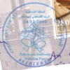

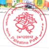
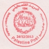


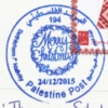


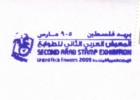

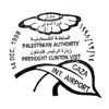


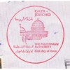


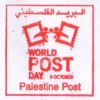
Official and Departmental Handstamps and Cachets


Other Marks
| "Postage Paid" and "Service des Postes" cachets appear very rarely. I show such cachets ansd meter marks separately: | ||||
| ||||
| There are also "no service" cachets, saying the the Postal Authority regrets that the letter could not be delivered to Arab countries due to the occupation powers refusing to allow the forwarding. The left image is scaled to the same size as the postmarks on this page; a 250% enlargement is on the right. Below a cover affected, courtesy of Thomas Schubert. | ||||
| ||||
| ||||
| Sometimes mail to Palestine gets mis-directed: the most common route seems to be Pakistan. The ordinary route should be via Israel, but some Post-Office staff apparently put letters just in the next box if they can't have a seperate one for Palestine... These letters finally arrive in Palestine, but on their way receive often a machine-cancellation at Islamabad as well as other marks. Here are two examples of transit marks applied at the International Mail Office: | ||||

"RECEIVED AT I.M.O. ISLAMABAD 440 / INWARD SET/01" | ||||

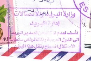
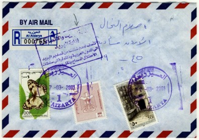


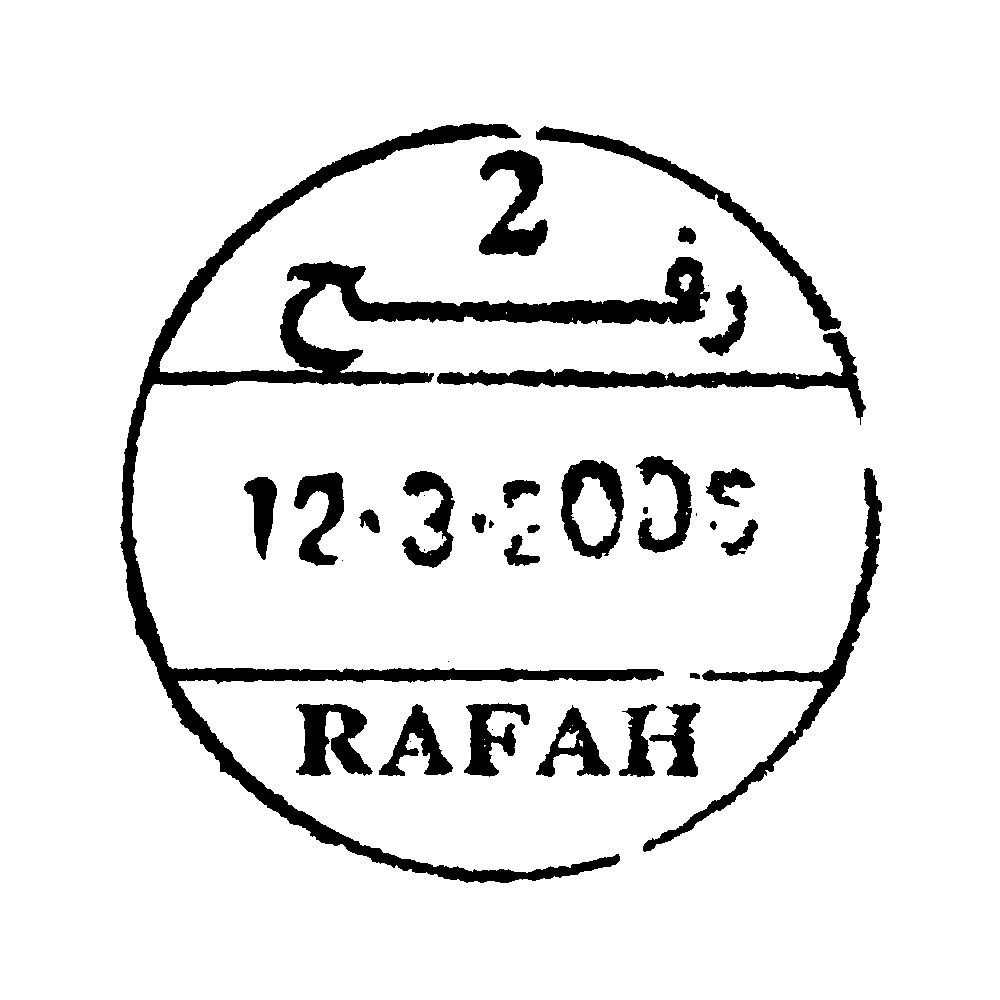
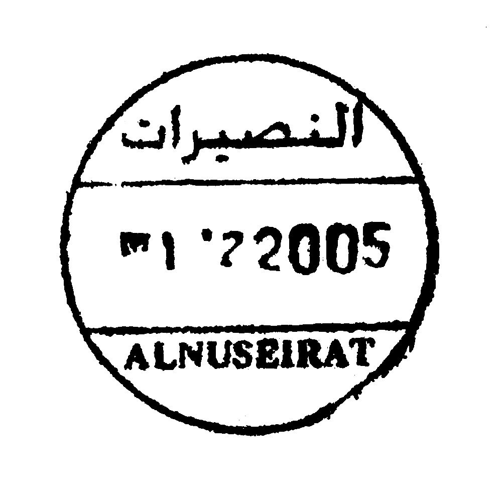
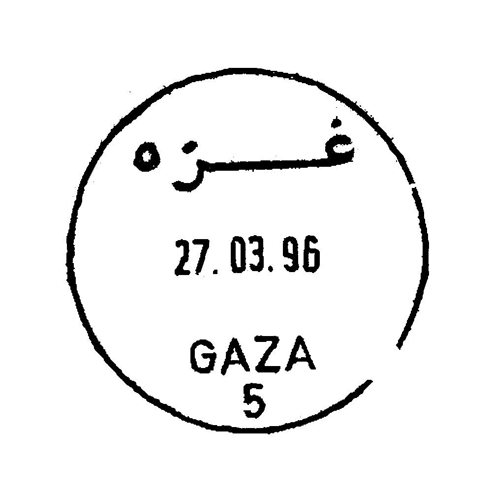
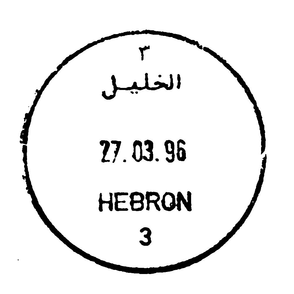
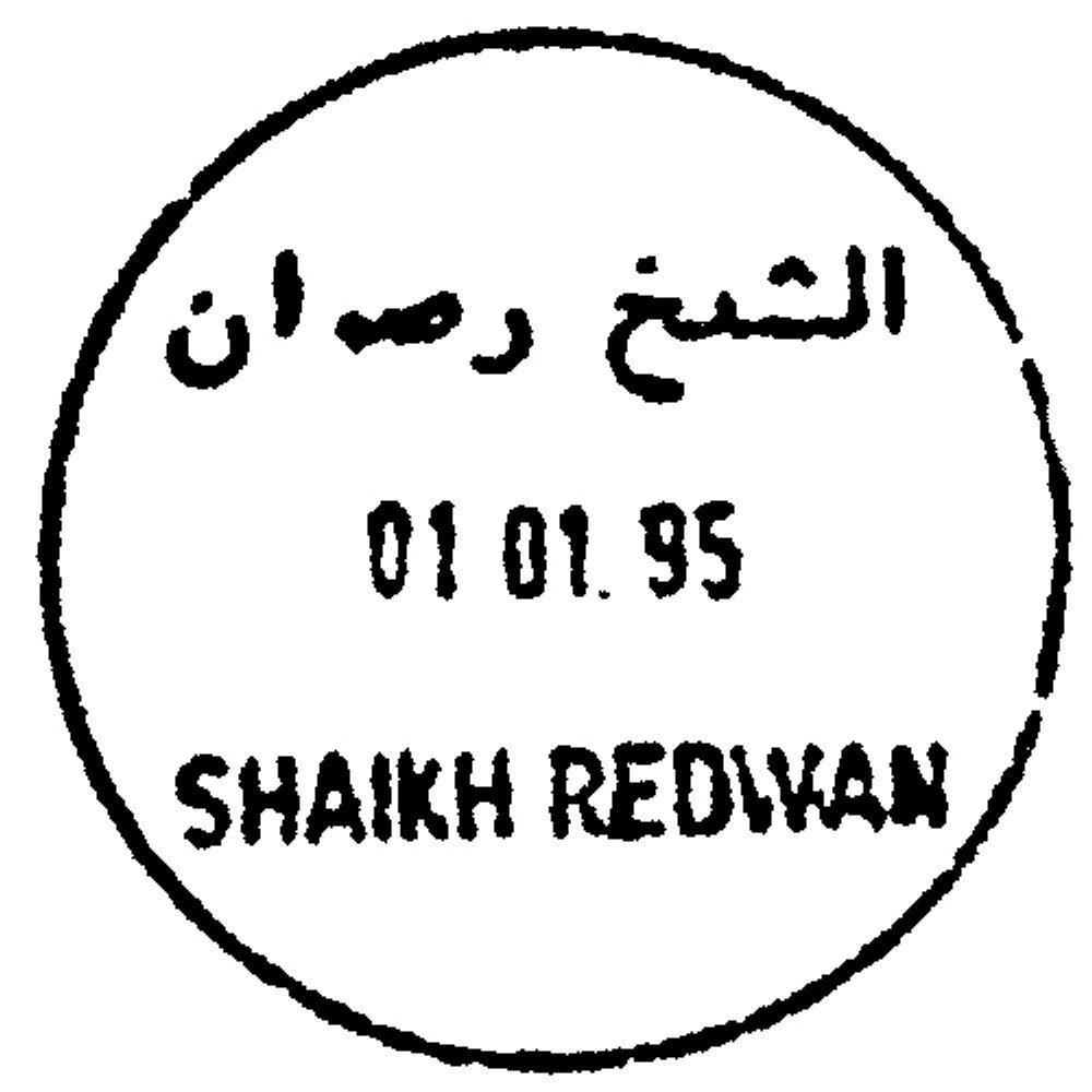
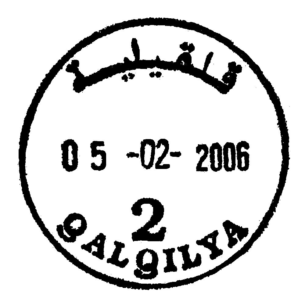
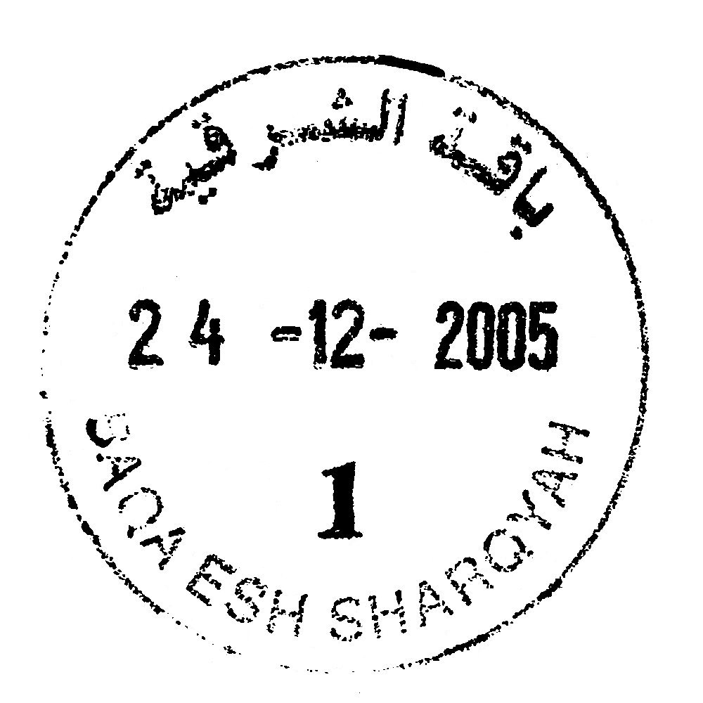
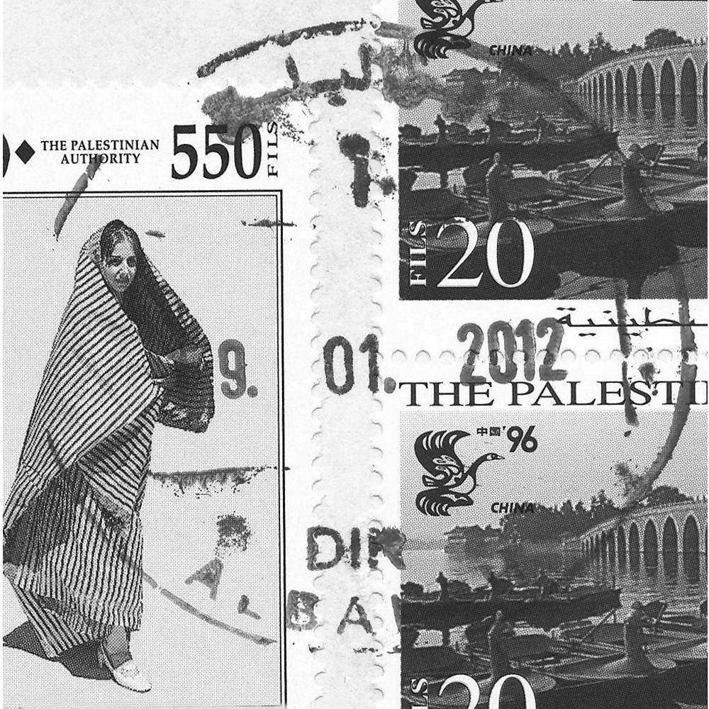
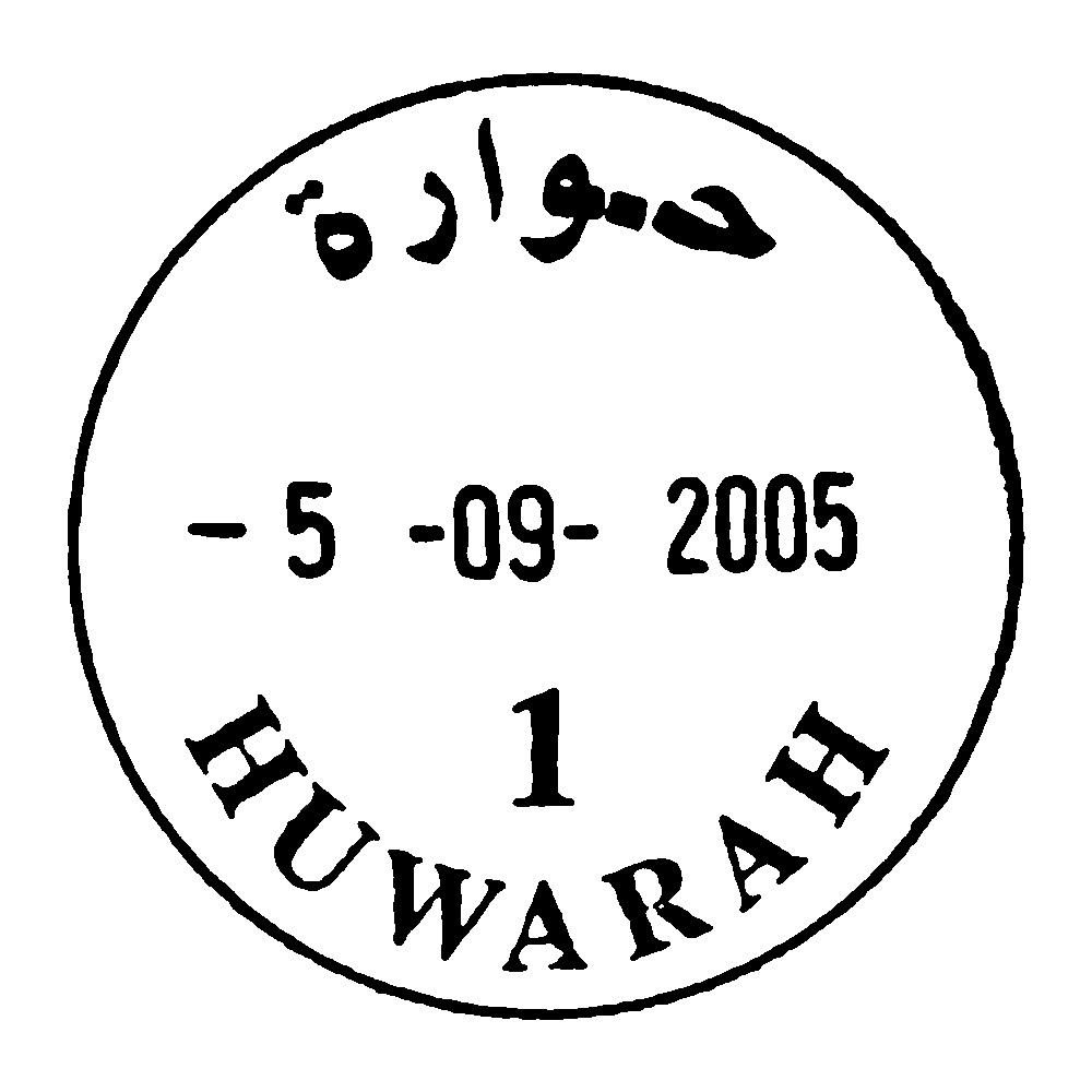
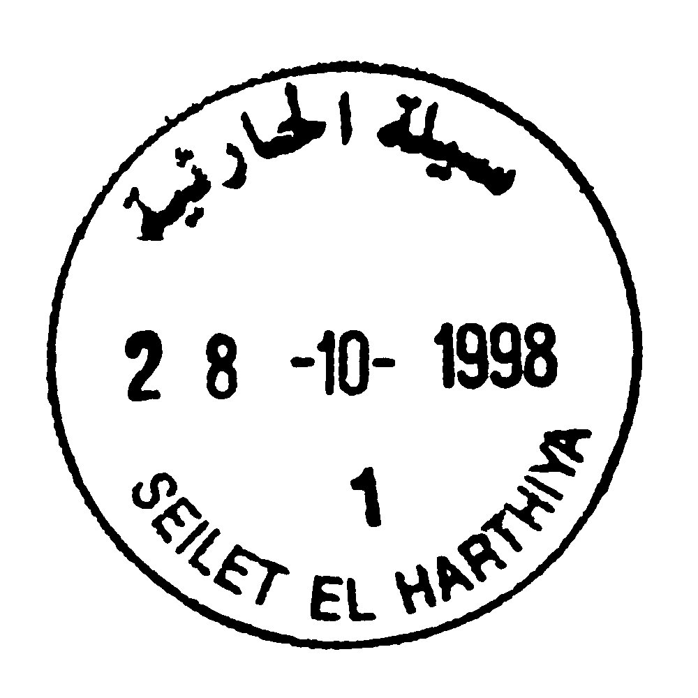
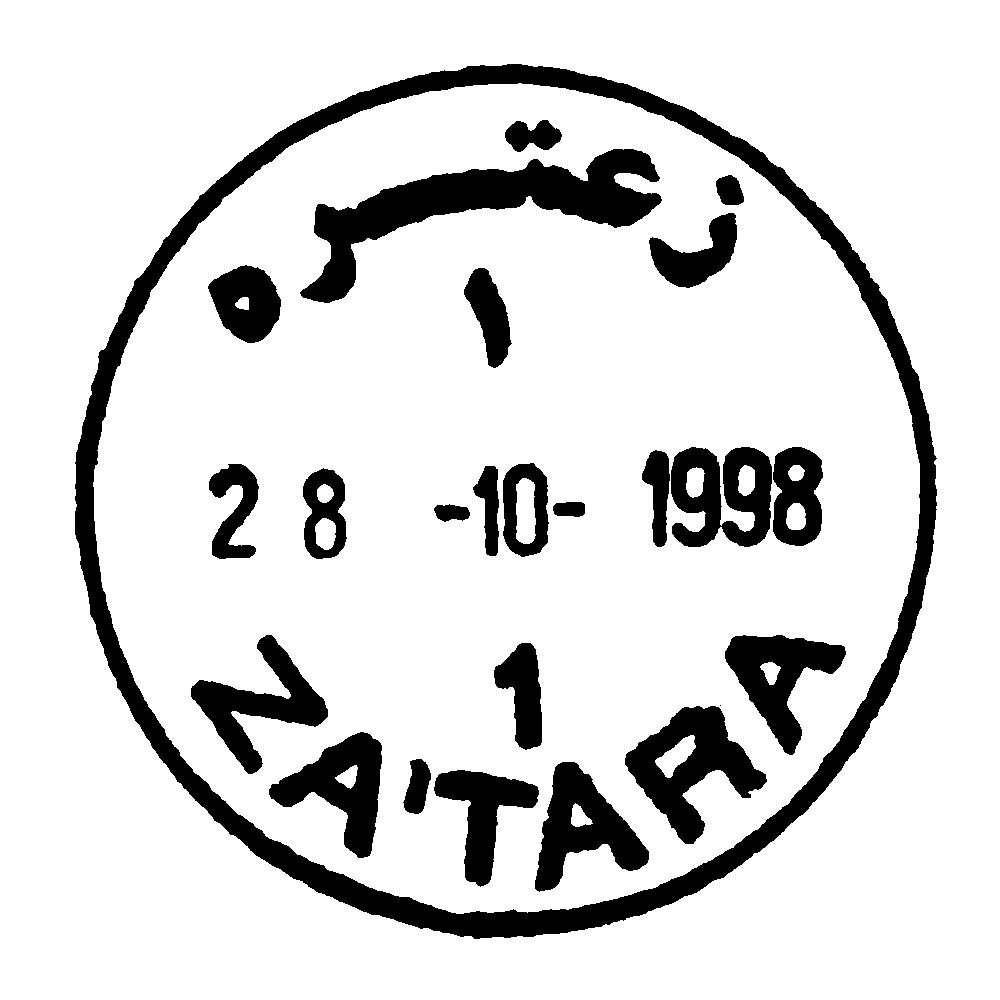
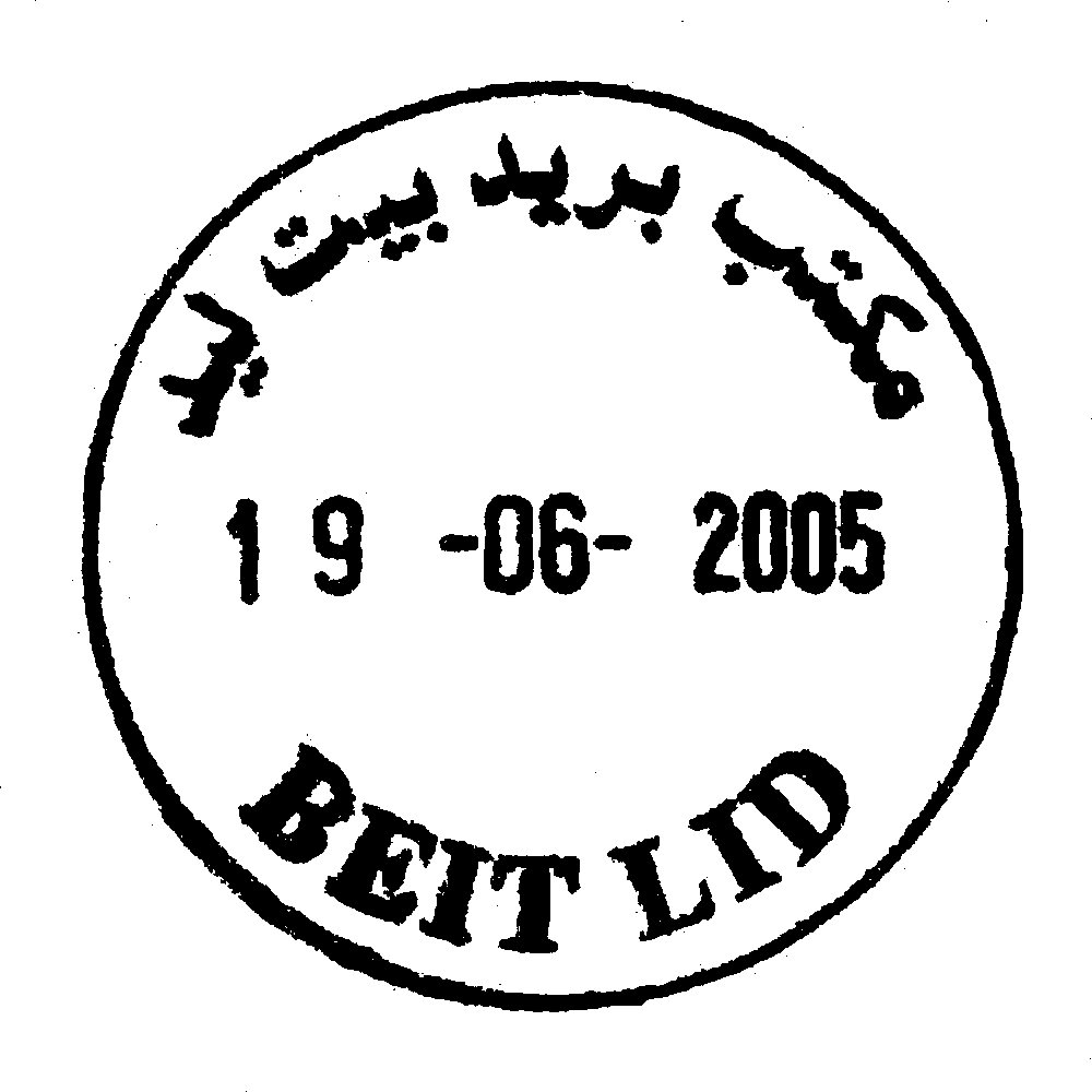
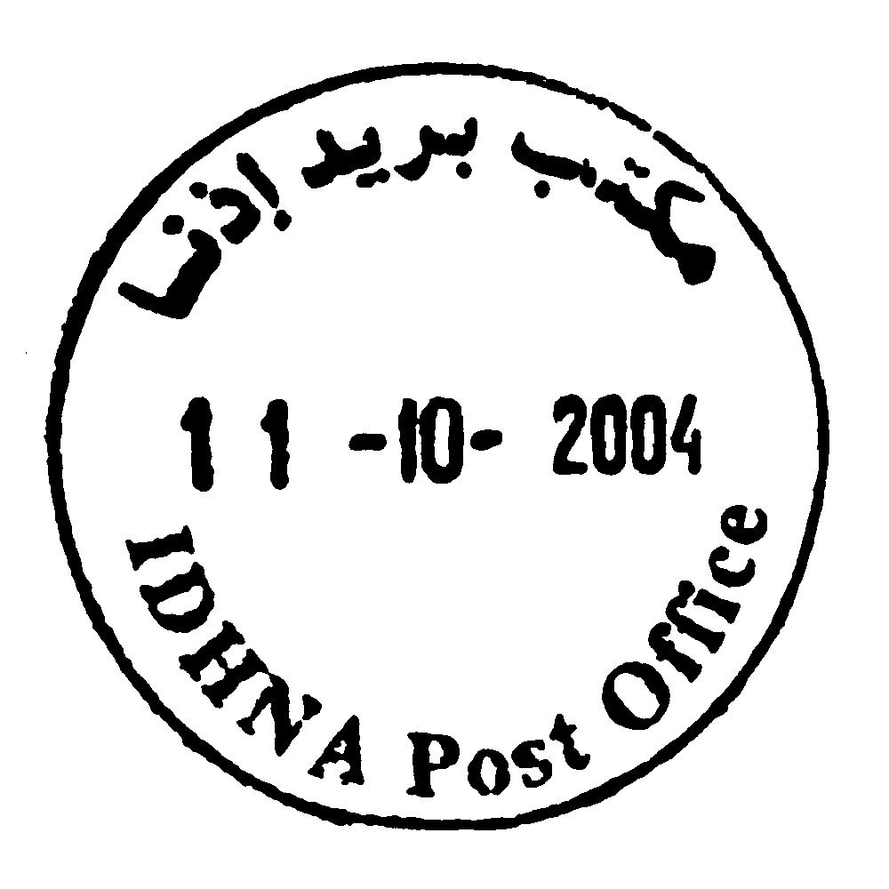
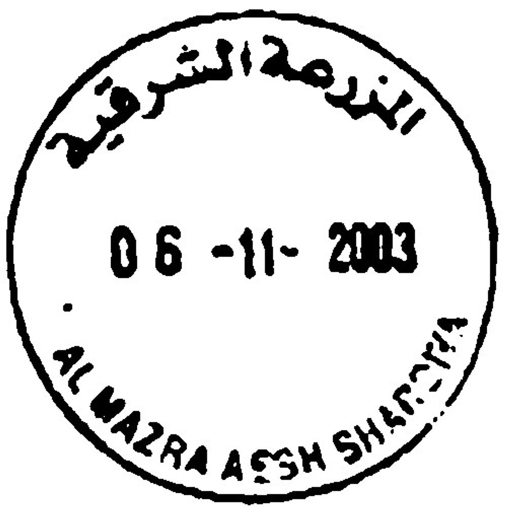
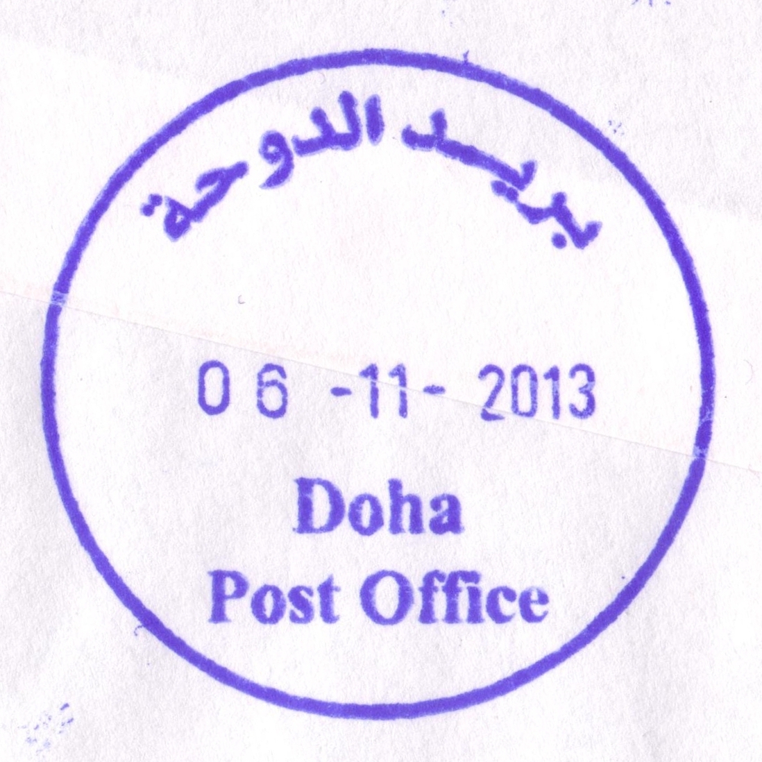
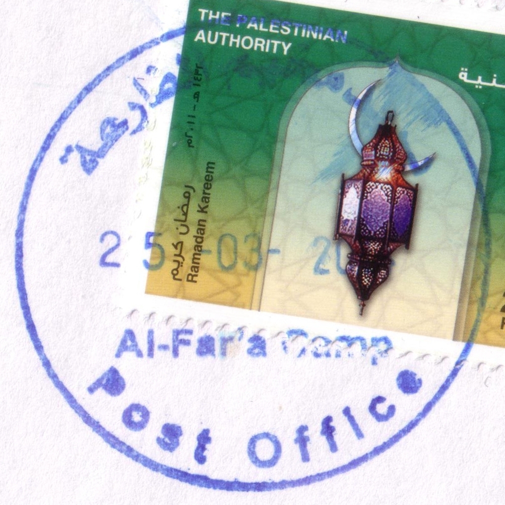
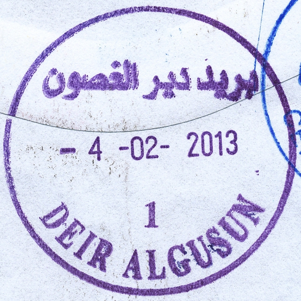
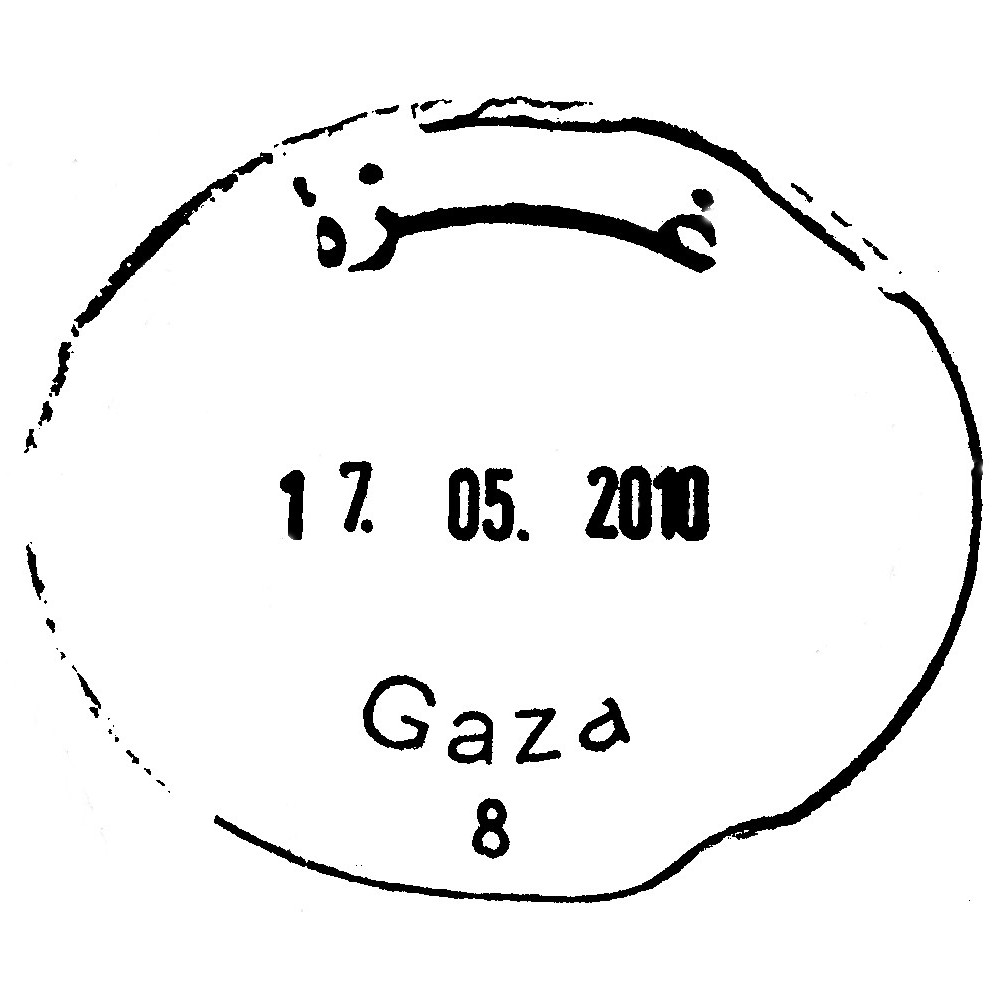
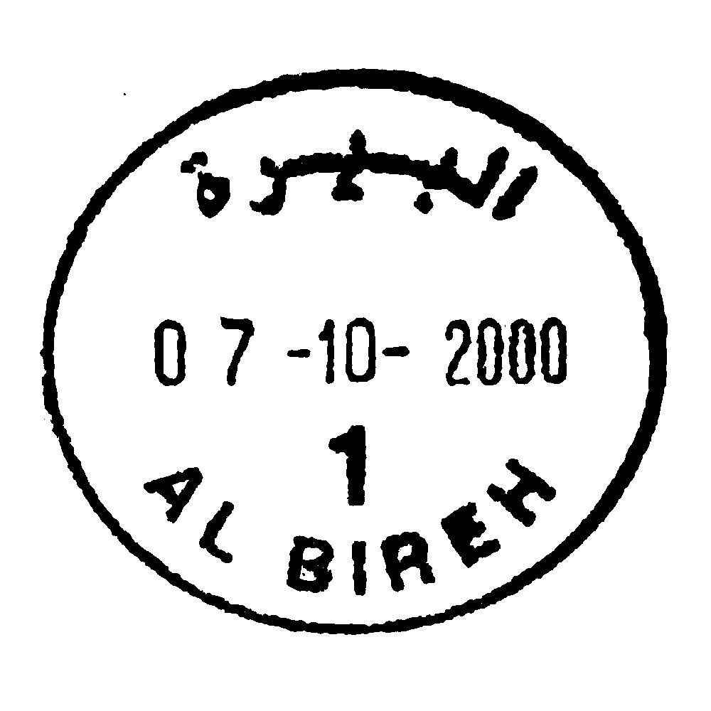
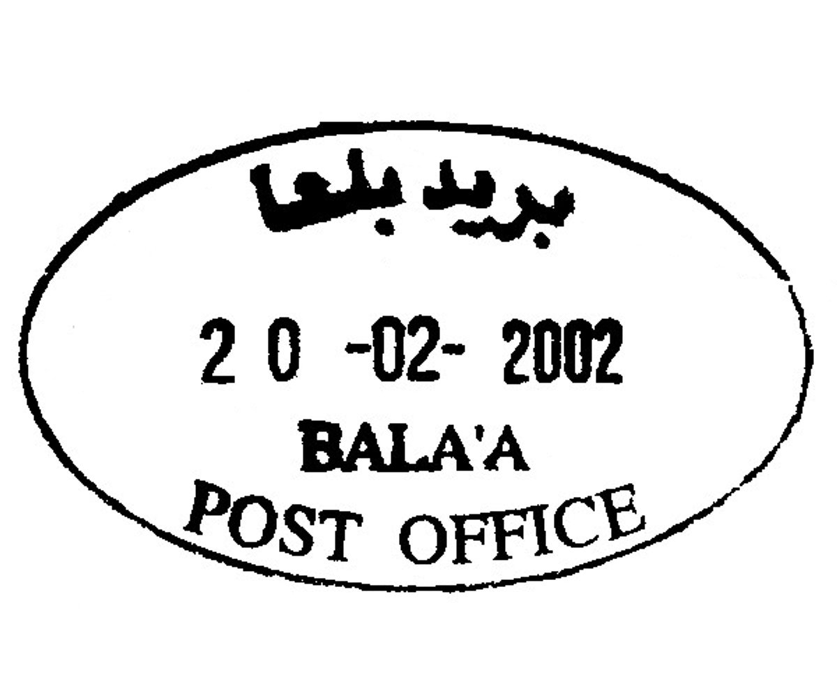
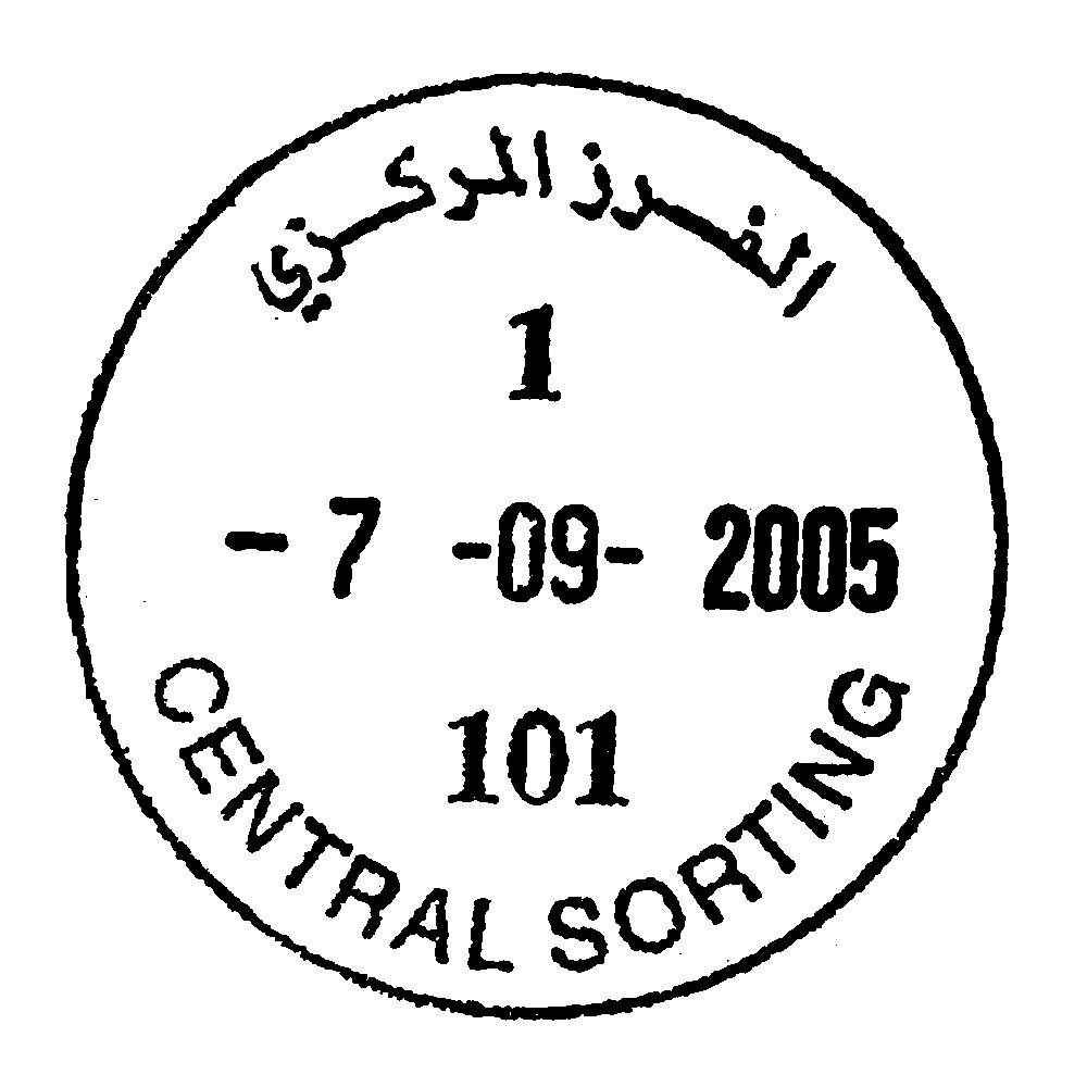
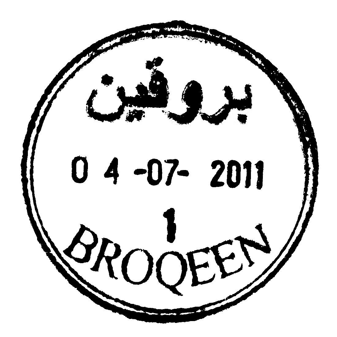
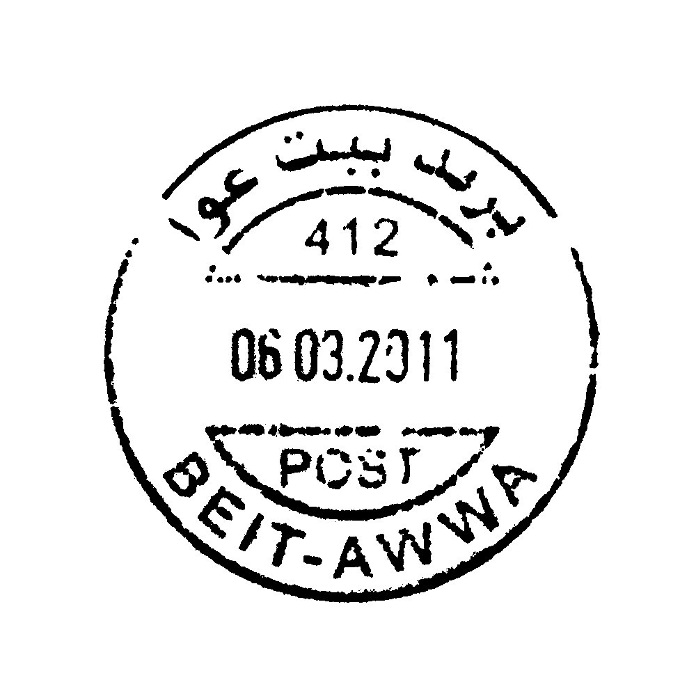
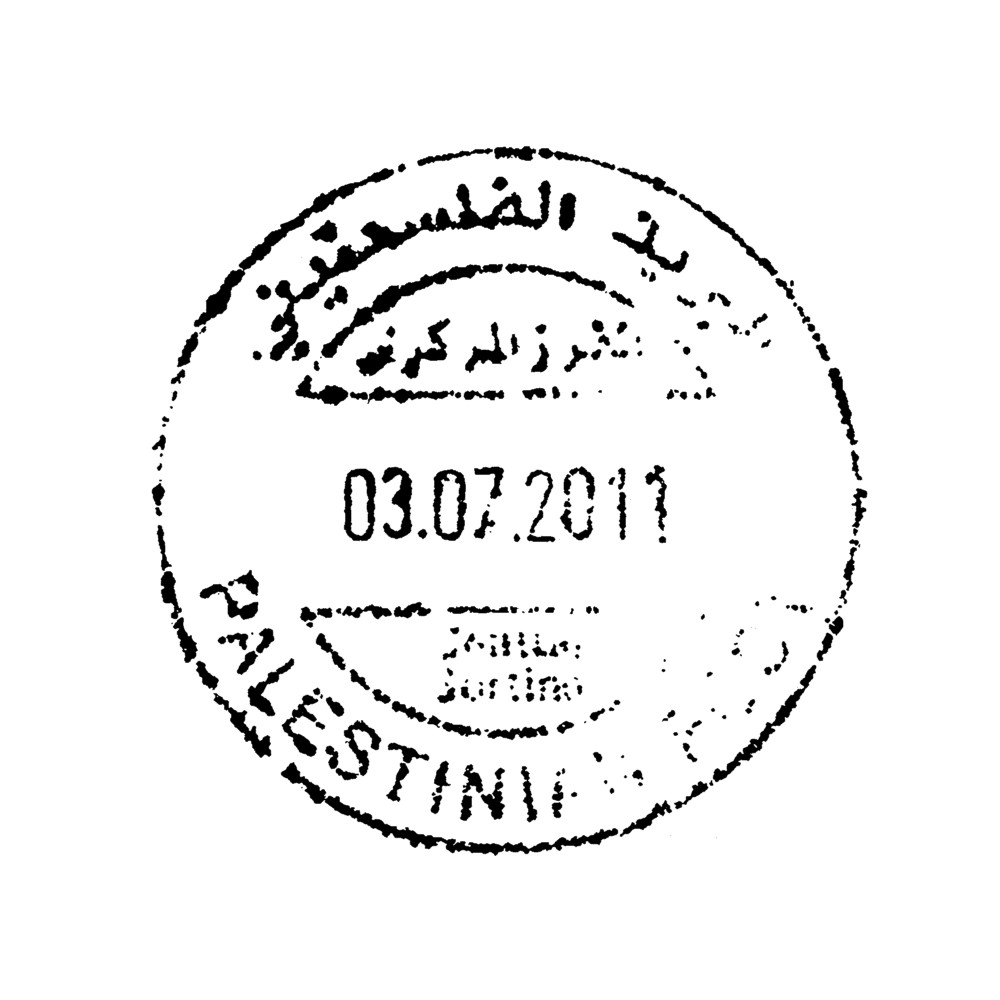
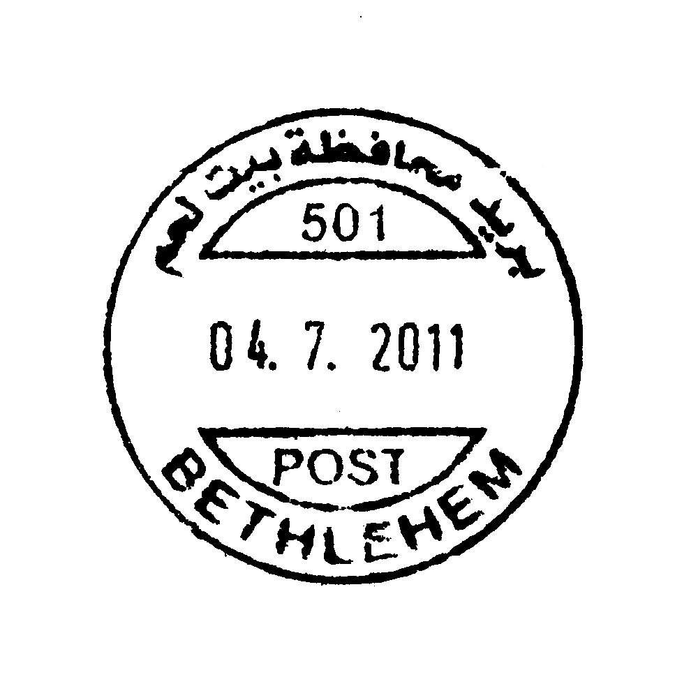
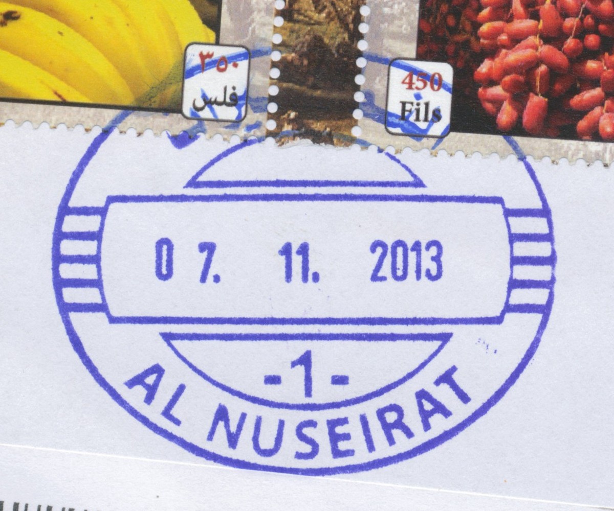
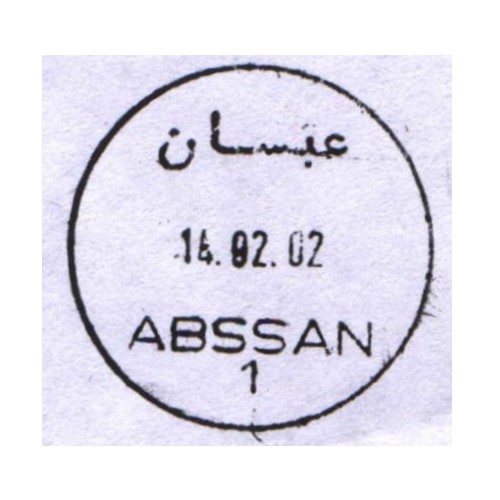
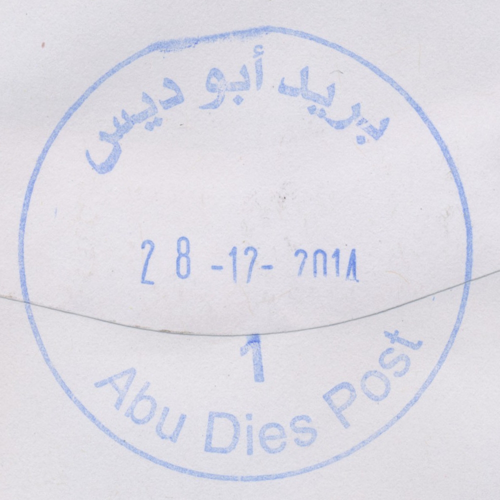
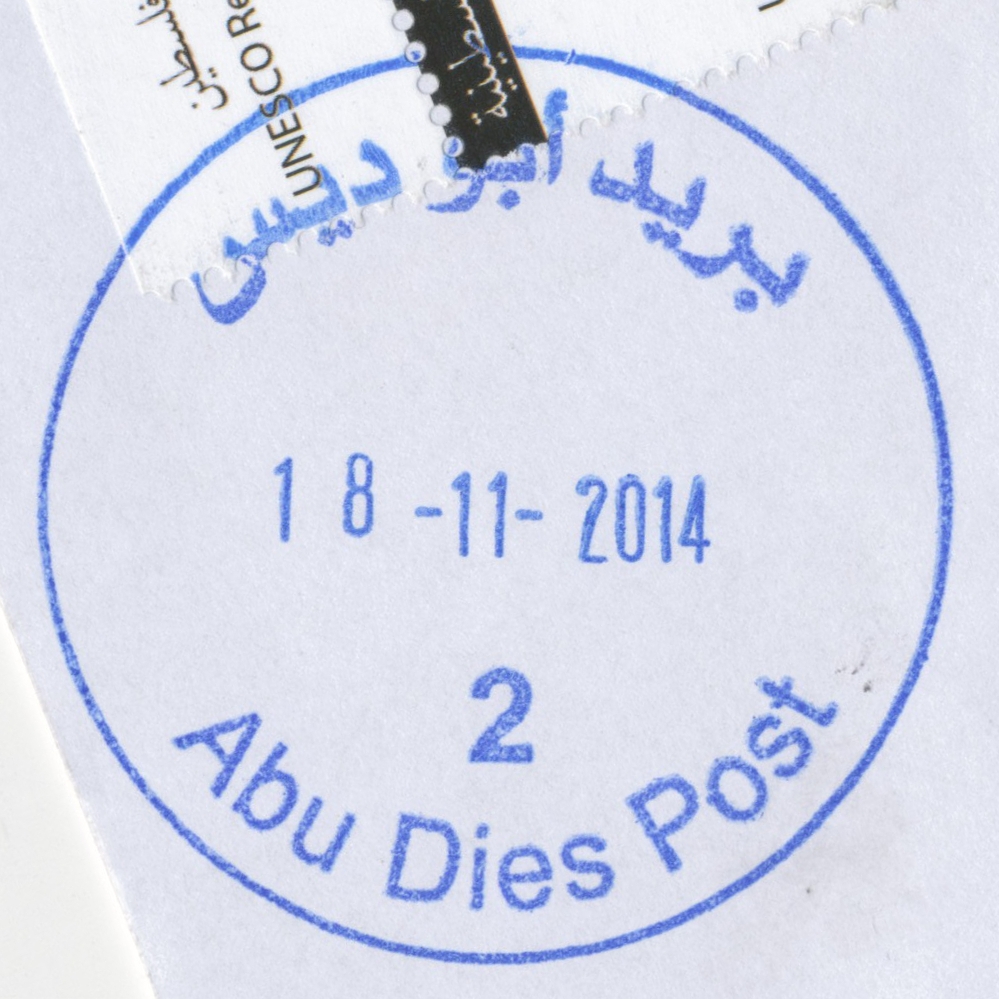
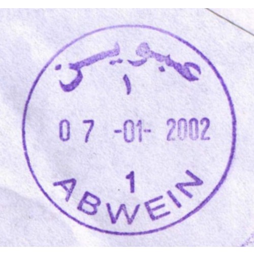
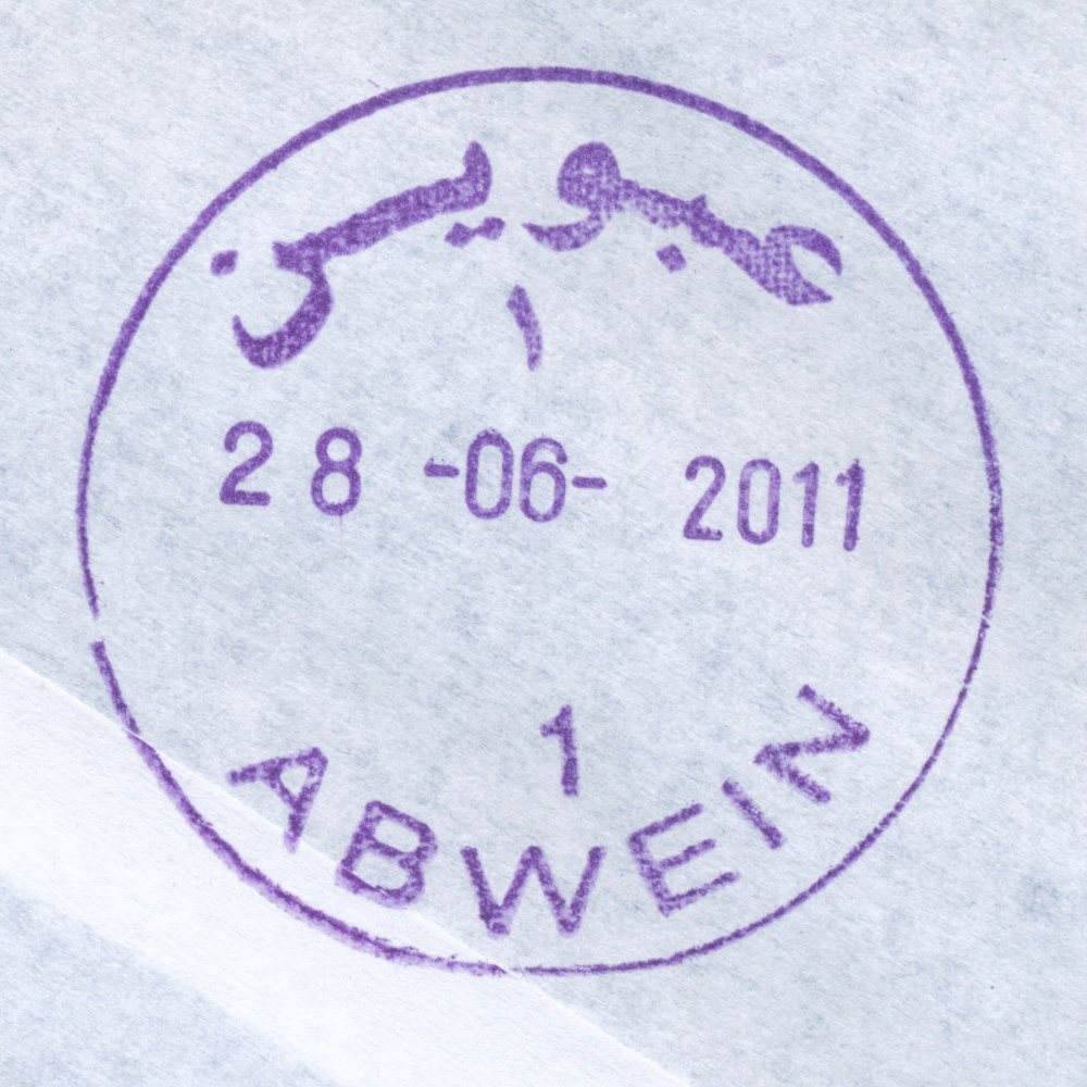
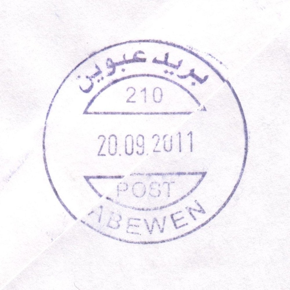
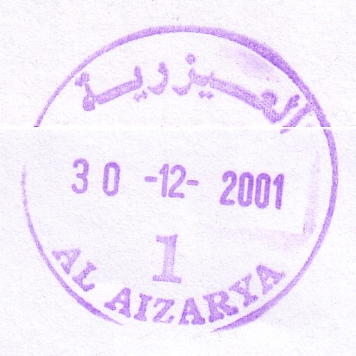
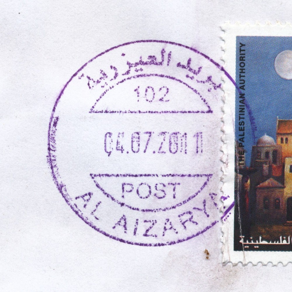
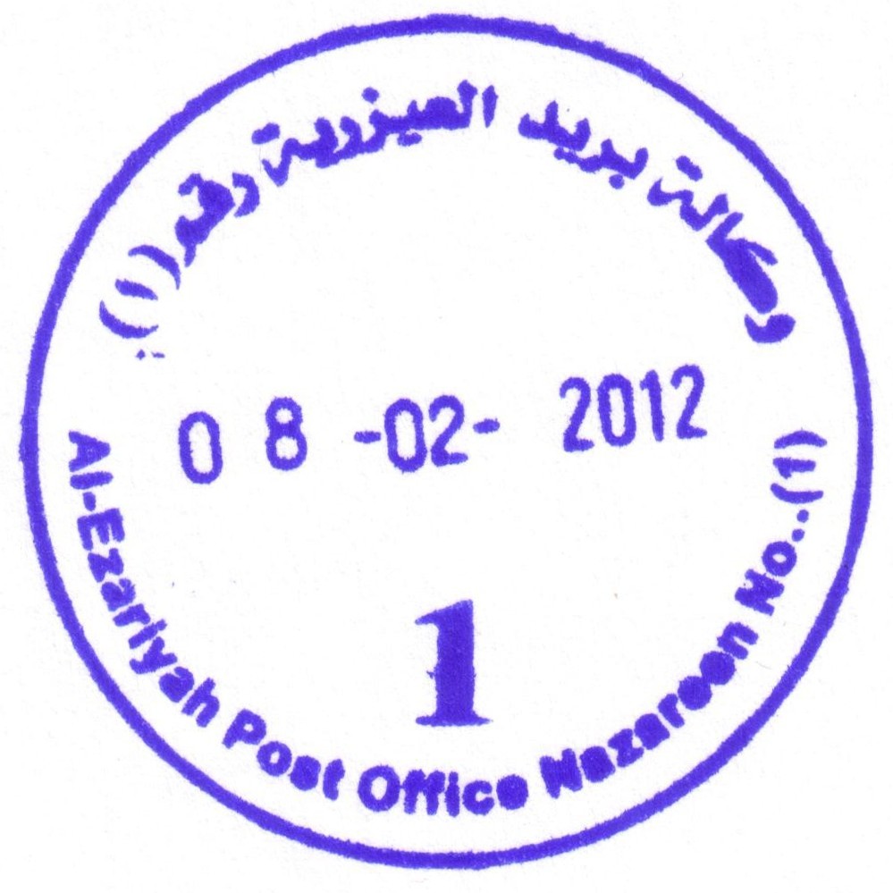
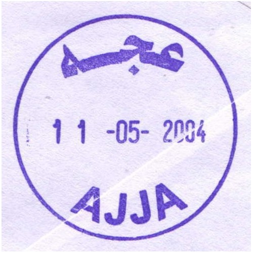
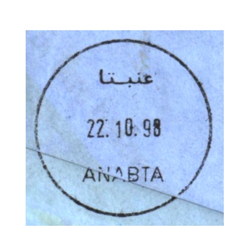
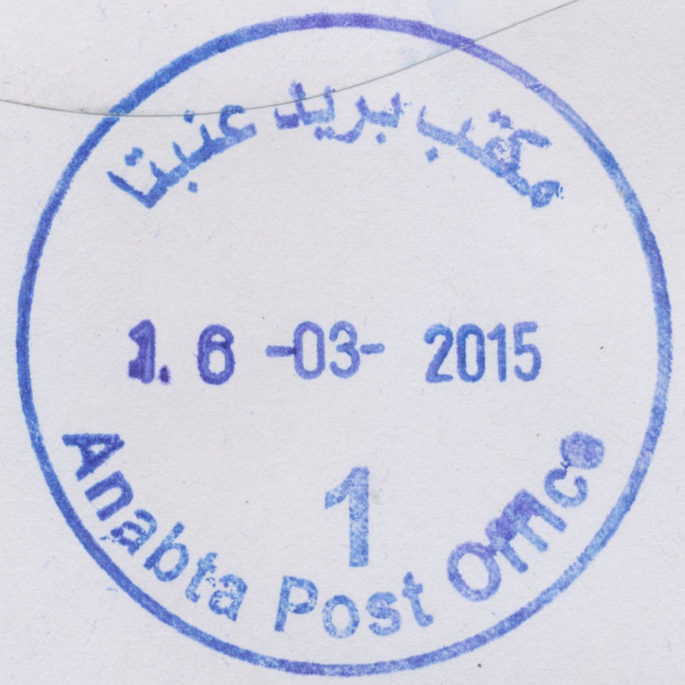
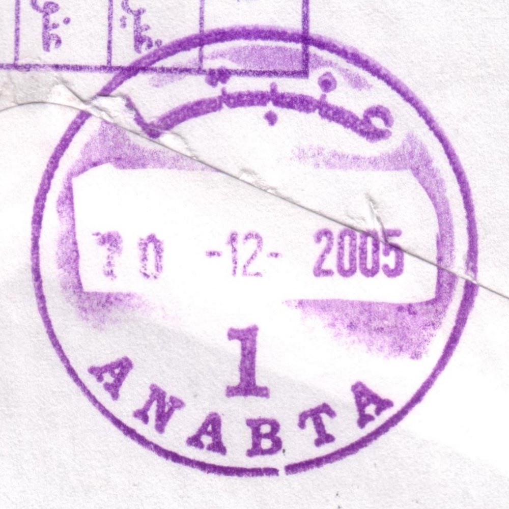
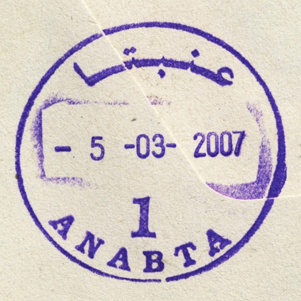
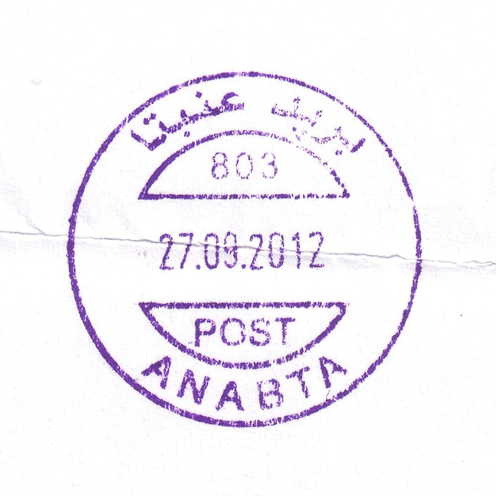
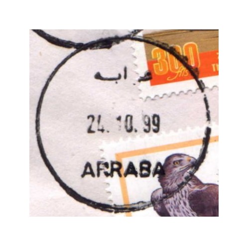
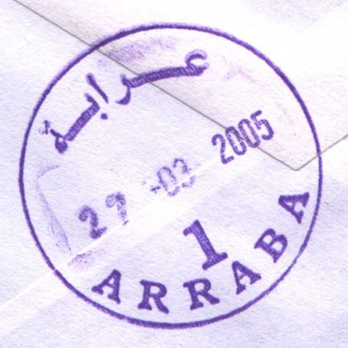
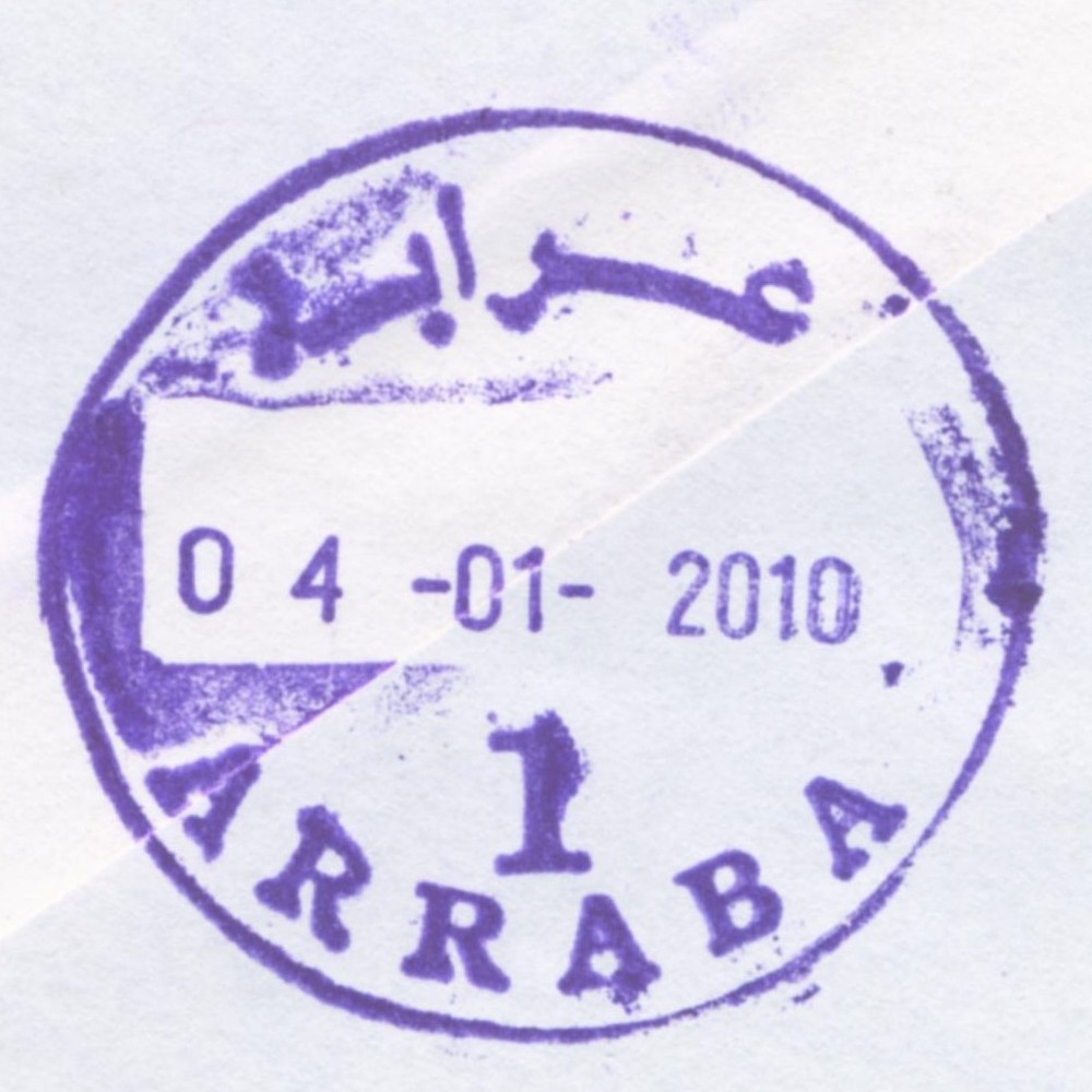
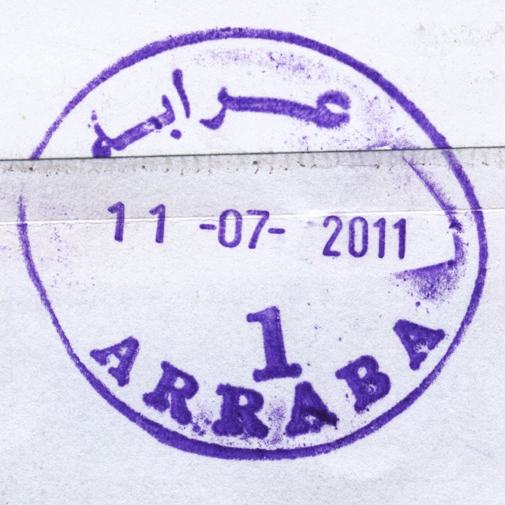
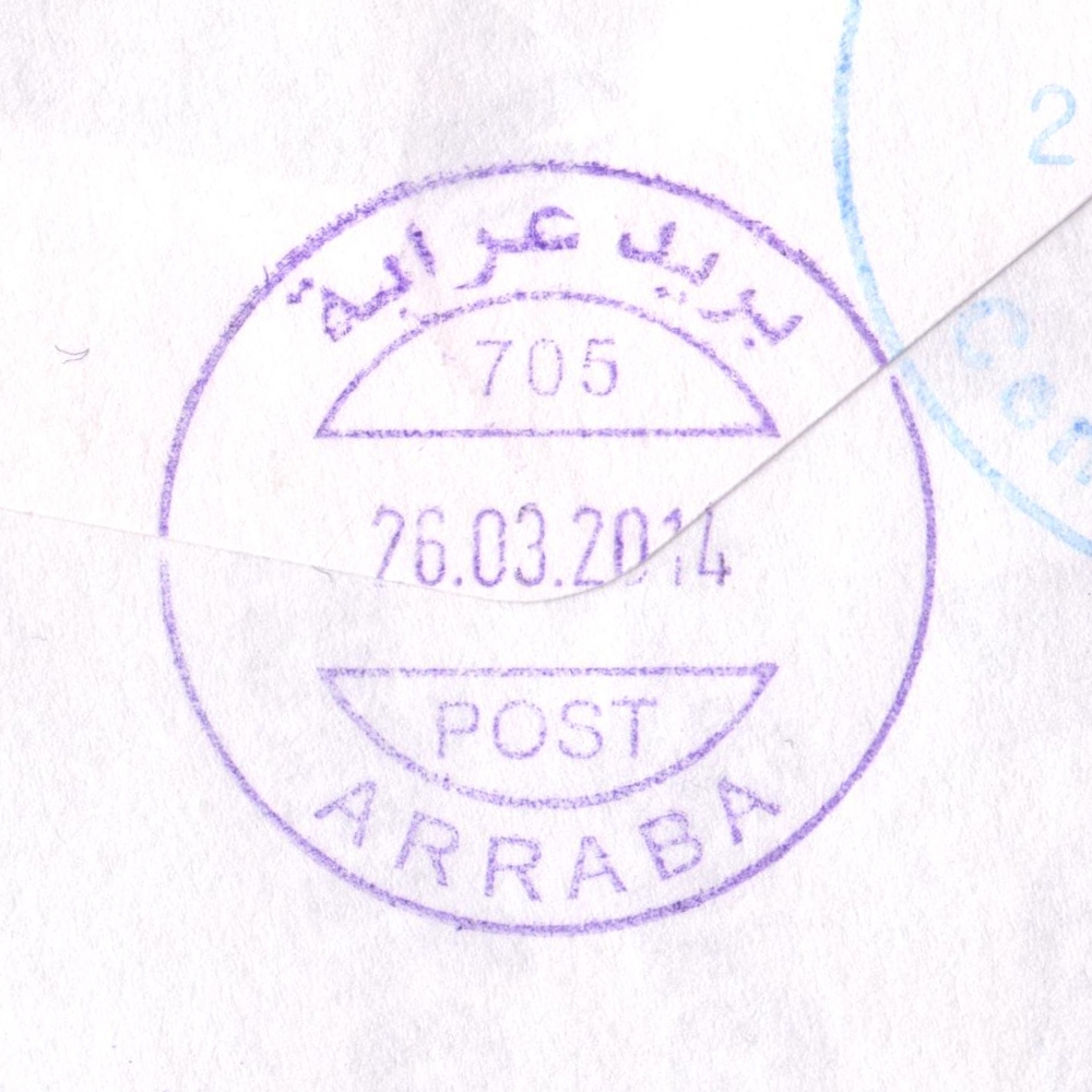
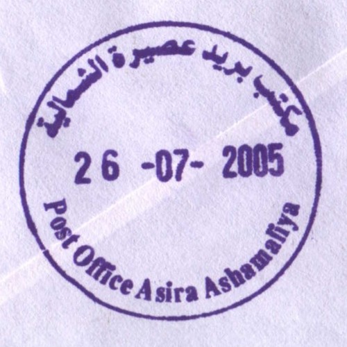
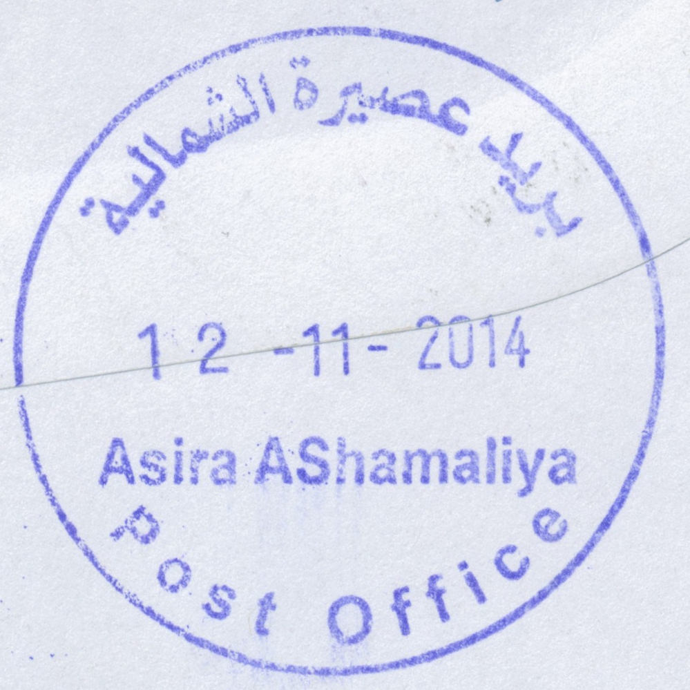
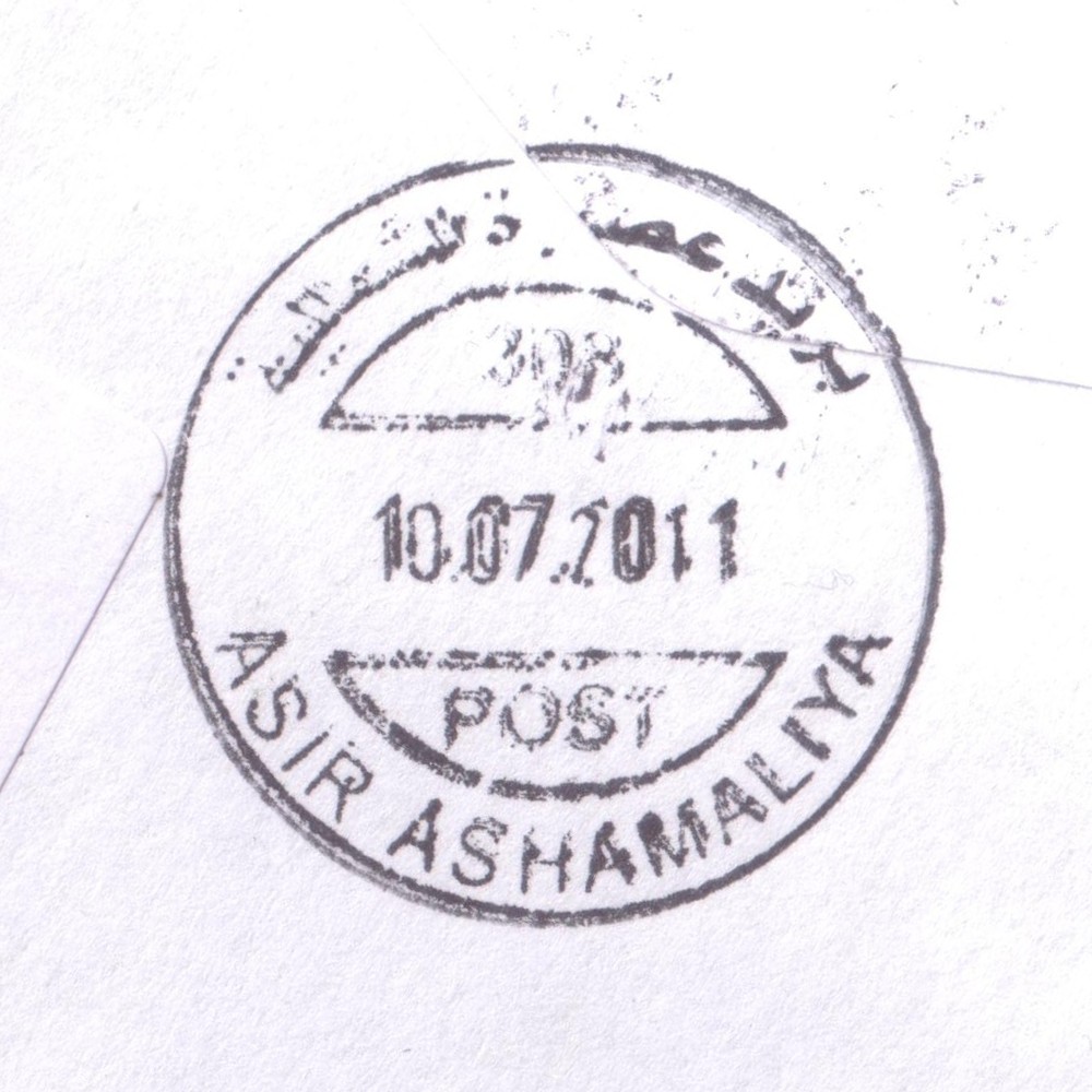
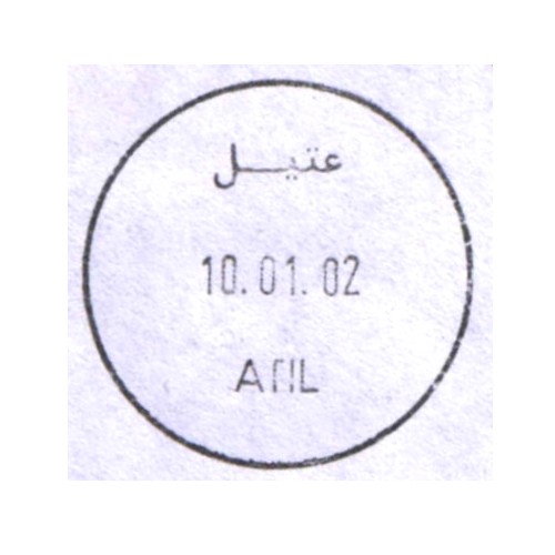
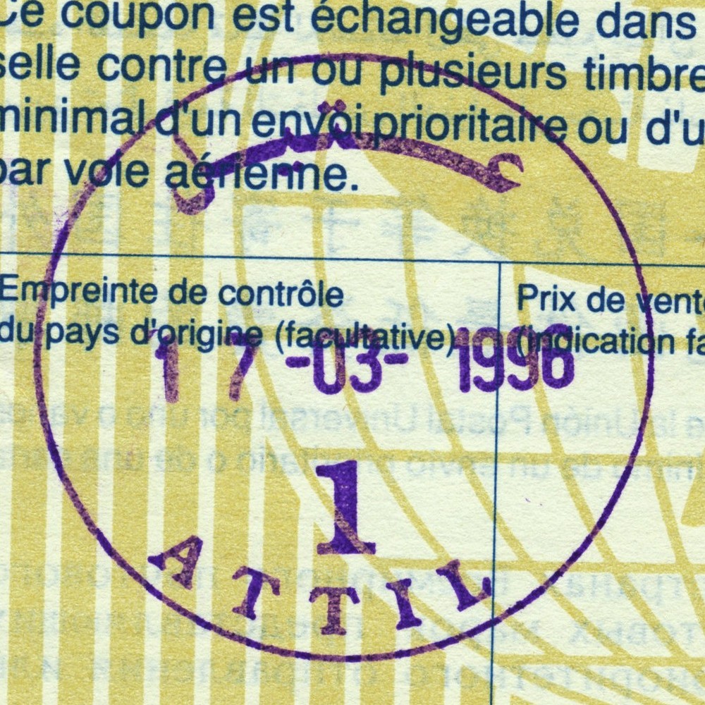
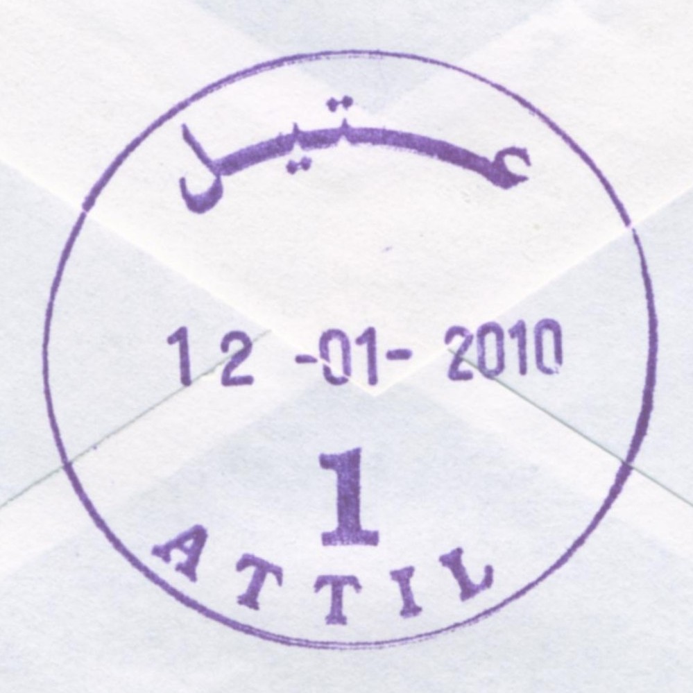
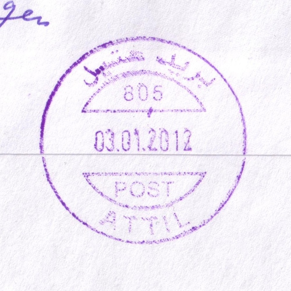
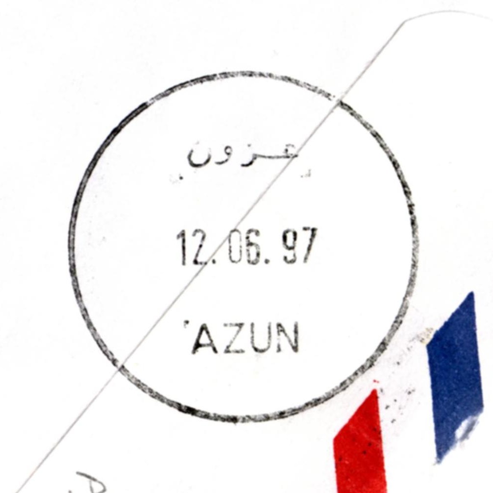
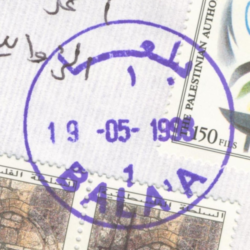
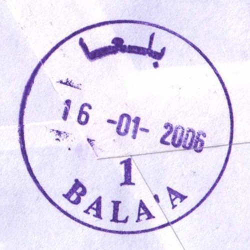
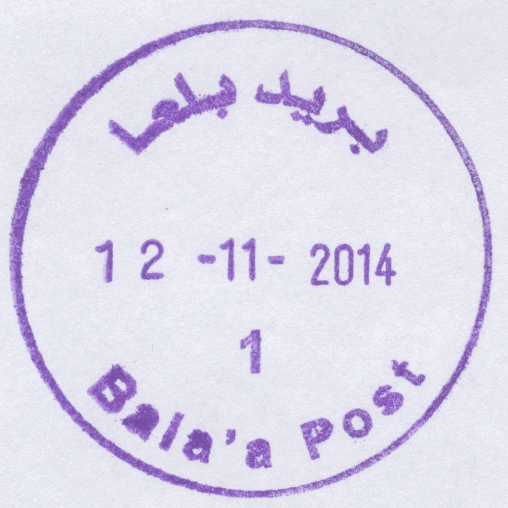
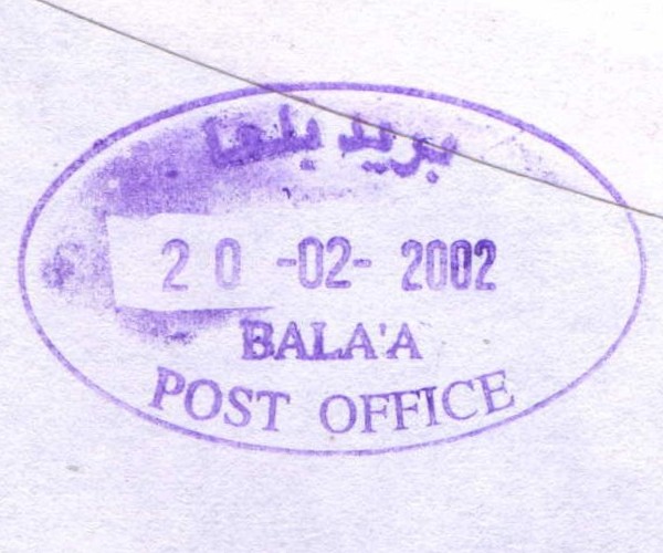
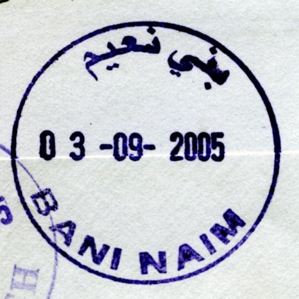
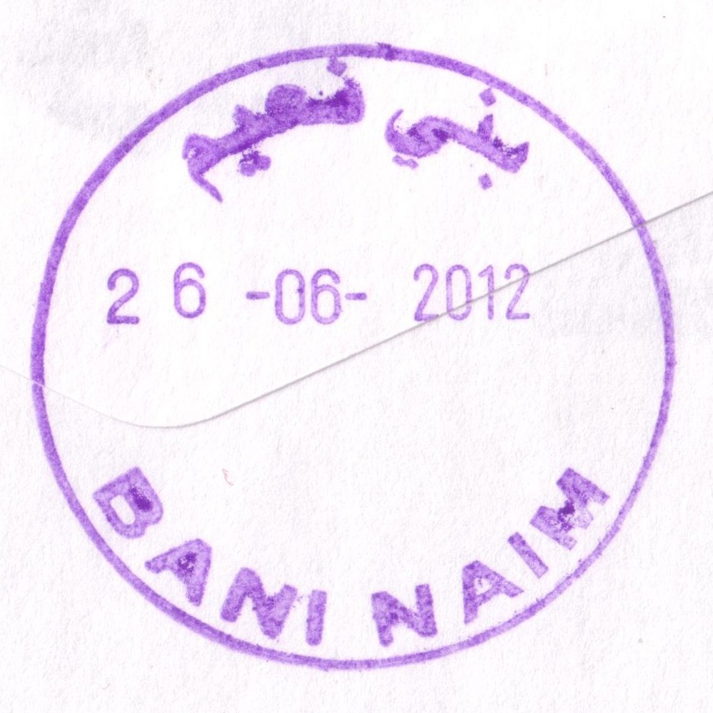
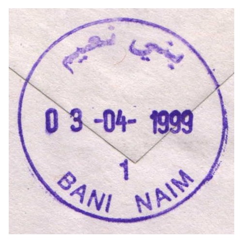
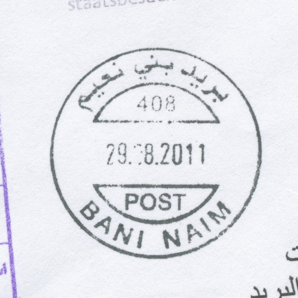
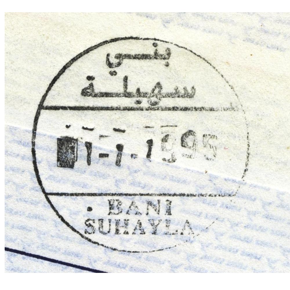
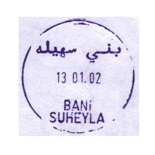
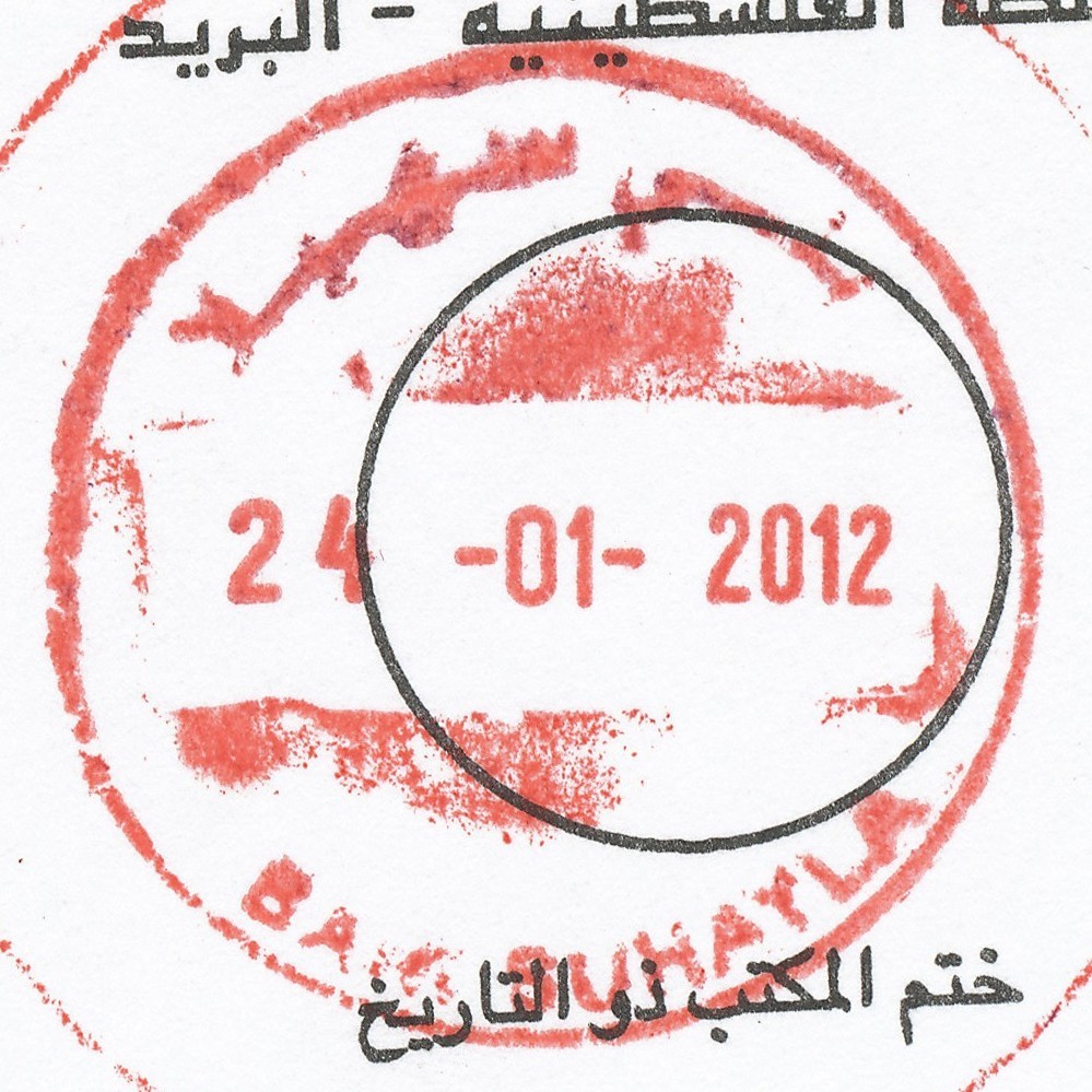
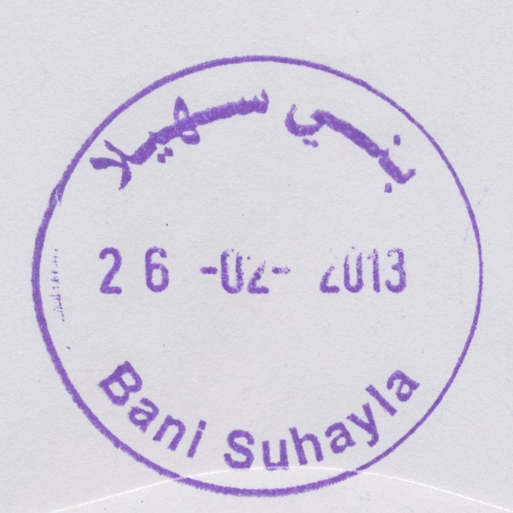
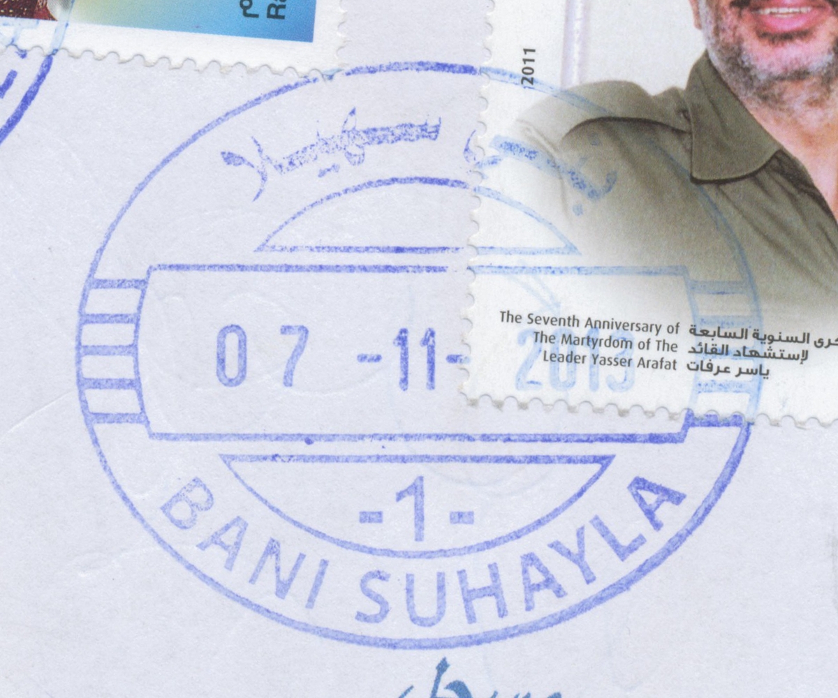
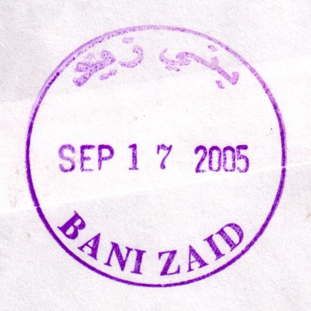
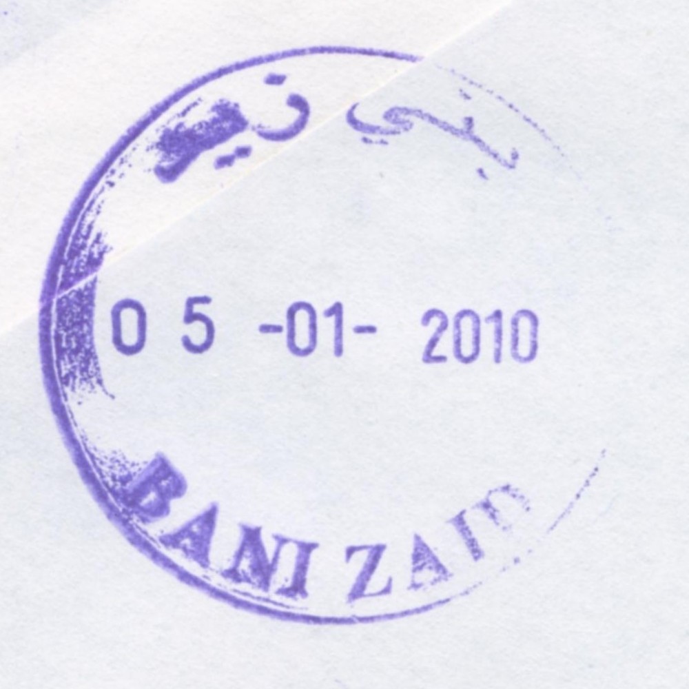
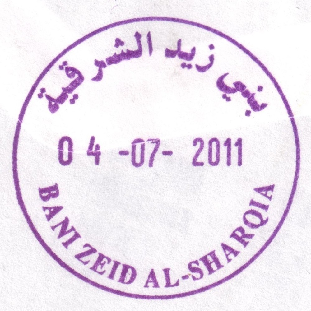
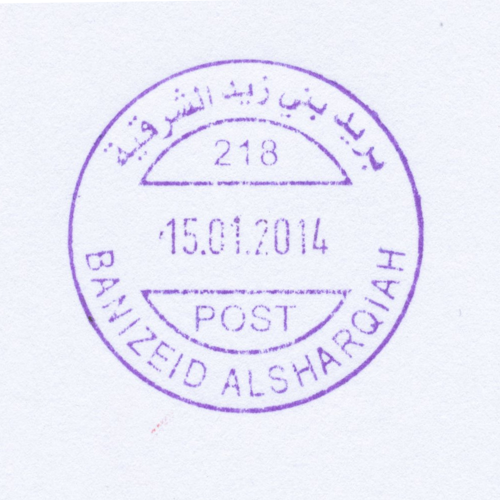
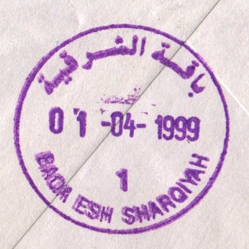
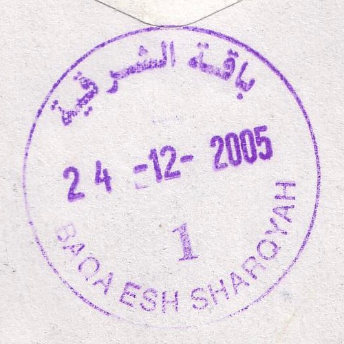
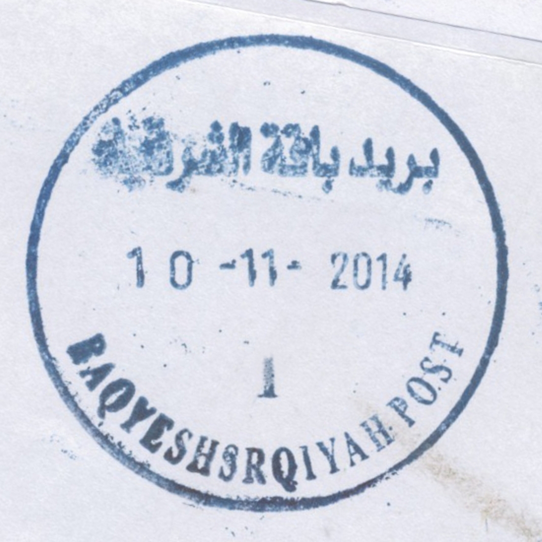
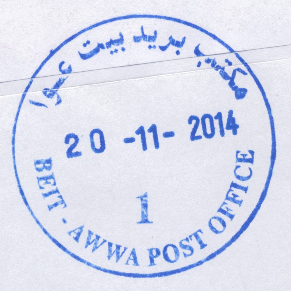
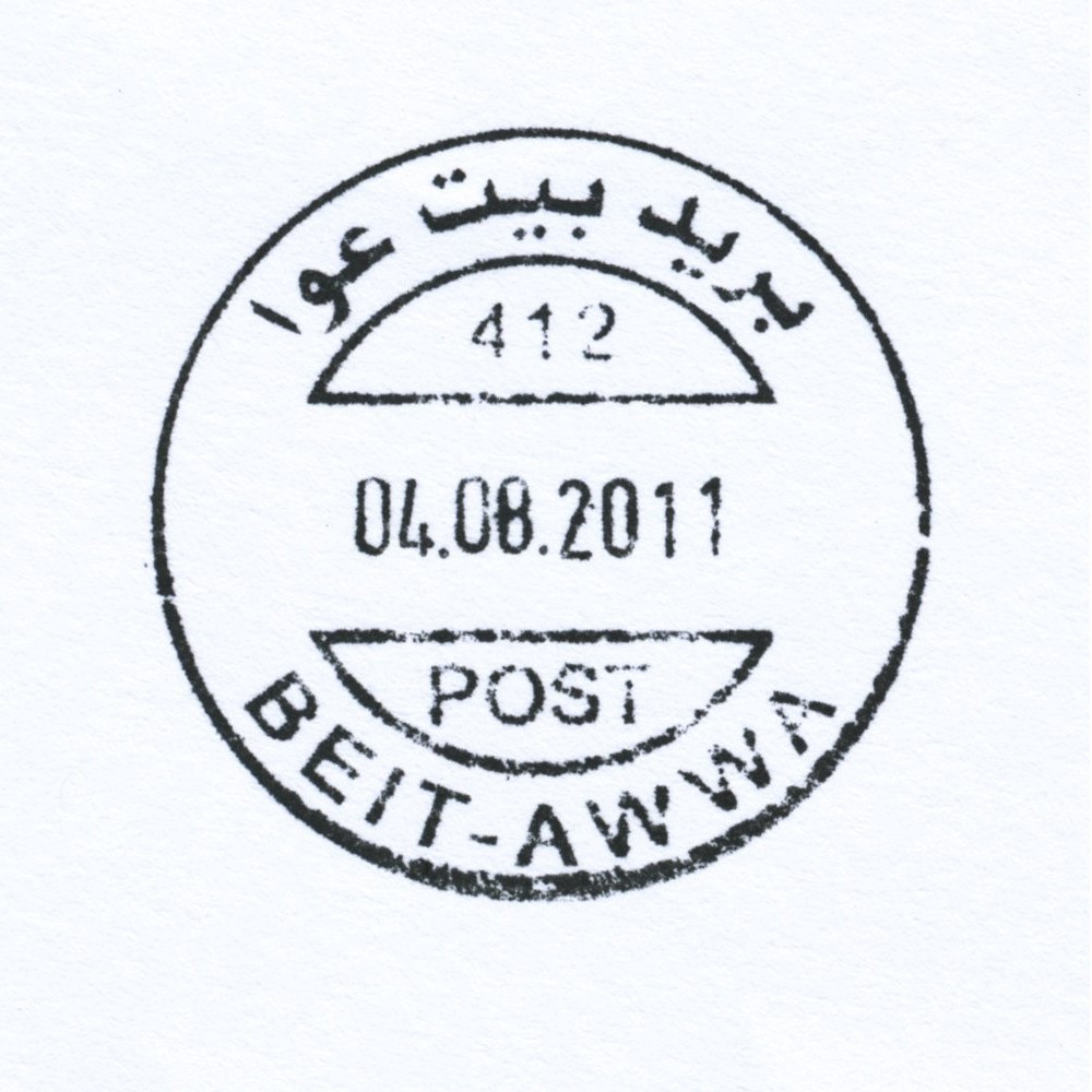
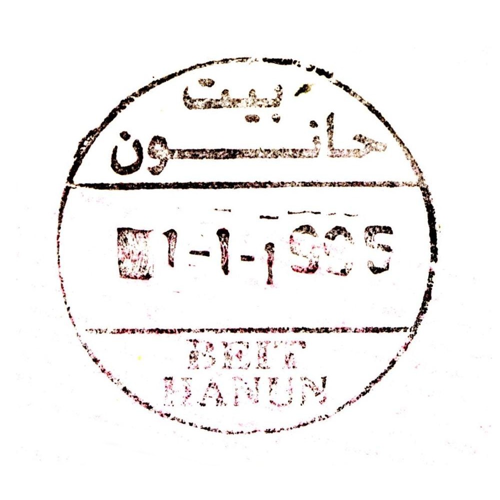
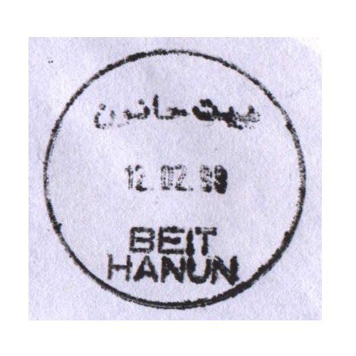
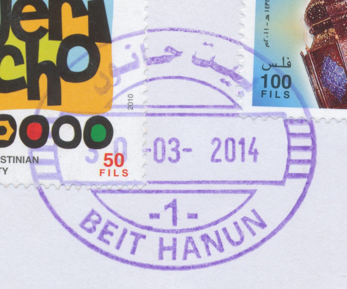
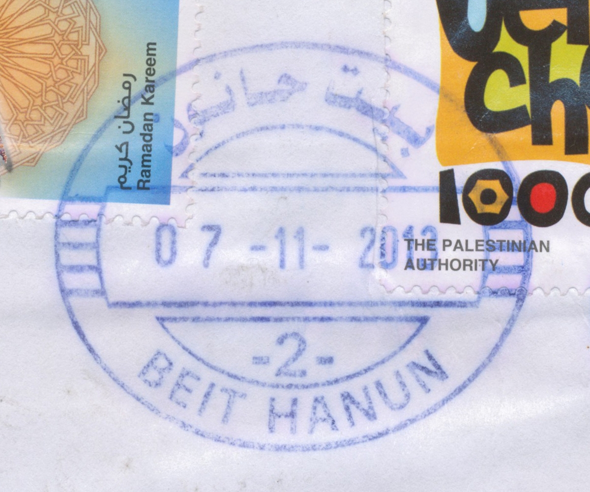
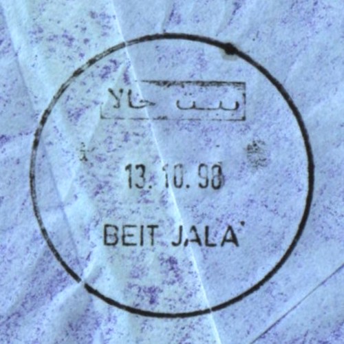
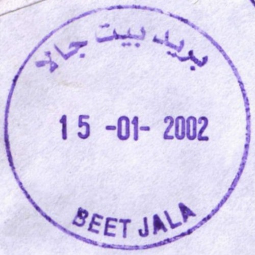
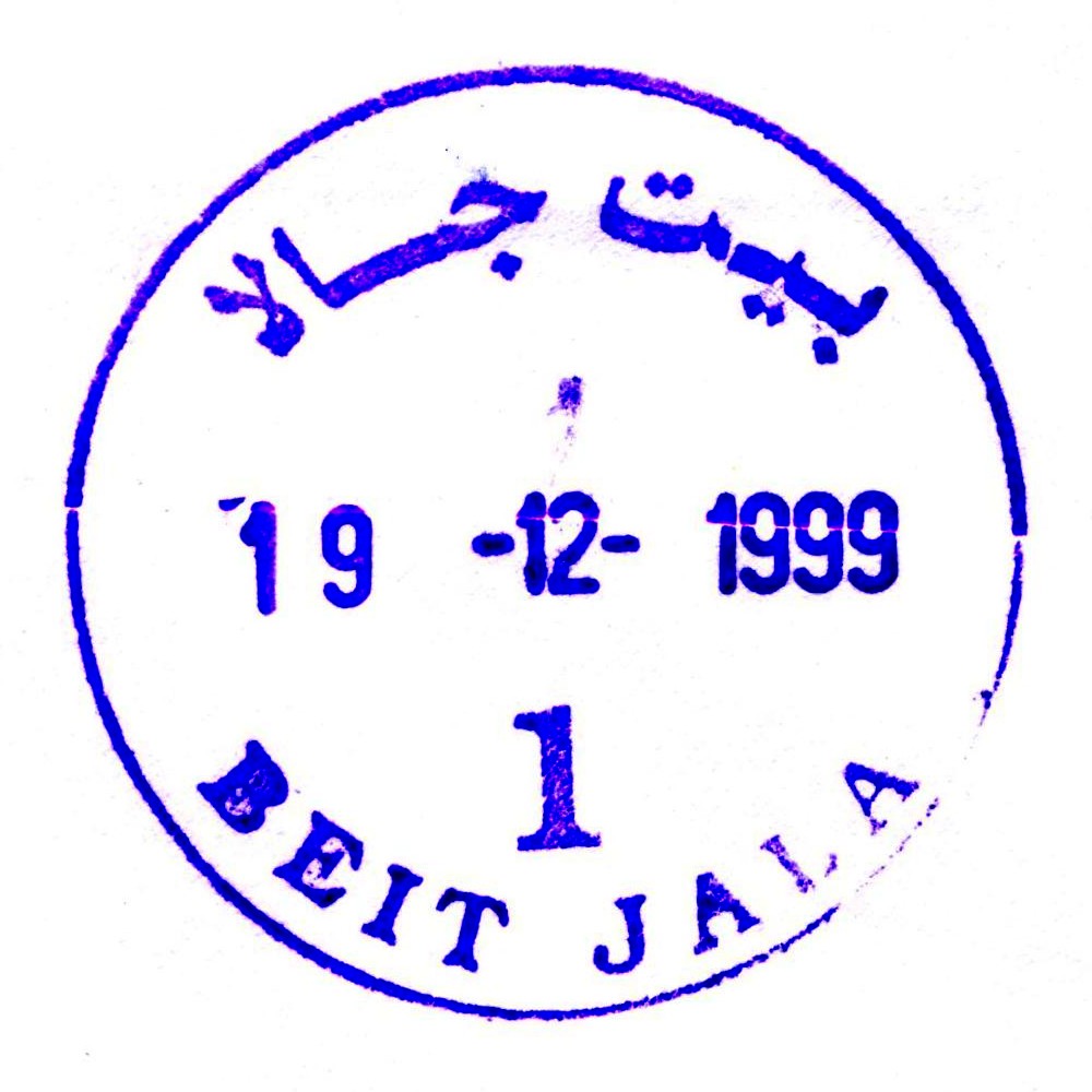
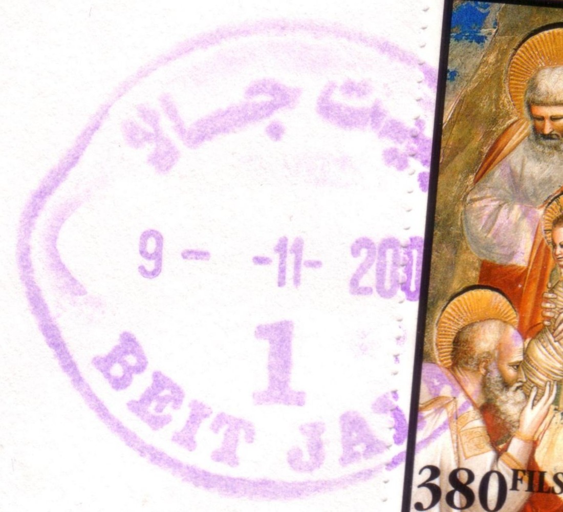
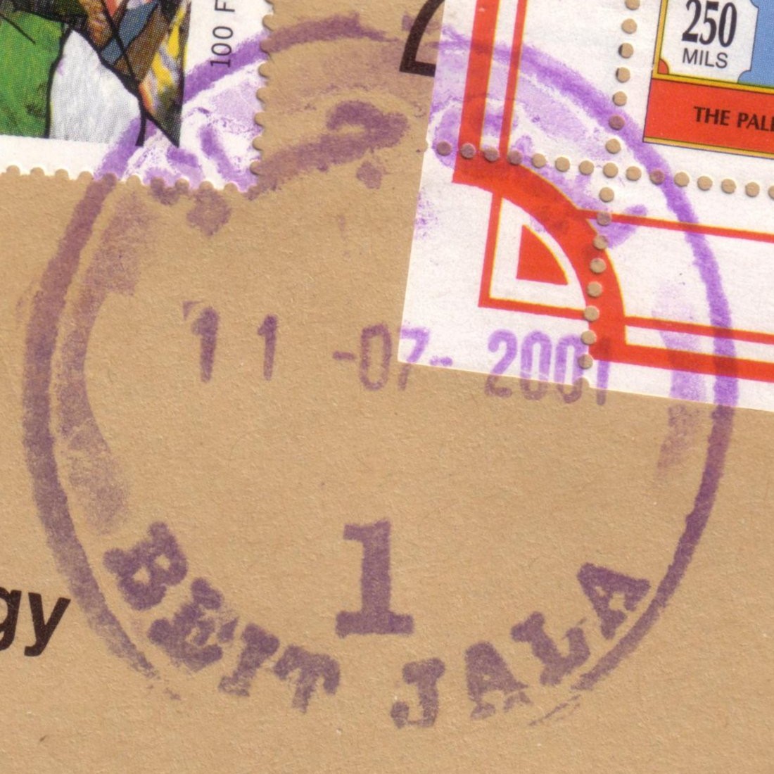
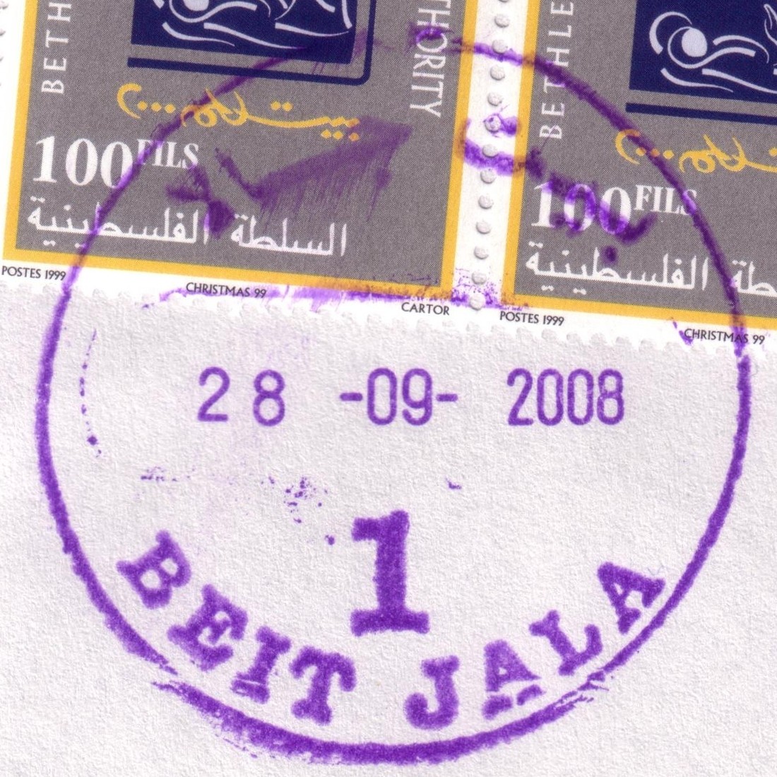
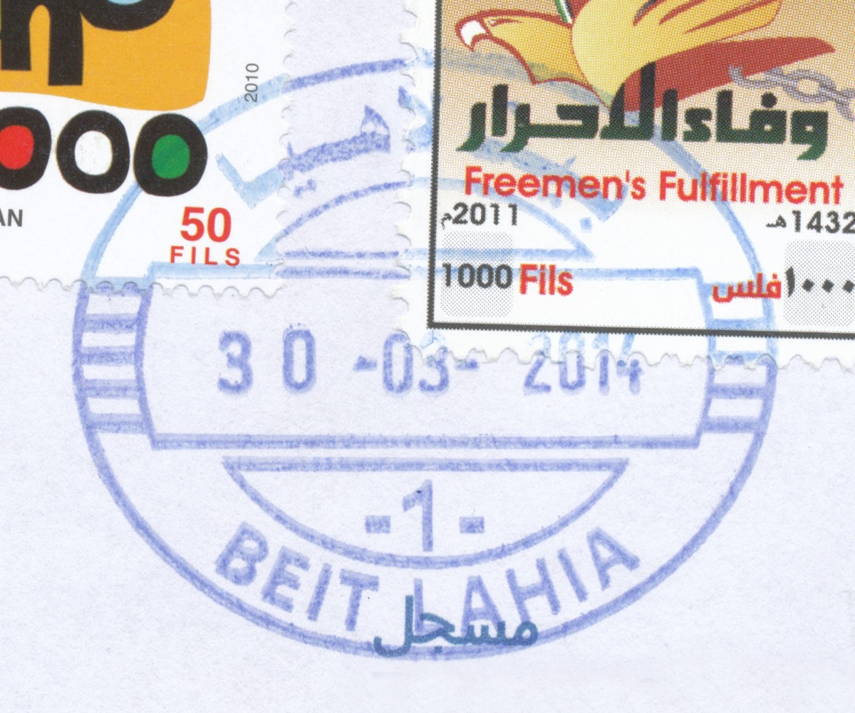
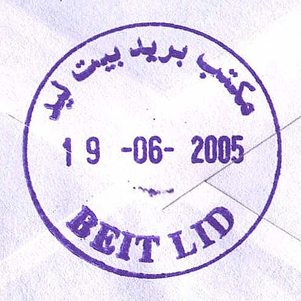
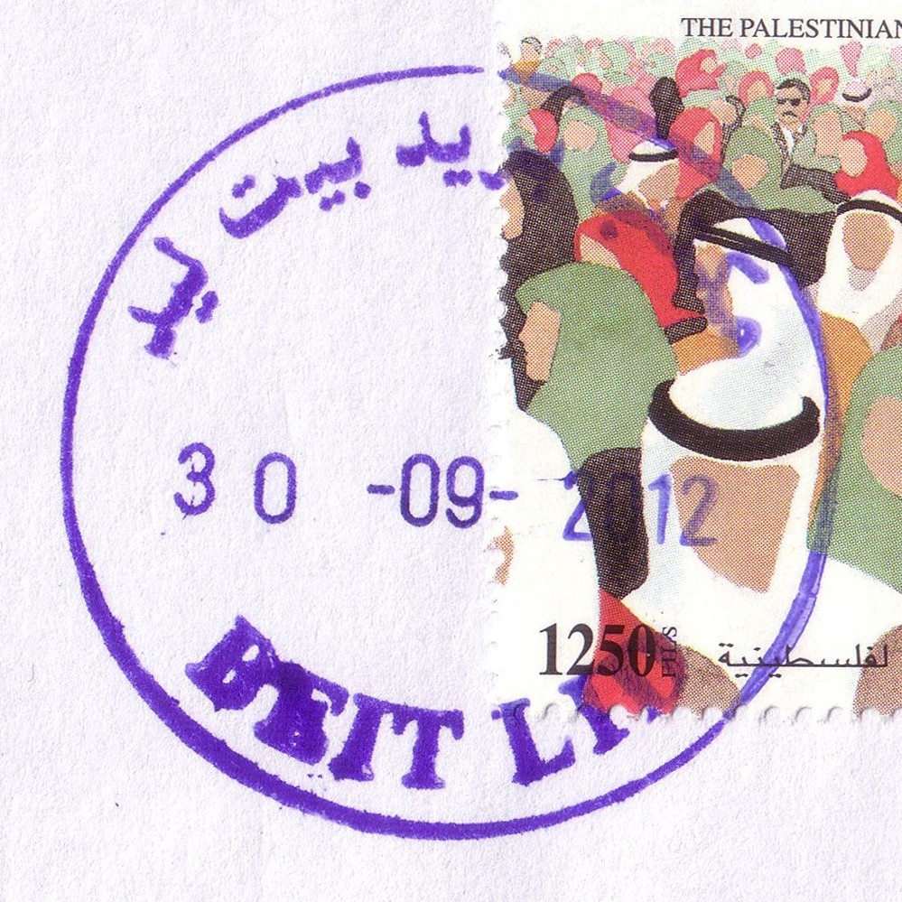
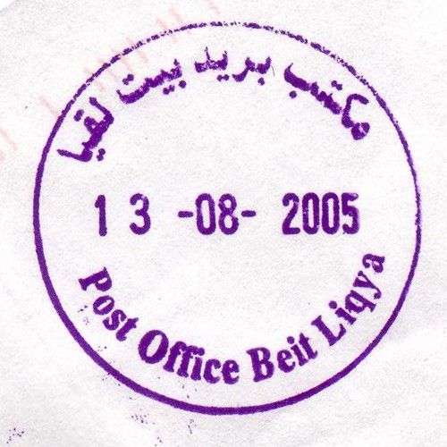
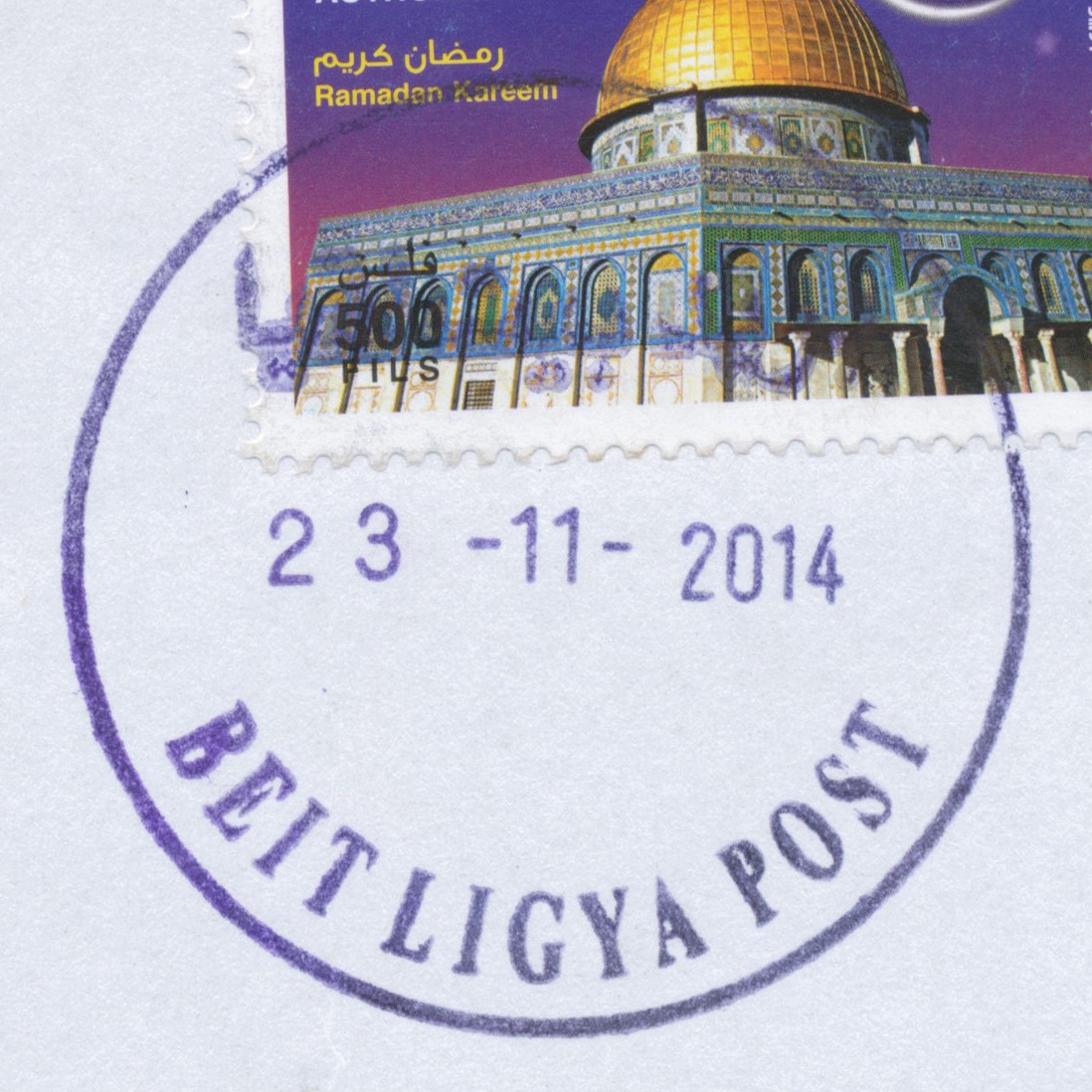
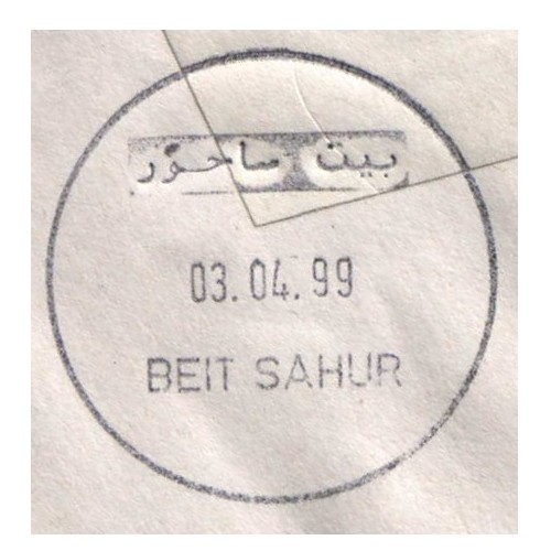
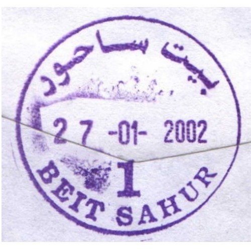
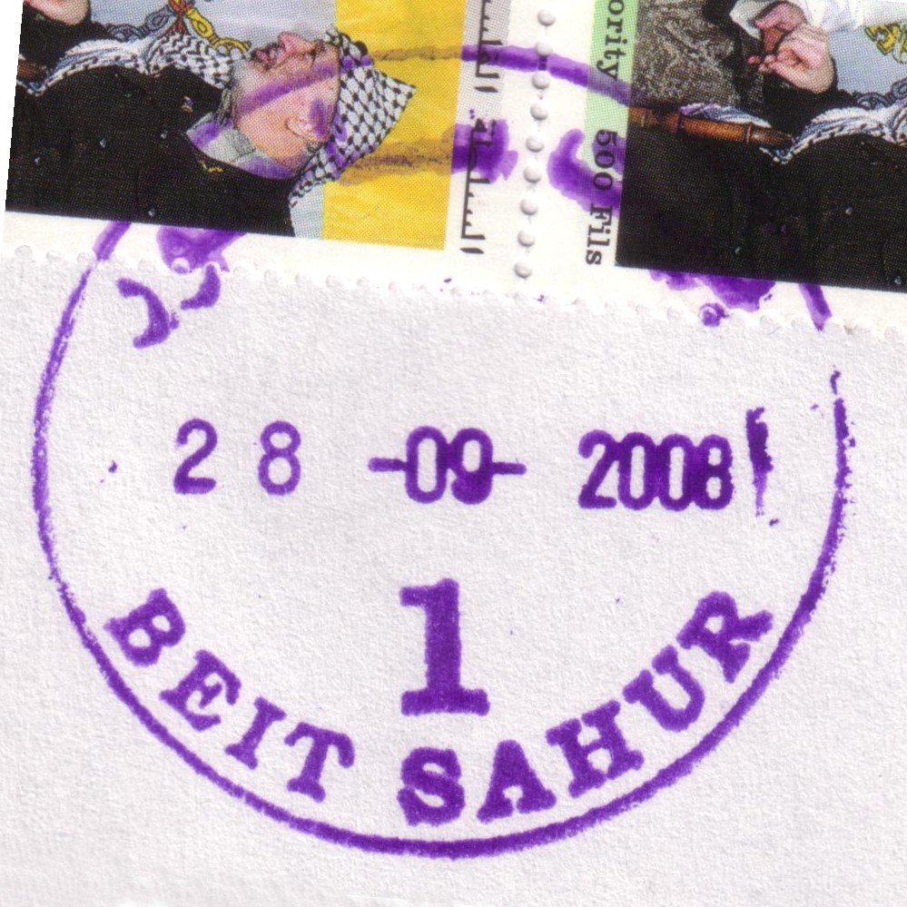
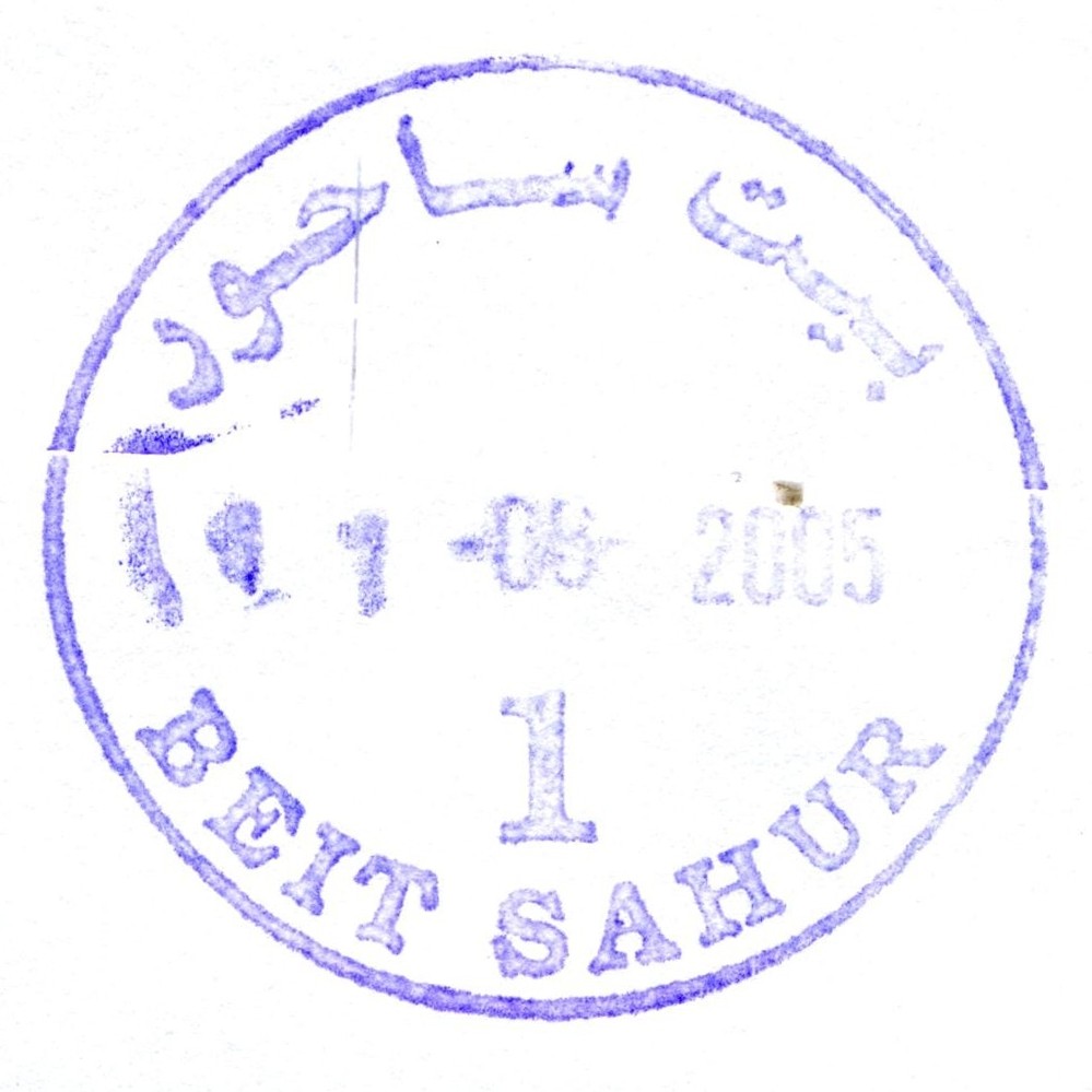
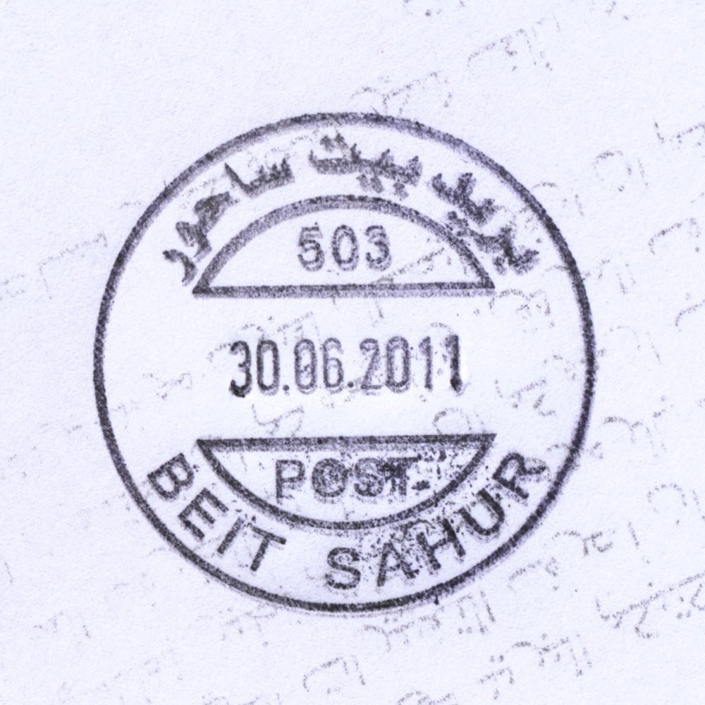
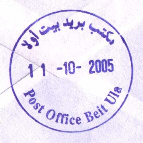
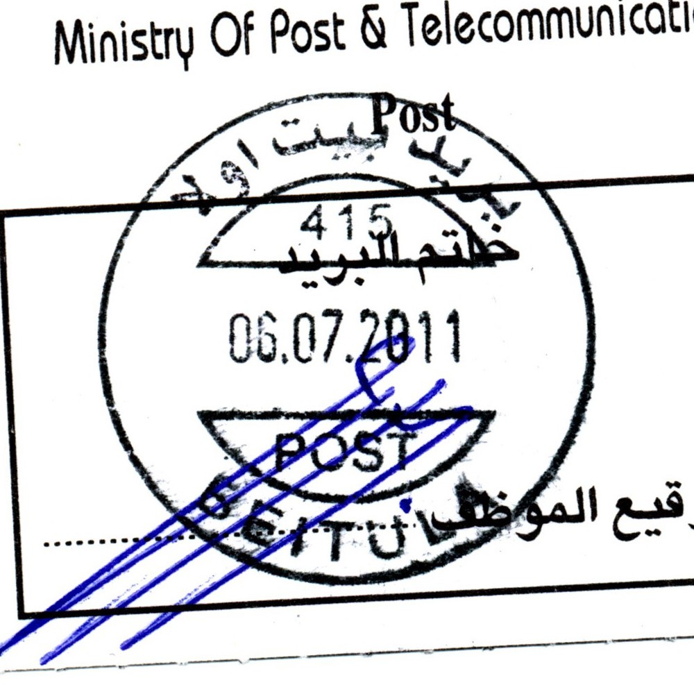
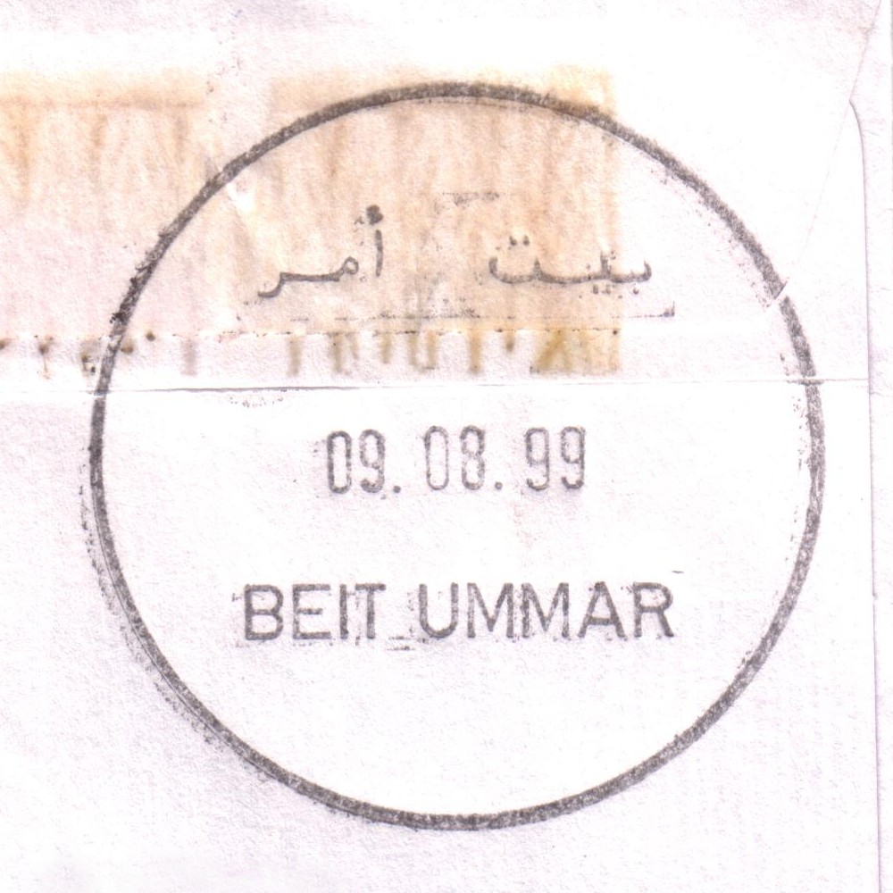
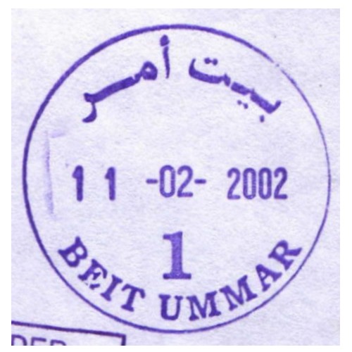
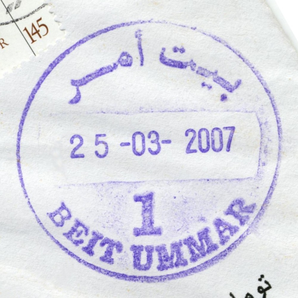
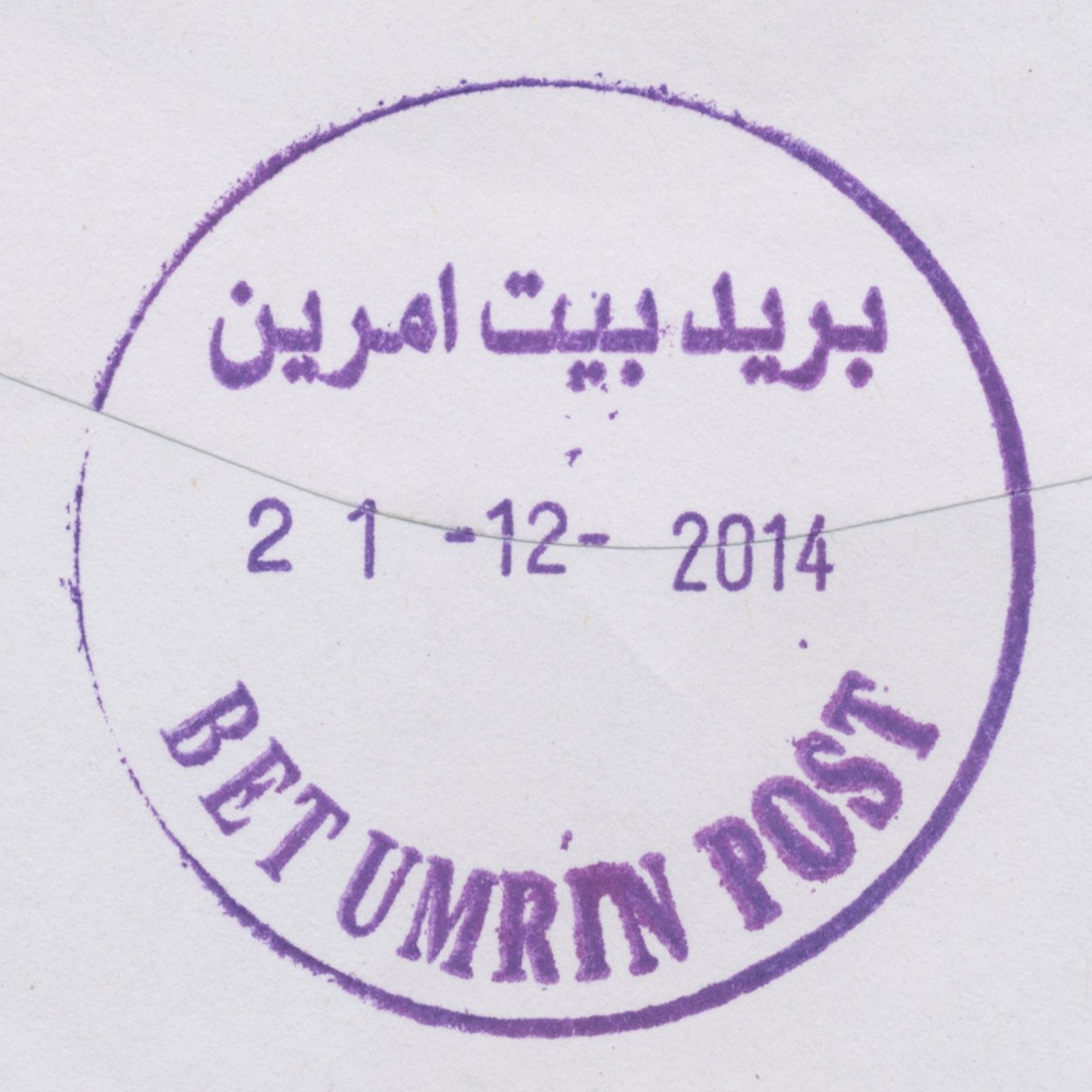
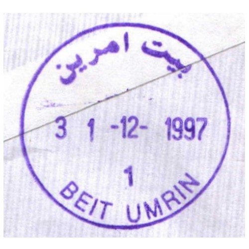
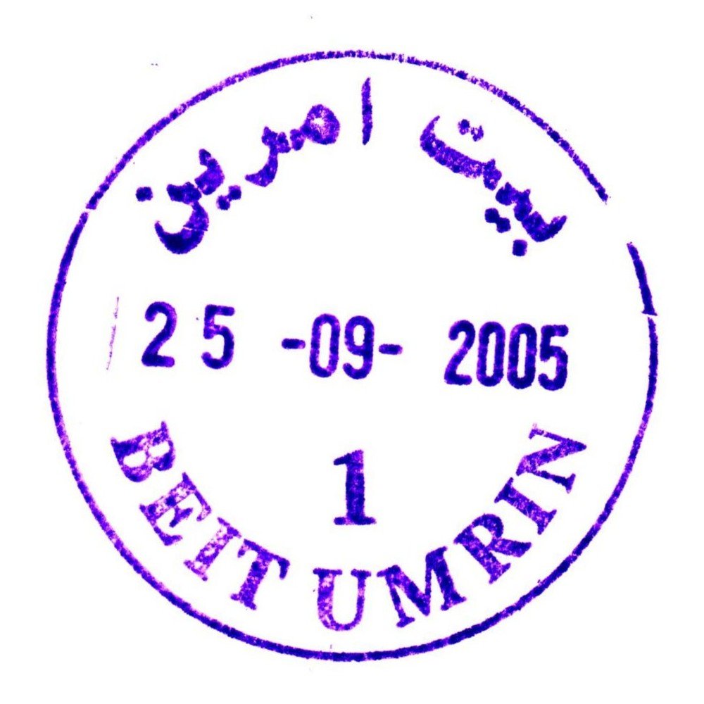
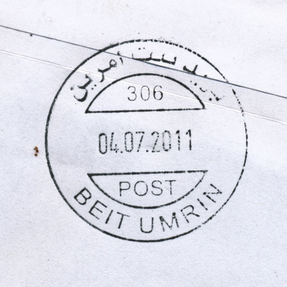
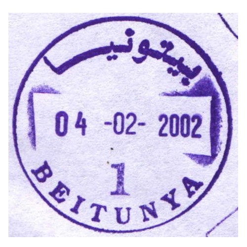
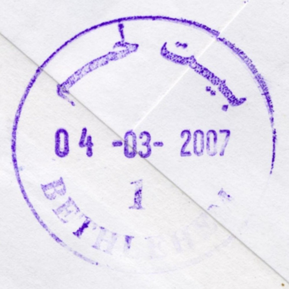
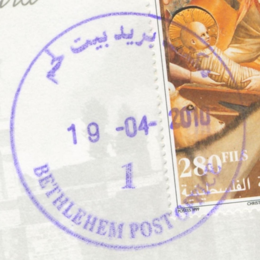
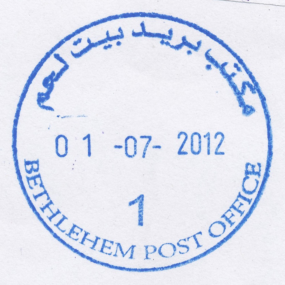
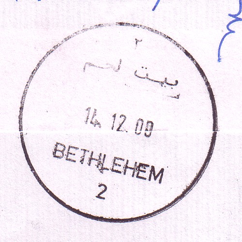
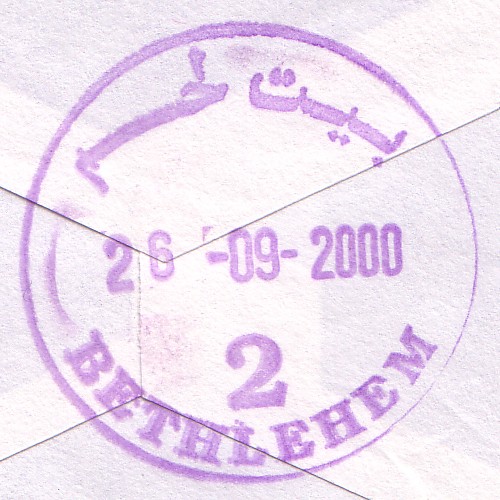
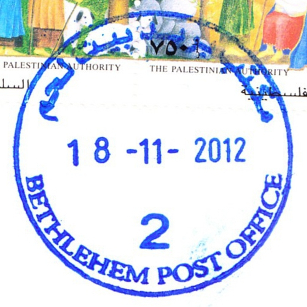
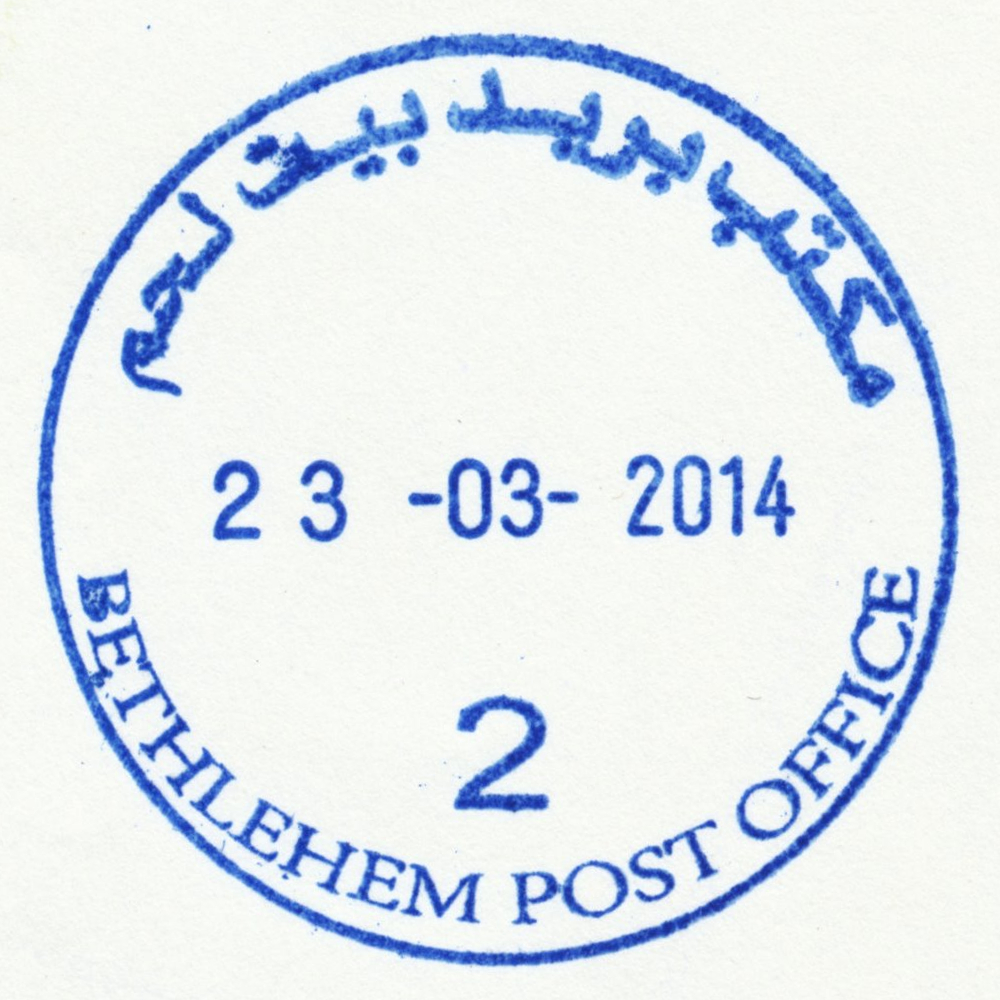
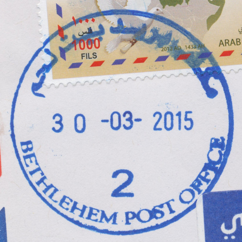
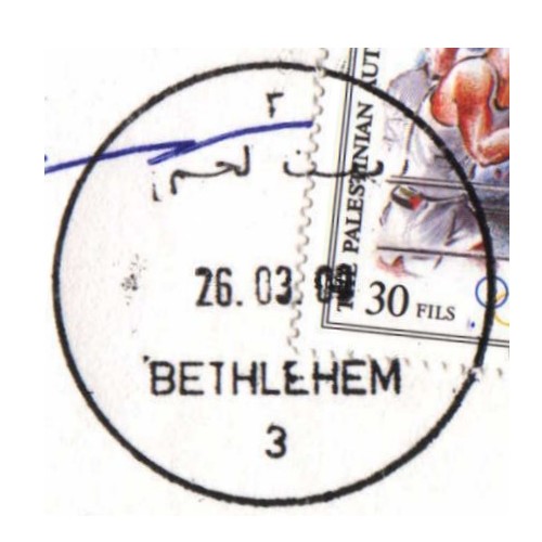
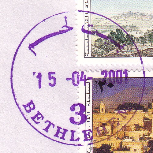
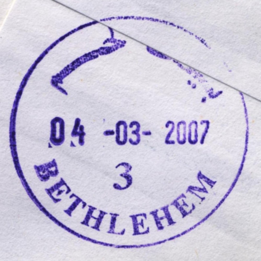
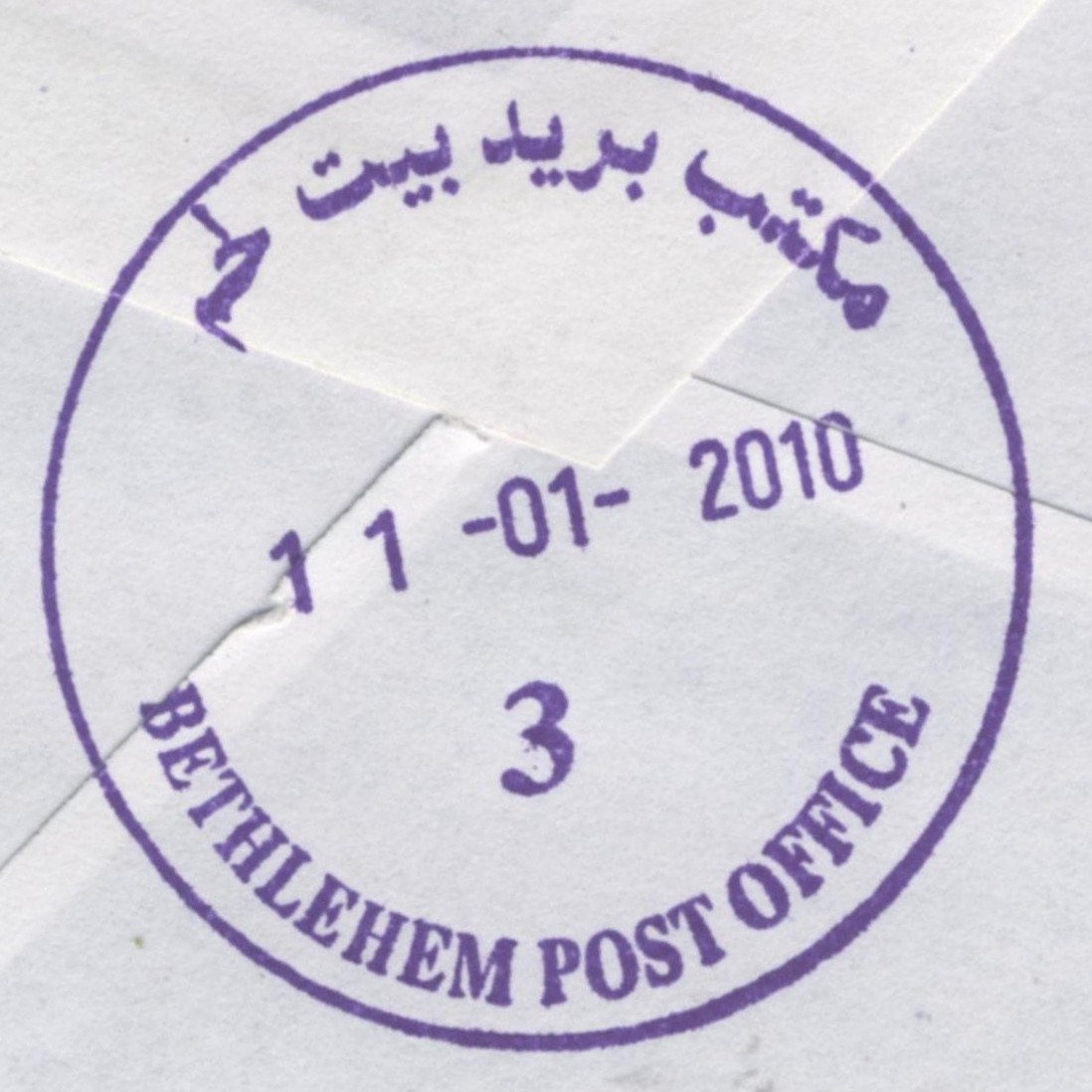
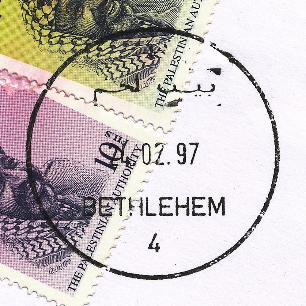
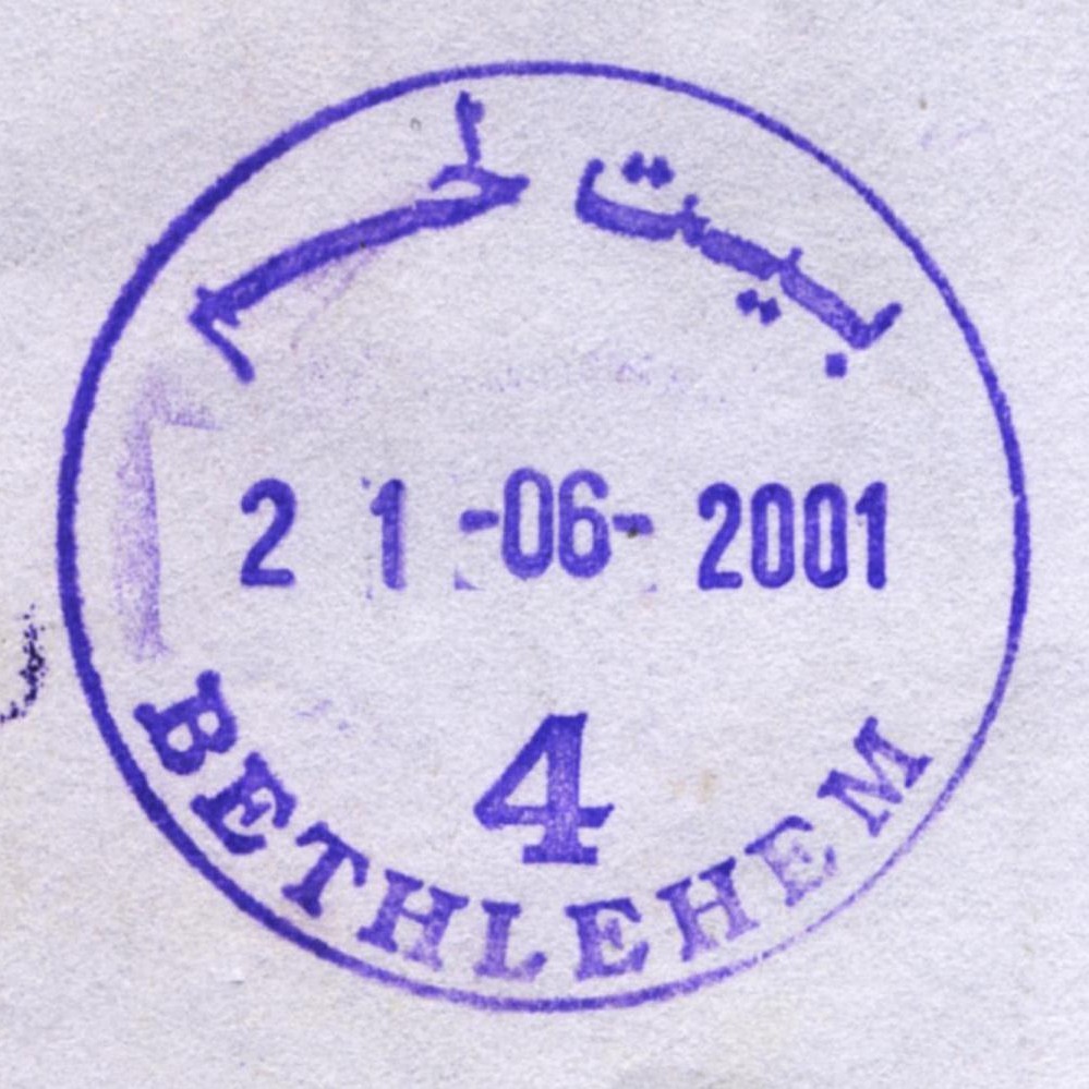
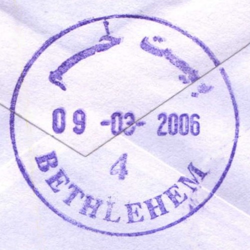
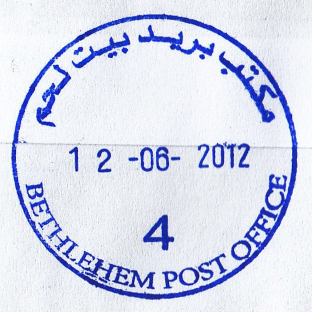
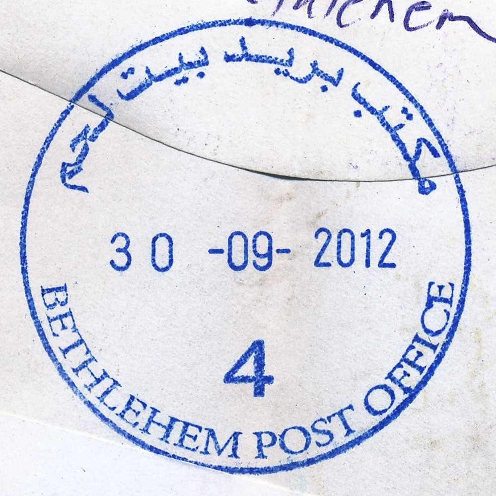
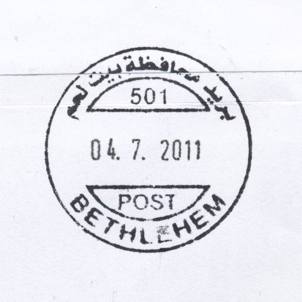
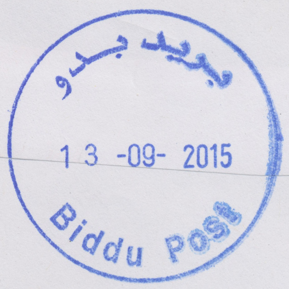
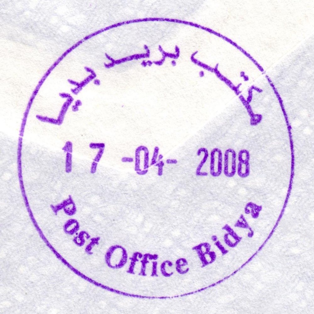
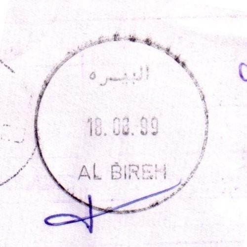
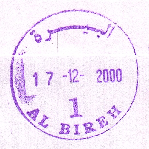
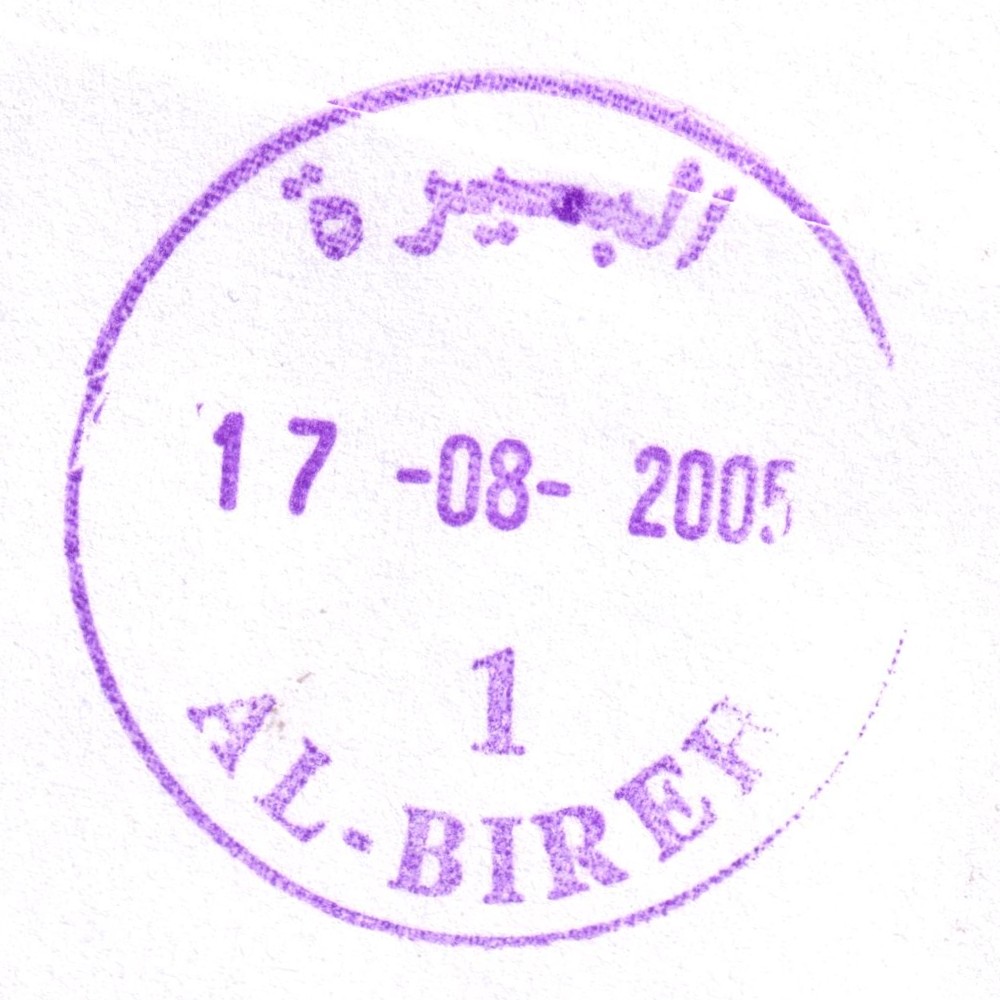
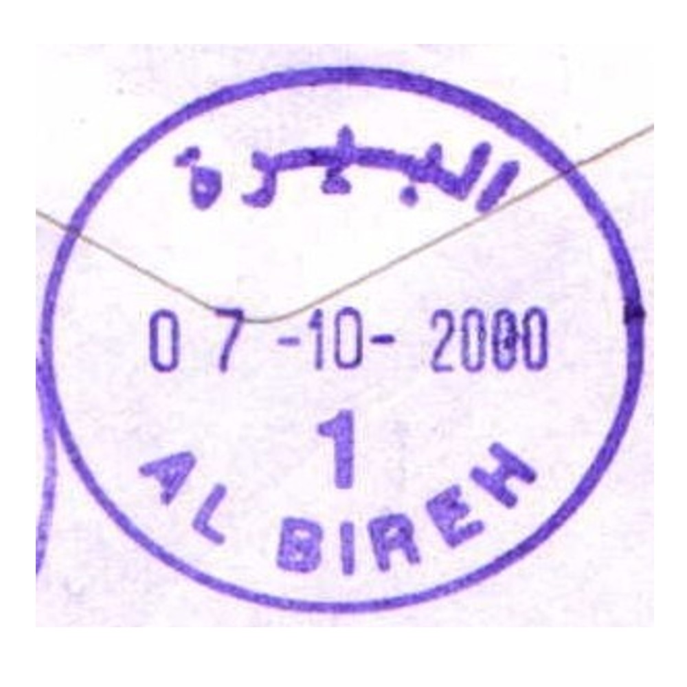
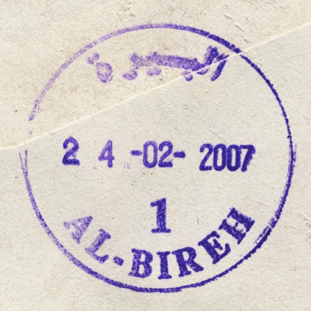
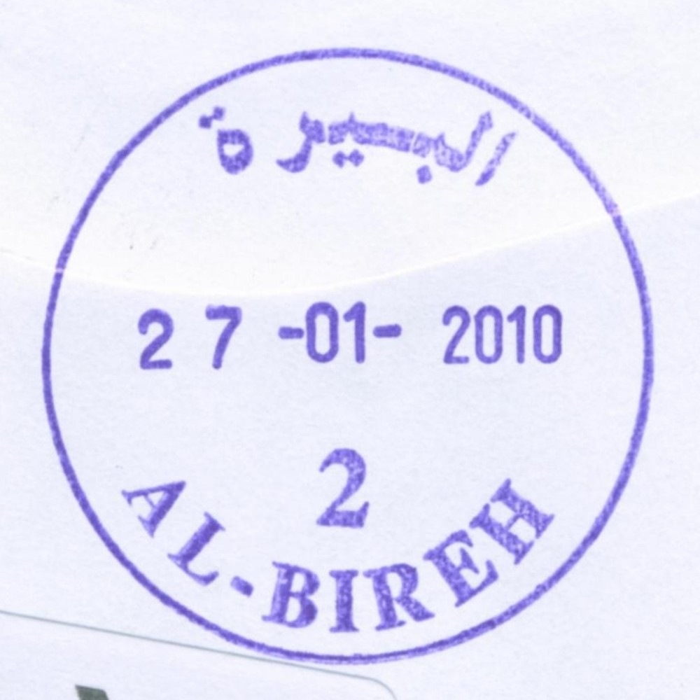
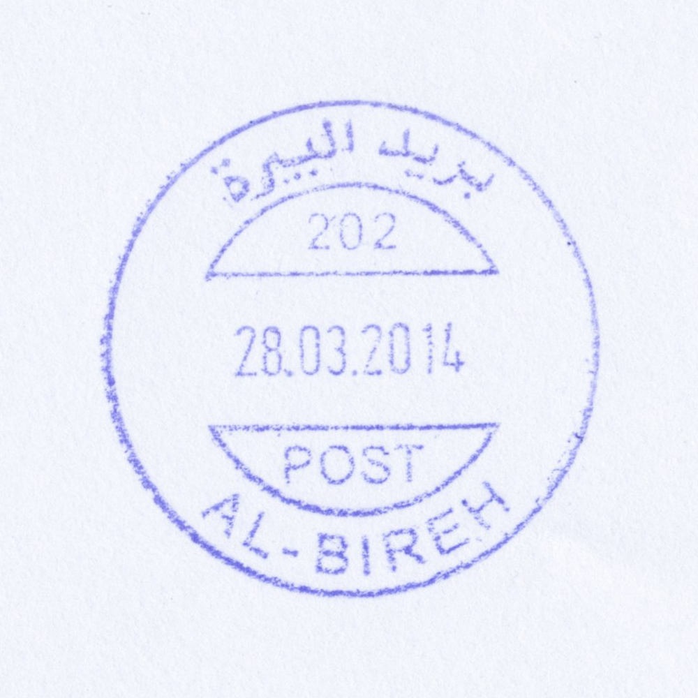
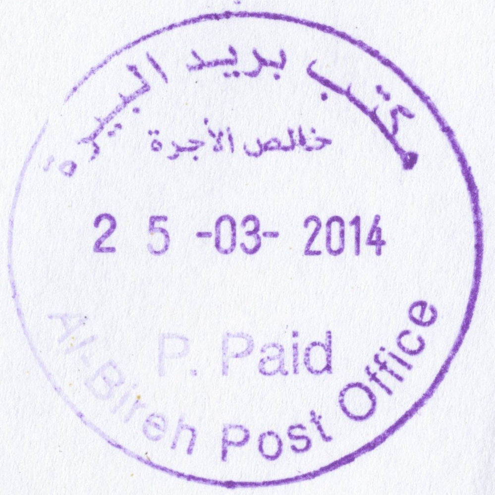
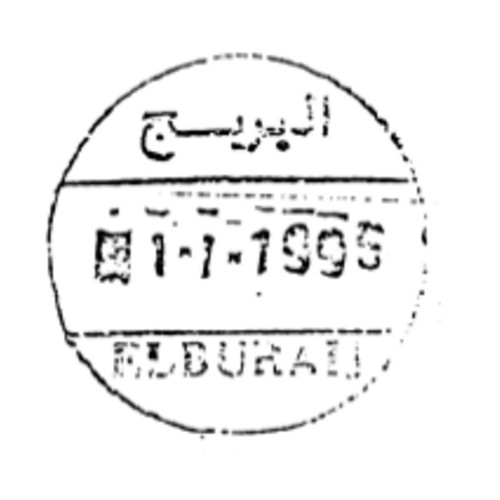
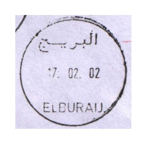
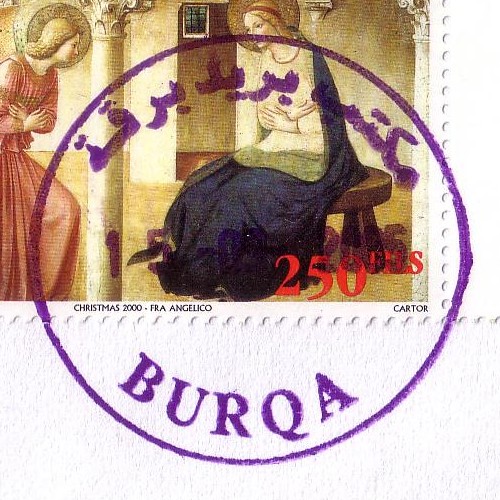
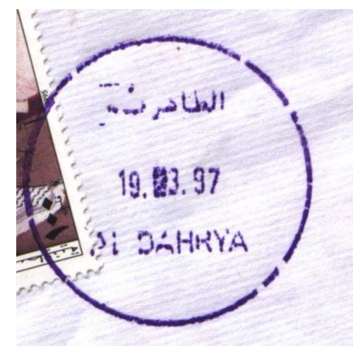
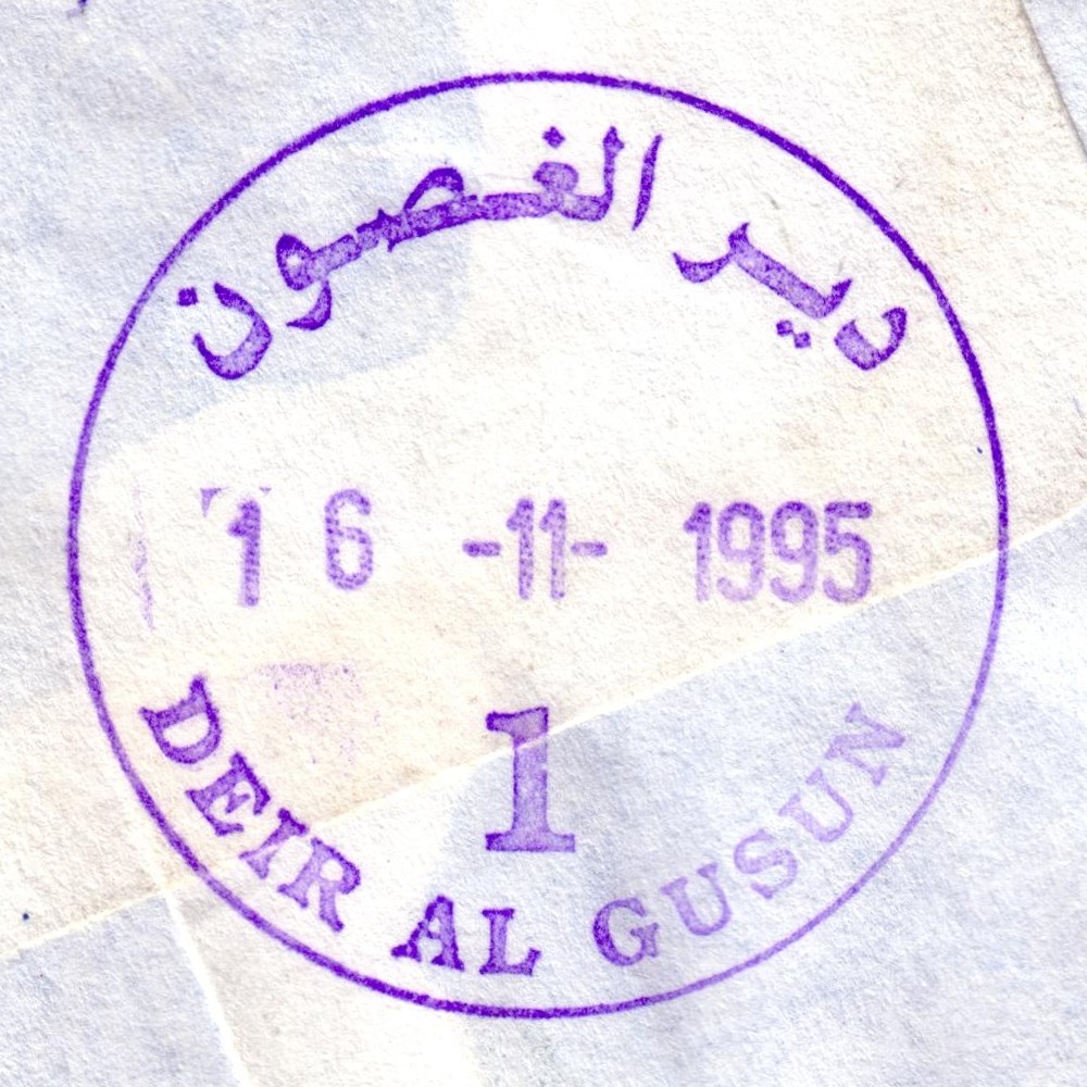
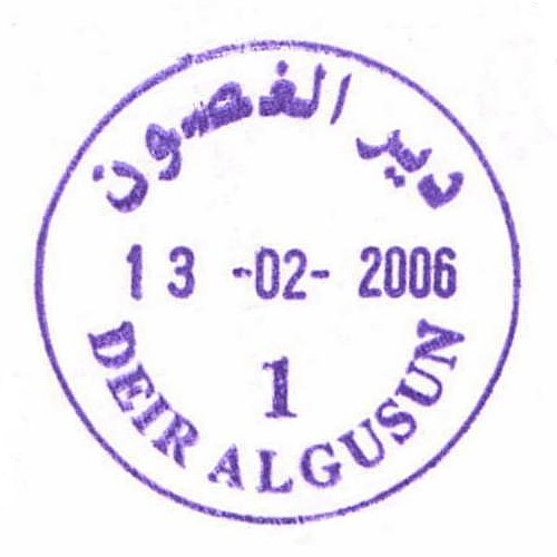
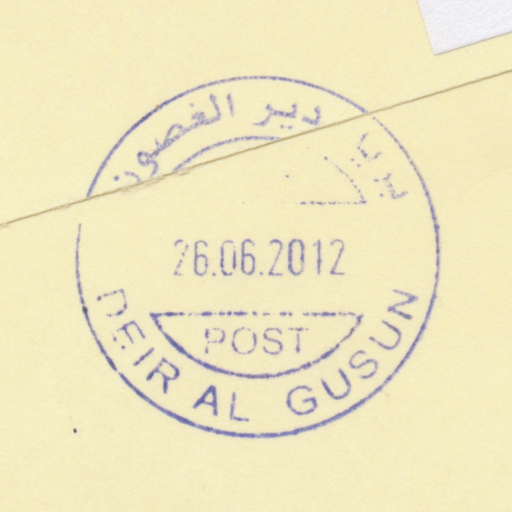
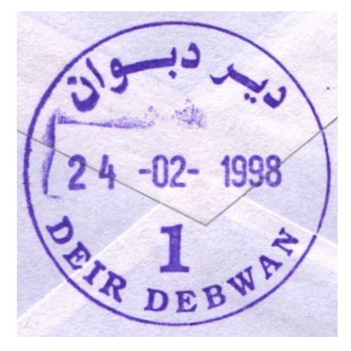
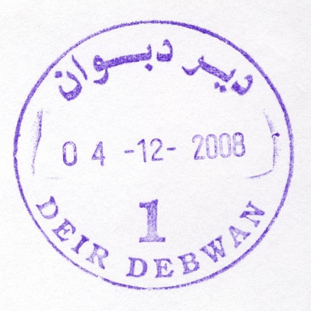
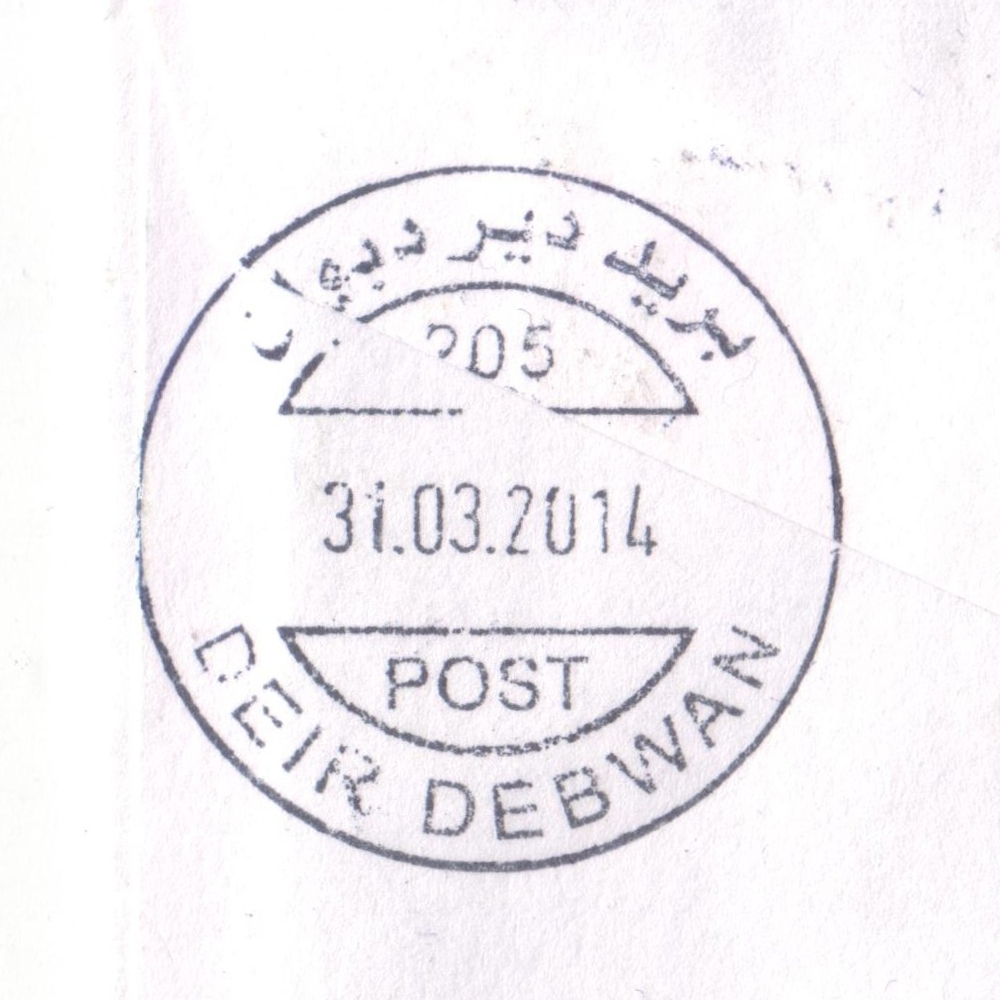
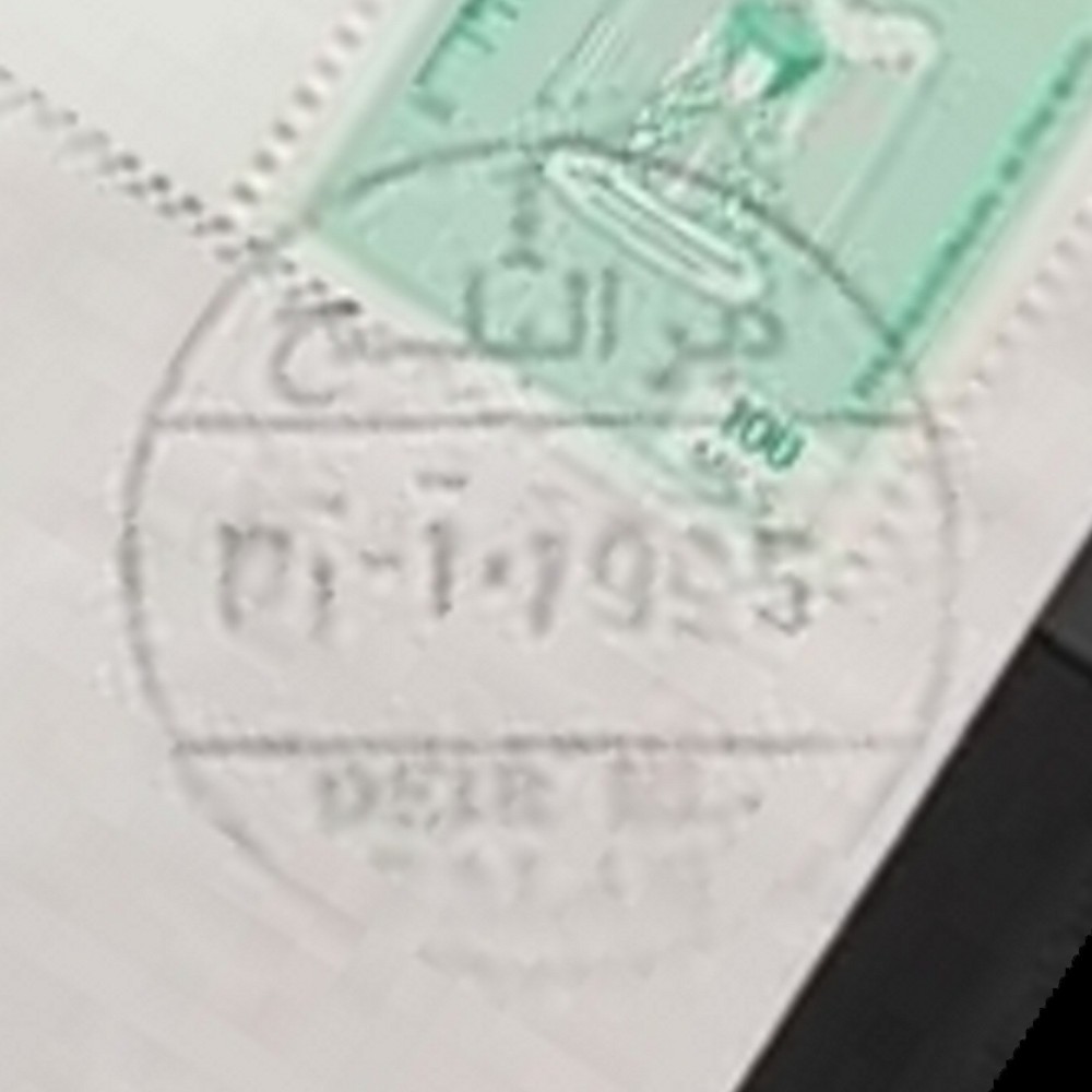
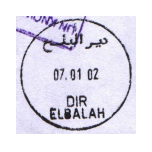
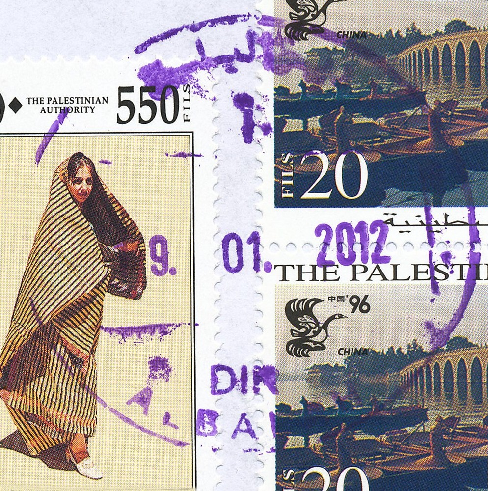
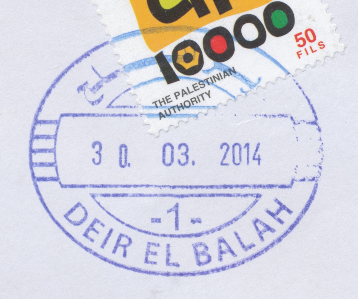
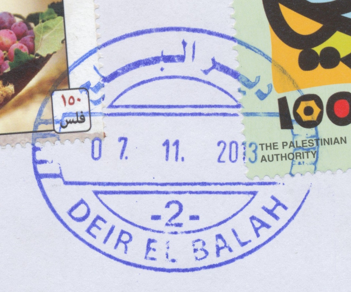
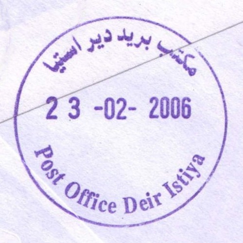
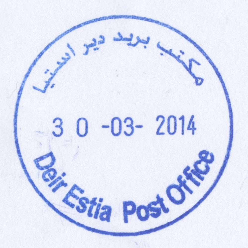
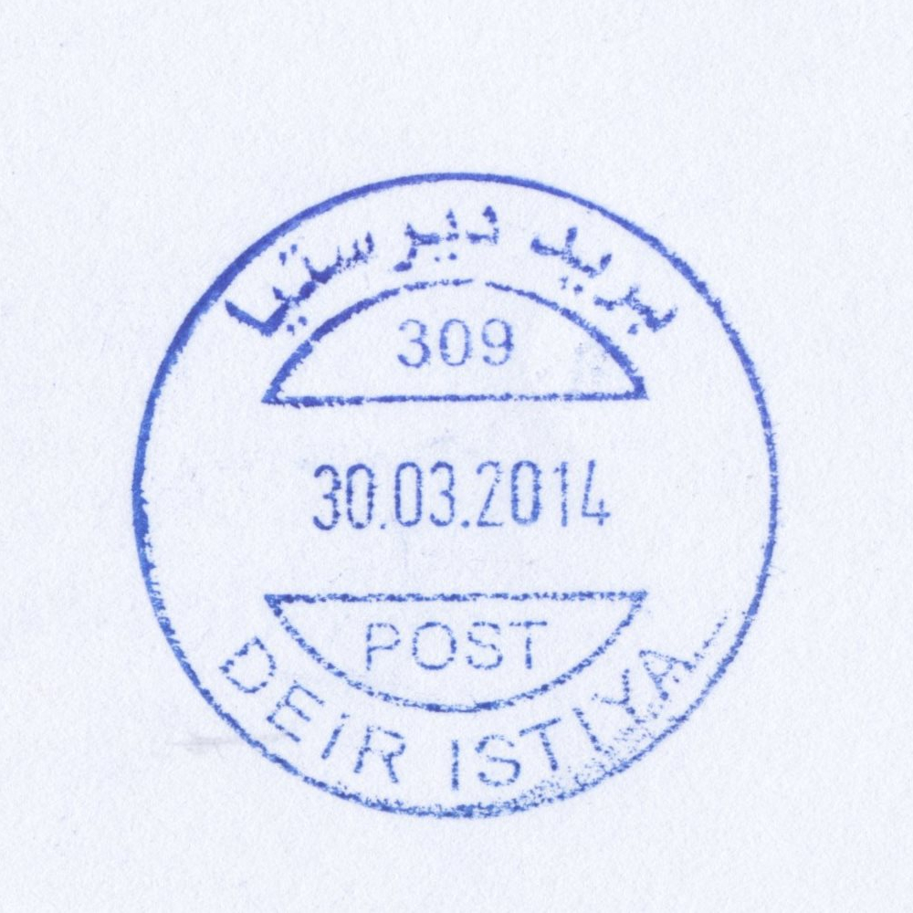
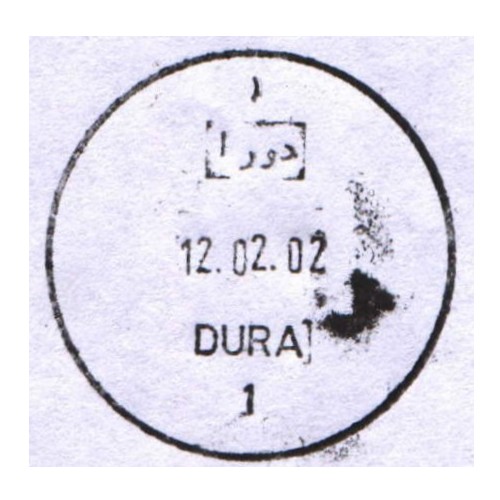
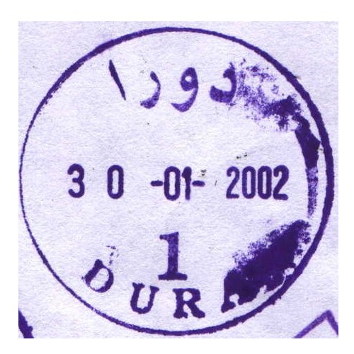
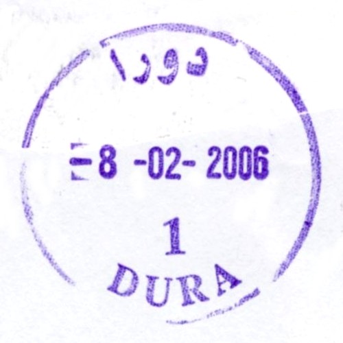
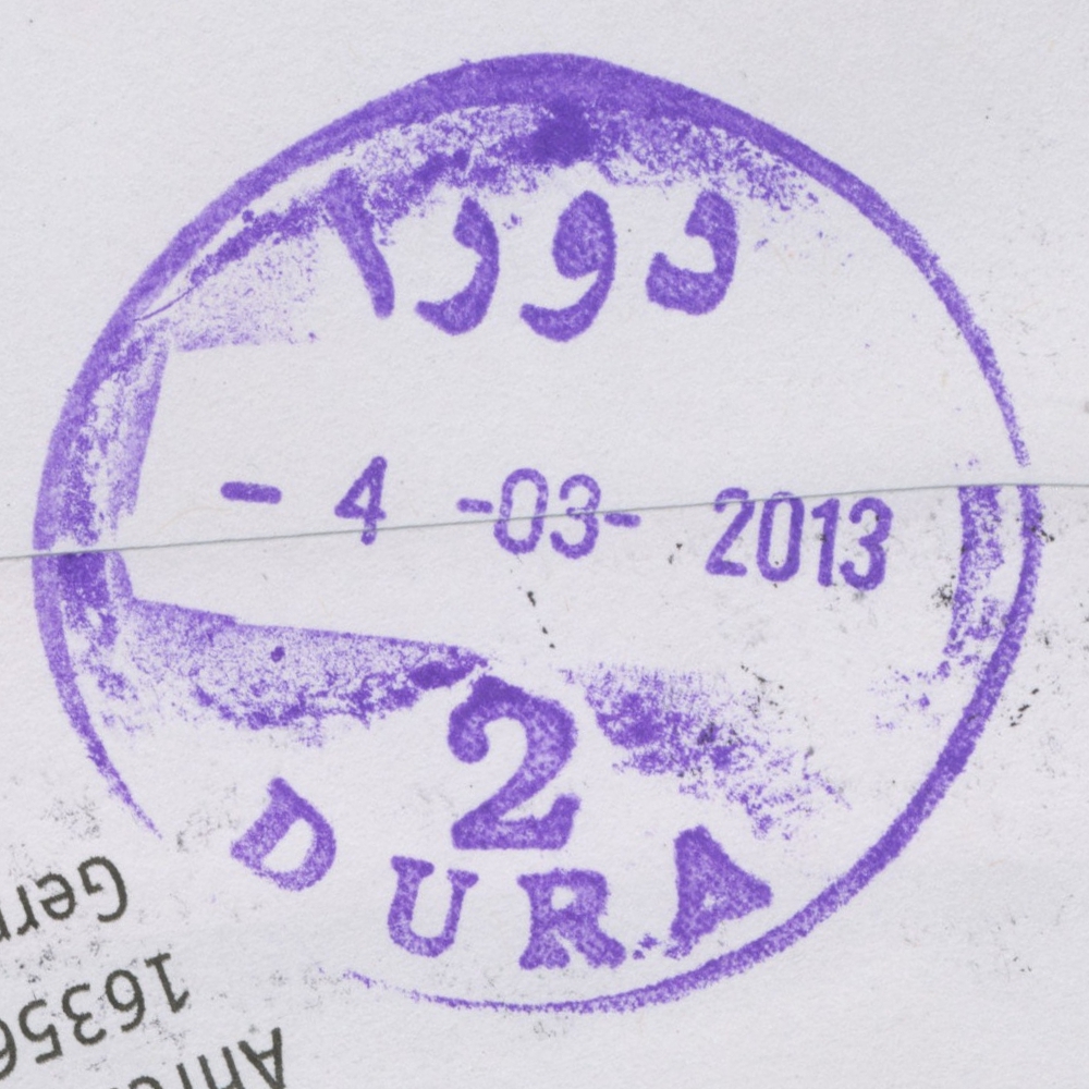
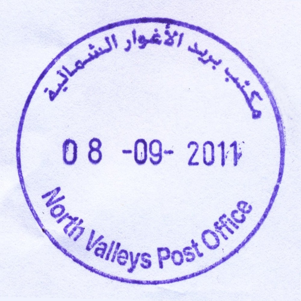
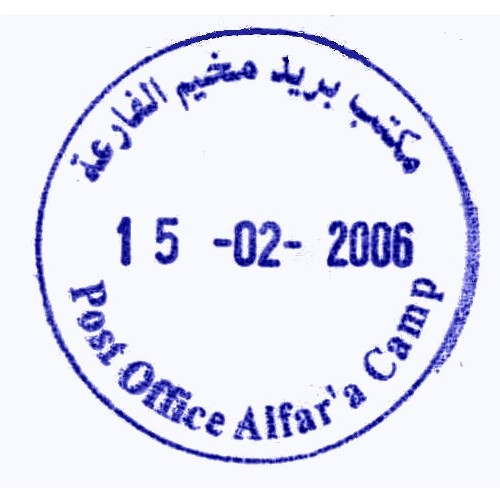
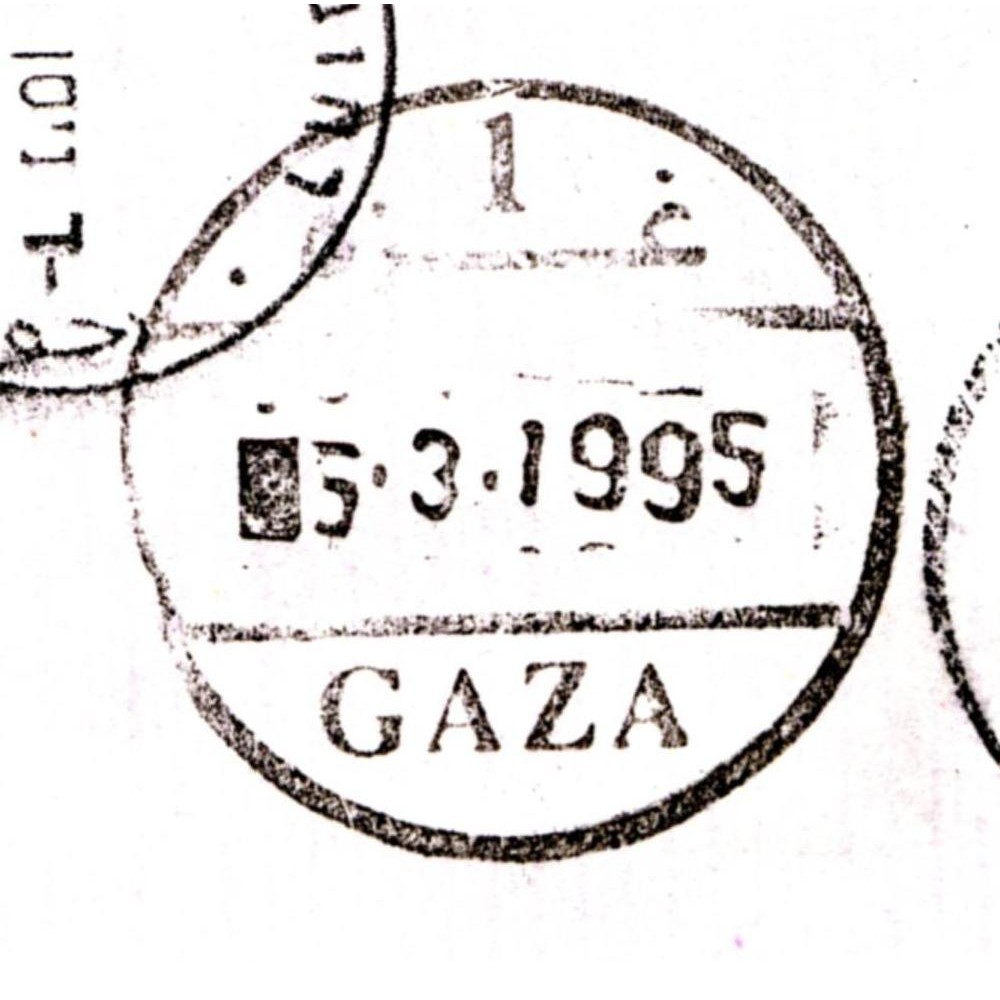
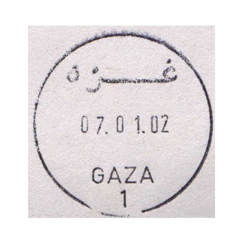
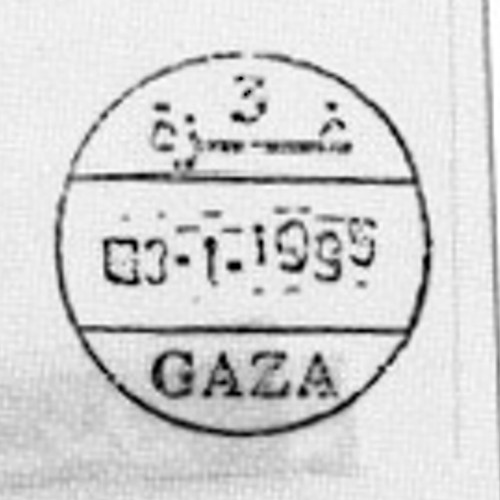
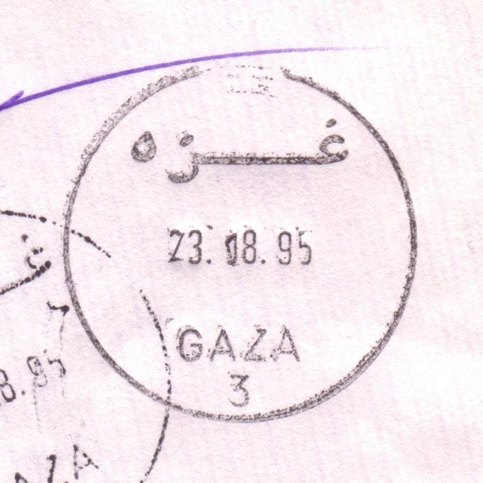
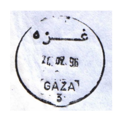
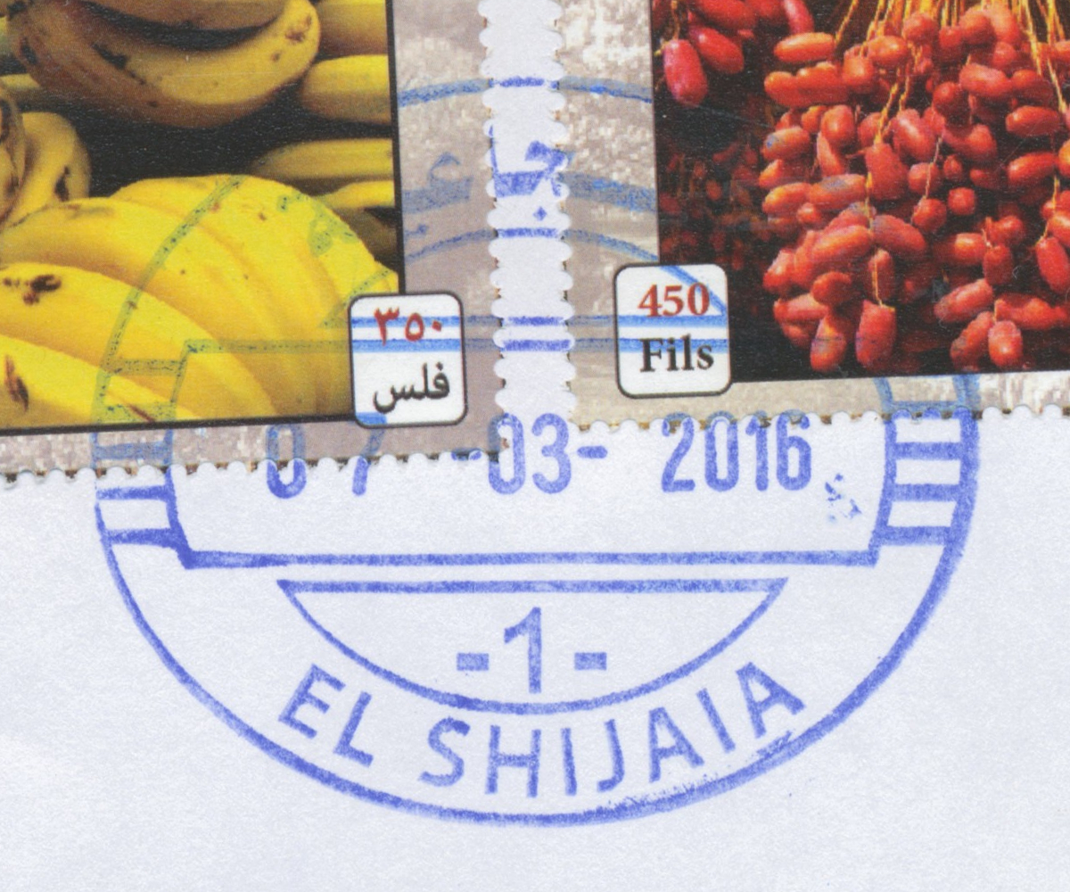
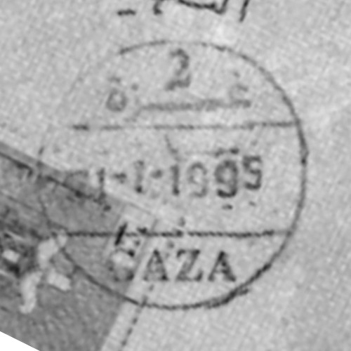
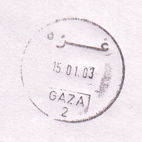
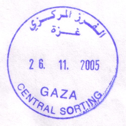
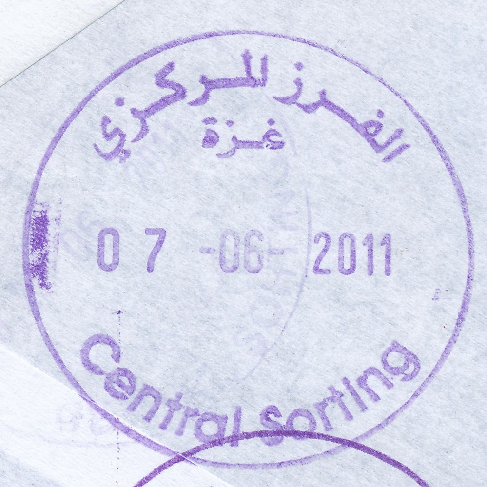
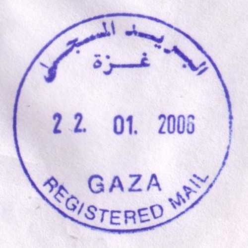
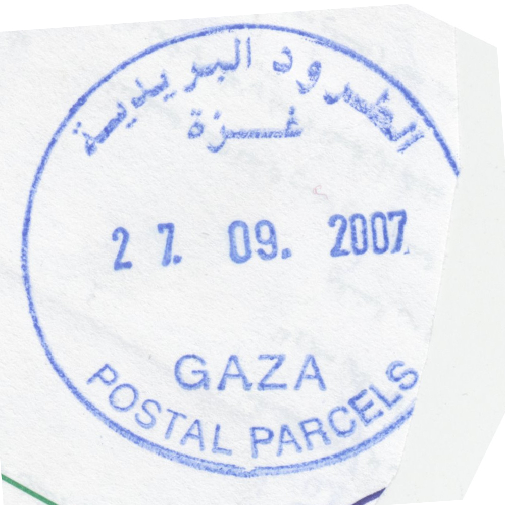
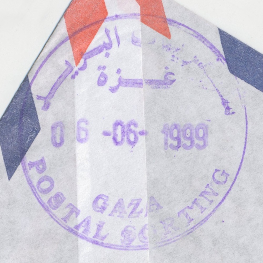
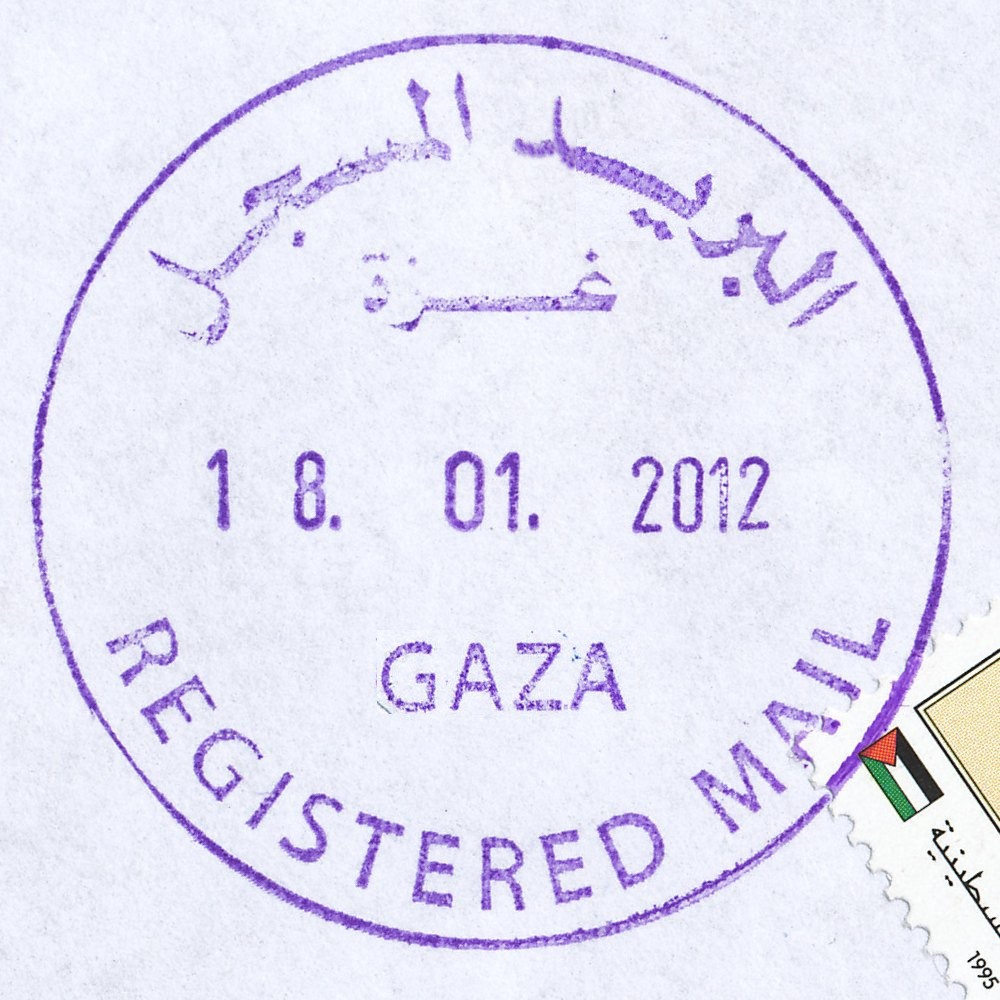
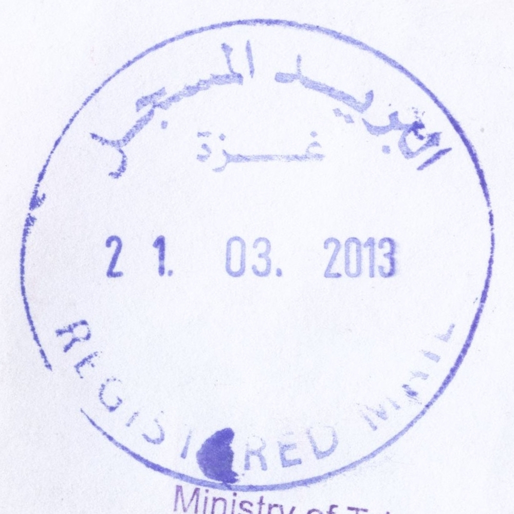
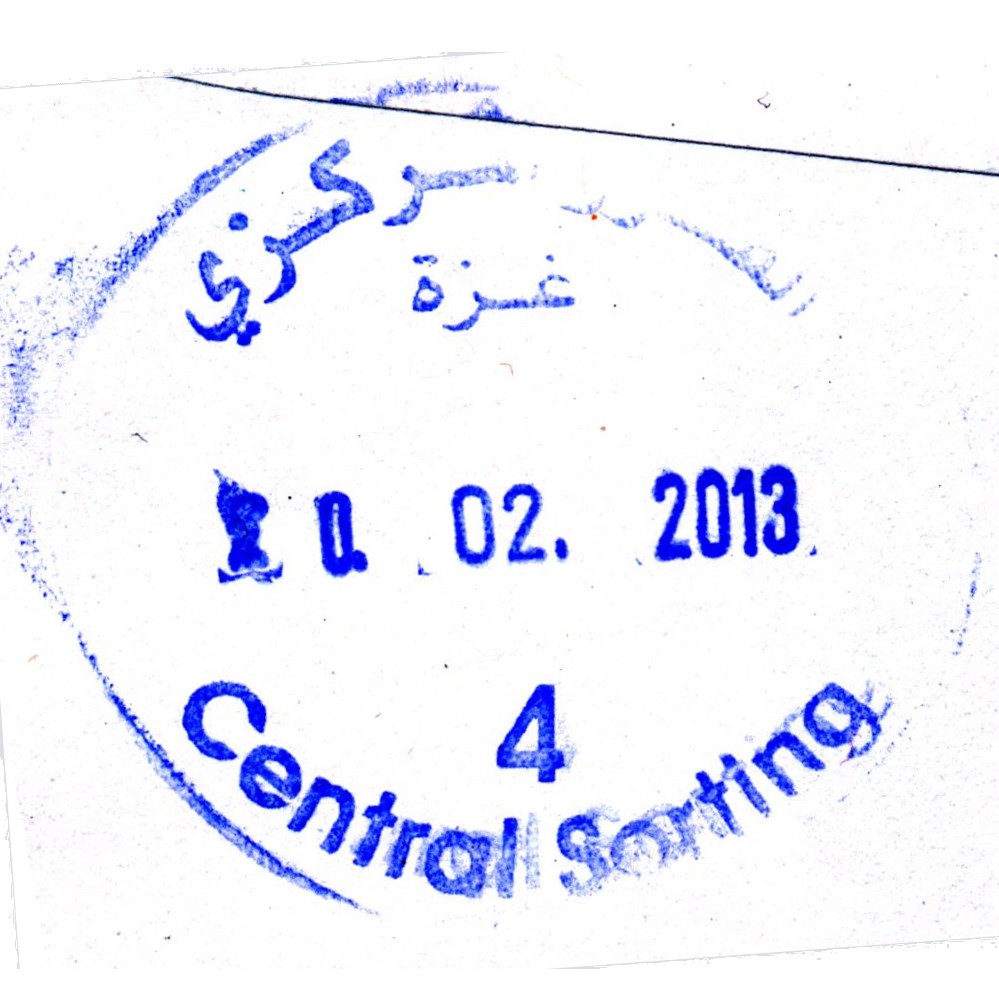
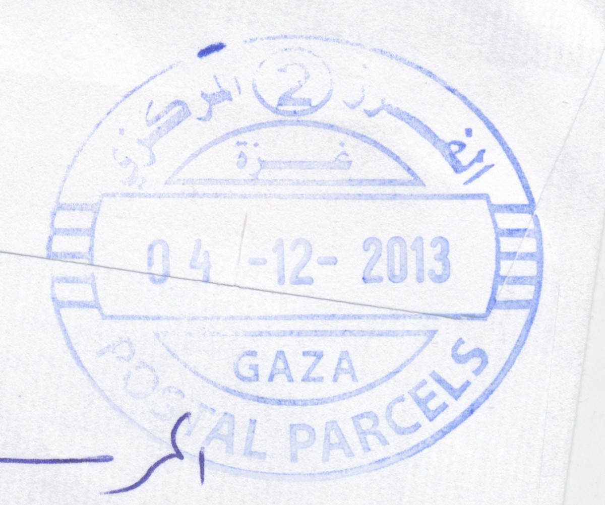
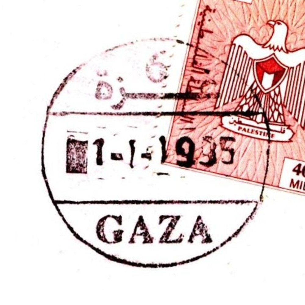
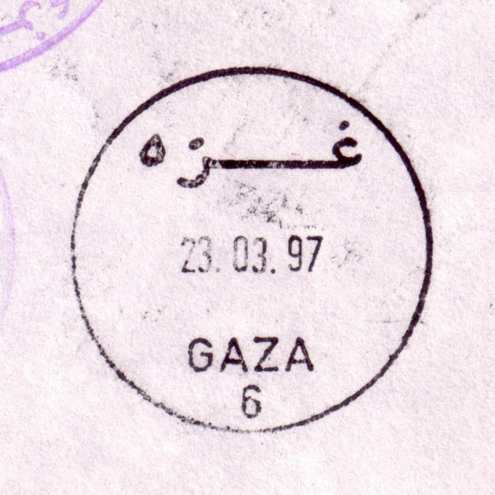
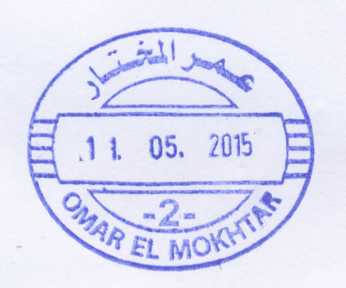
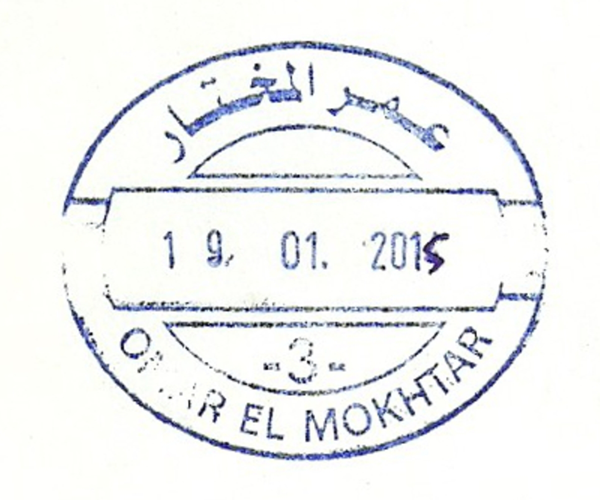
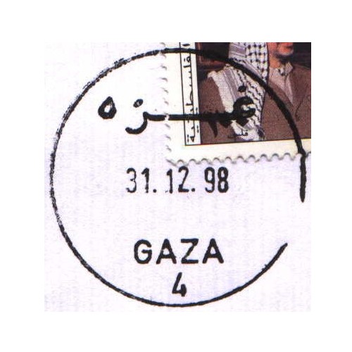
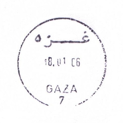
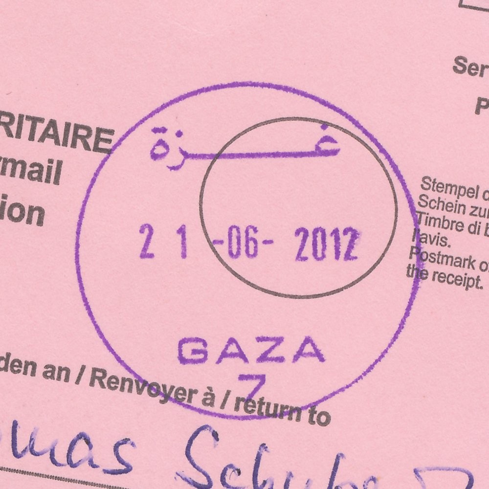
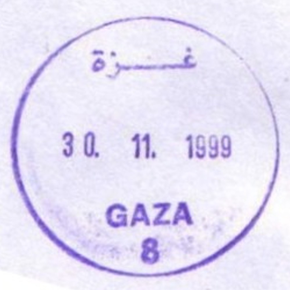
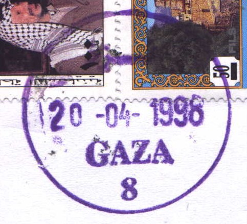
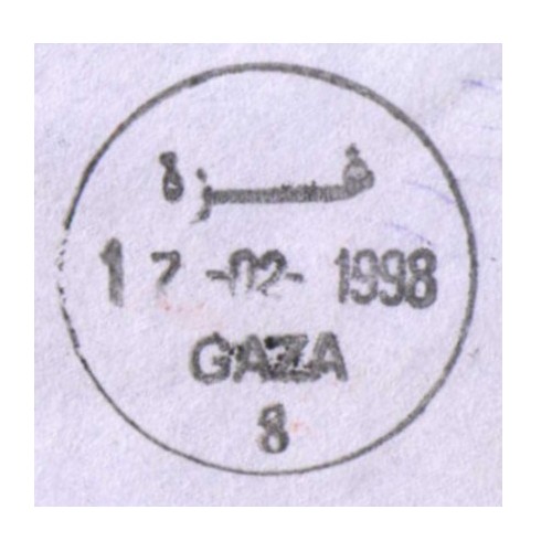
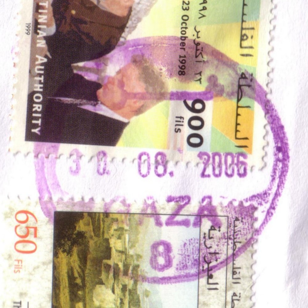
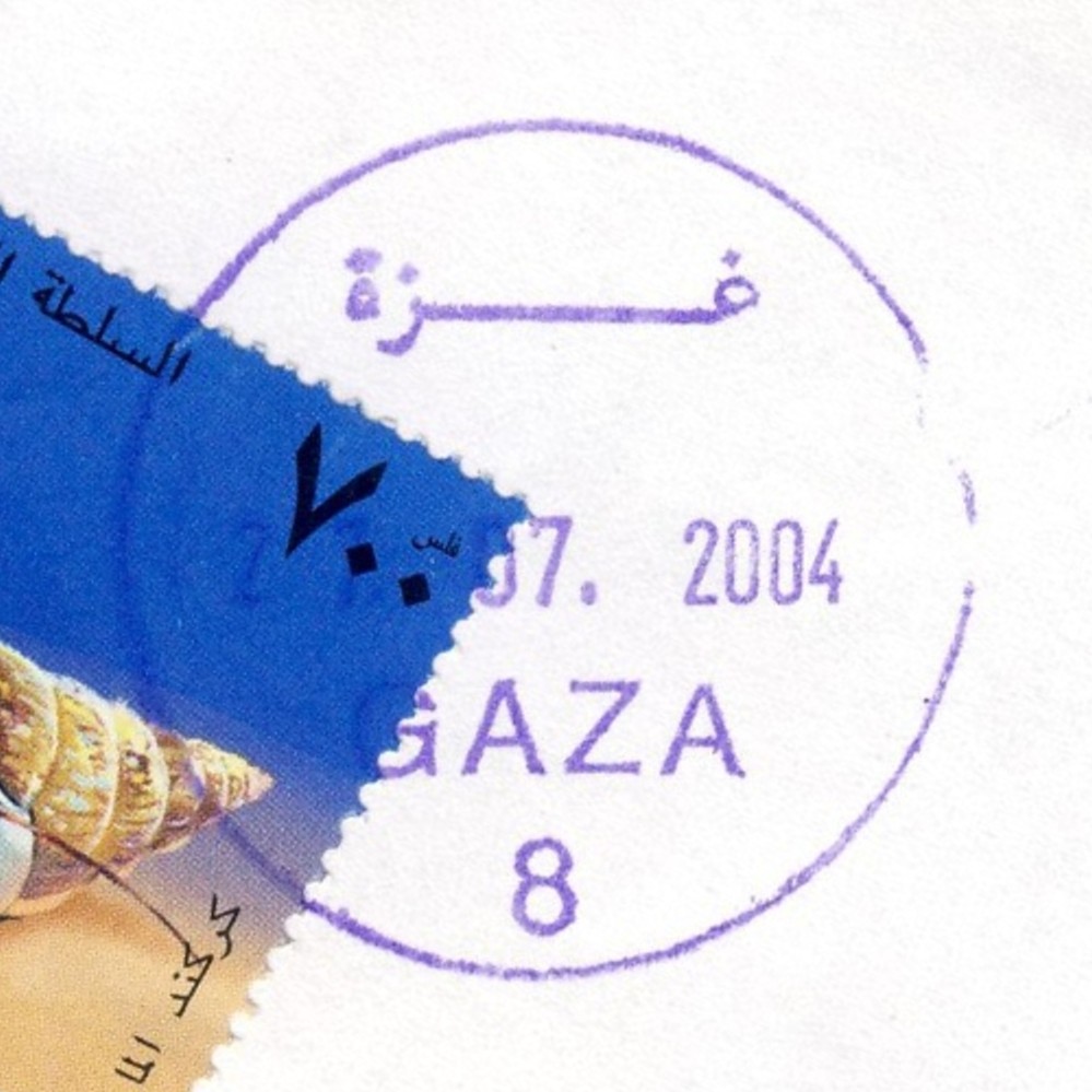
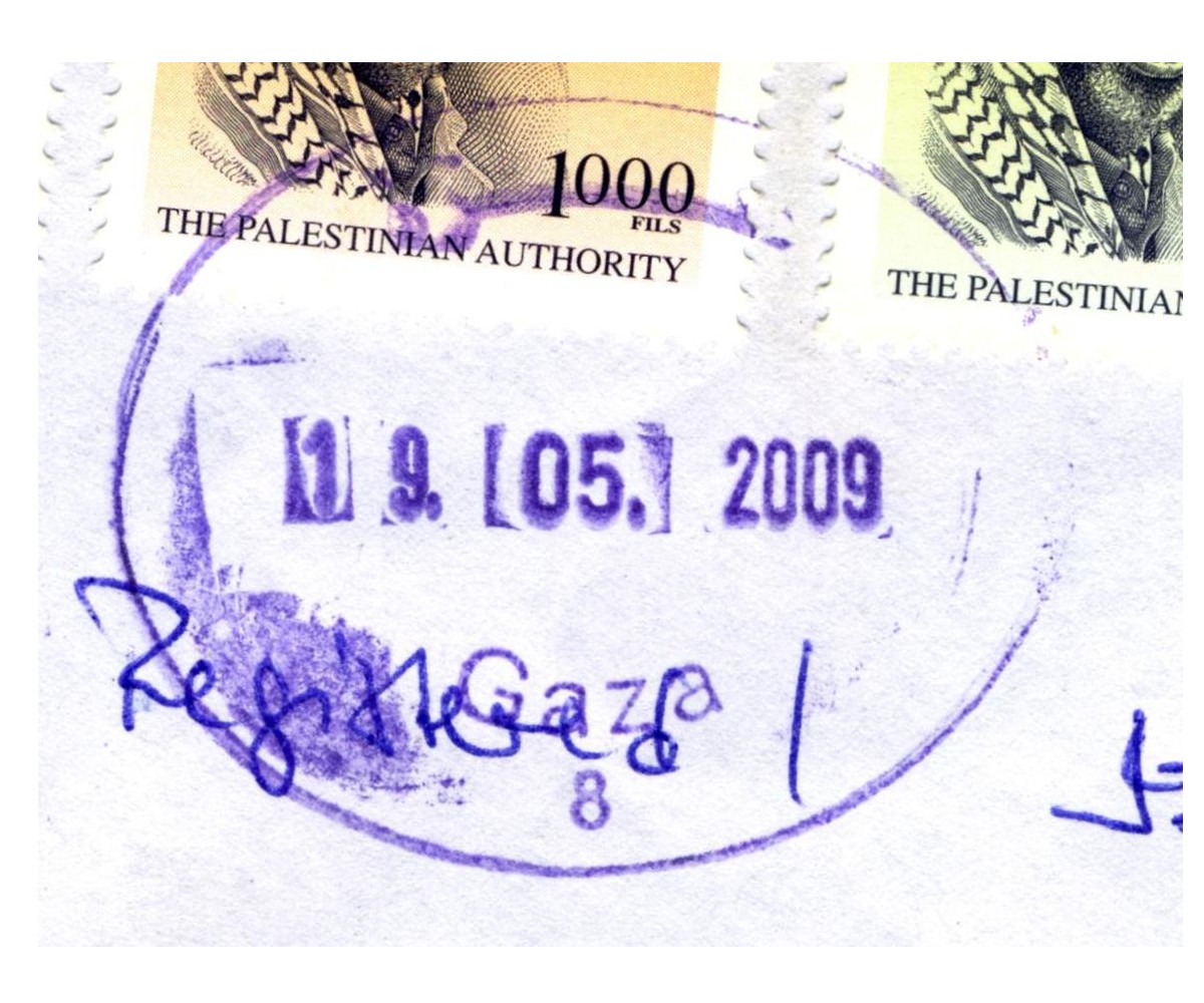
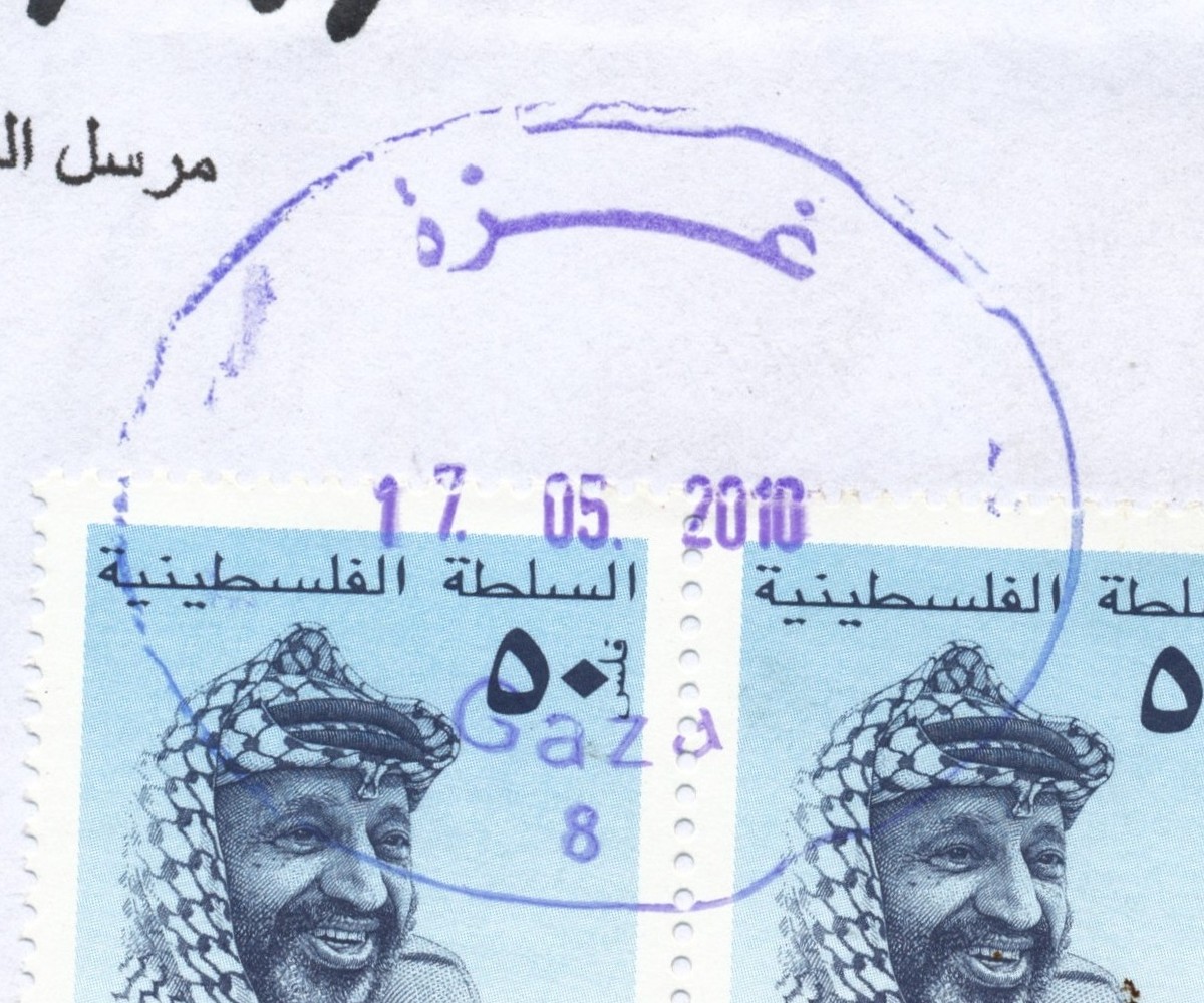
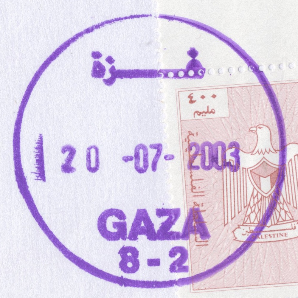
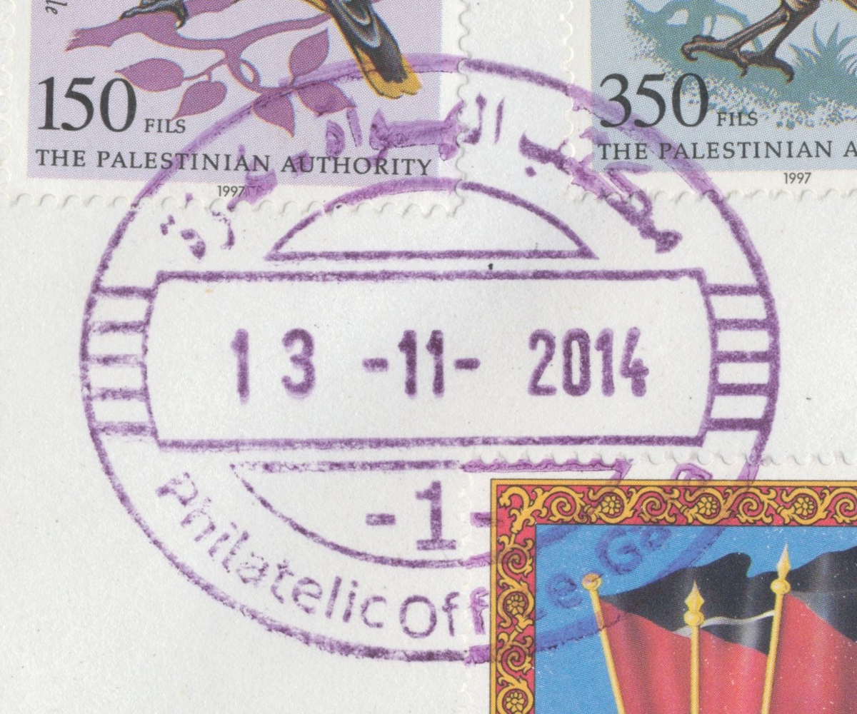
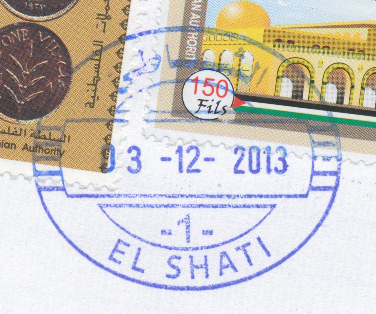
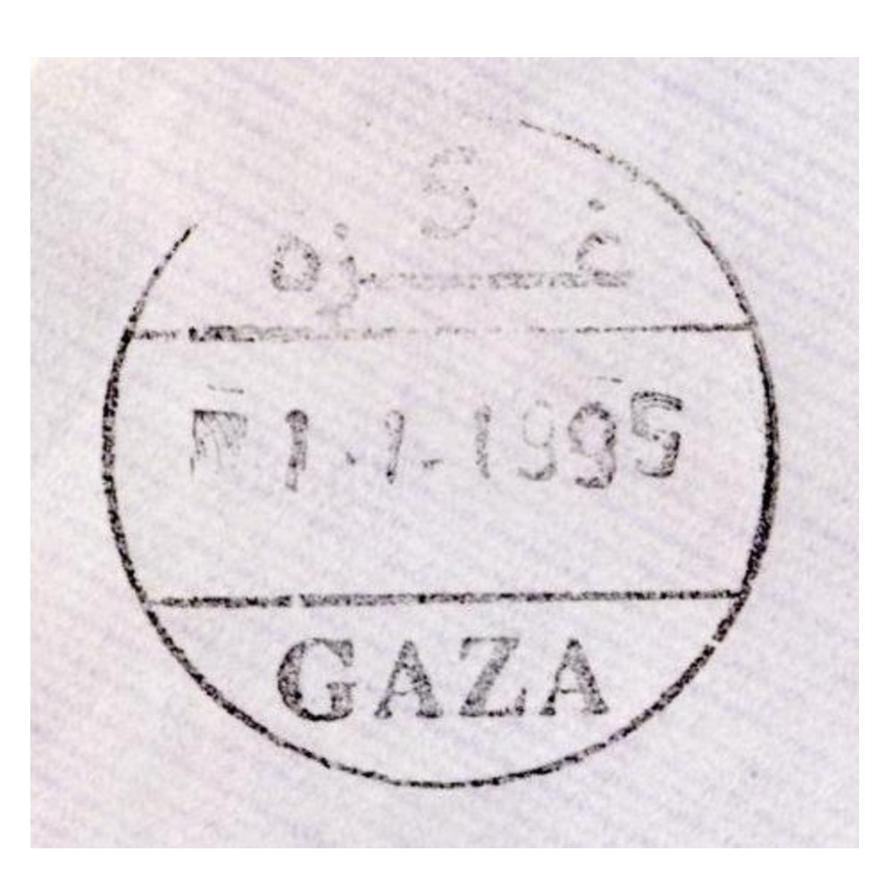
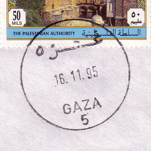
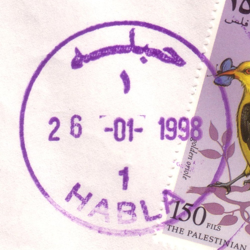
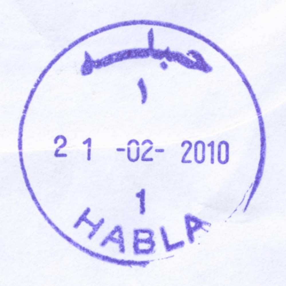
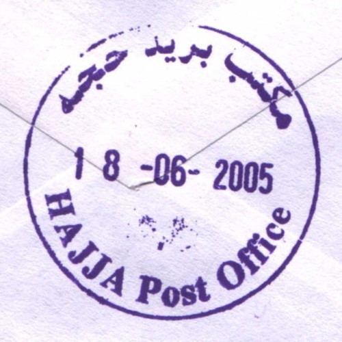
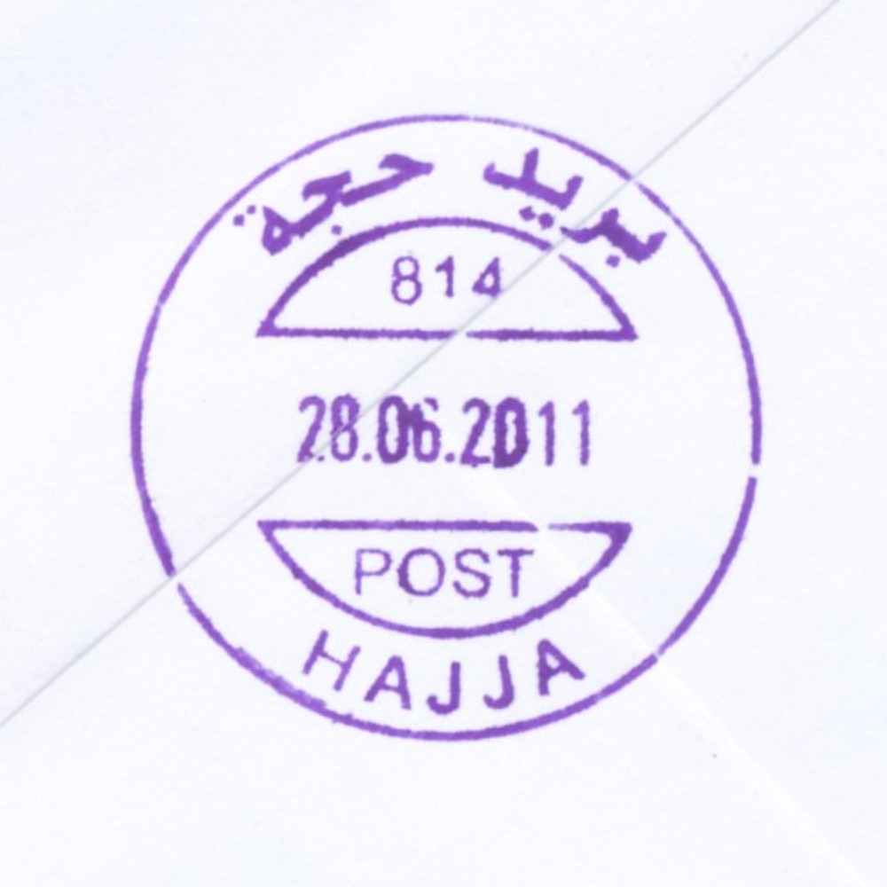
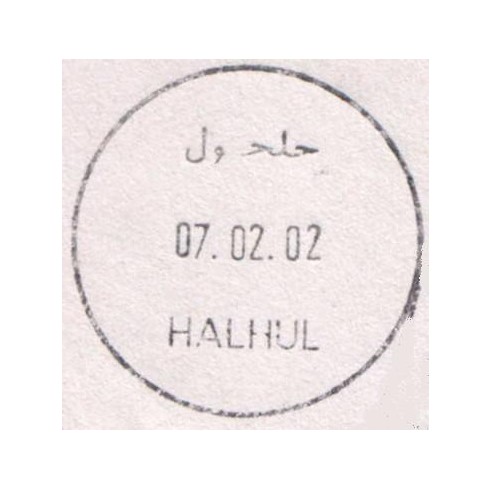
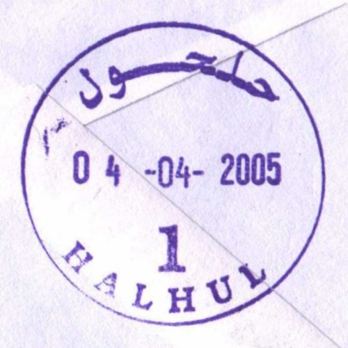
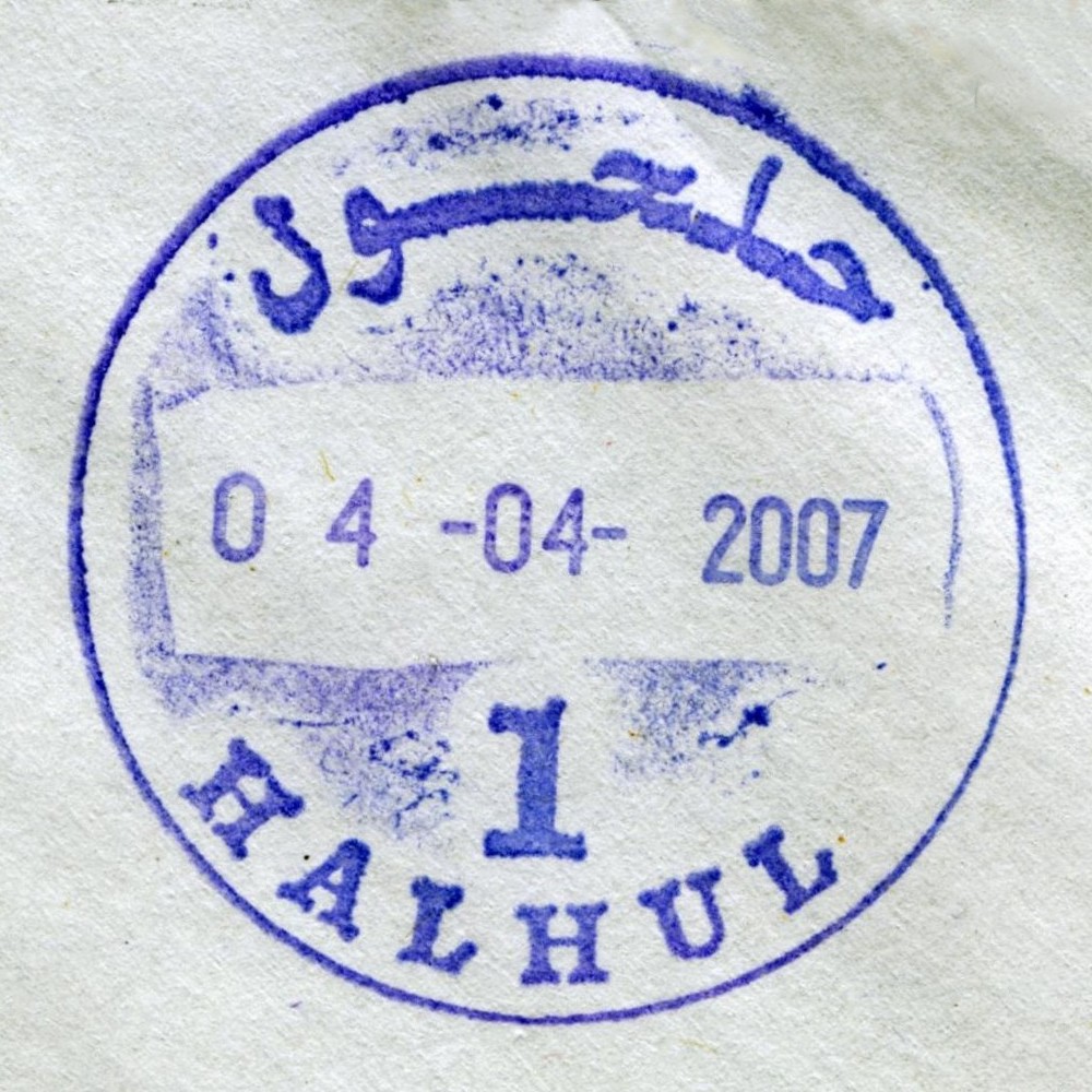
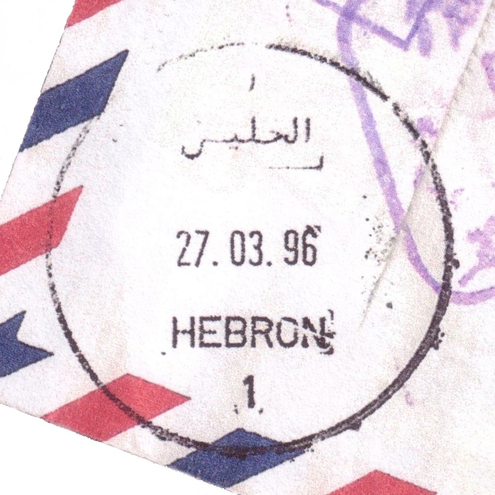
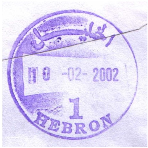
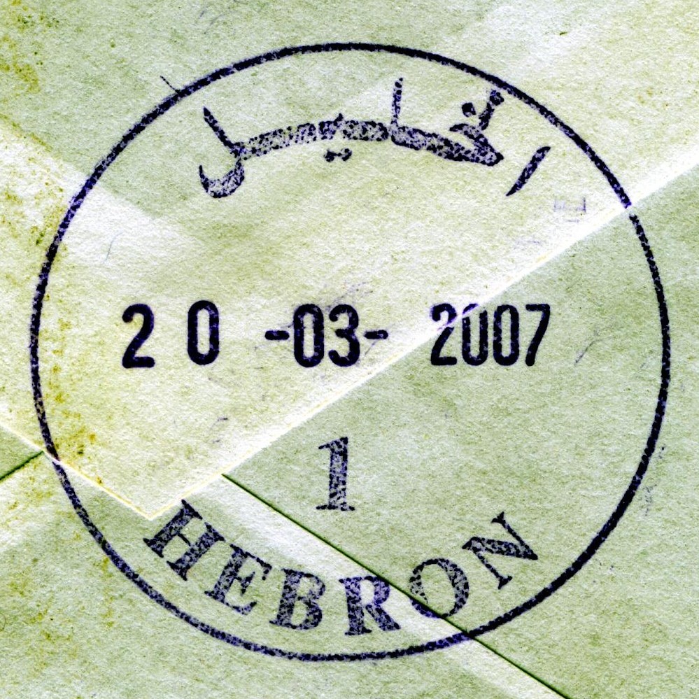
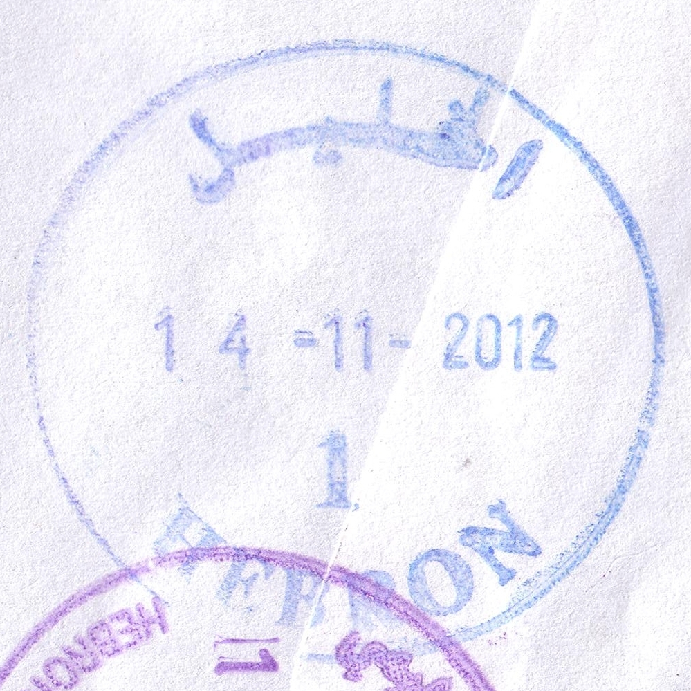
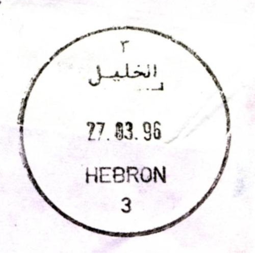
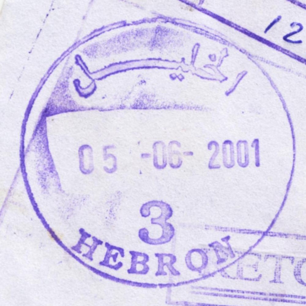
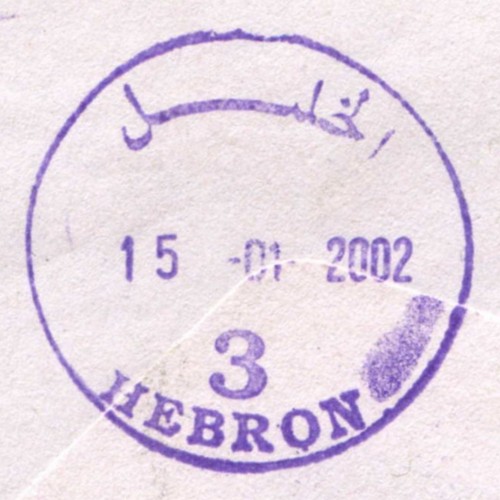
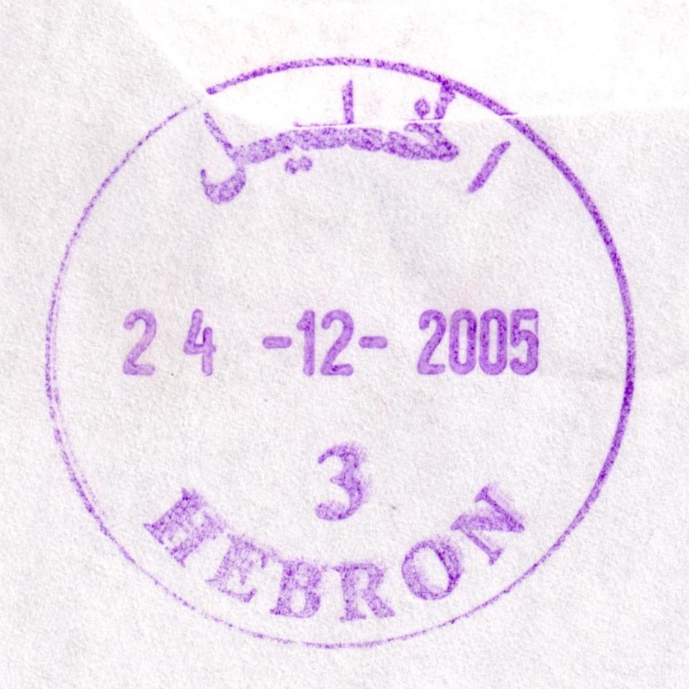
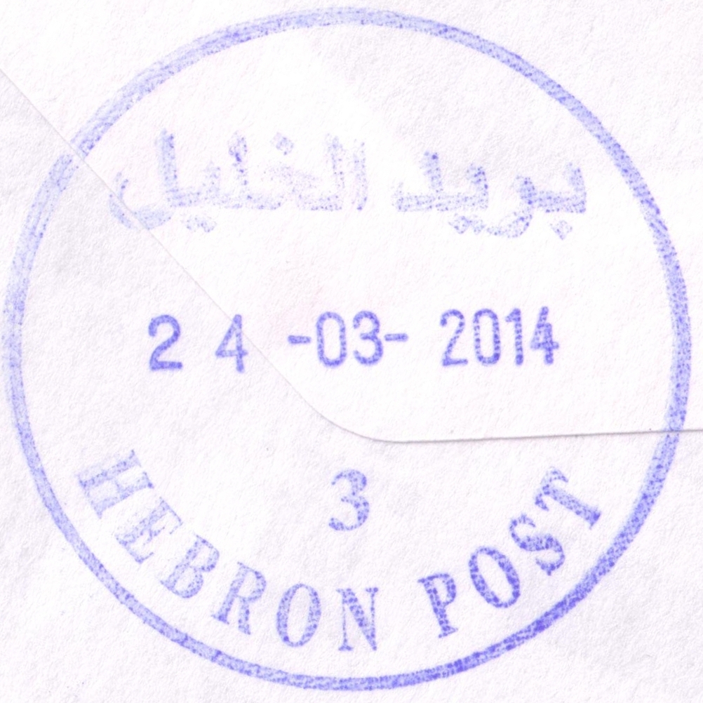
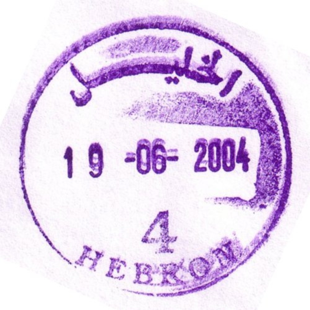
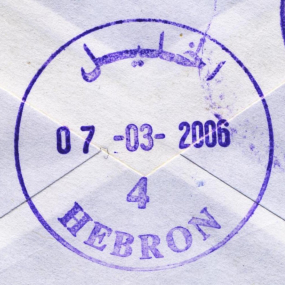
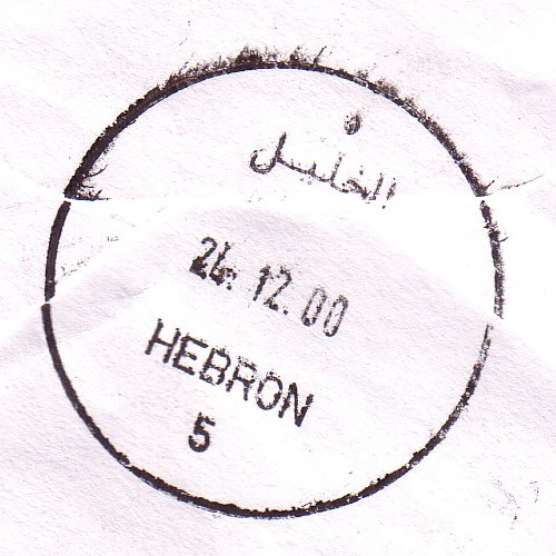
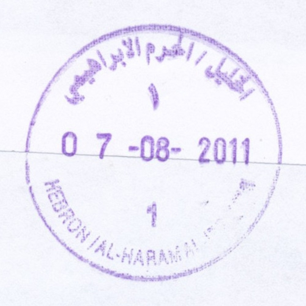
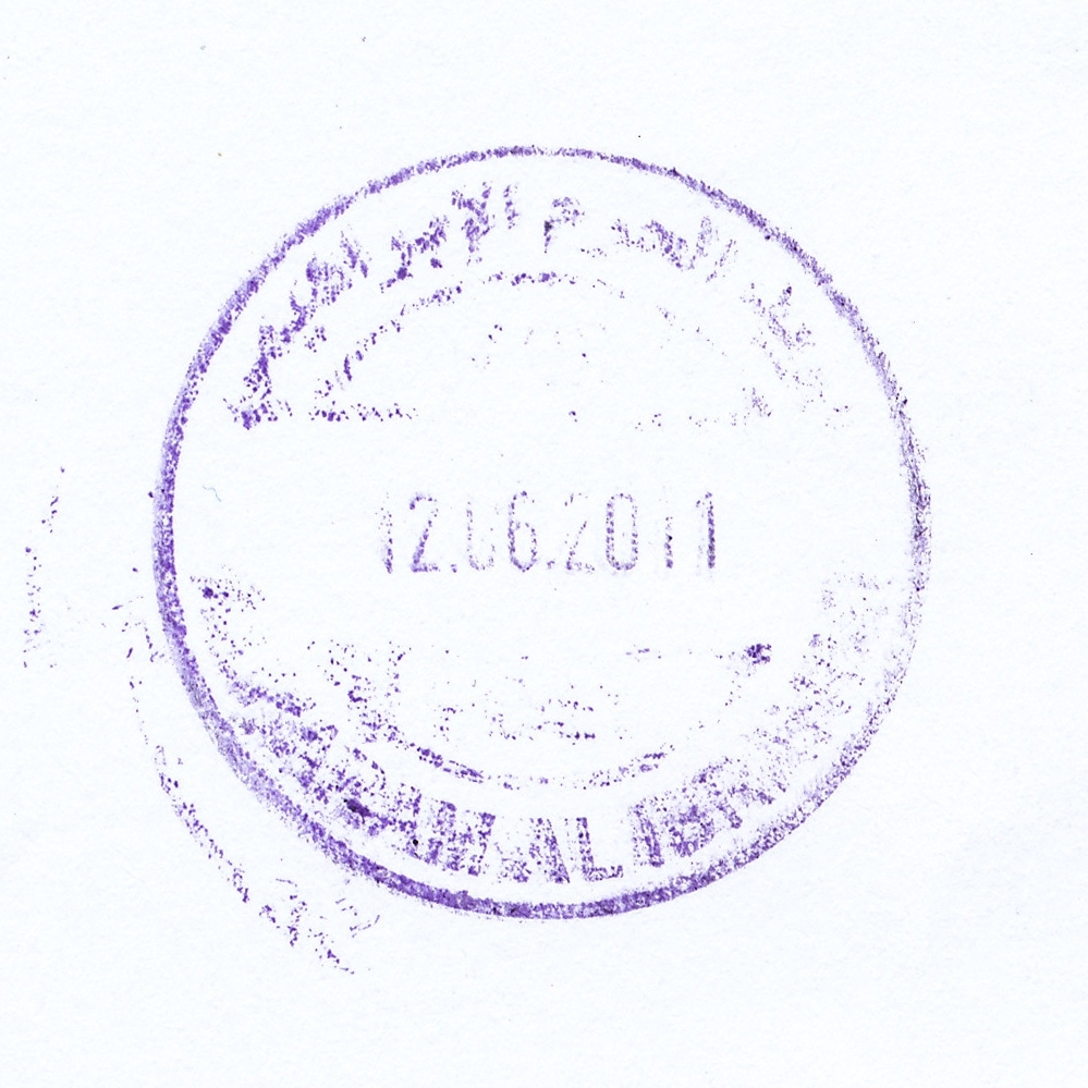
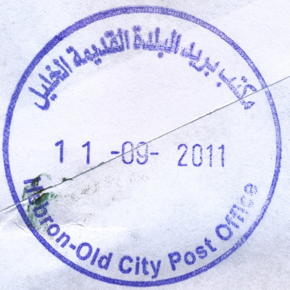
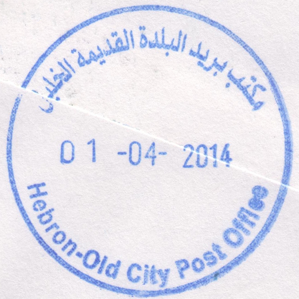
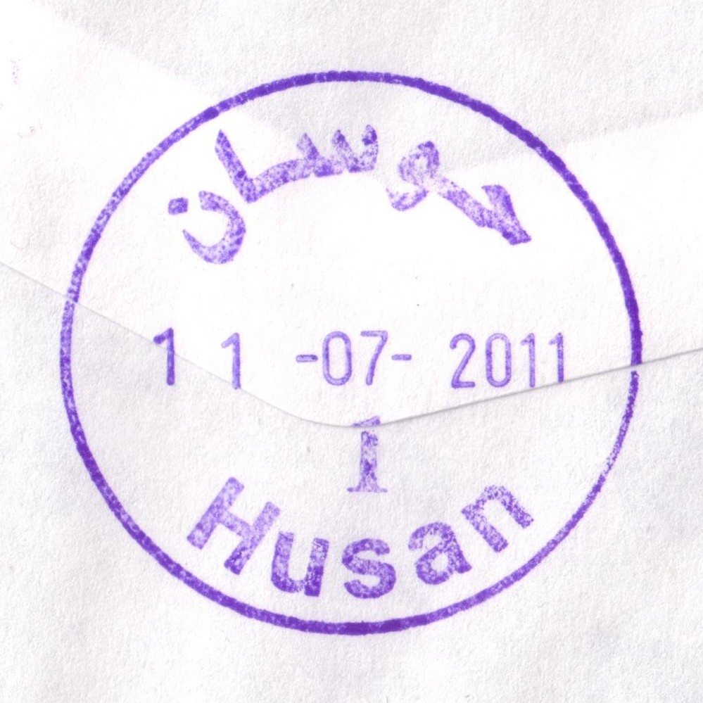
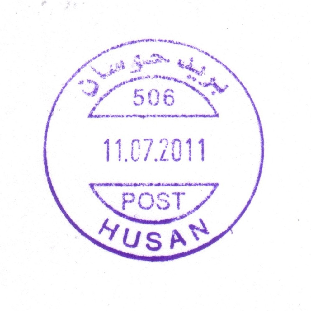
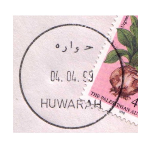
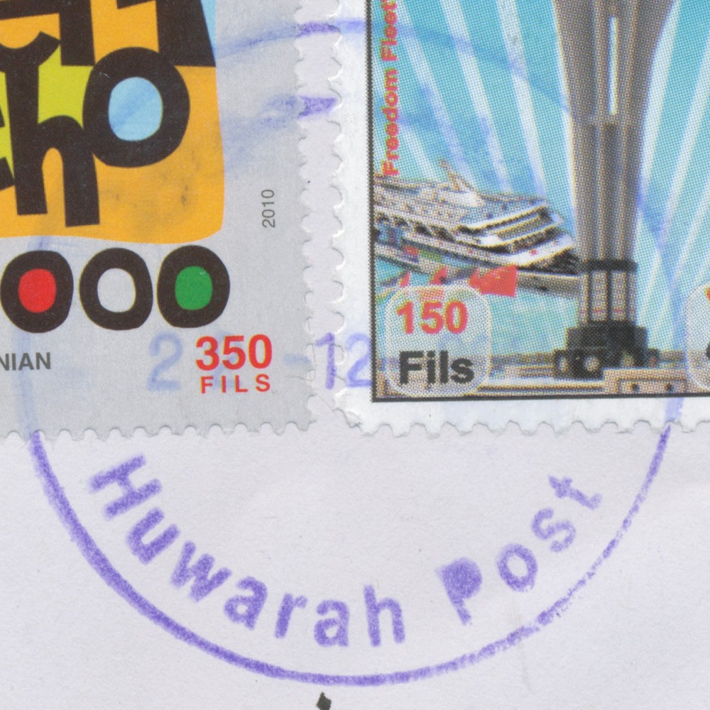
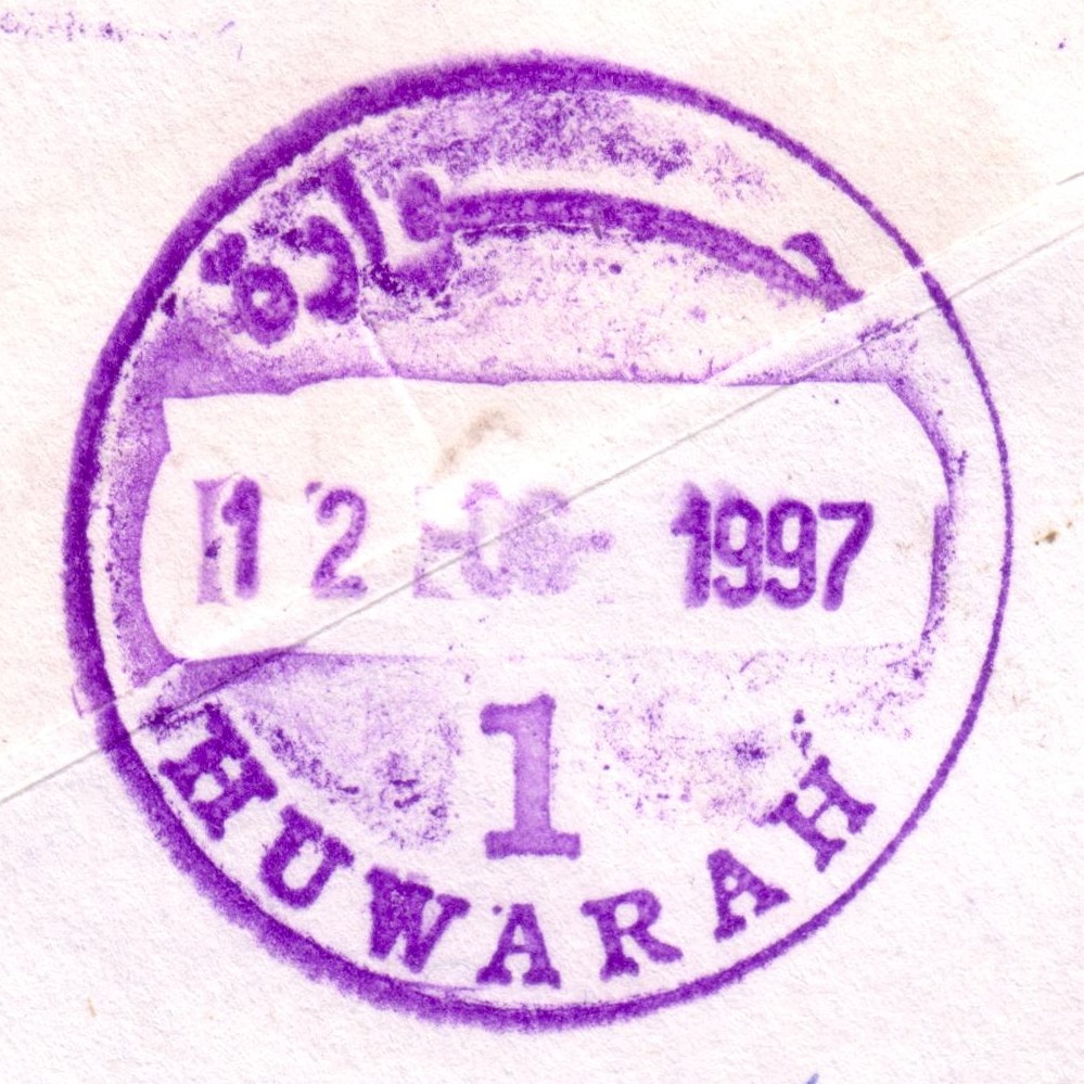
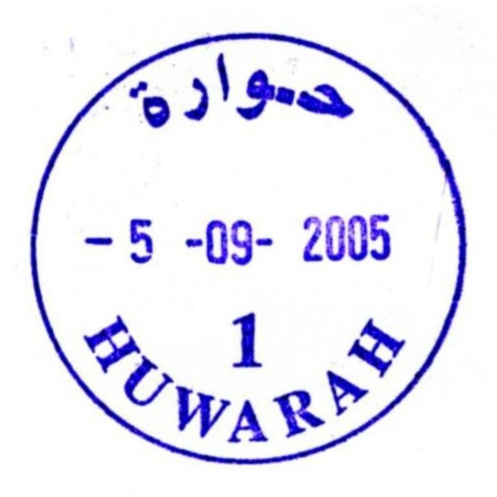
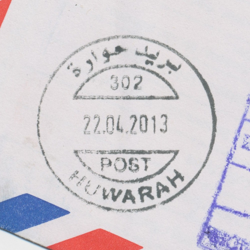
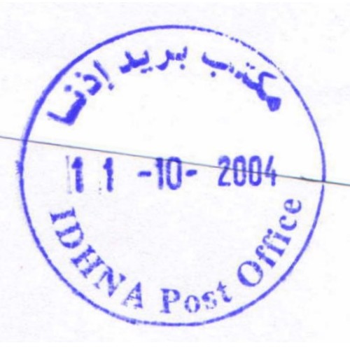
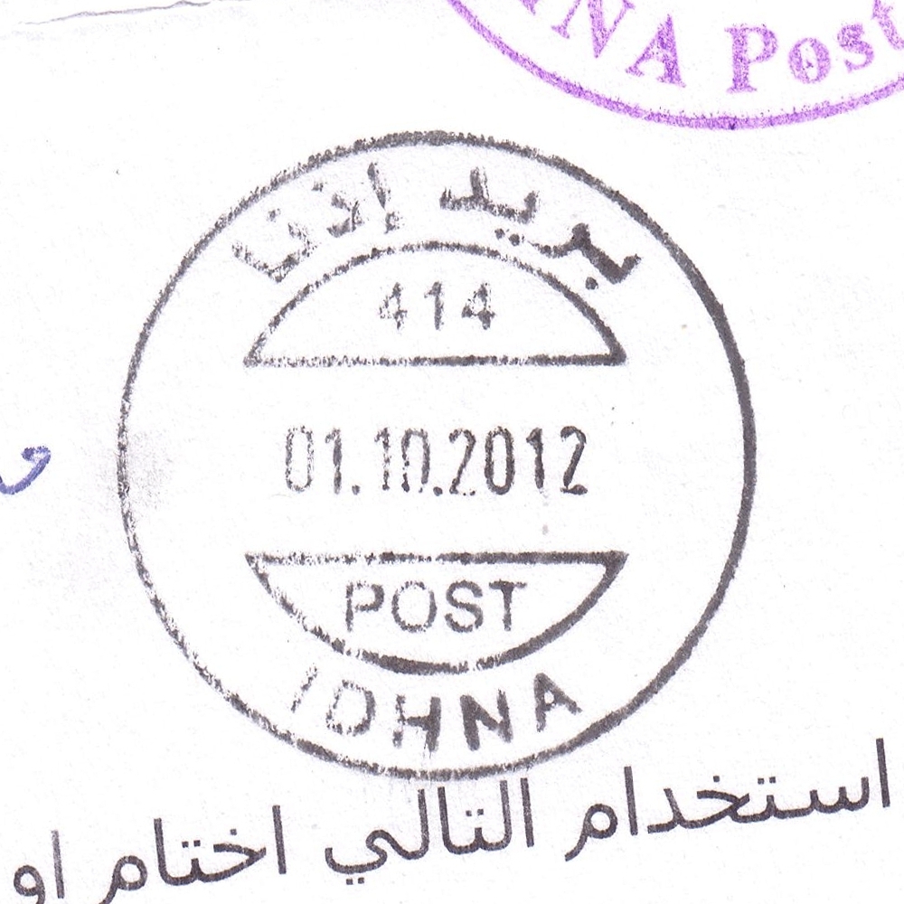
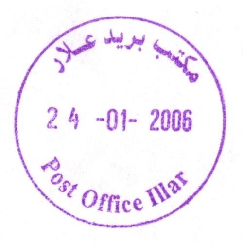
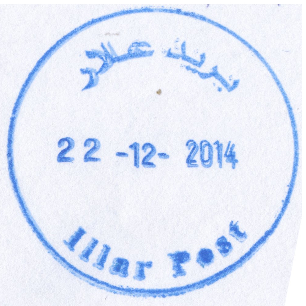
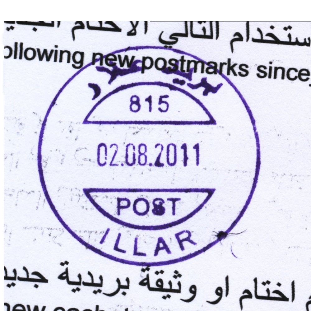
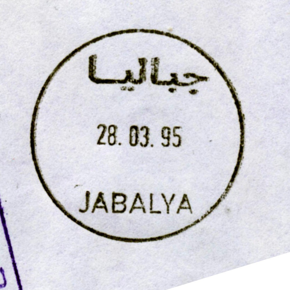
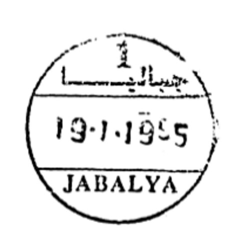
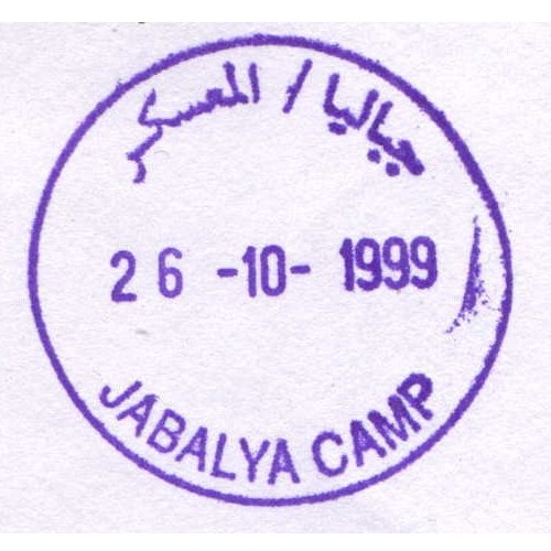
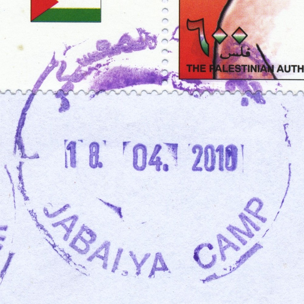
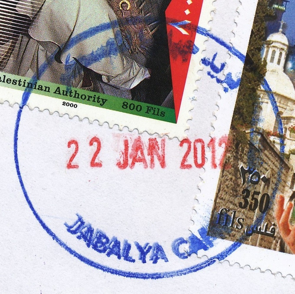
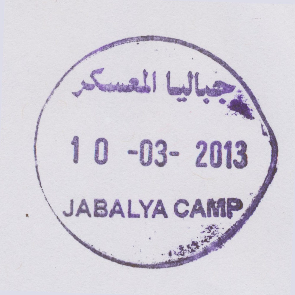
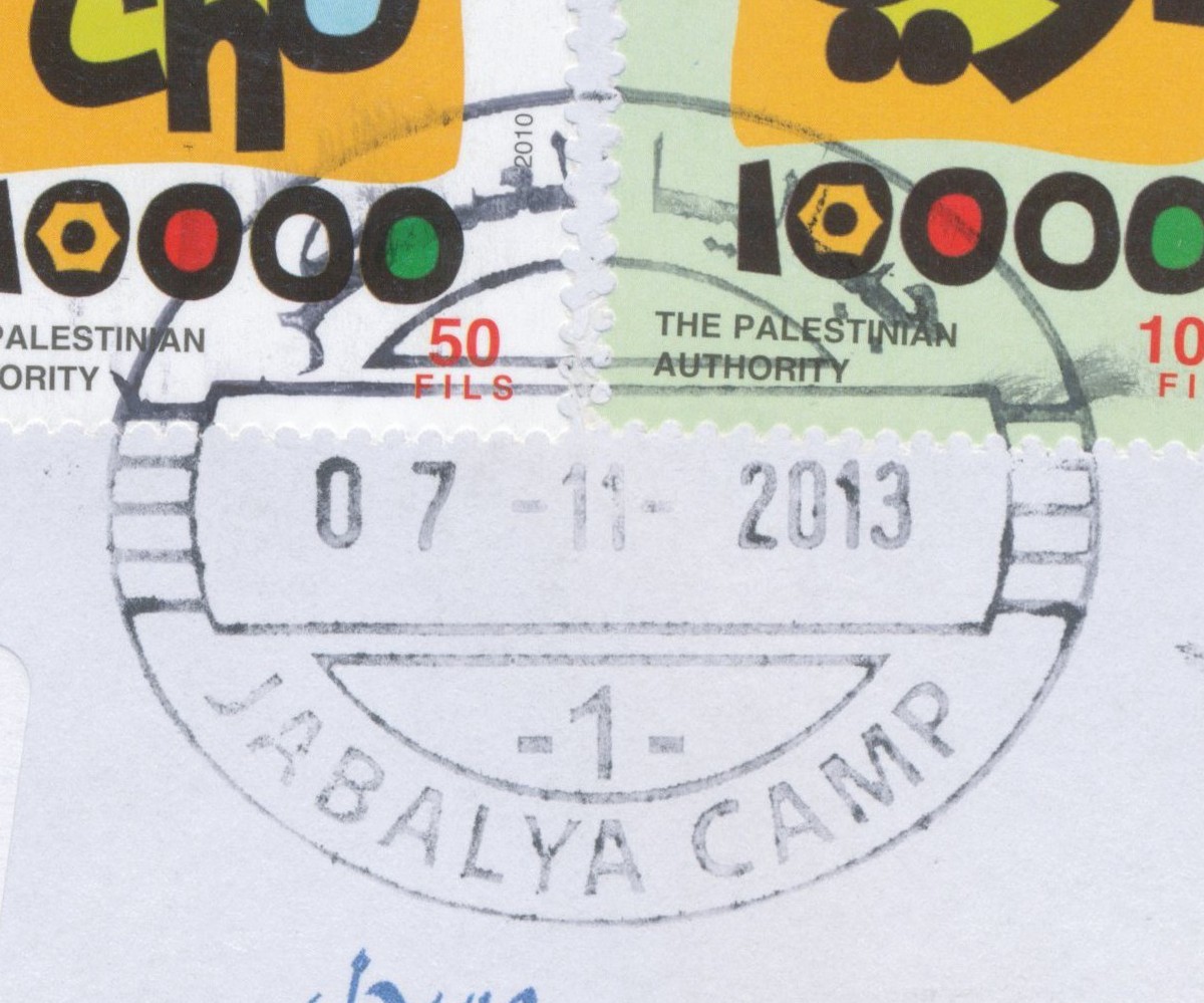
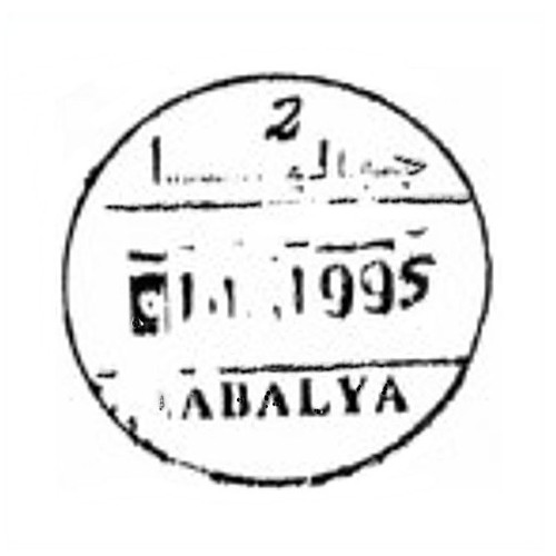
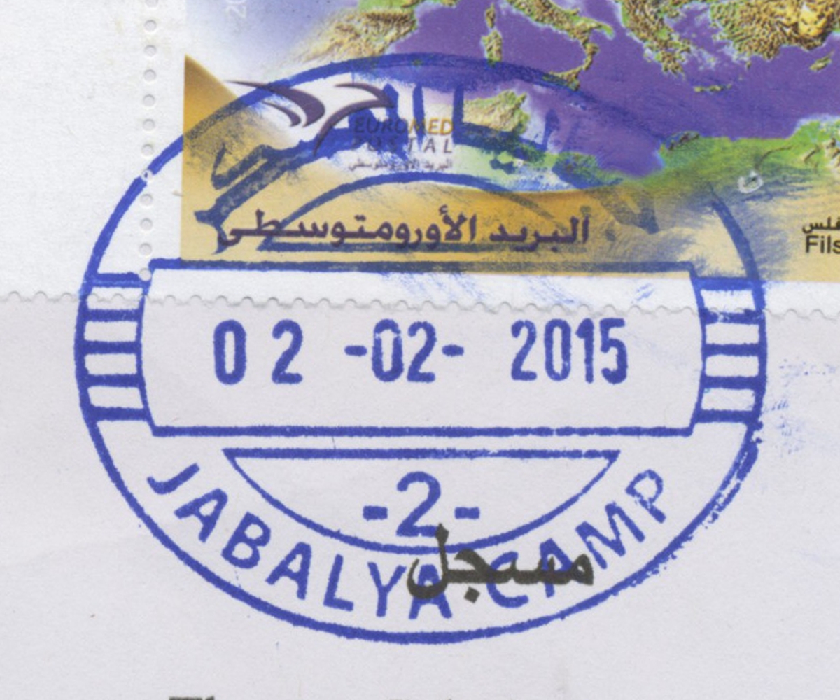
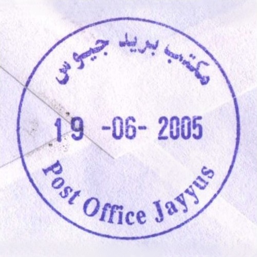
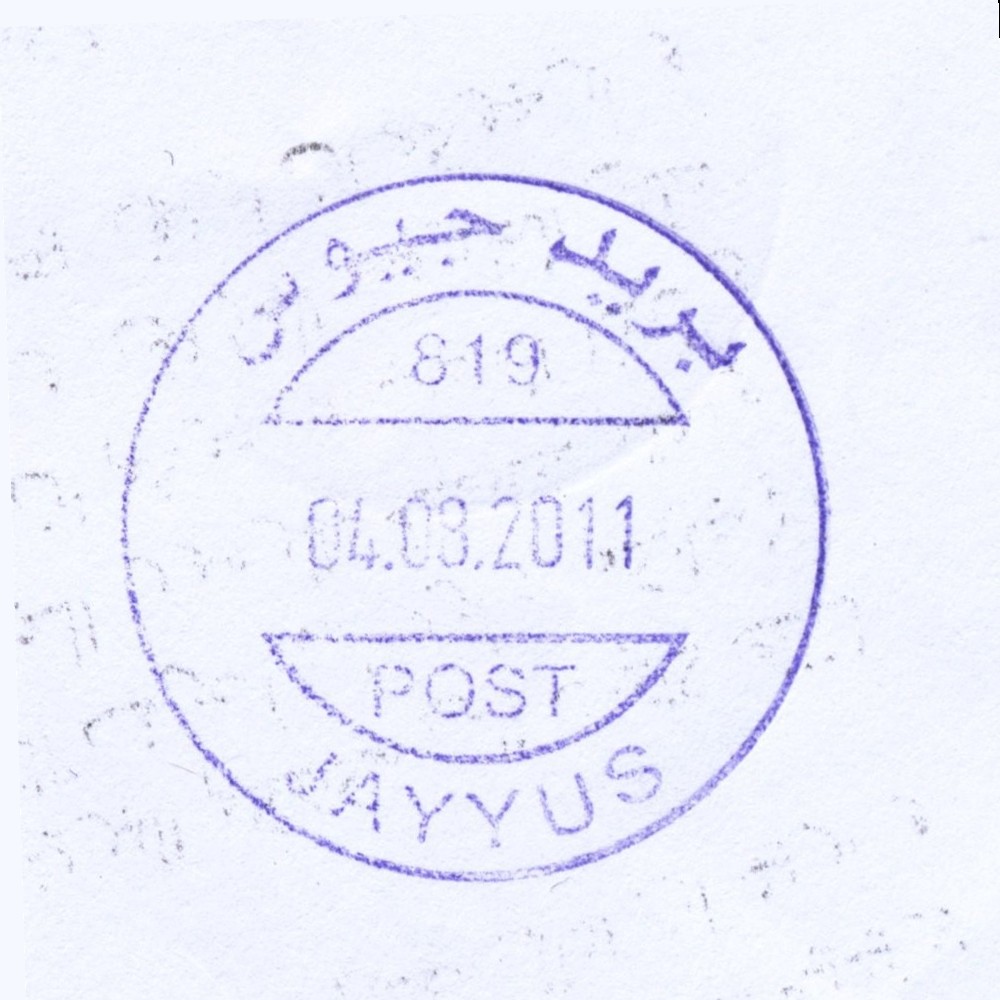
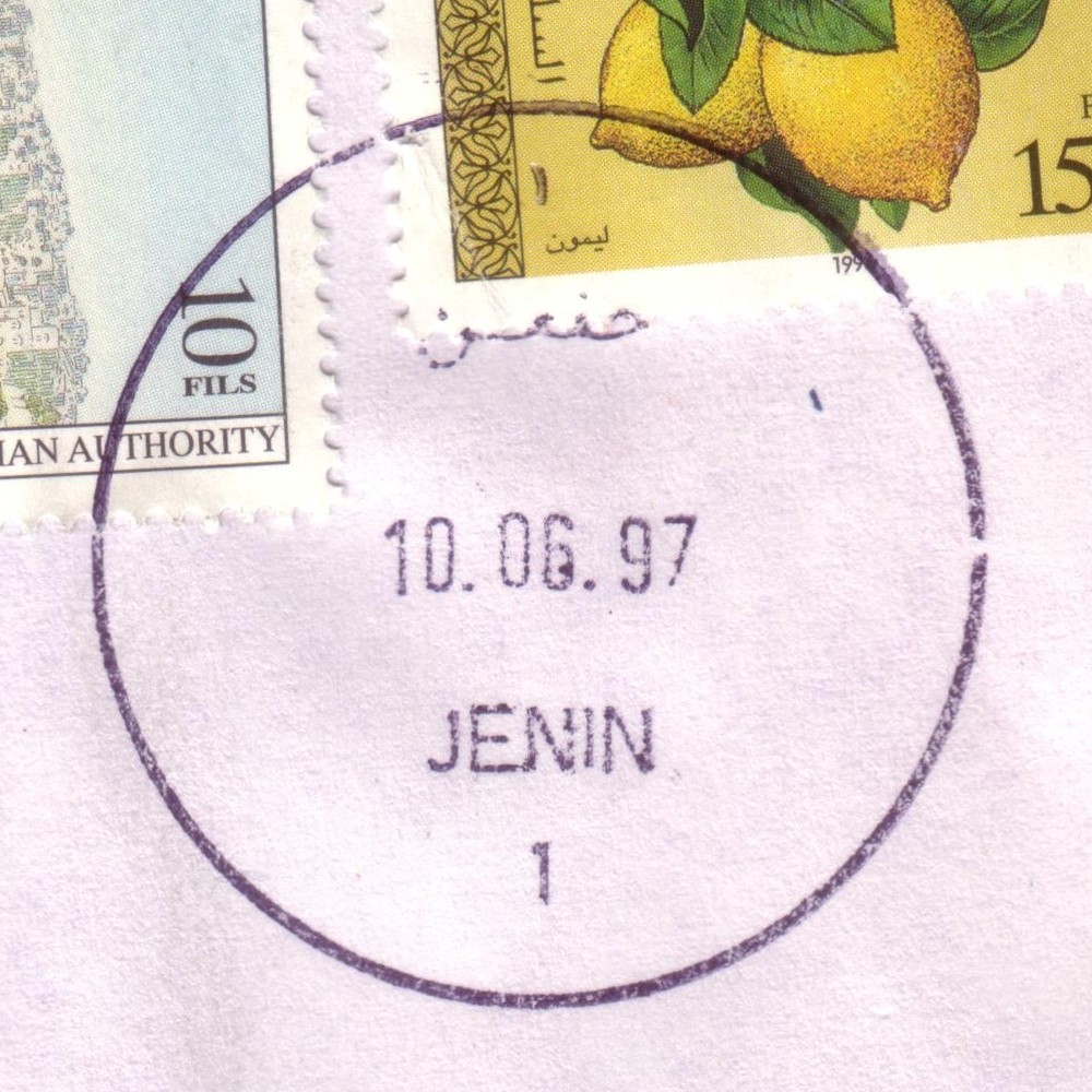
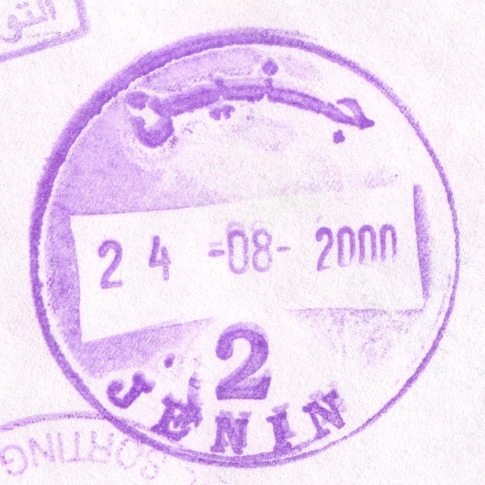
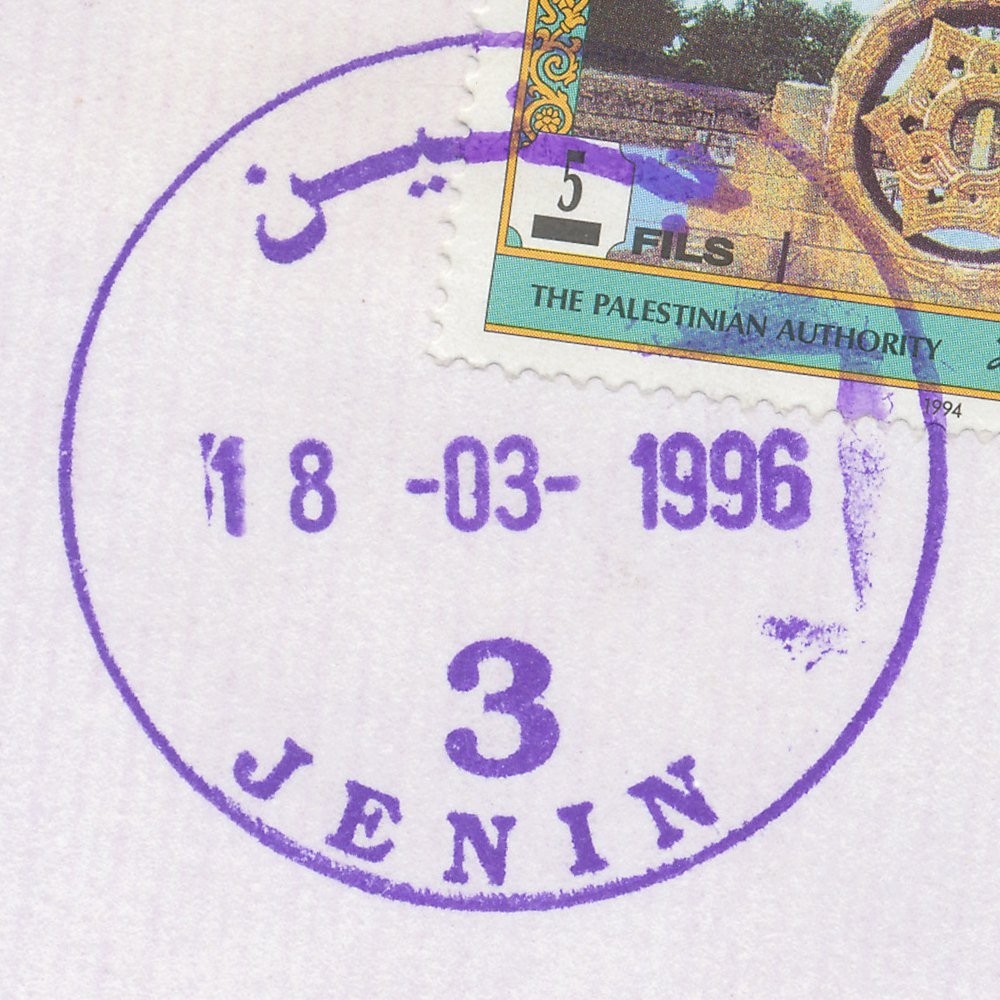
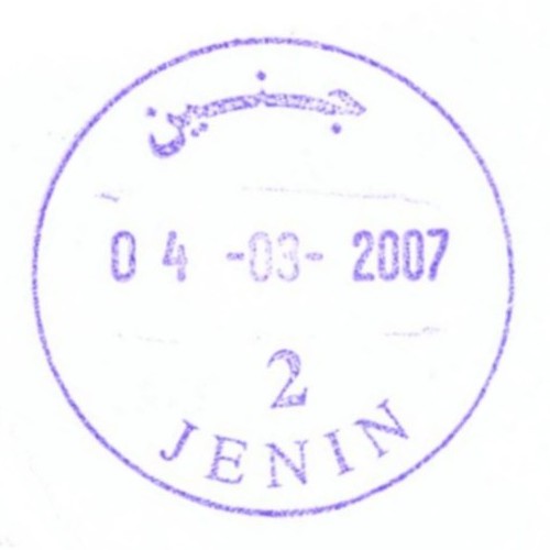
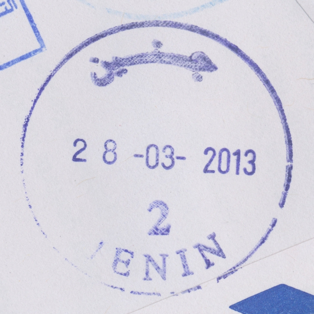
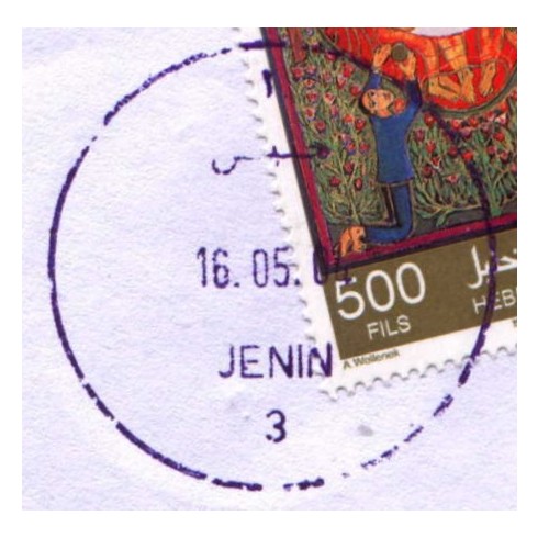
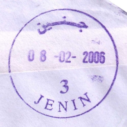
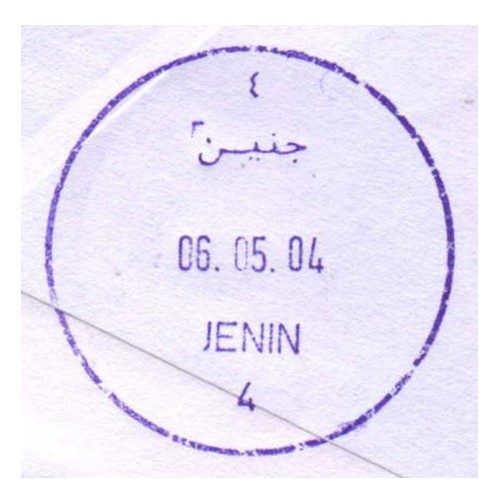
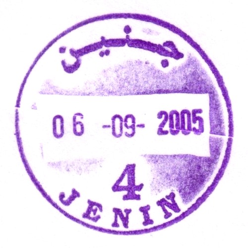
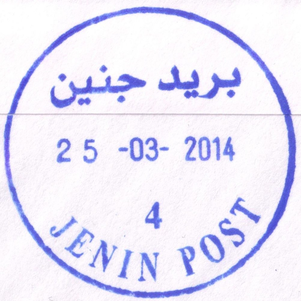
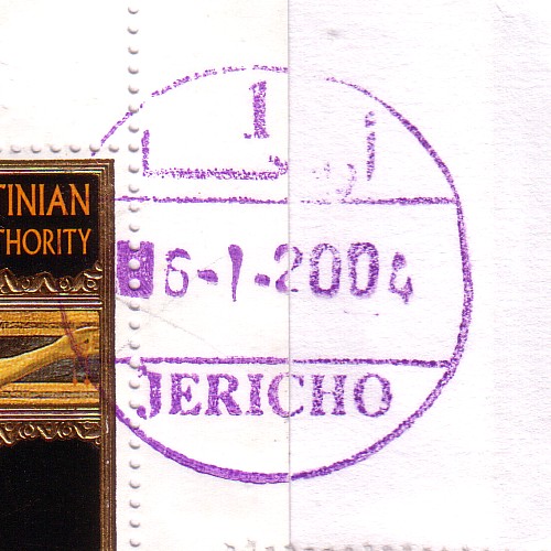
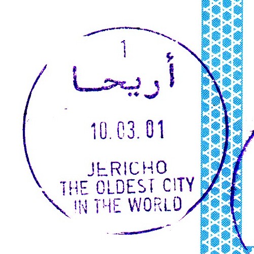
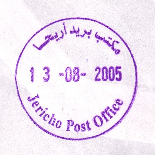
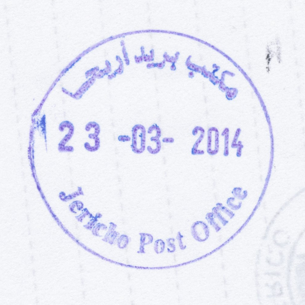
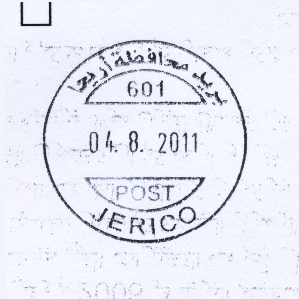
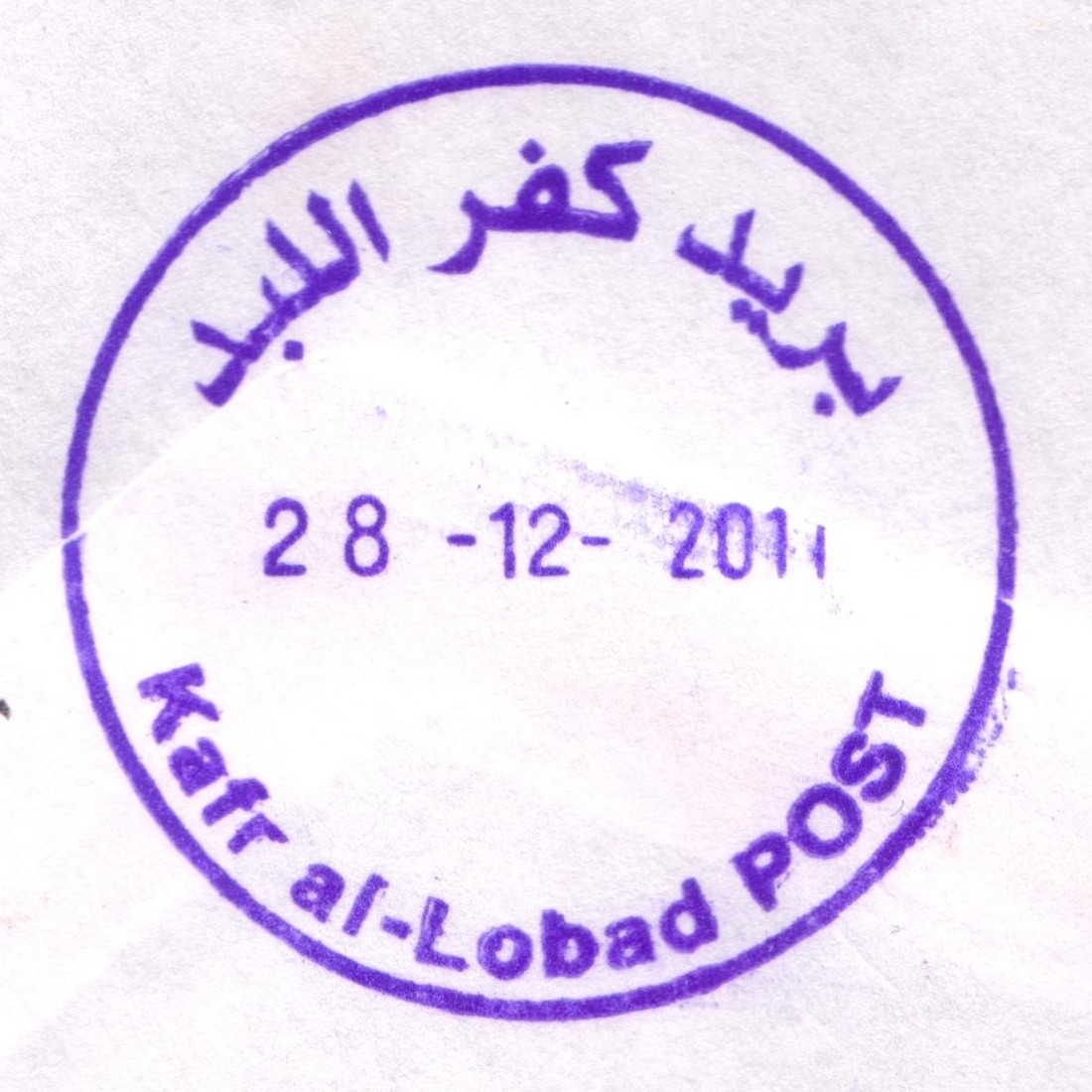
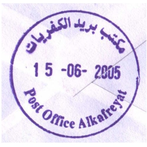
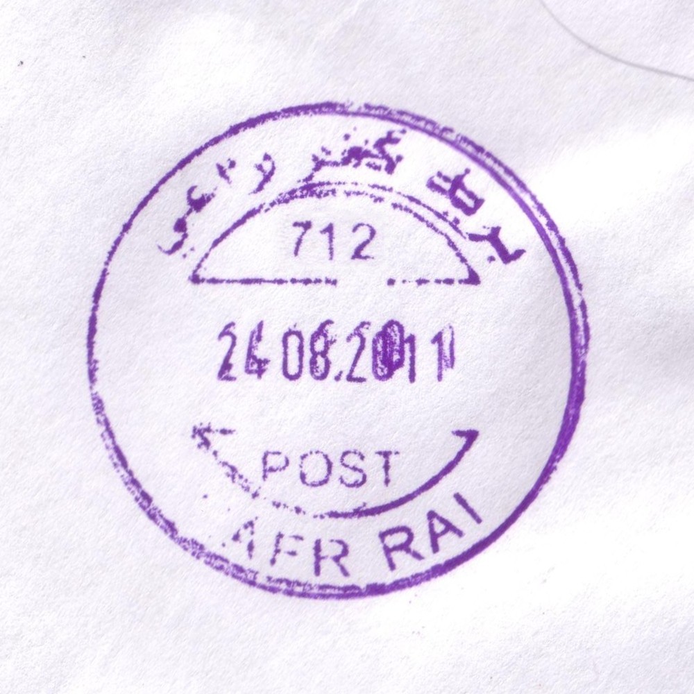
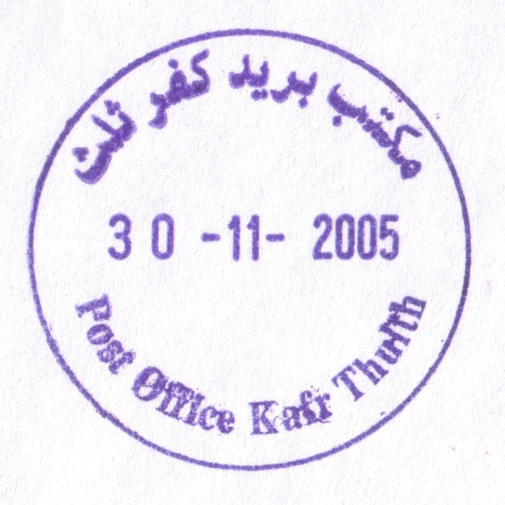
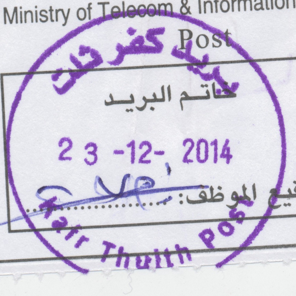
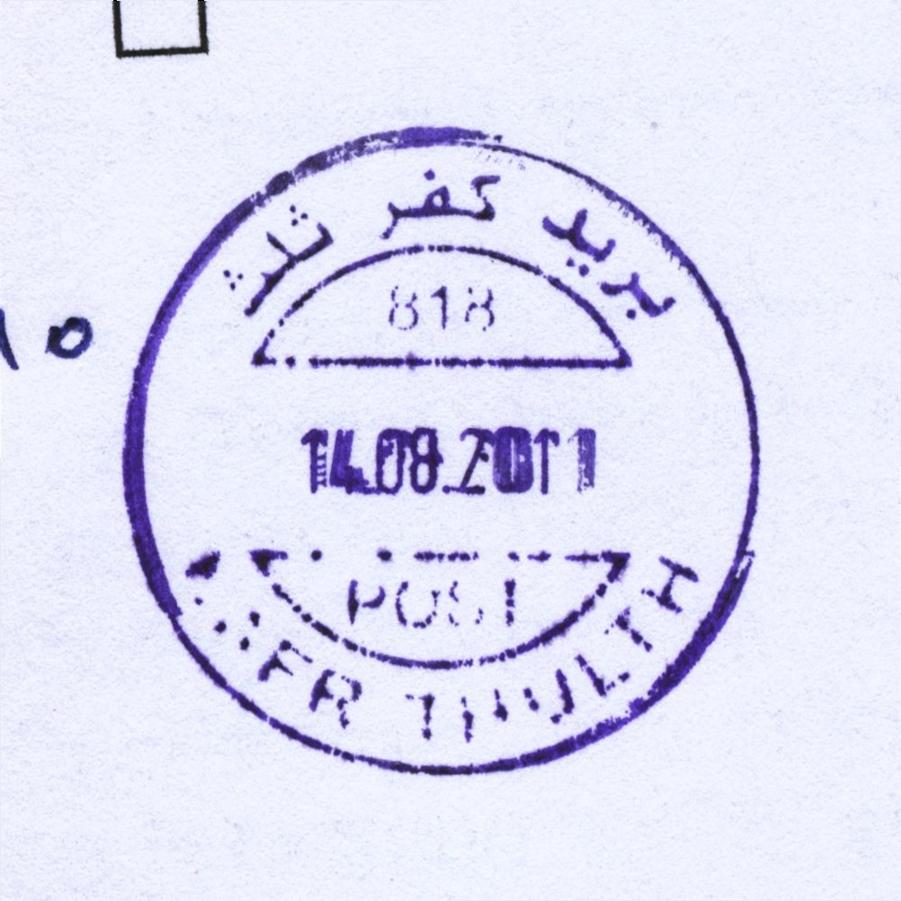
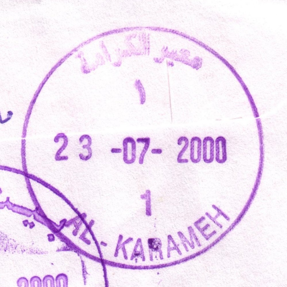
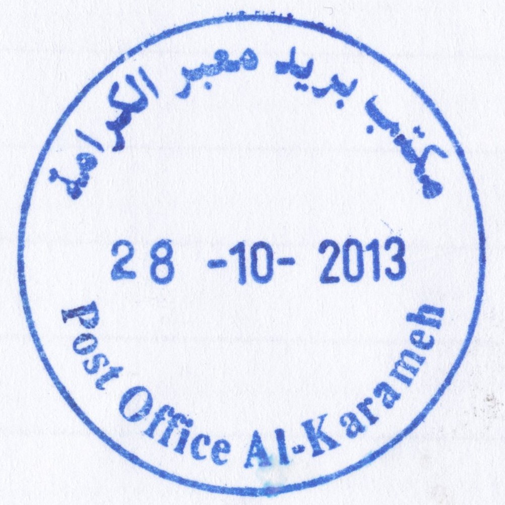
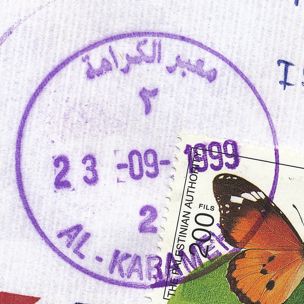
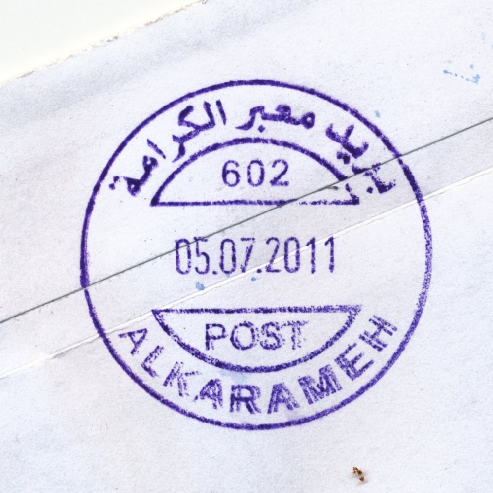
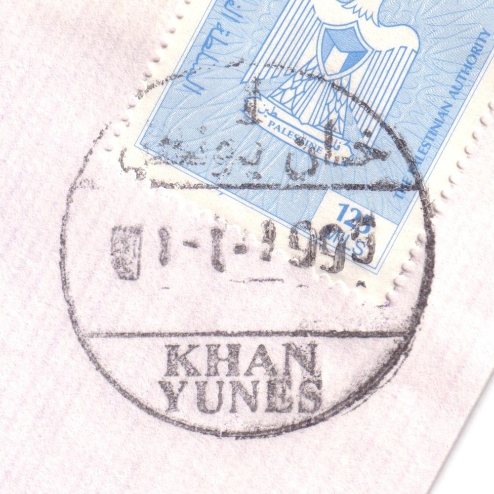
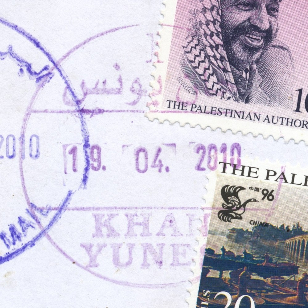
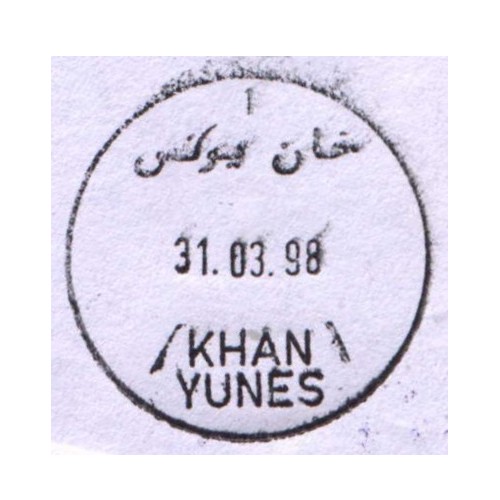
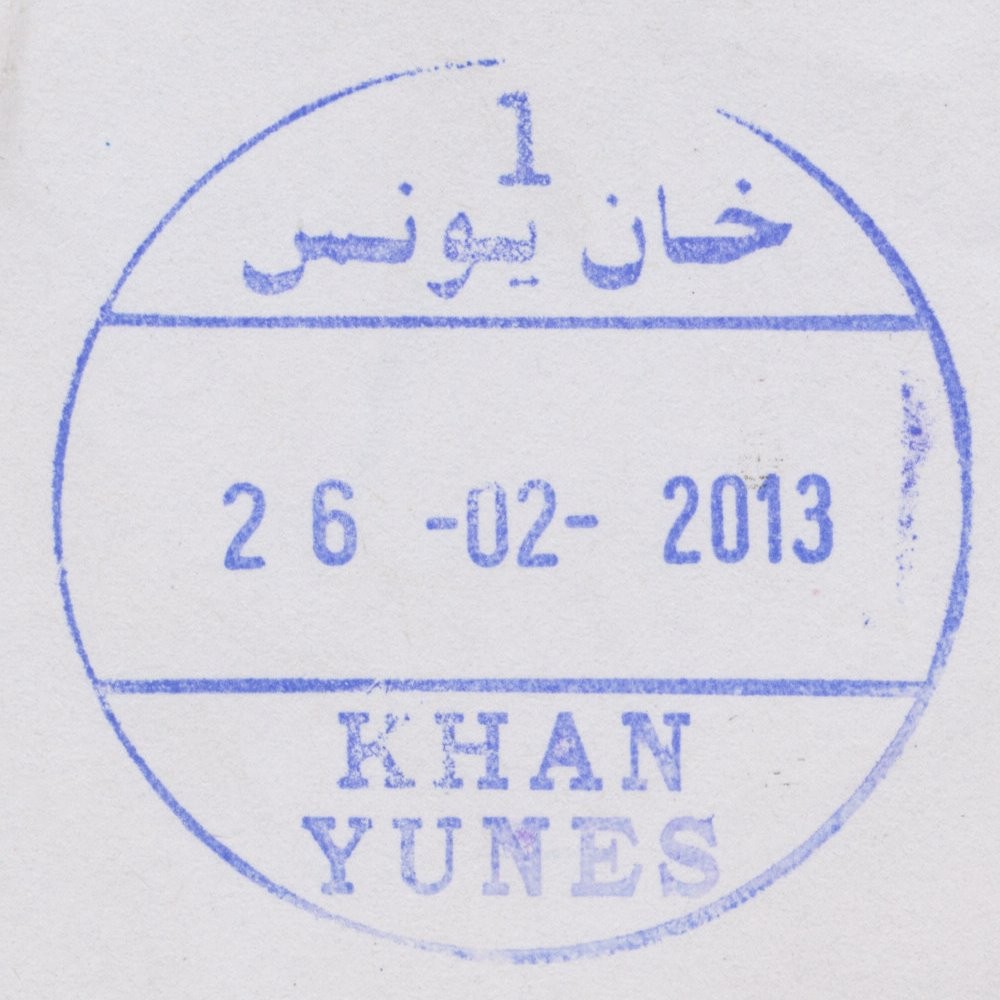
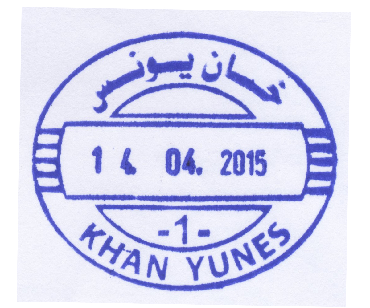
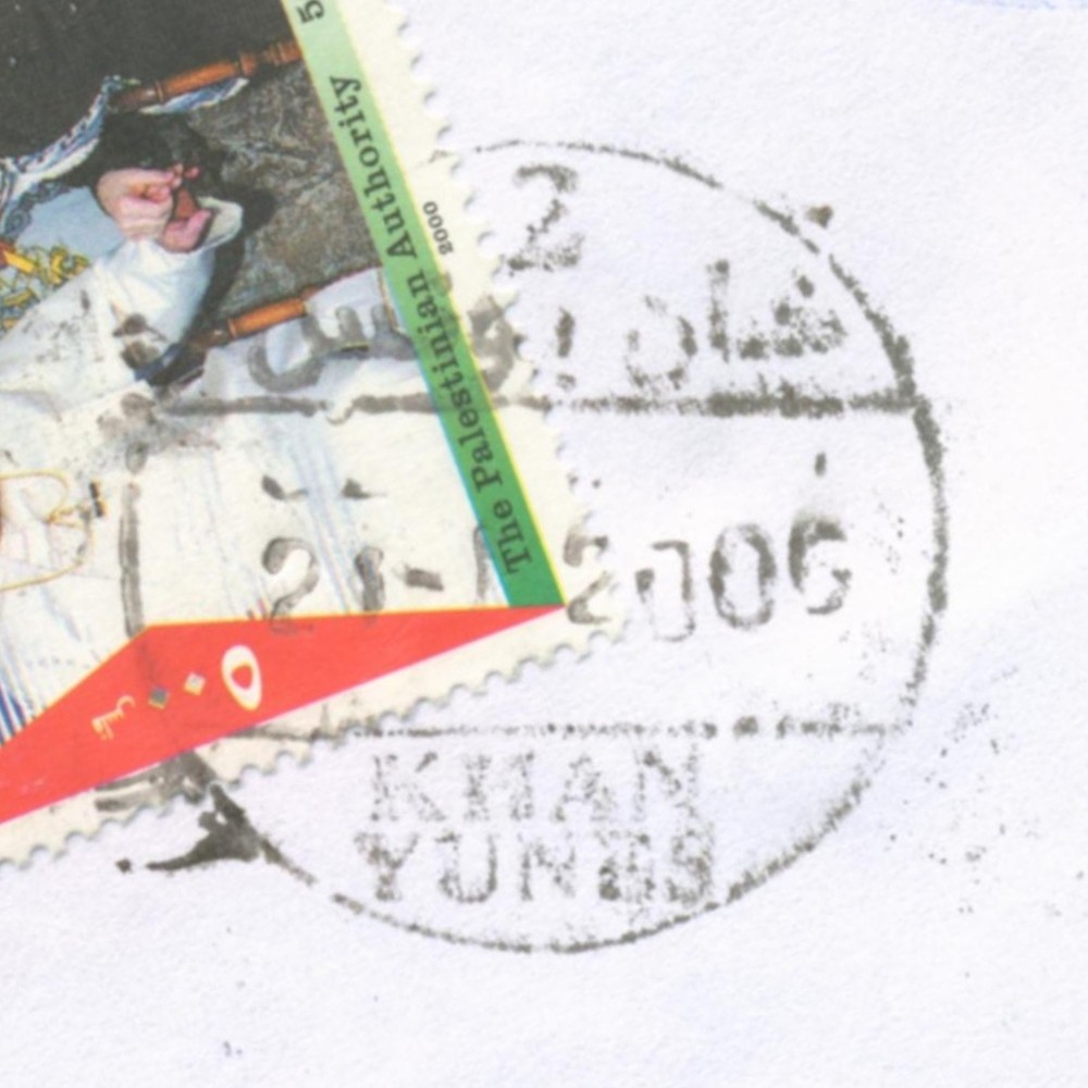
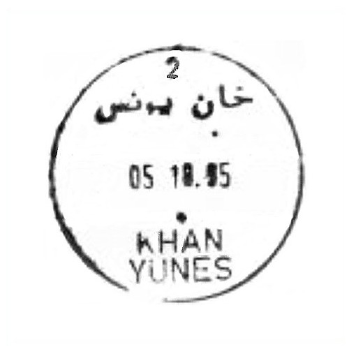
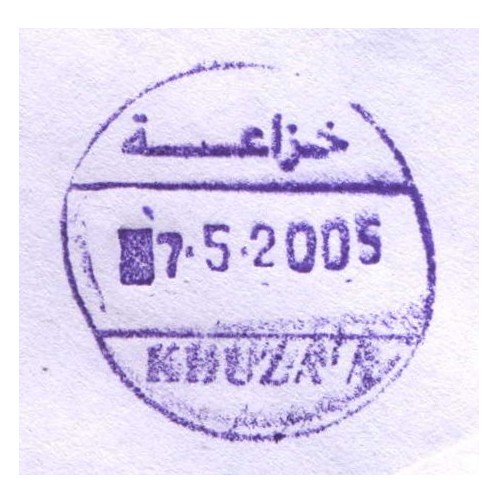
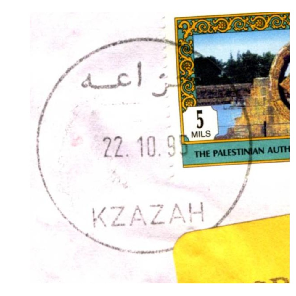
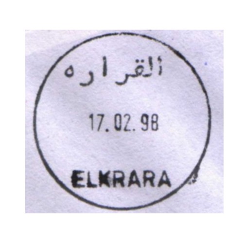
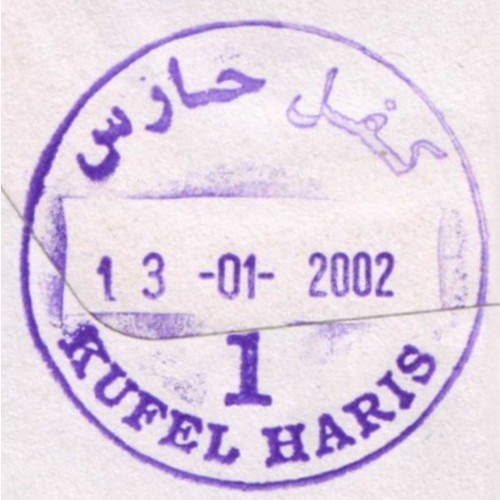
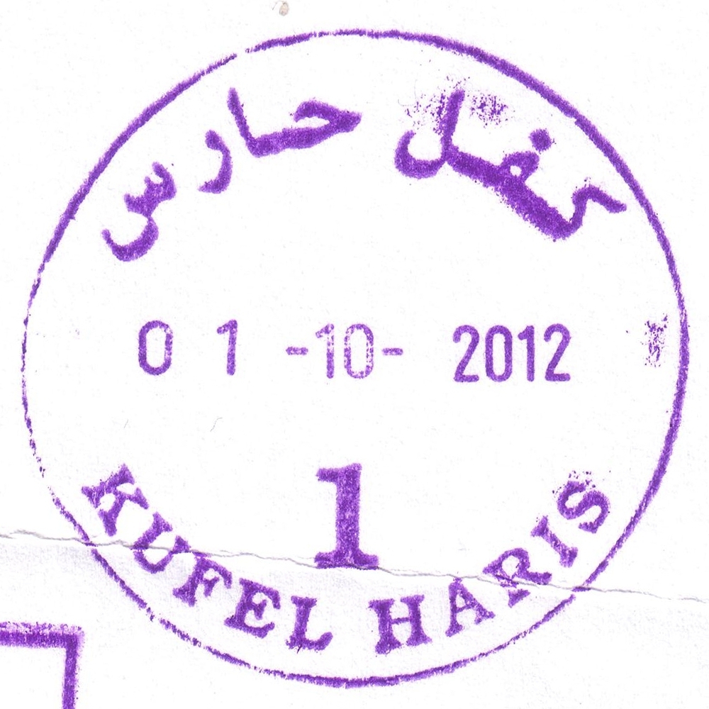
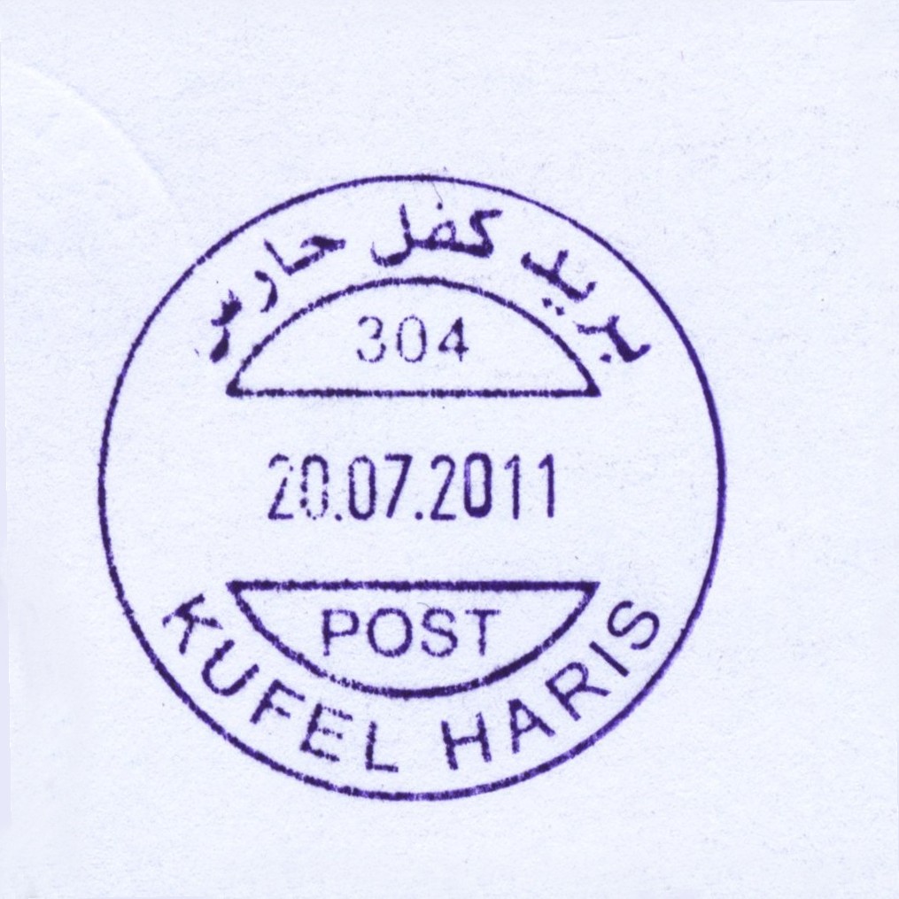
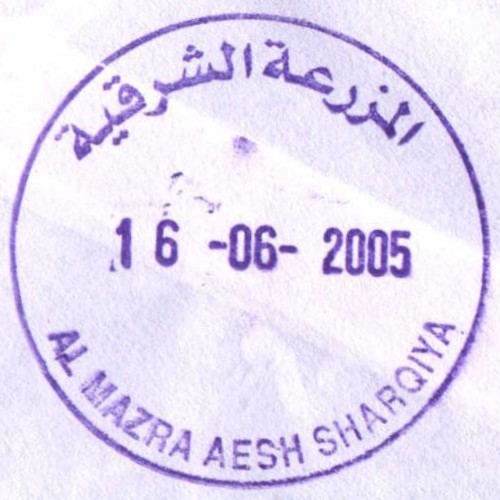
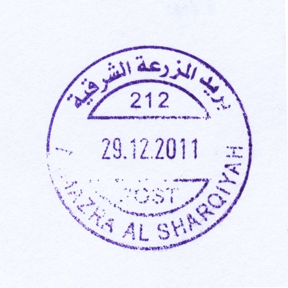
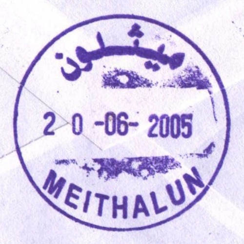
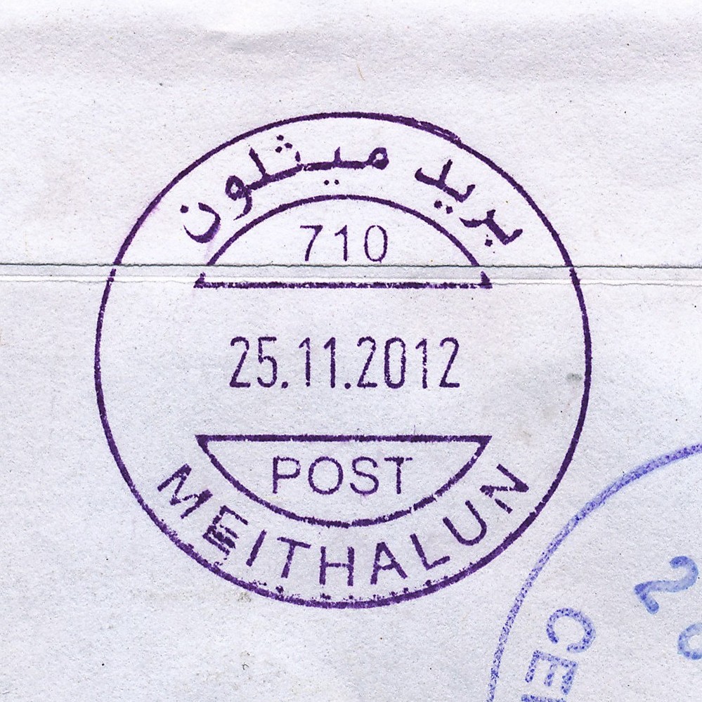
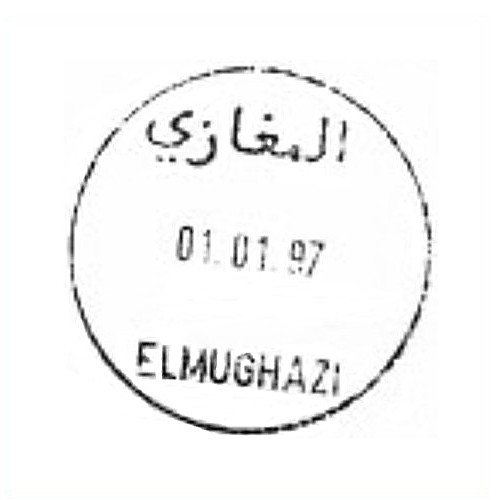
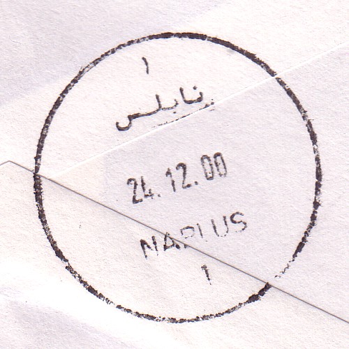
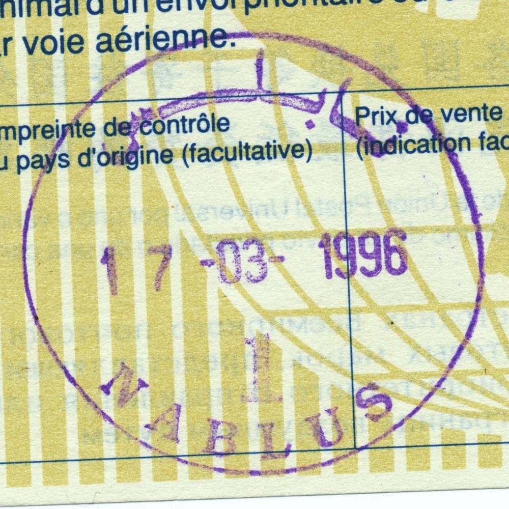
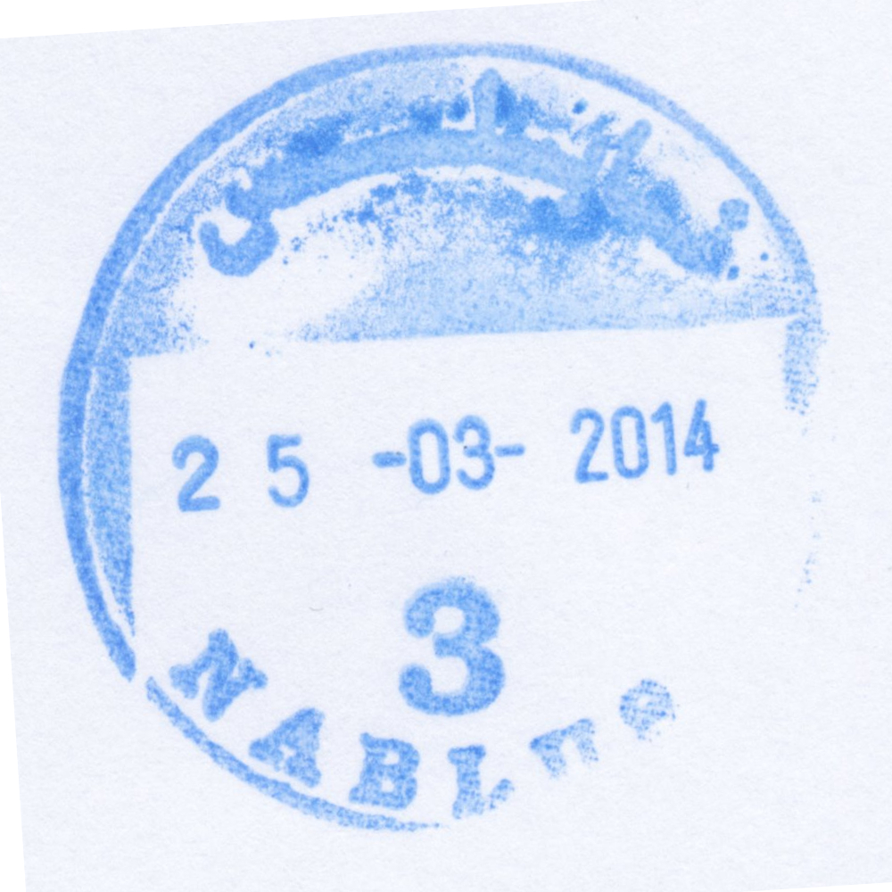
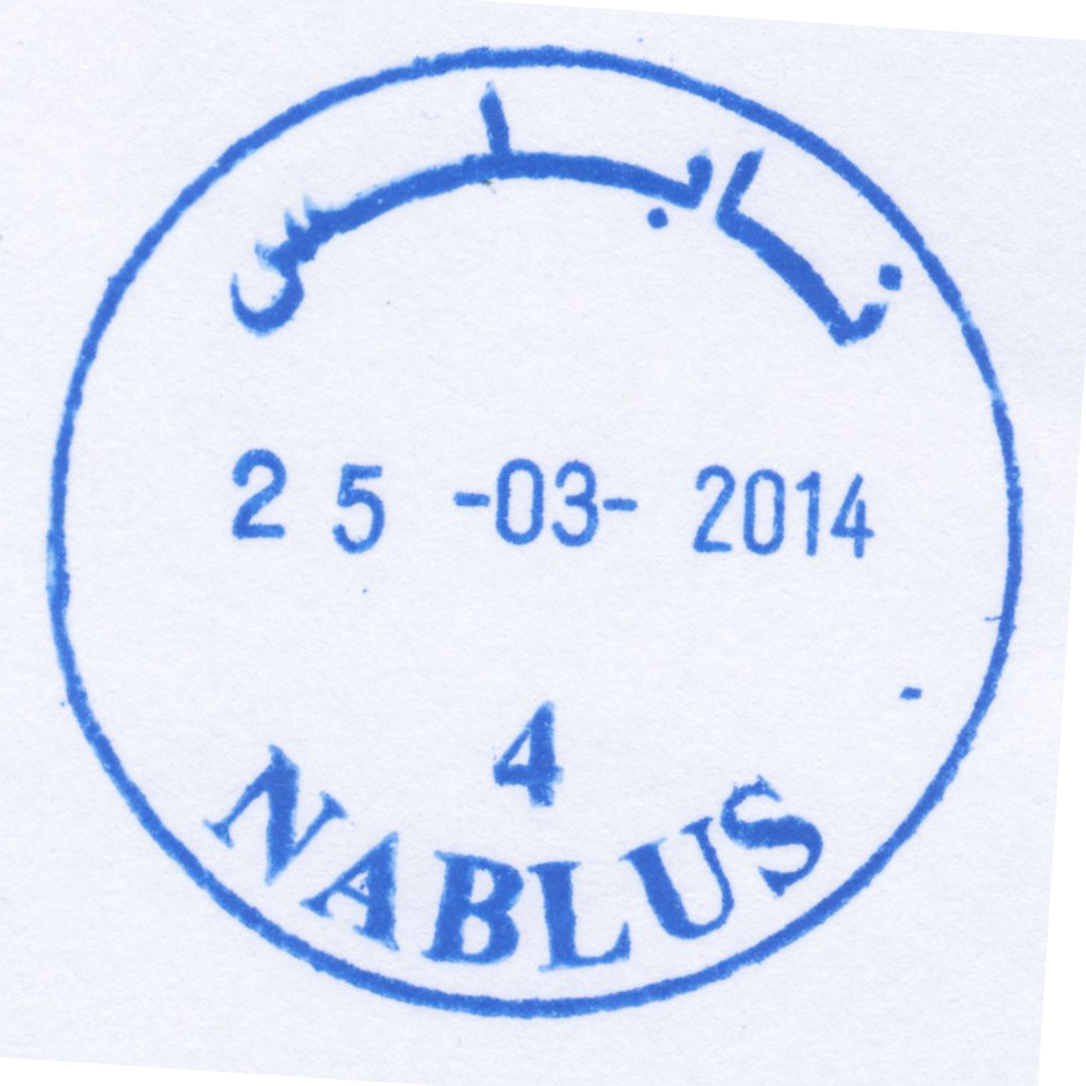
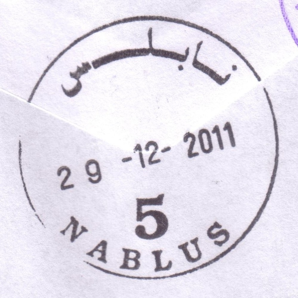
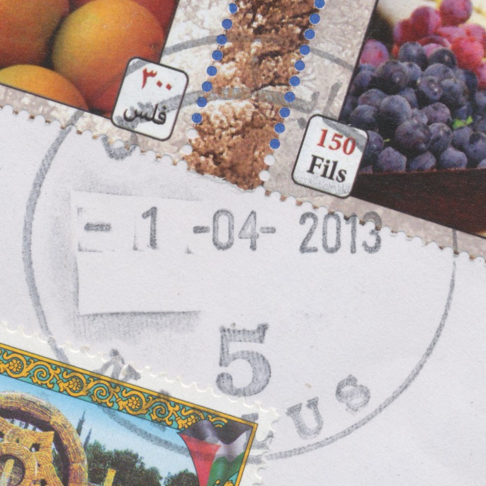
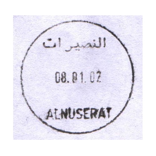
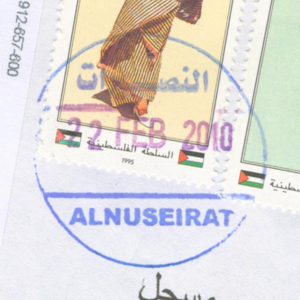
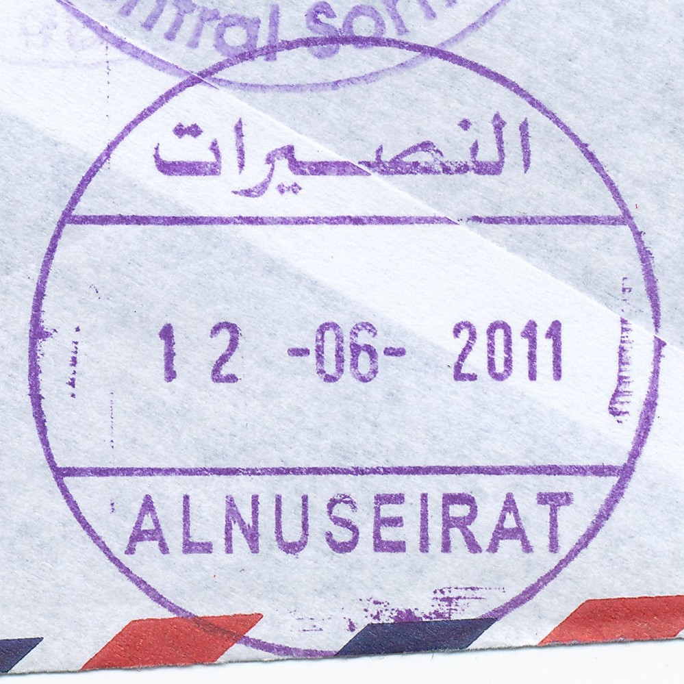
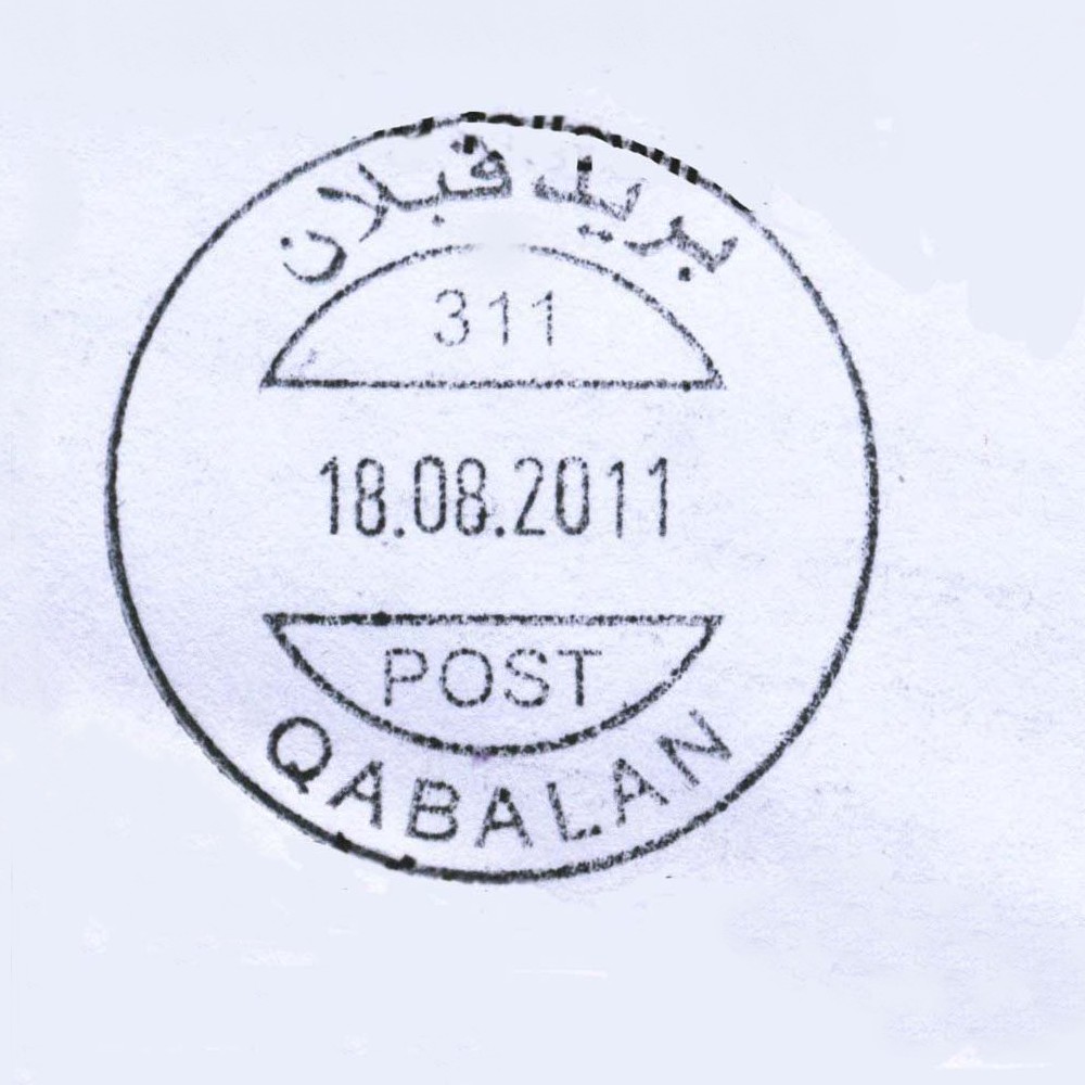
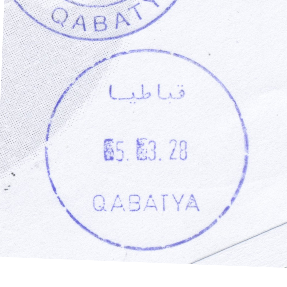
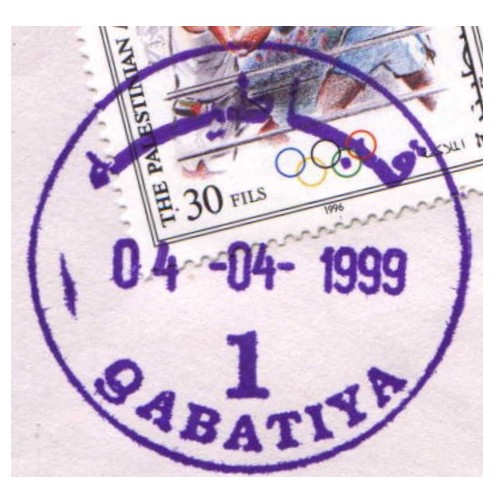
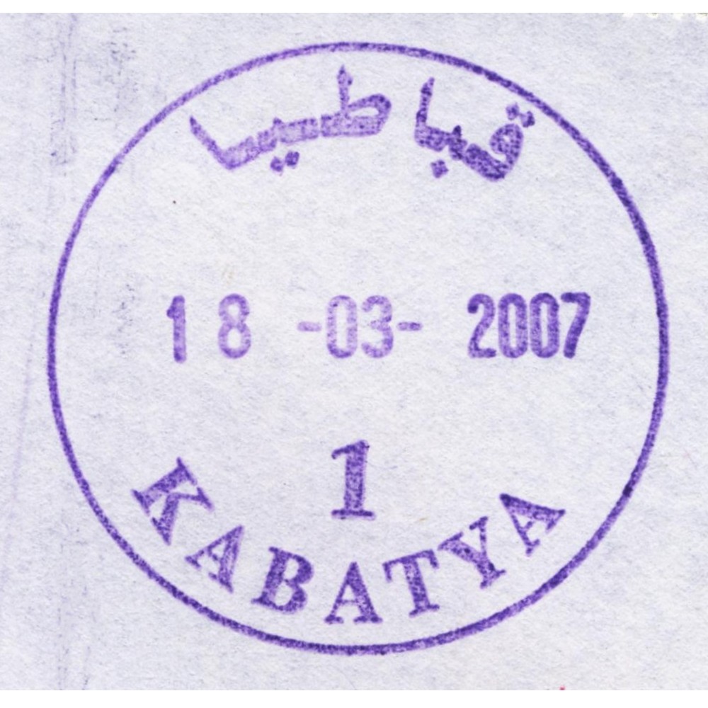
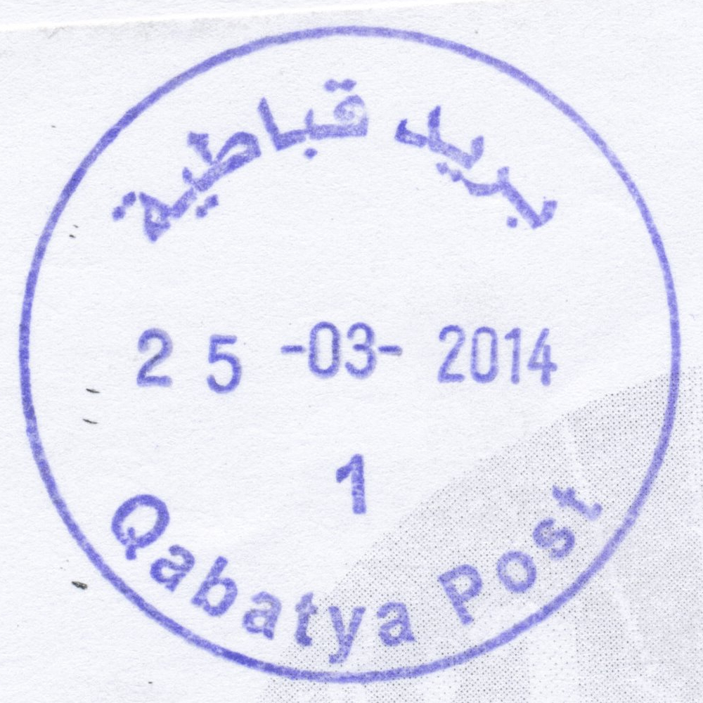
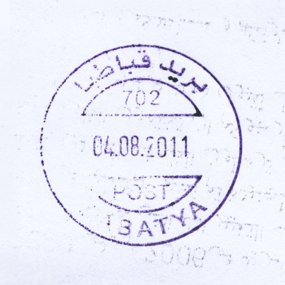
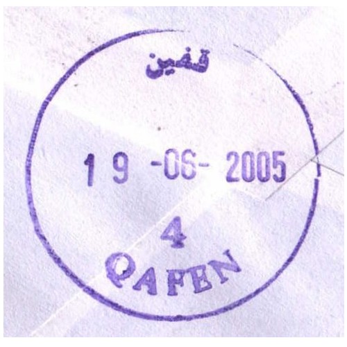
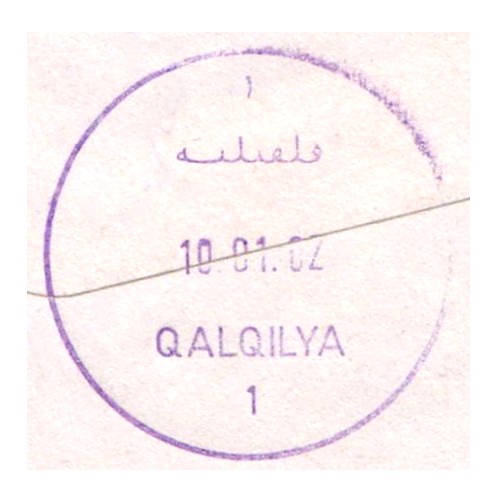
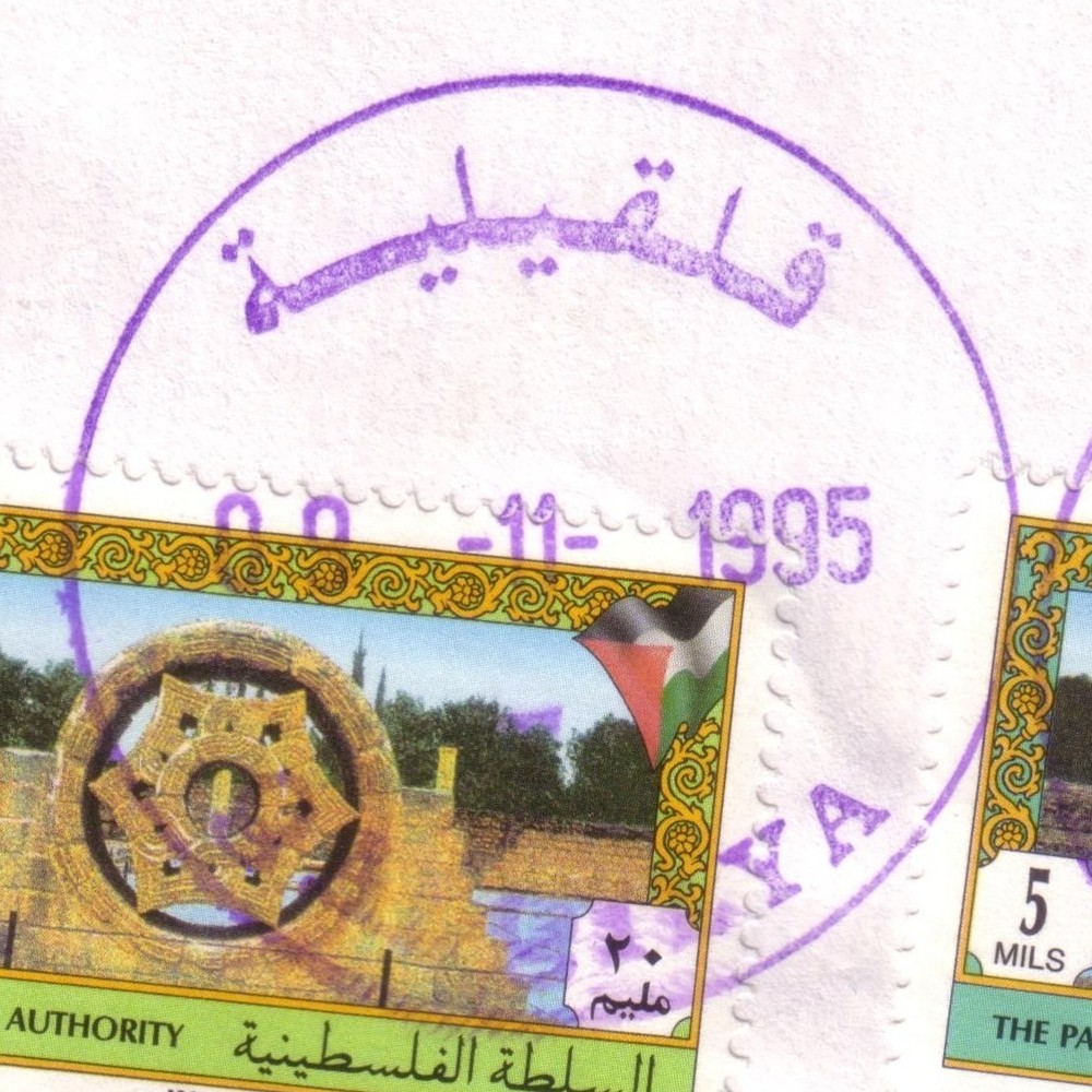
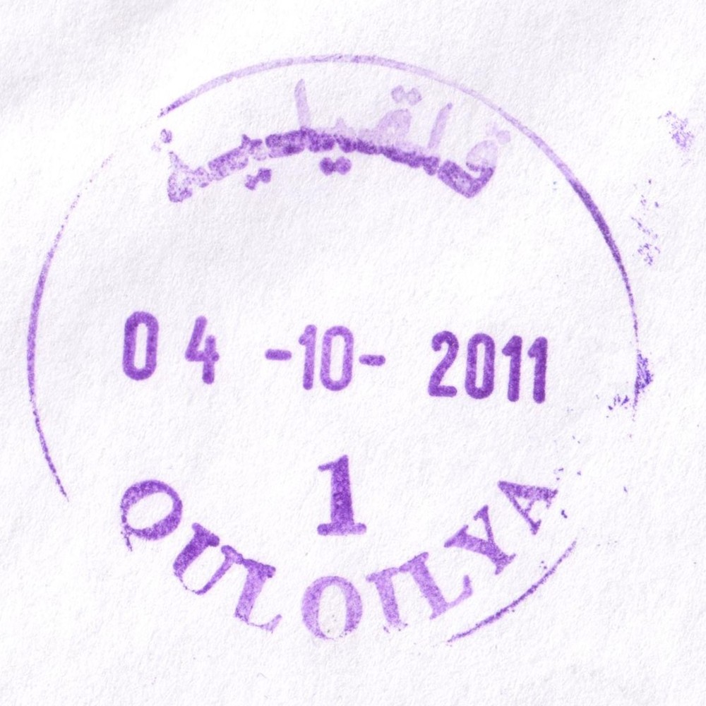
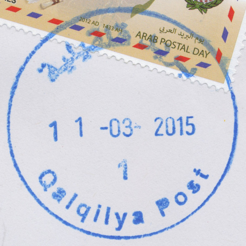
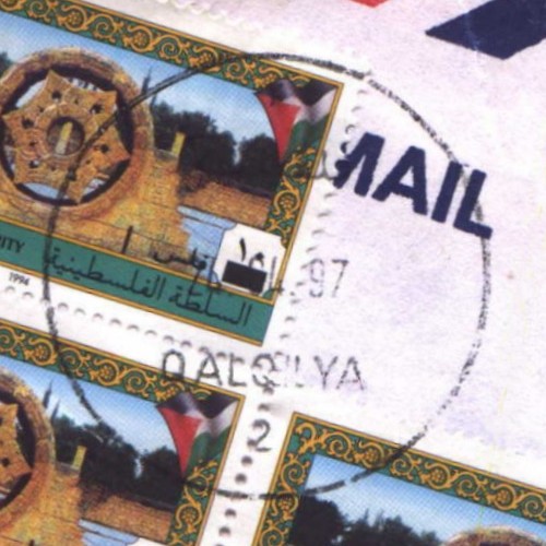
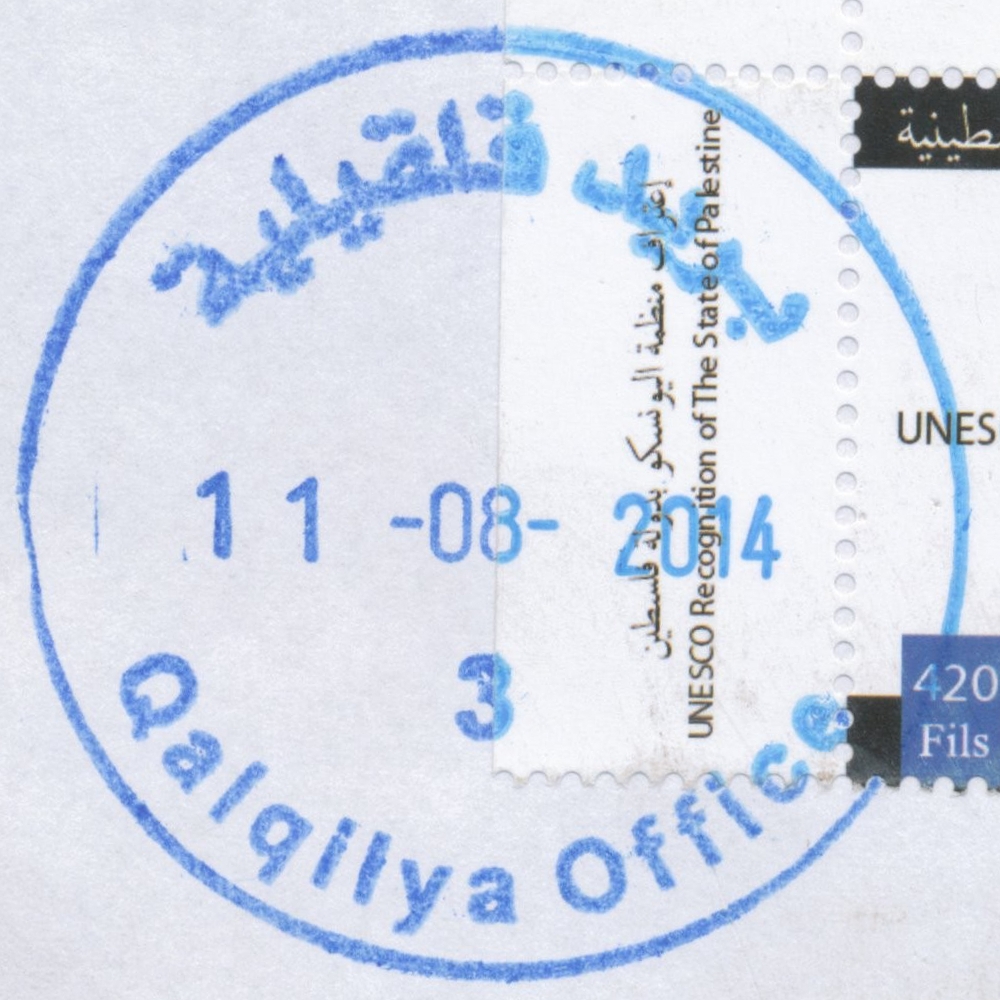
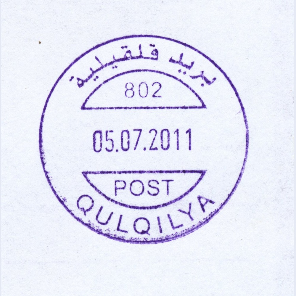
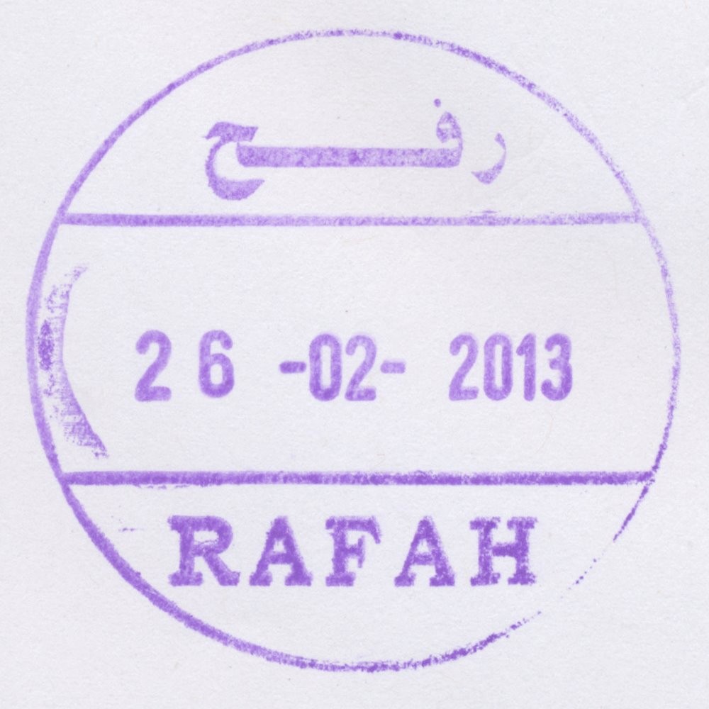
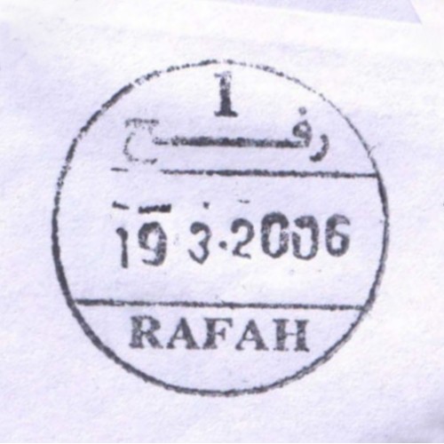
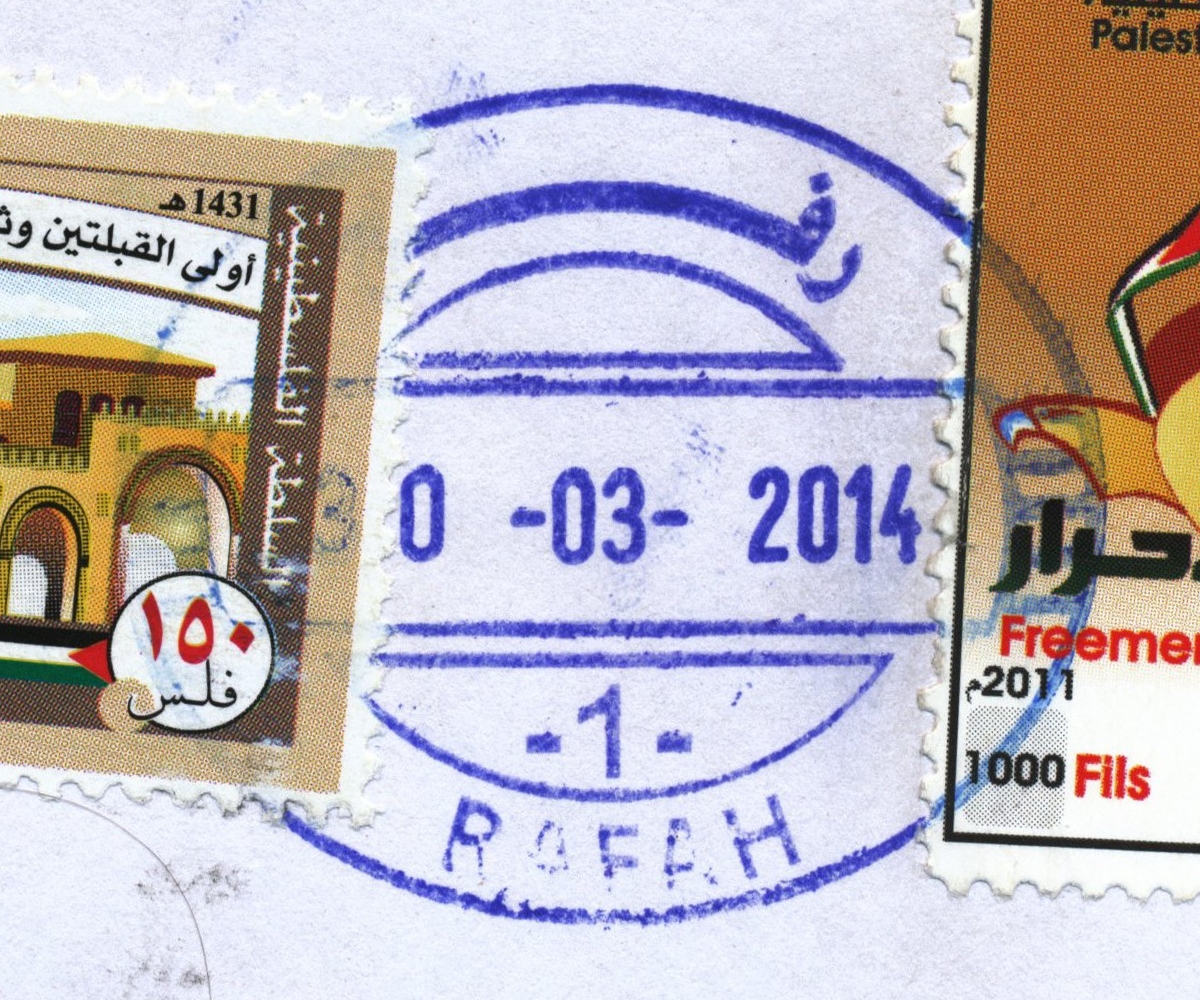
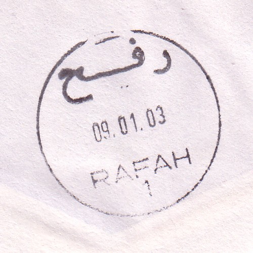
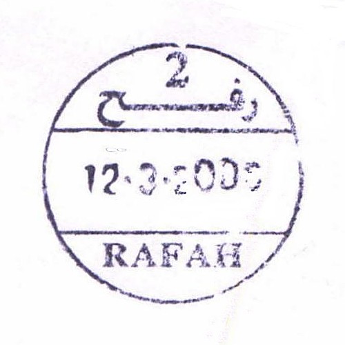
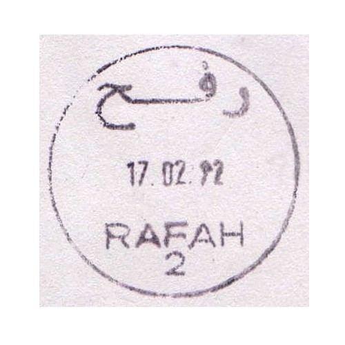
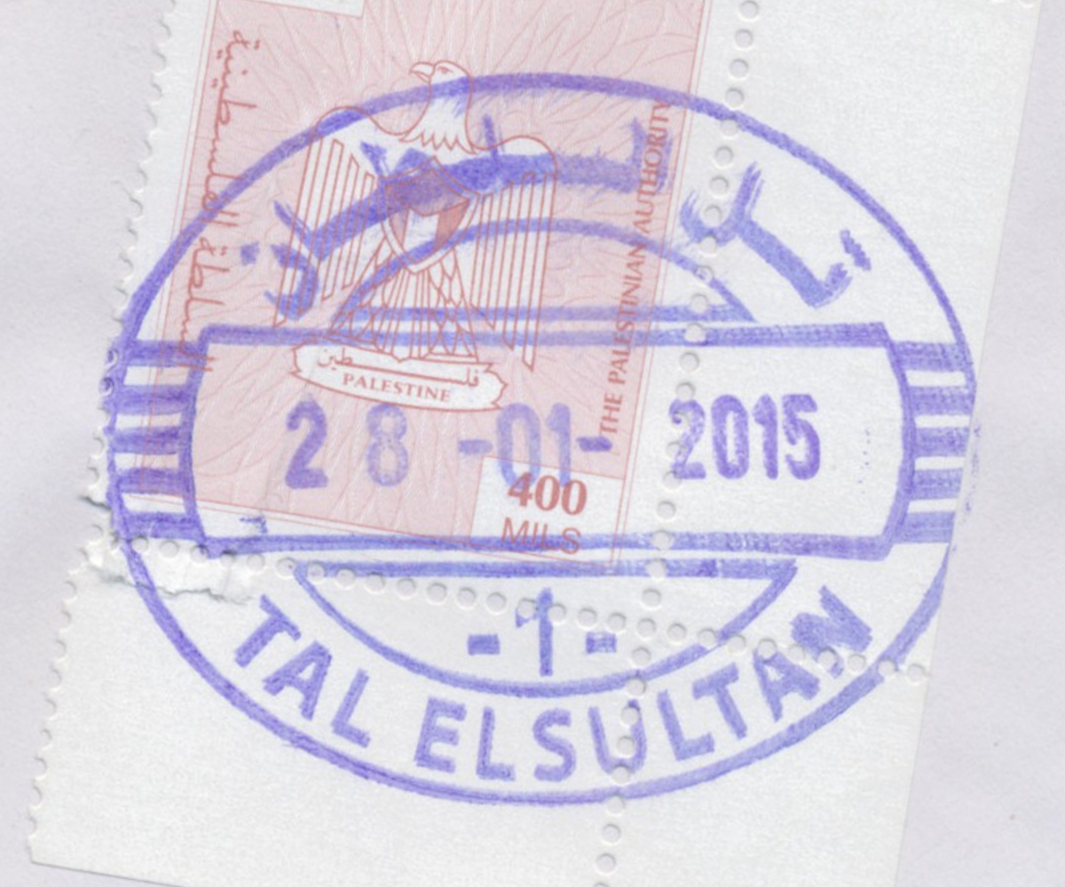
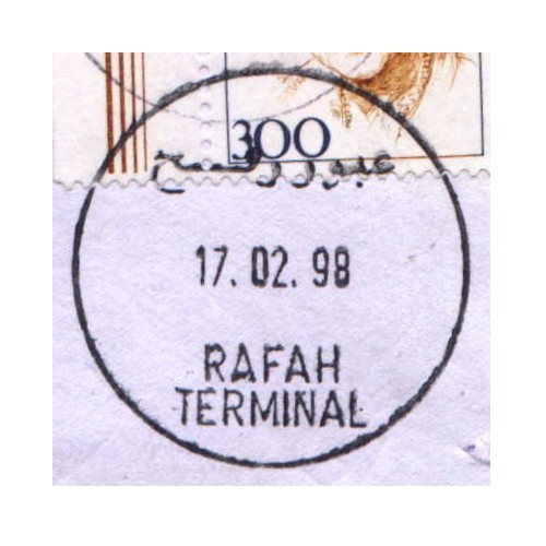
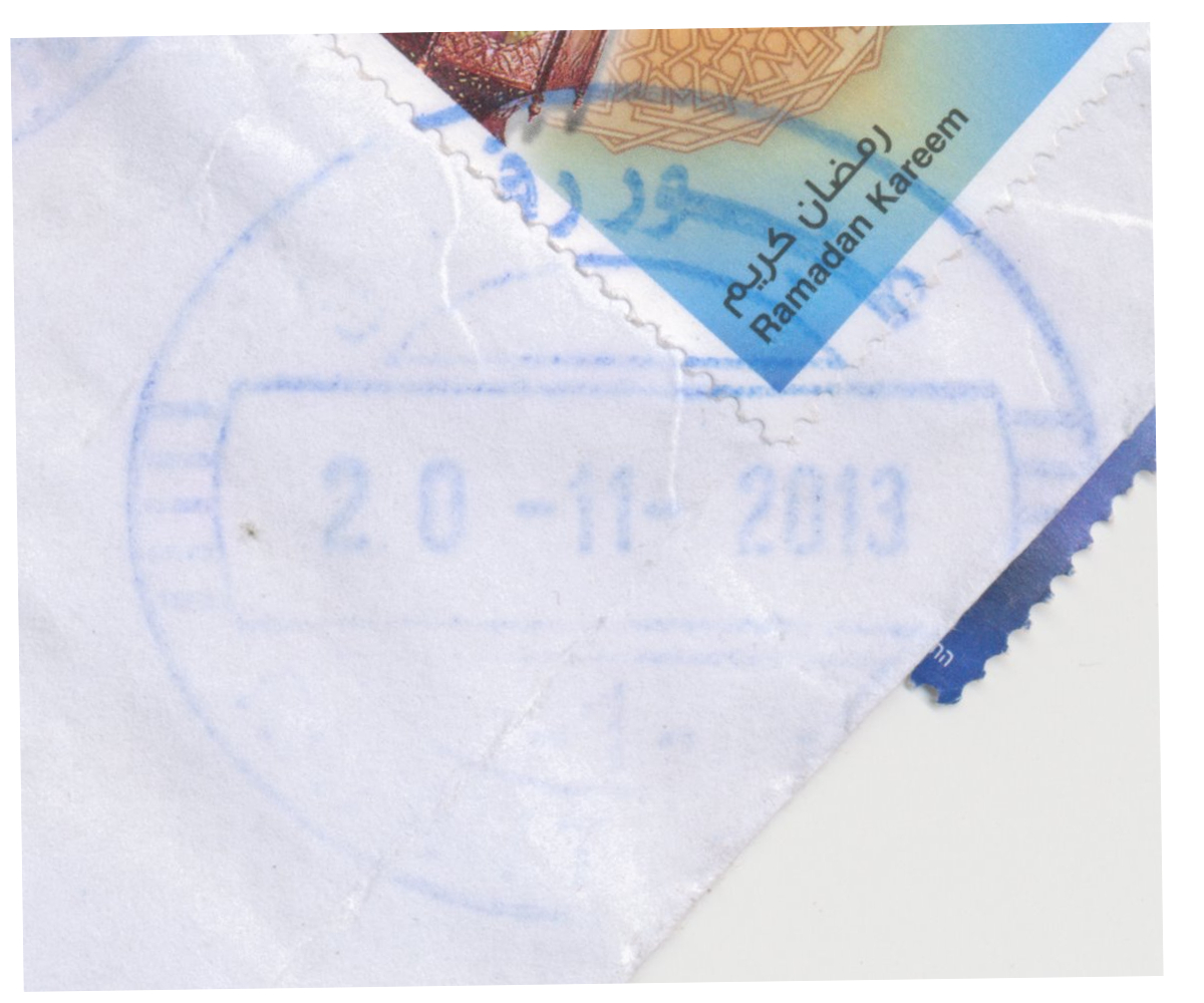
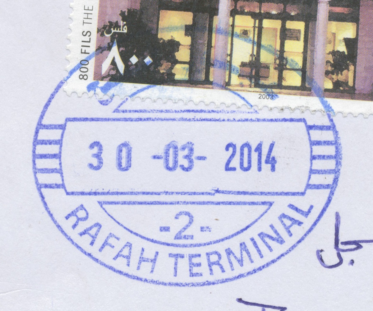
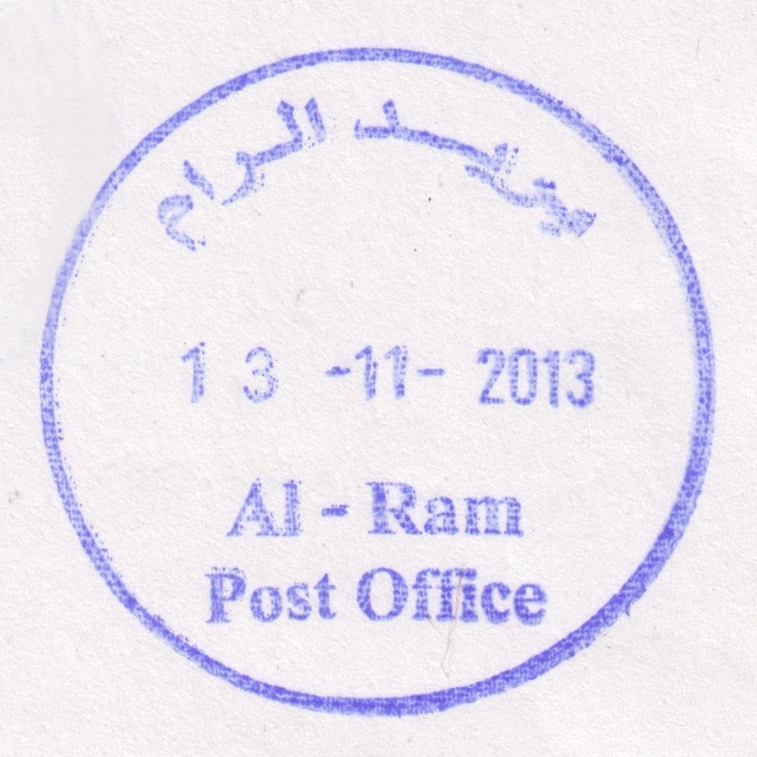
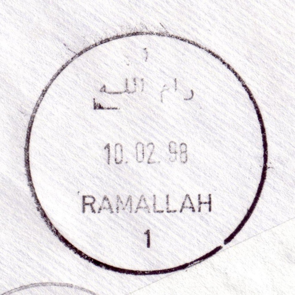
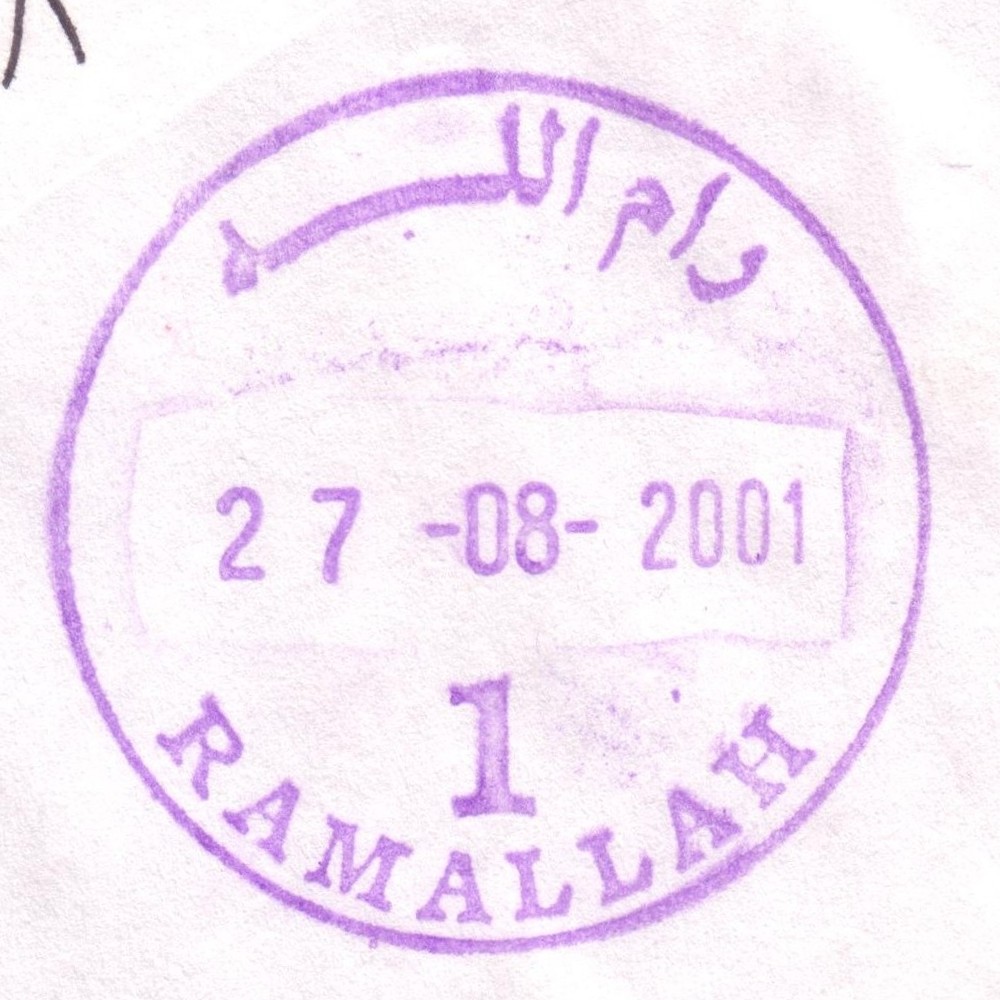
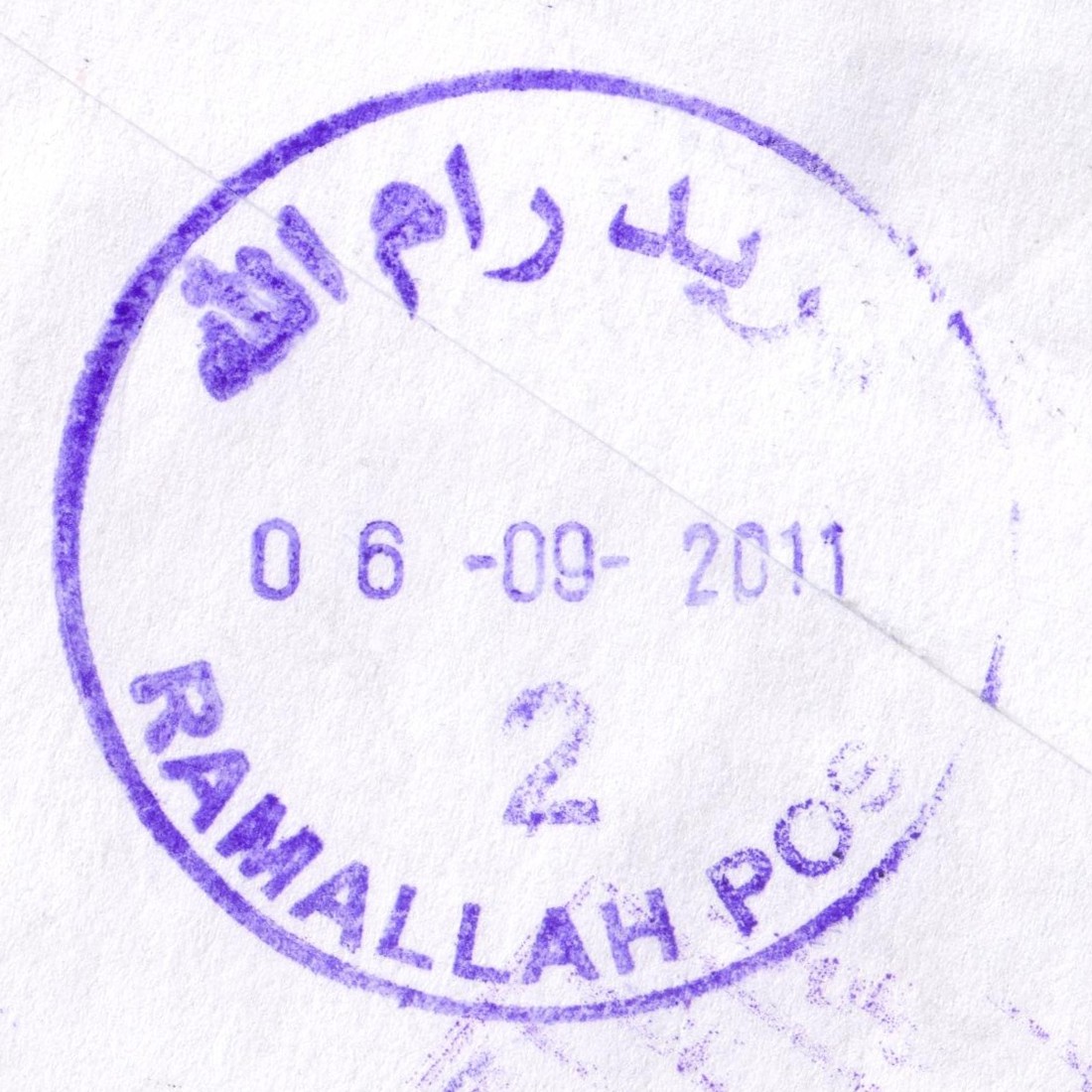
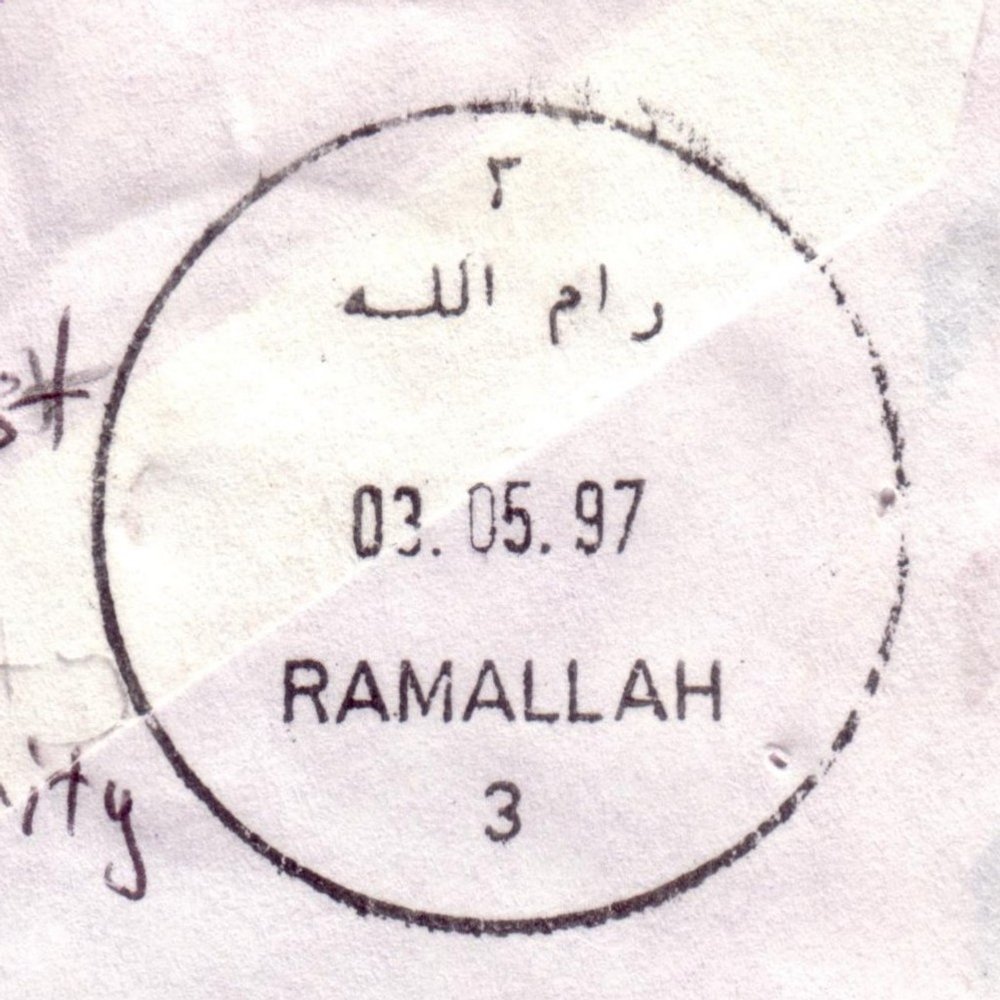
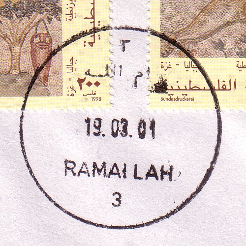
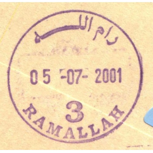
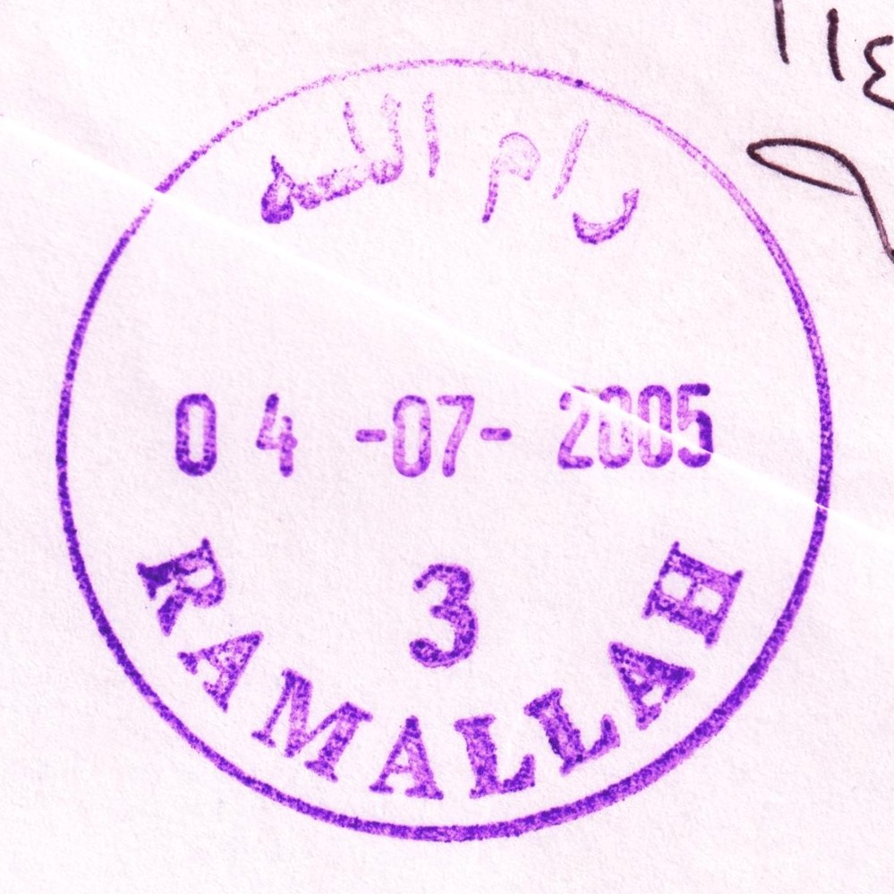
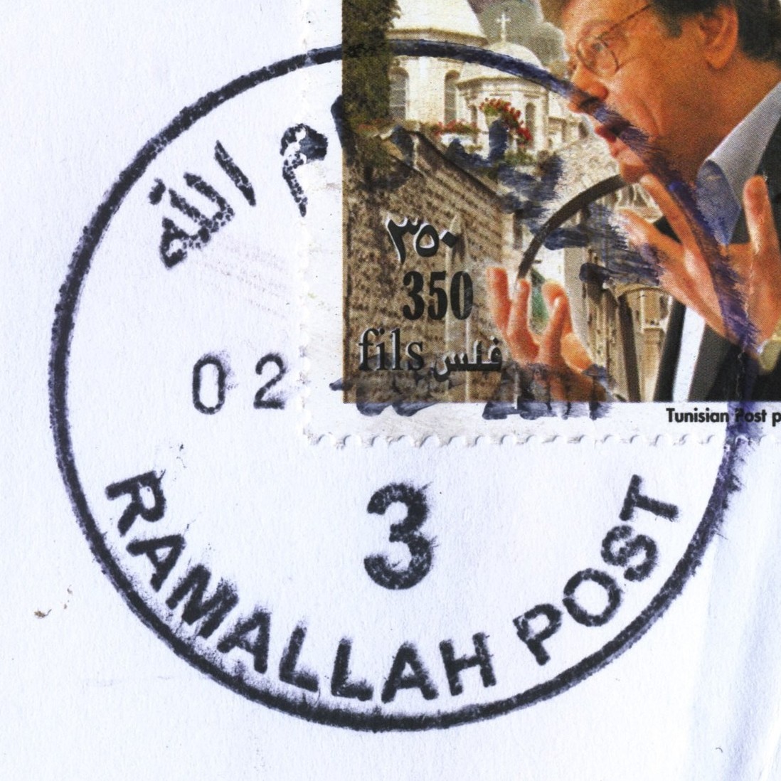
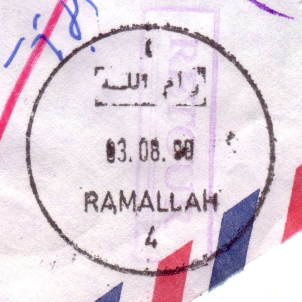
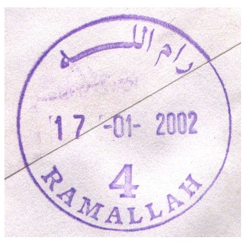
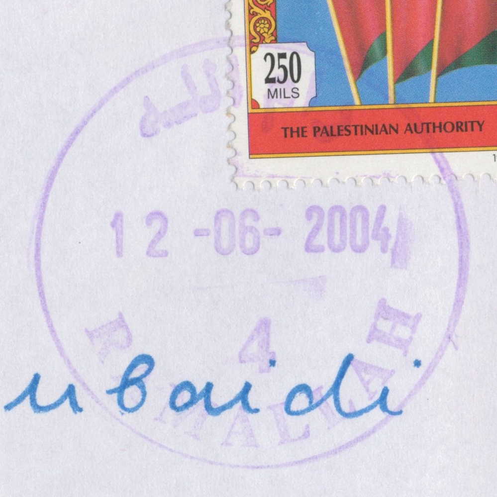
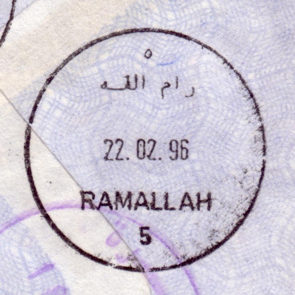
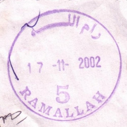
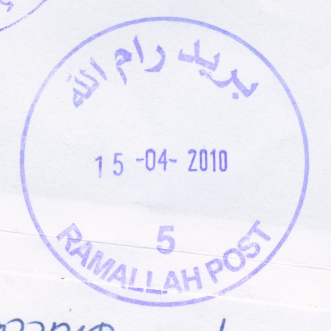
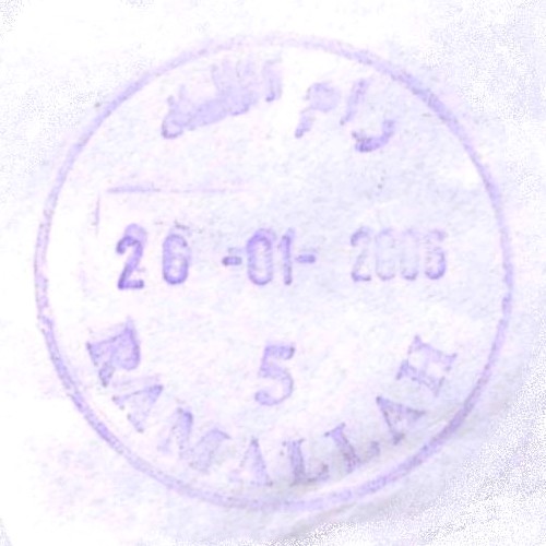
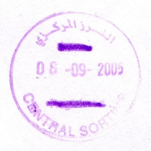
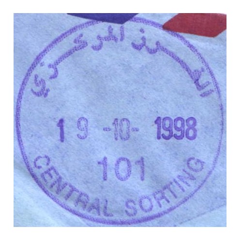
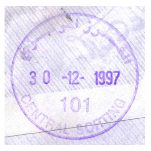
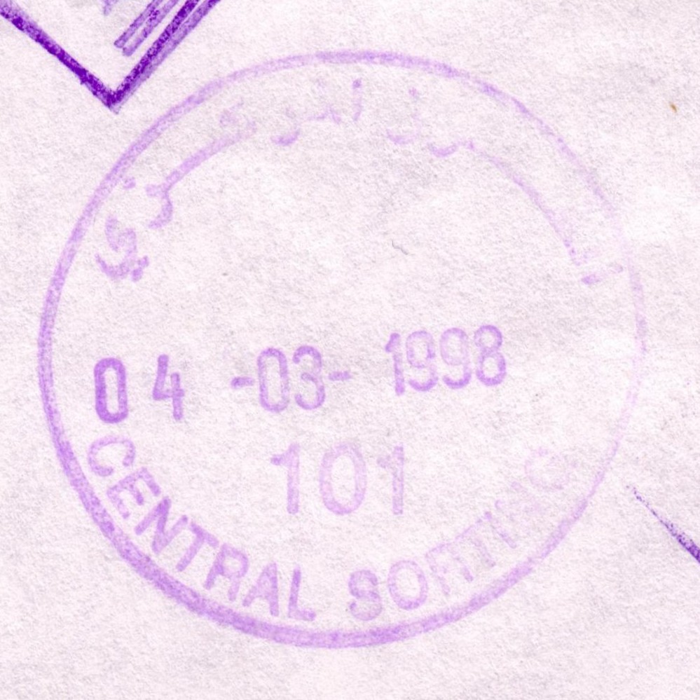
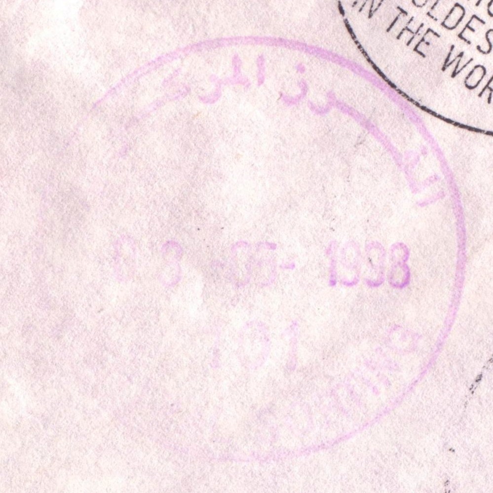
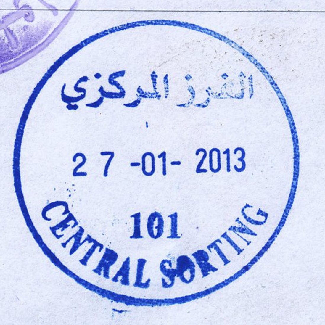
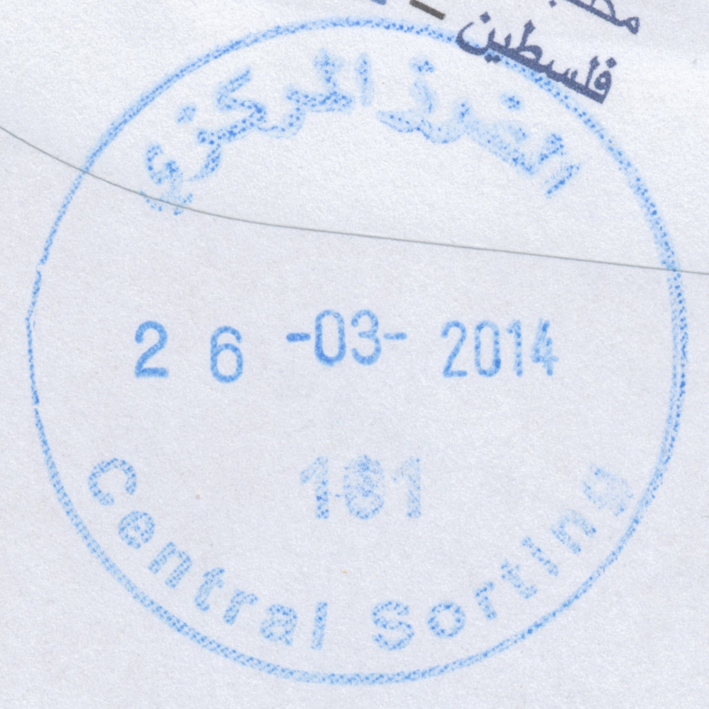
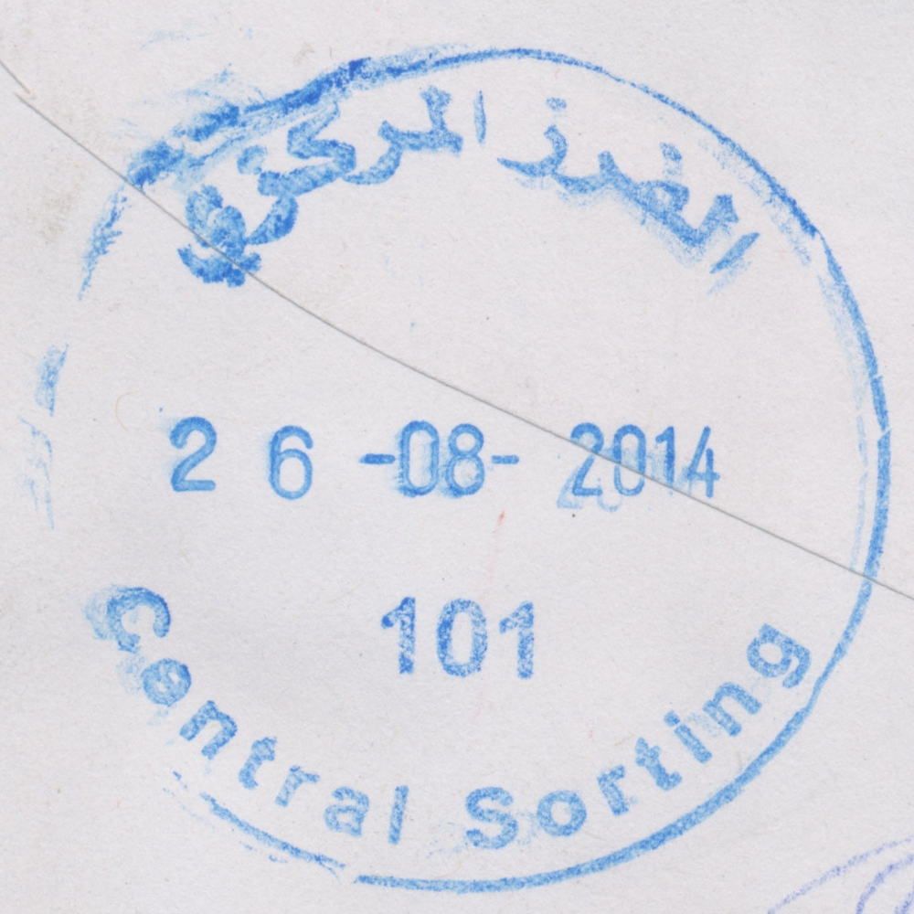
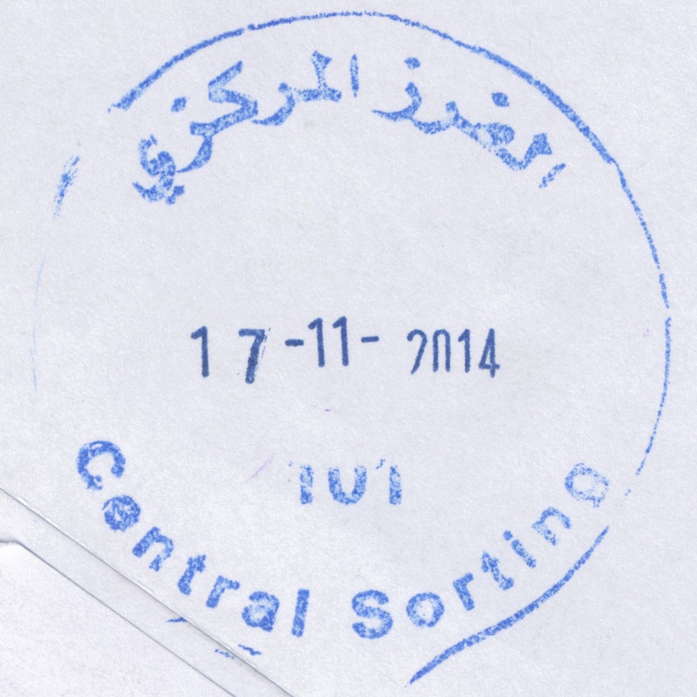
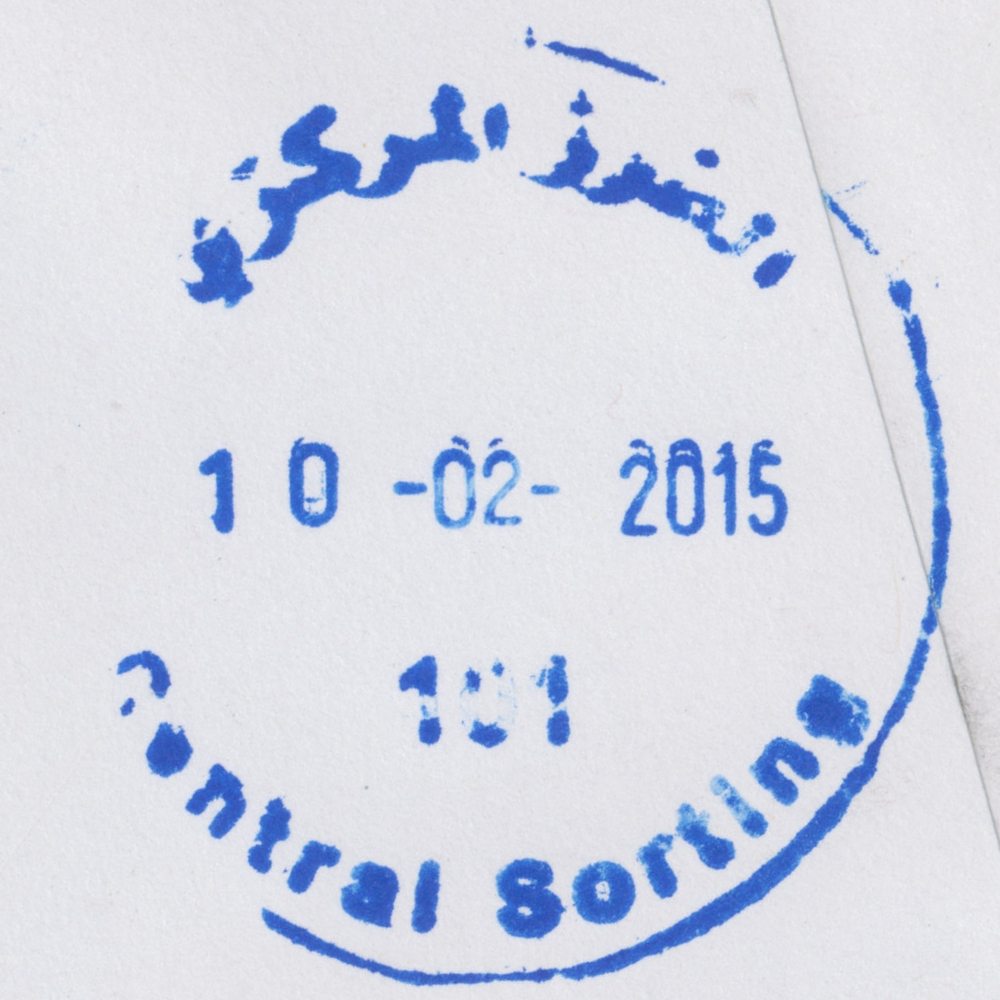
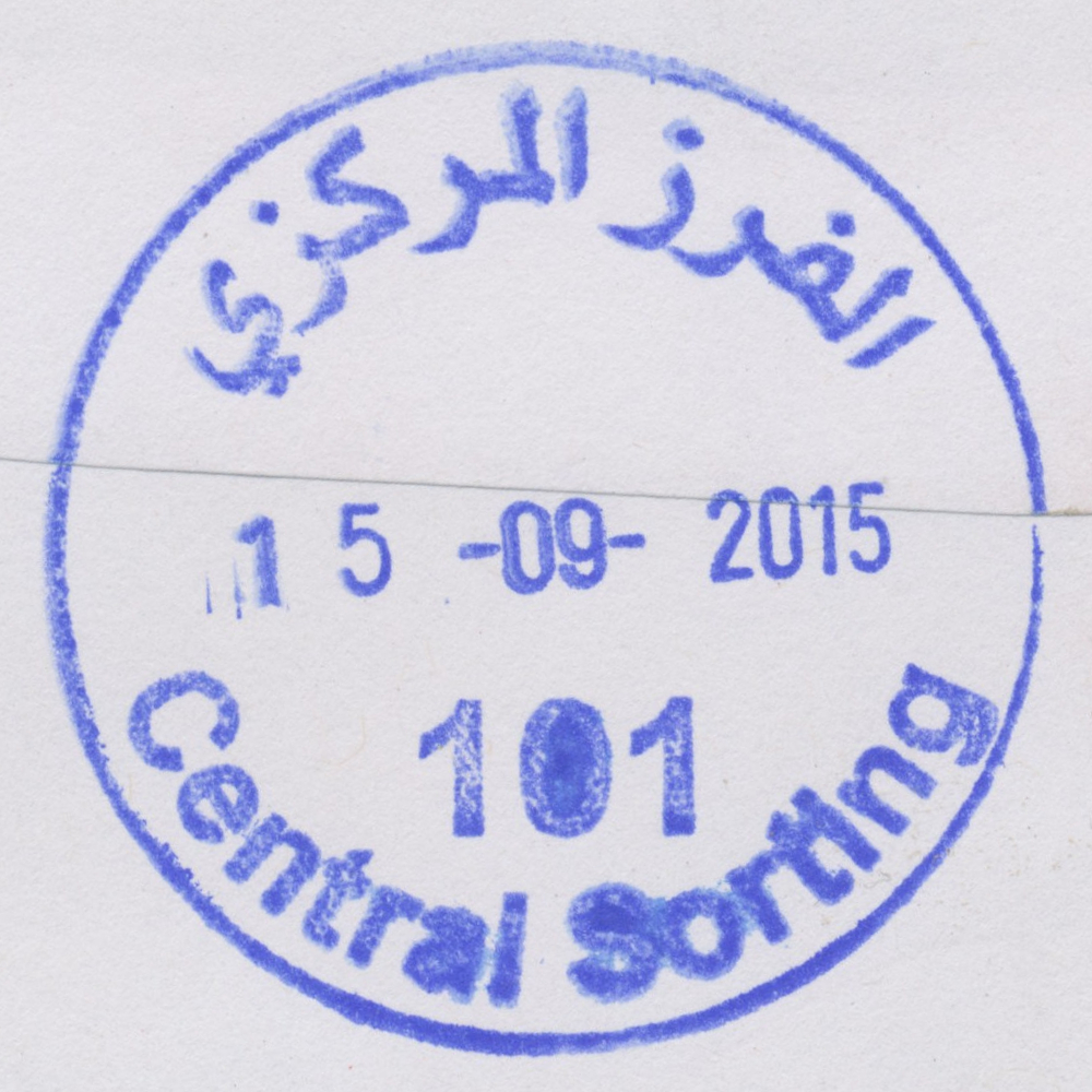
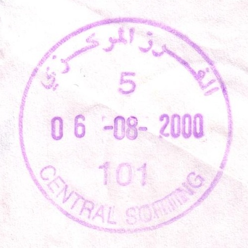
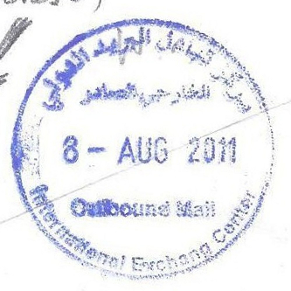
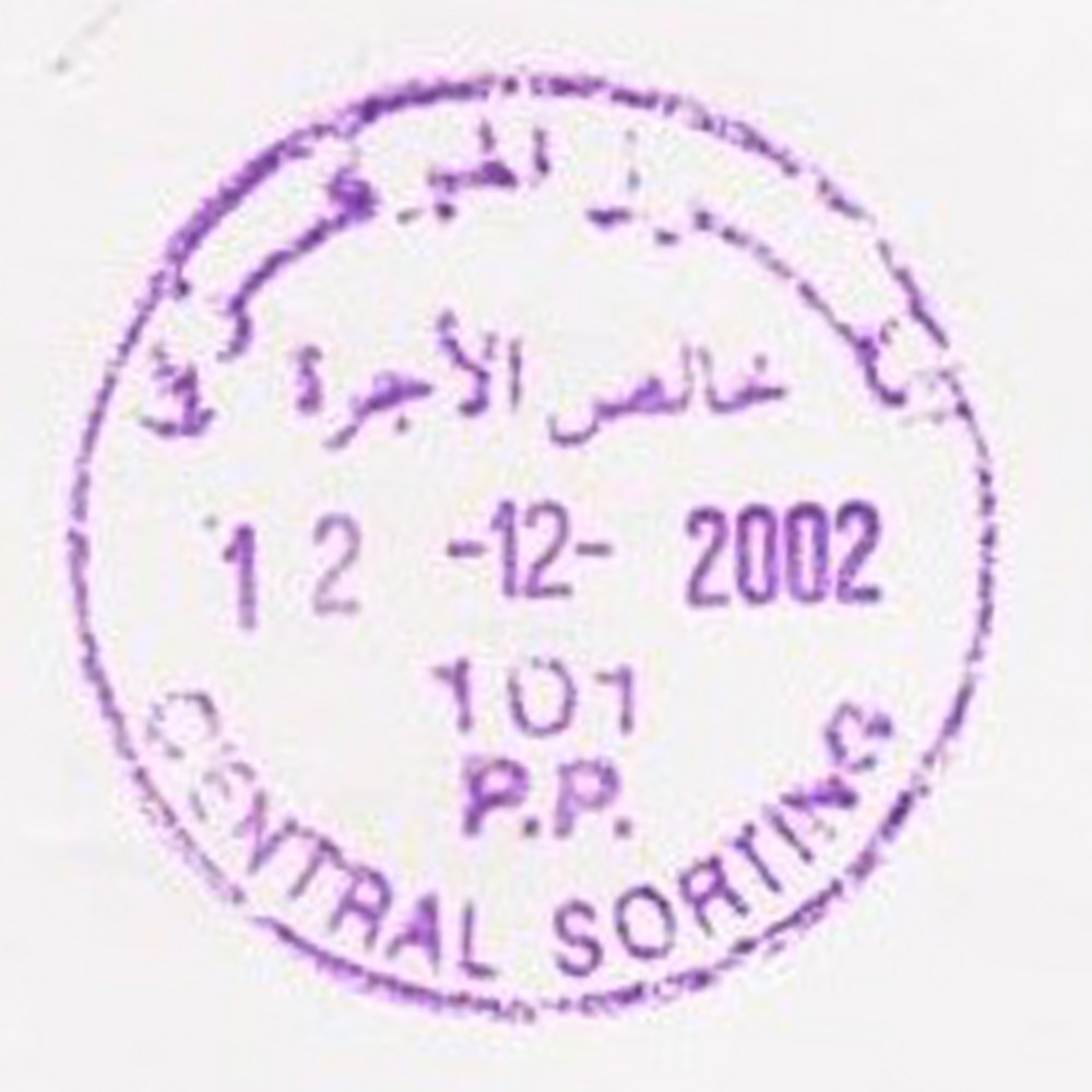
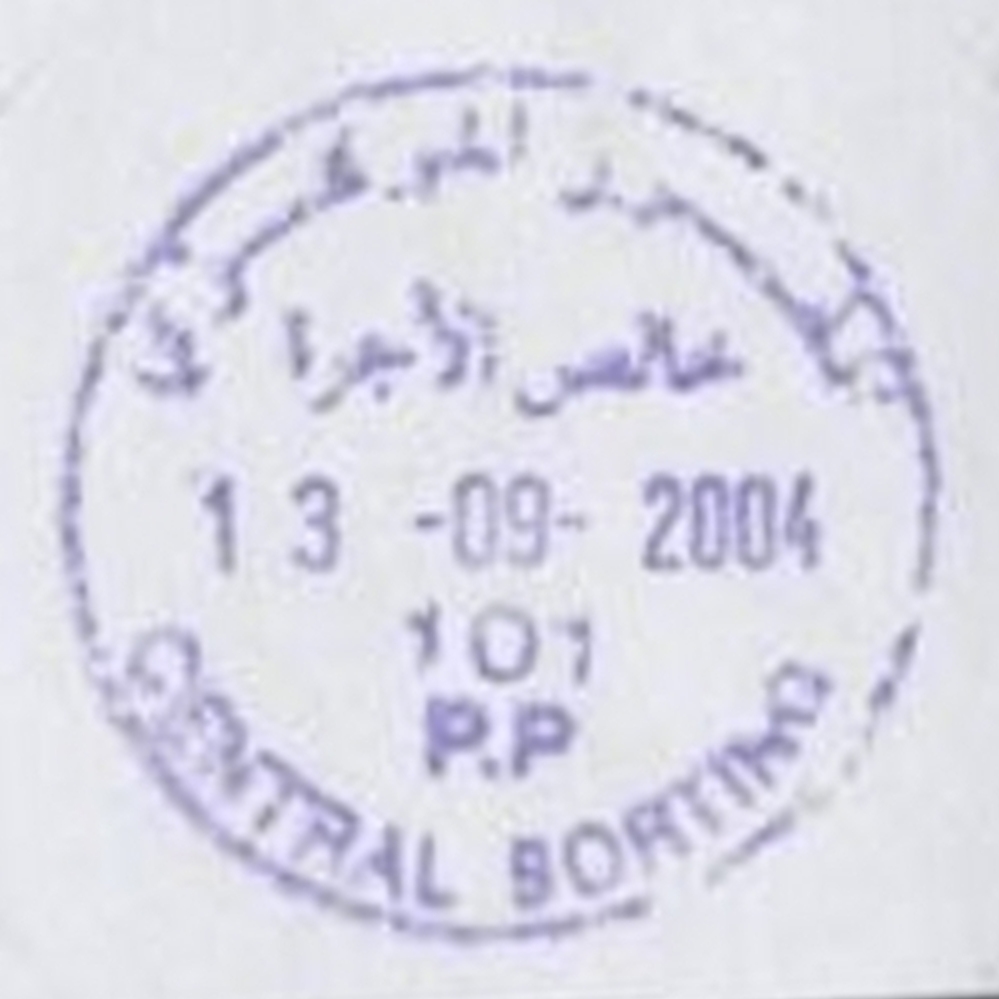
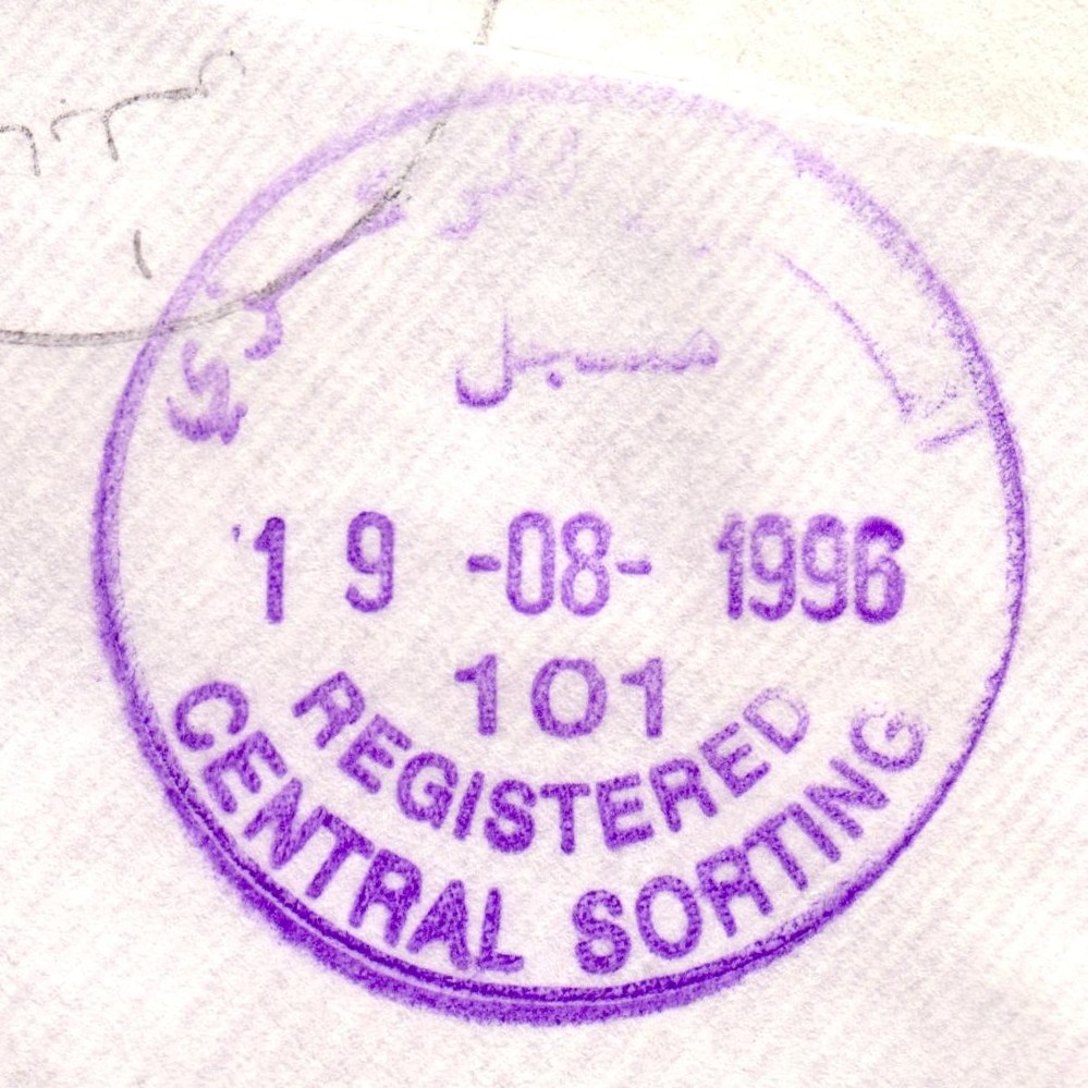
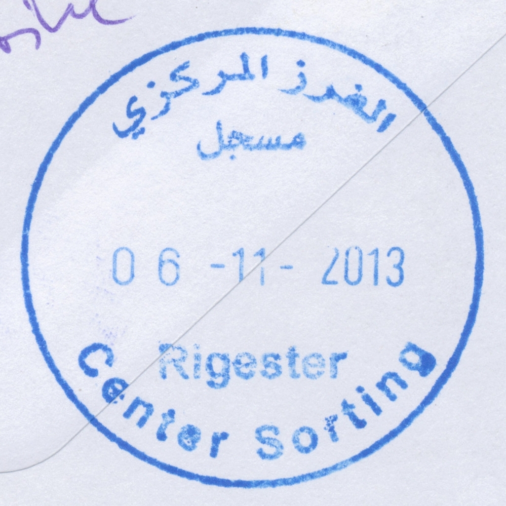
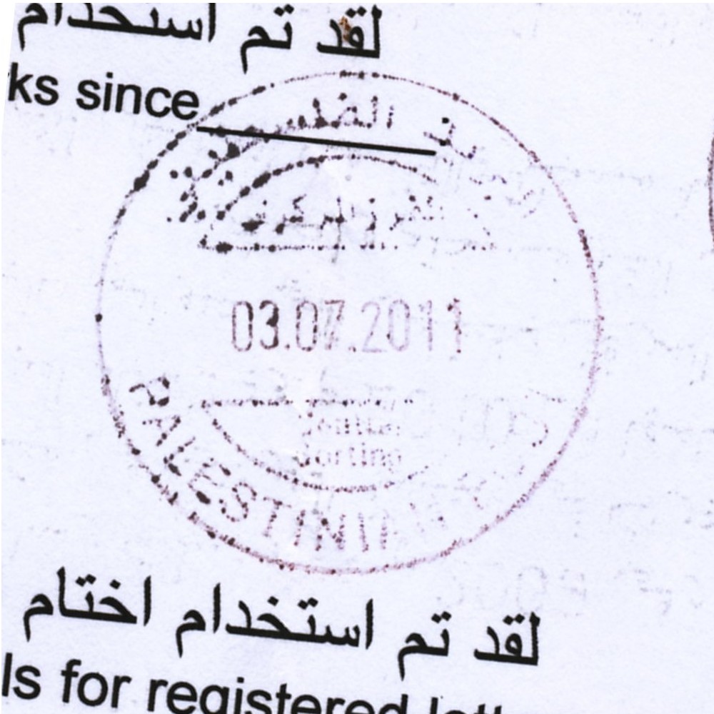
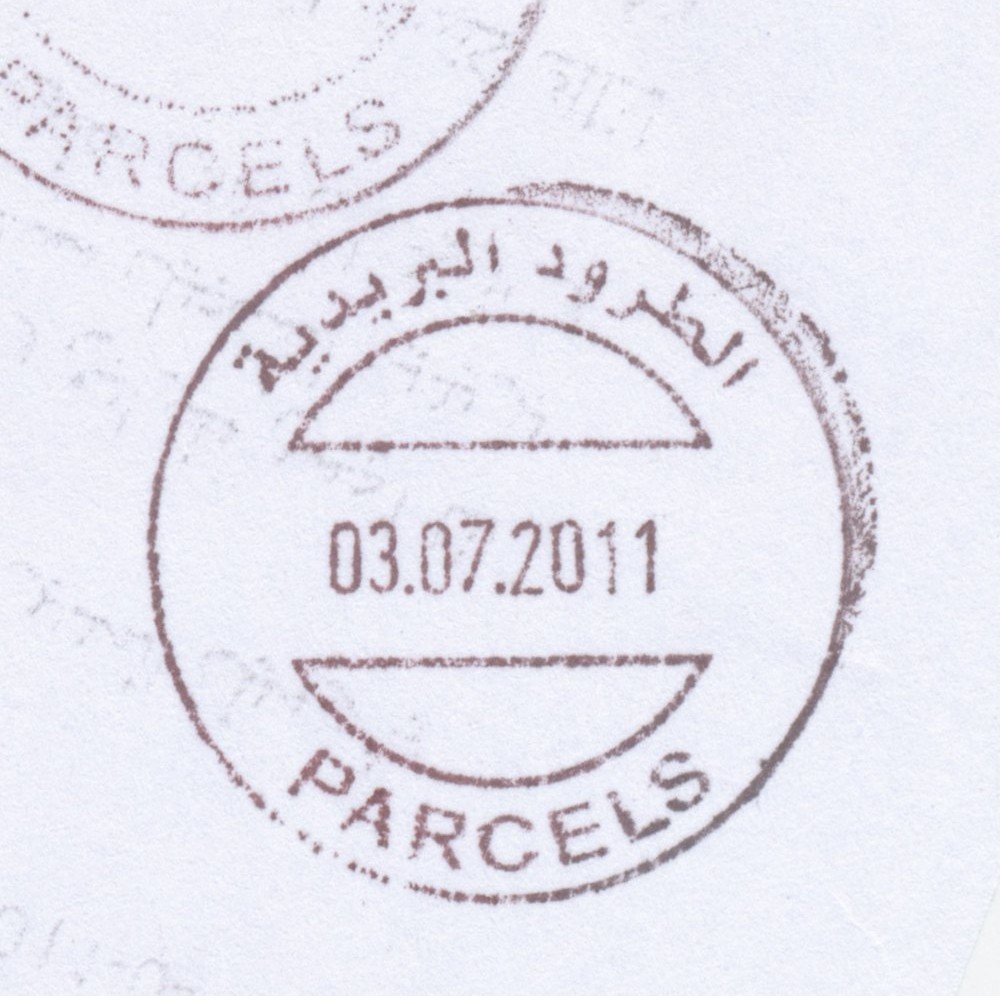
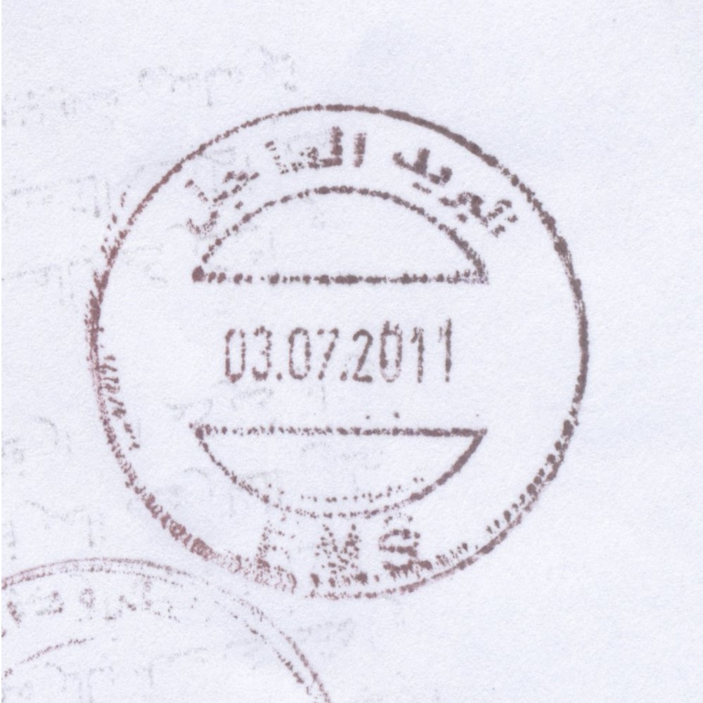
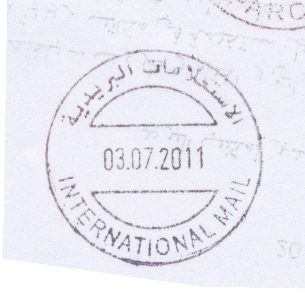
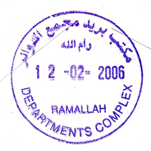
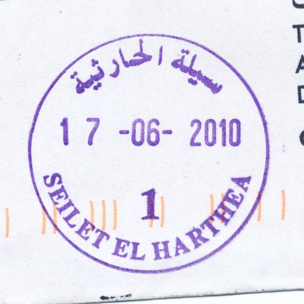
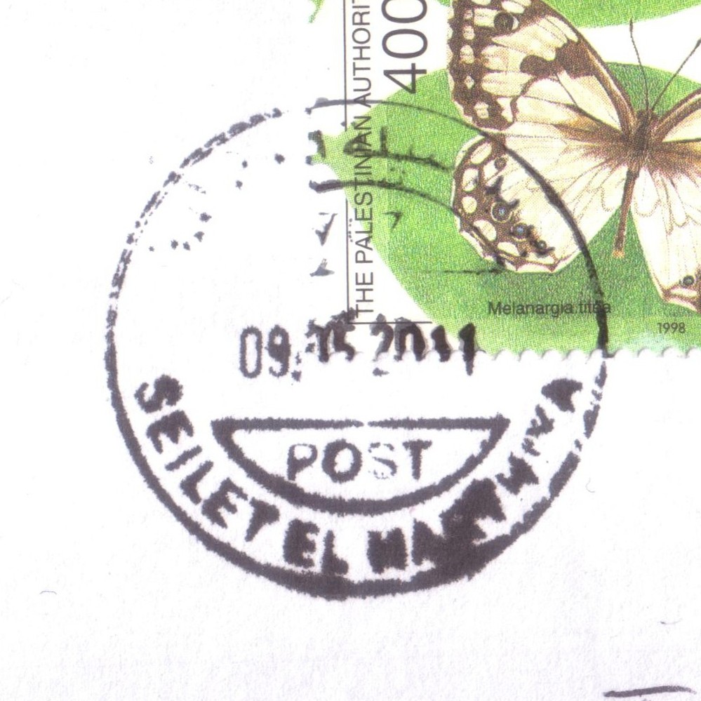
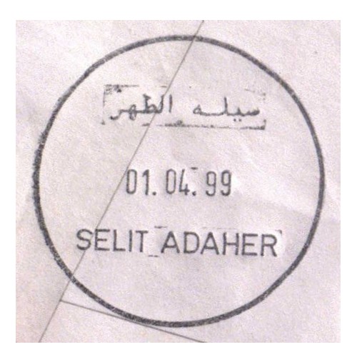
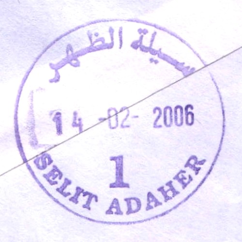
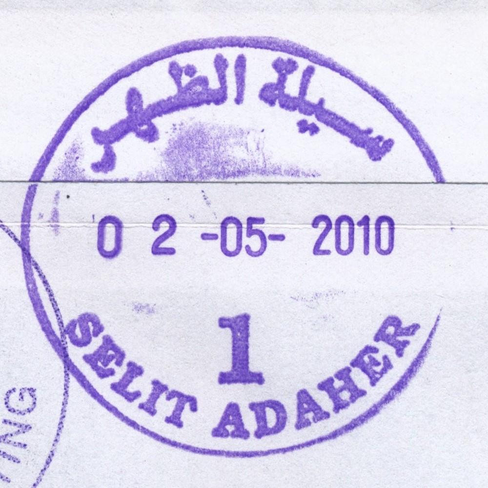
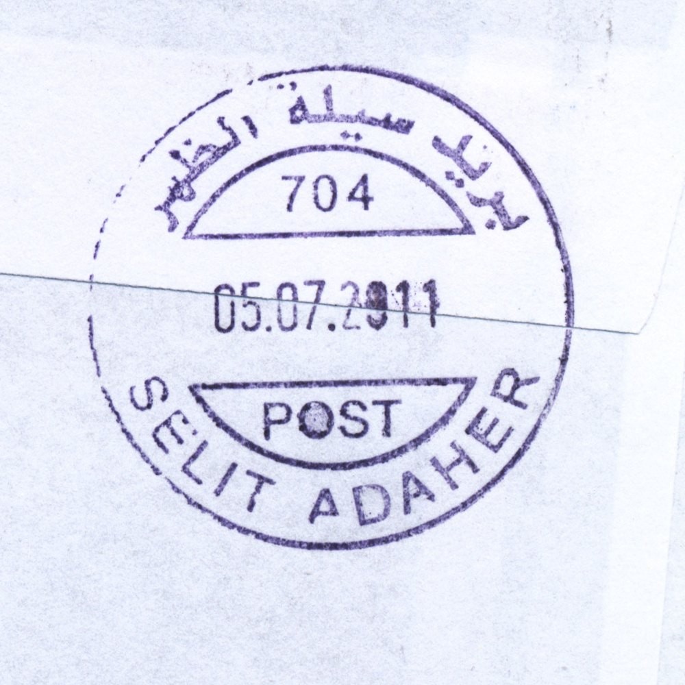
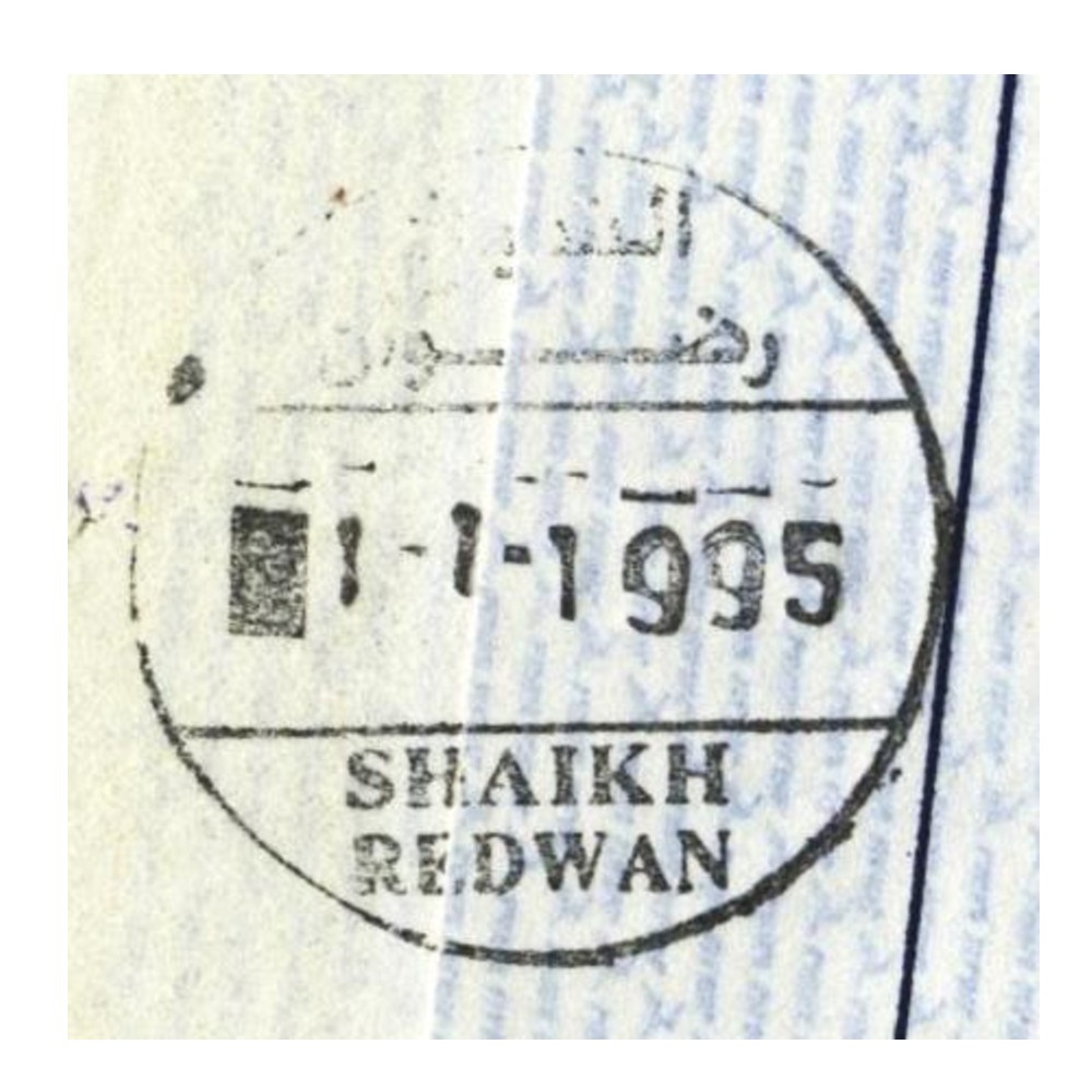
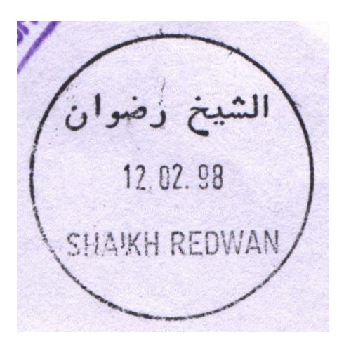
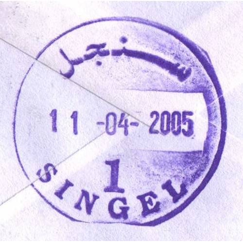
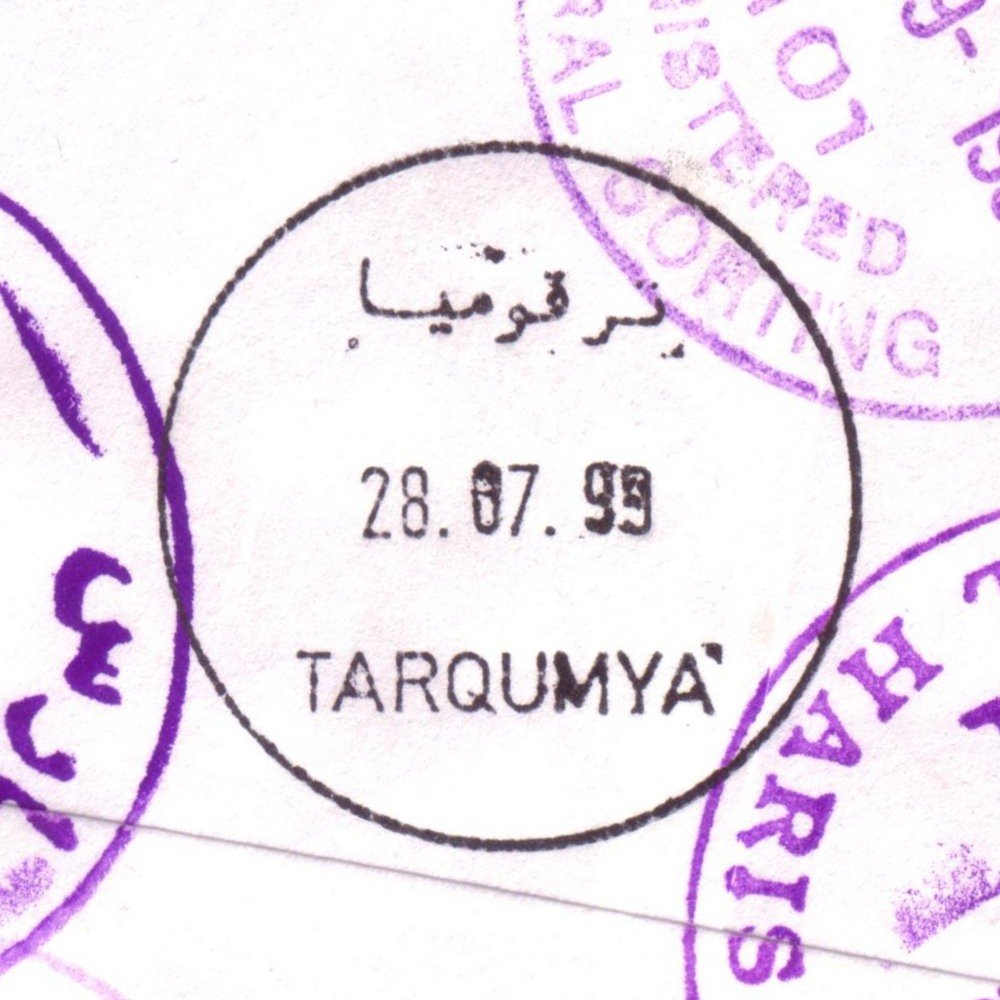
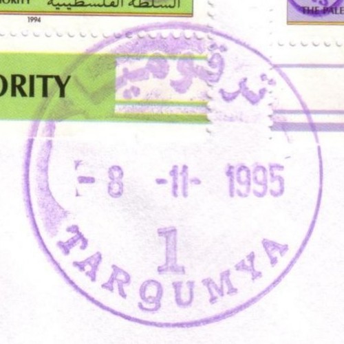
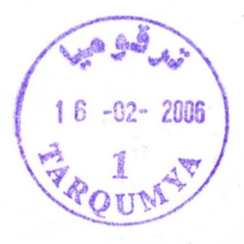
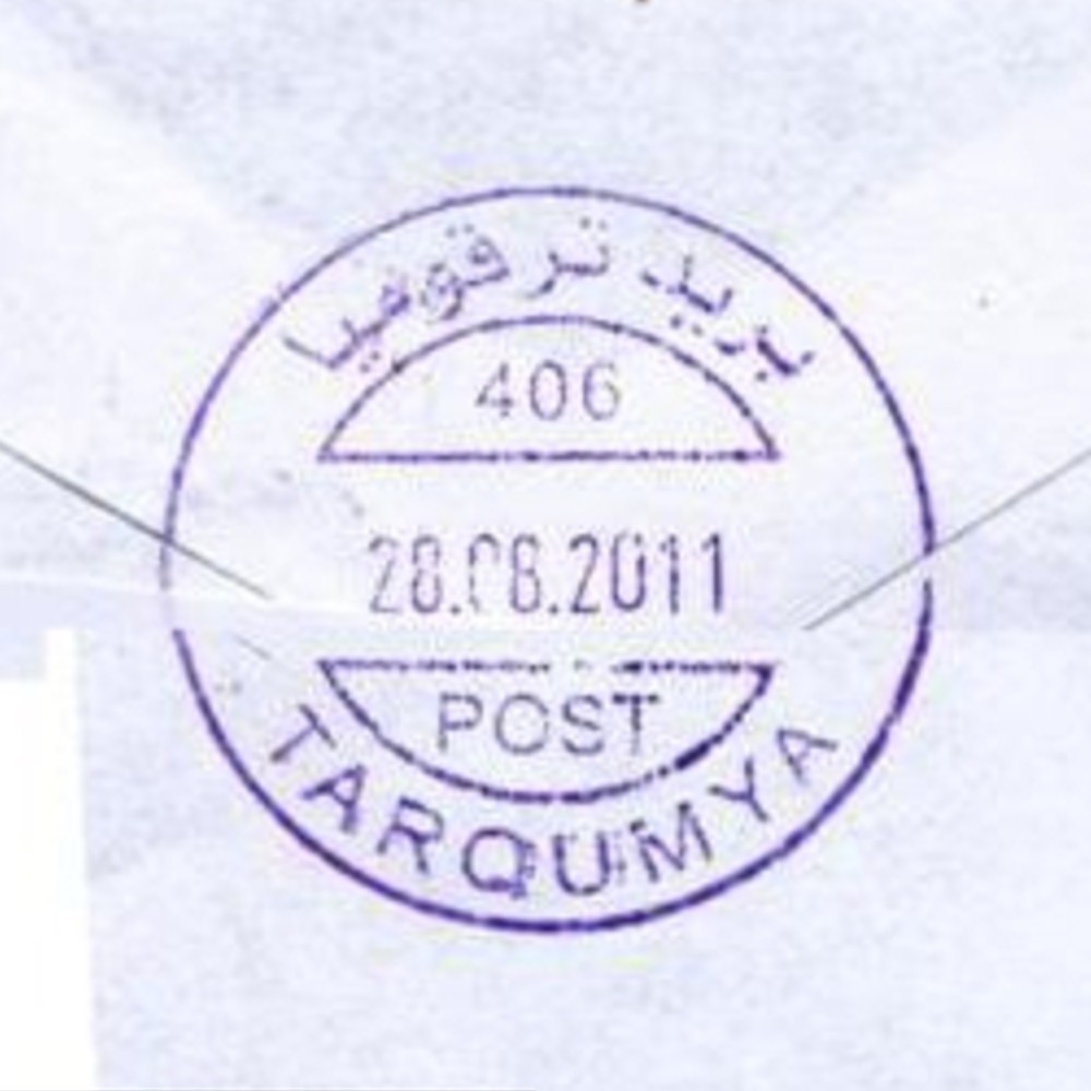
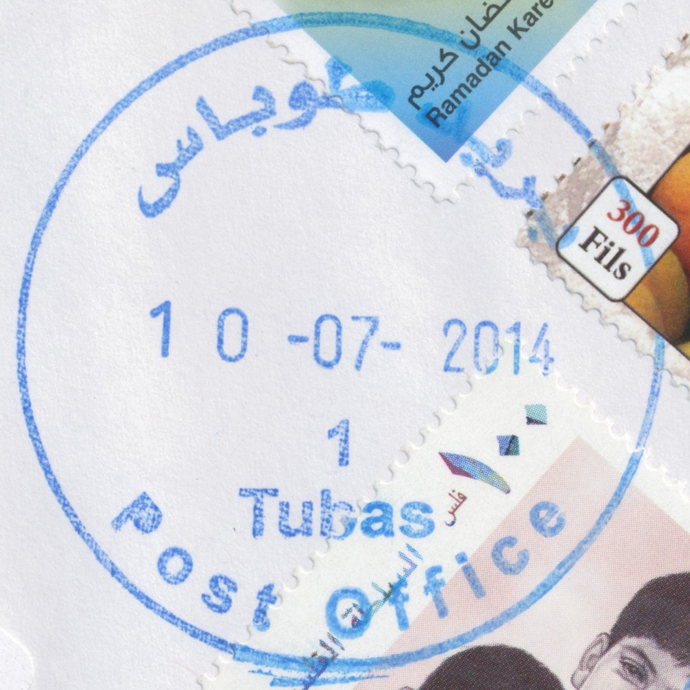
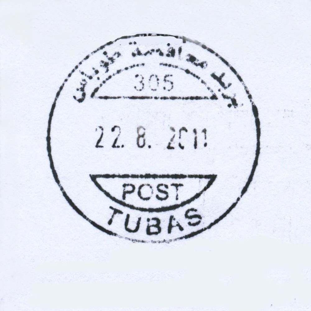
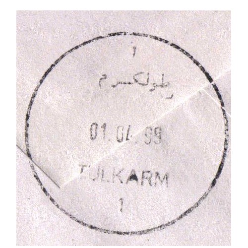
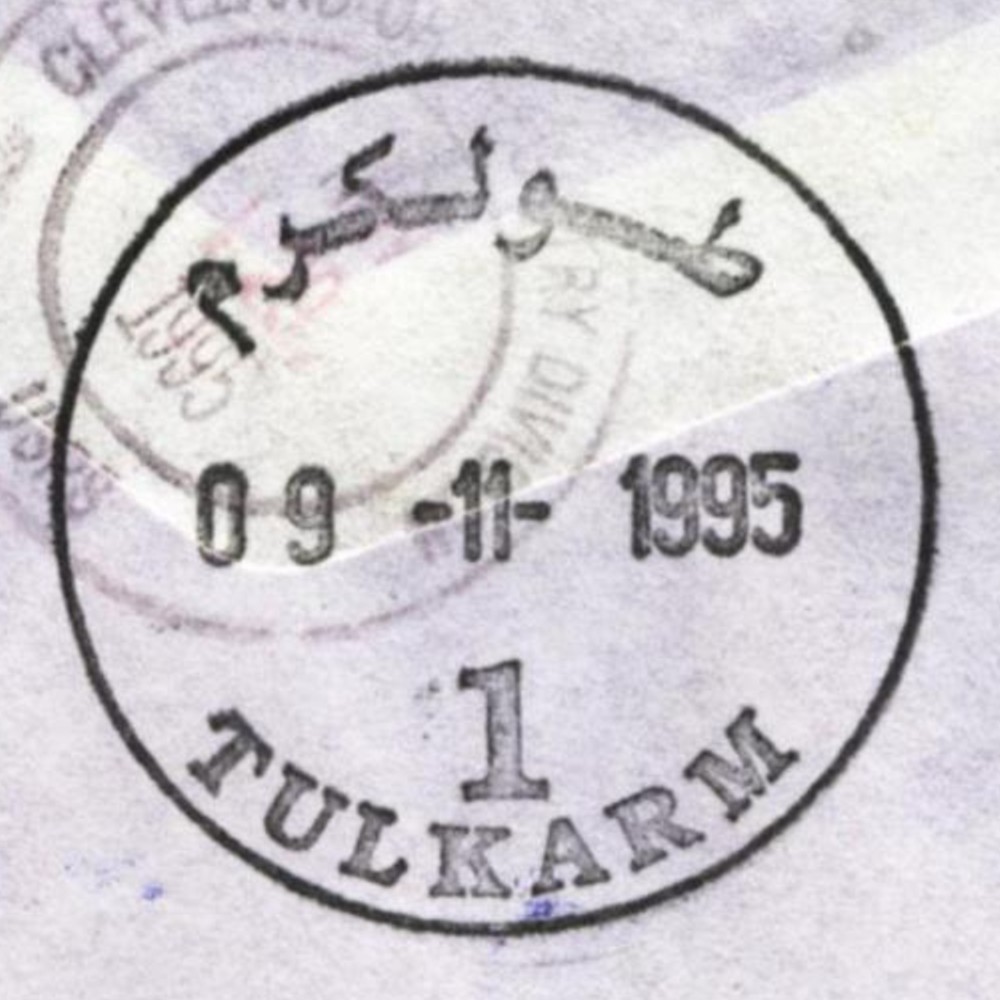
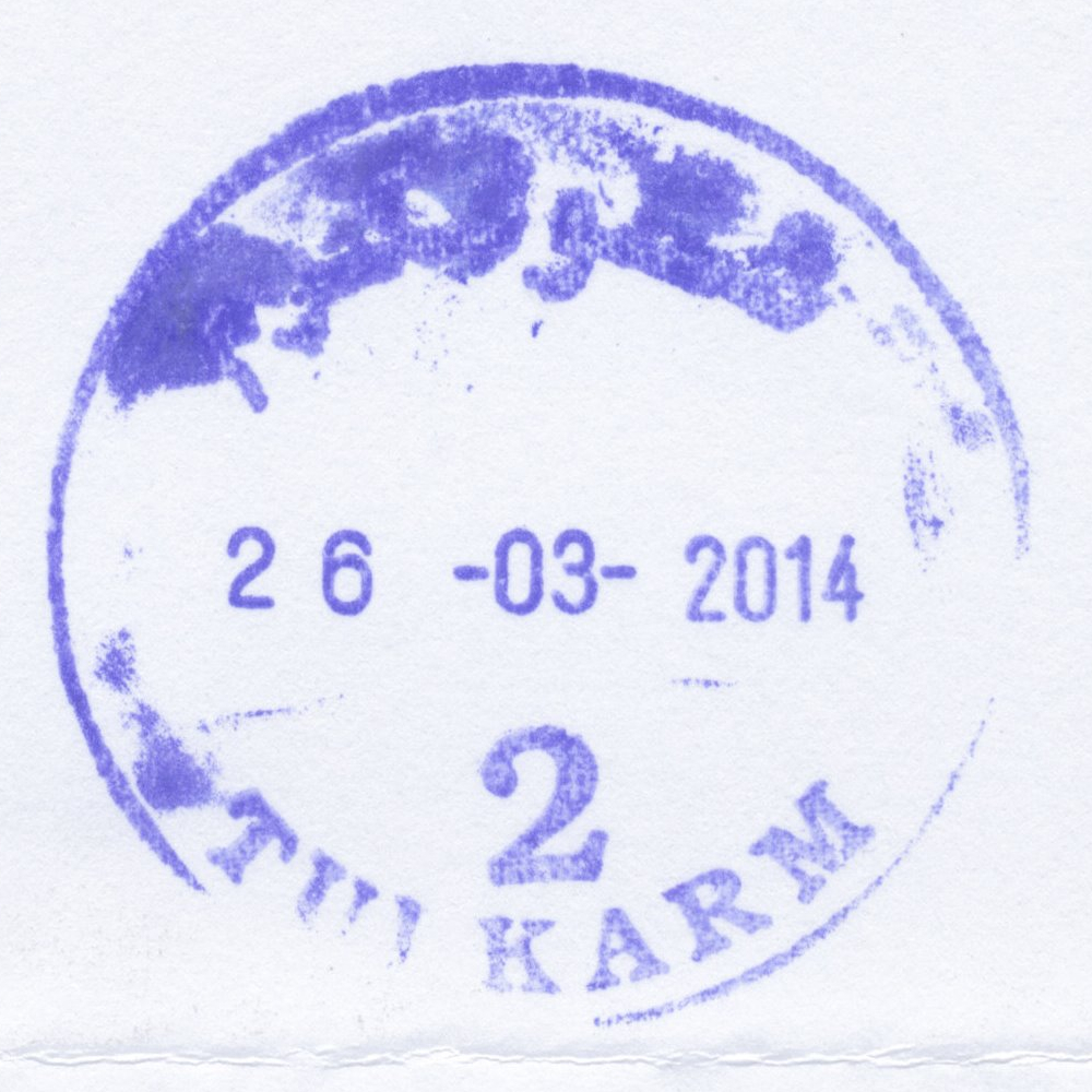
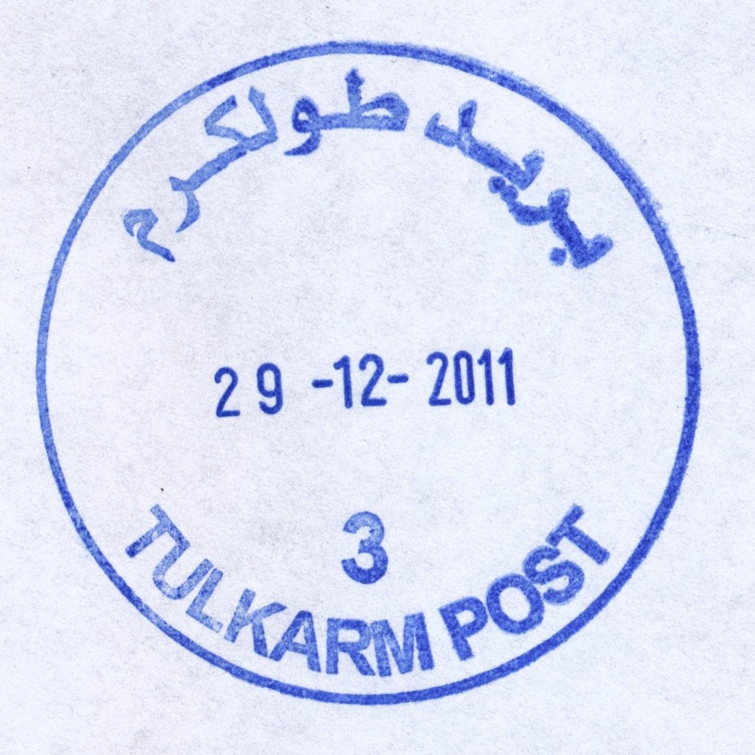
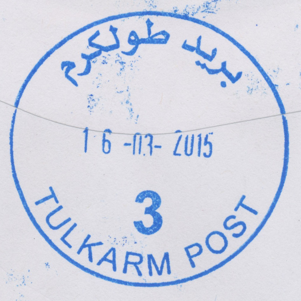
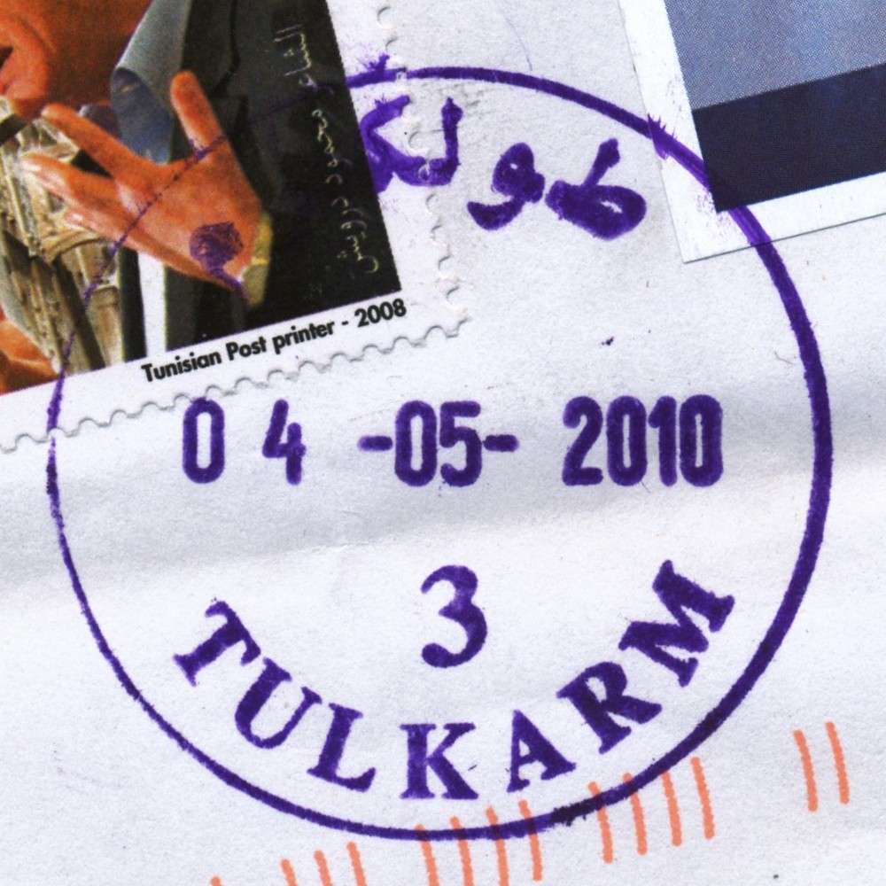
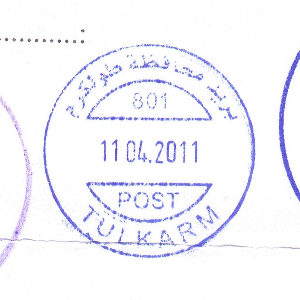
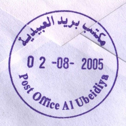
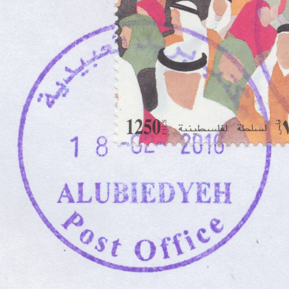
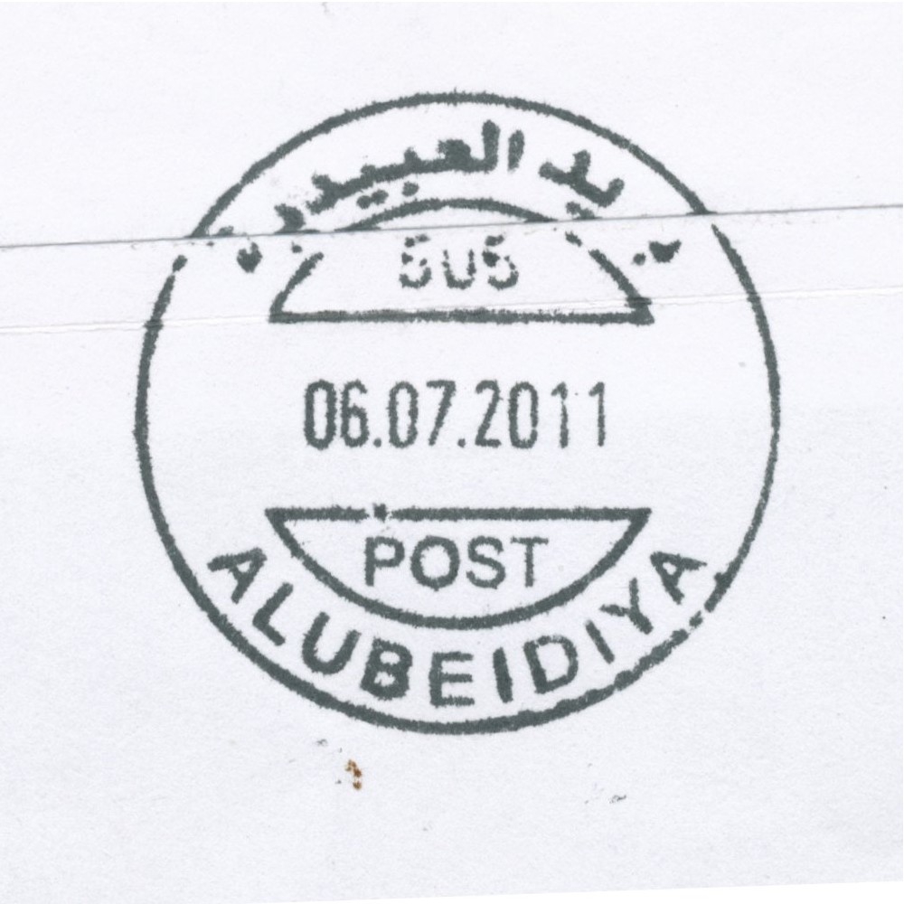
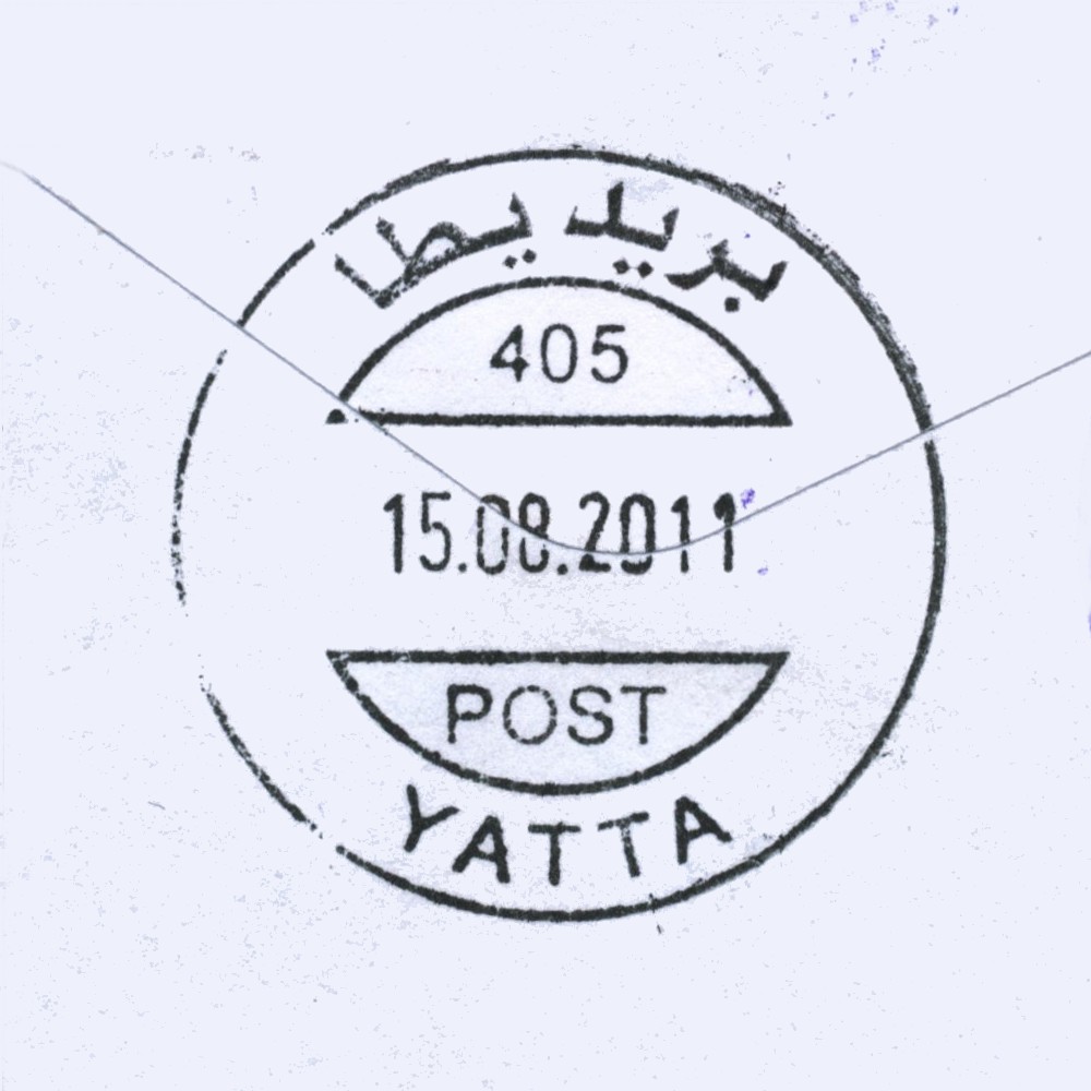
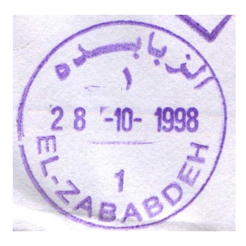
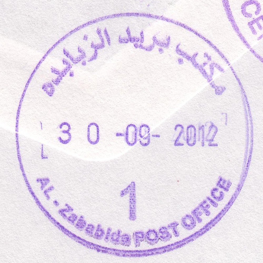
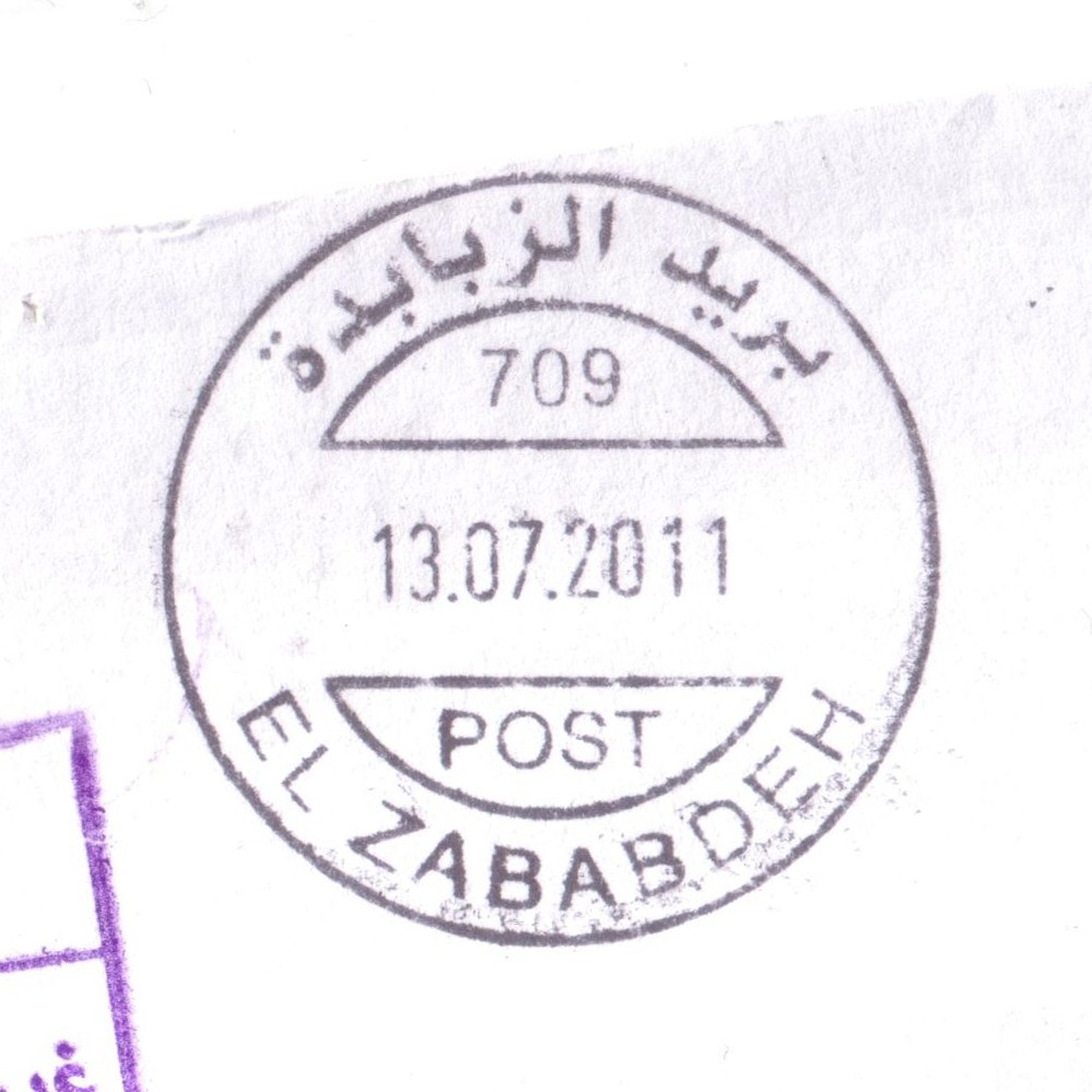
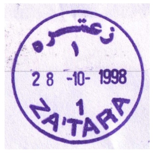
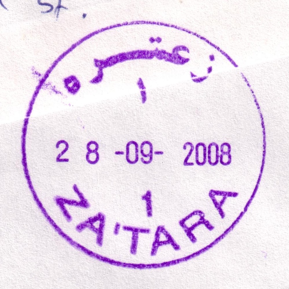
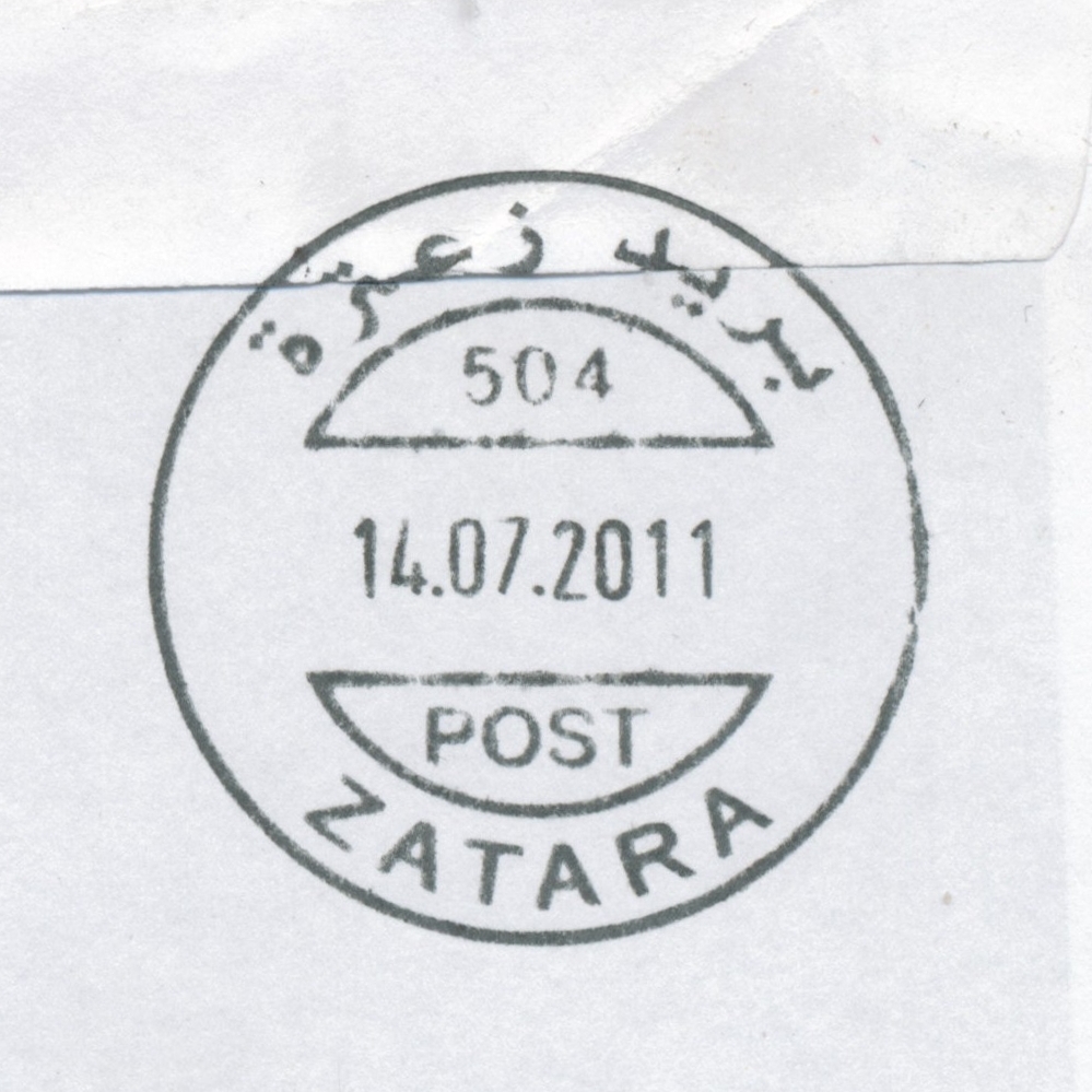
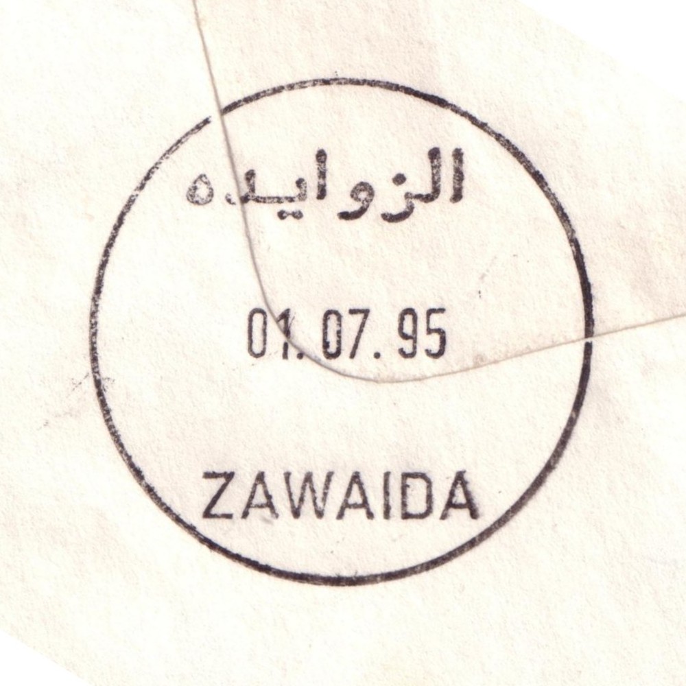
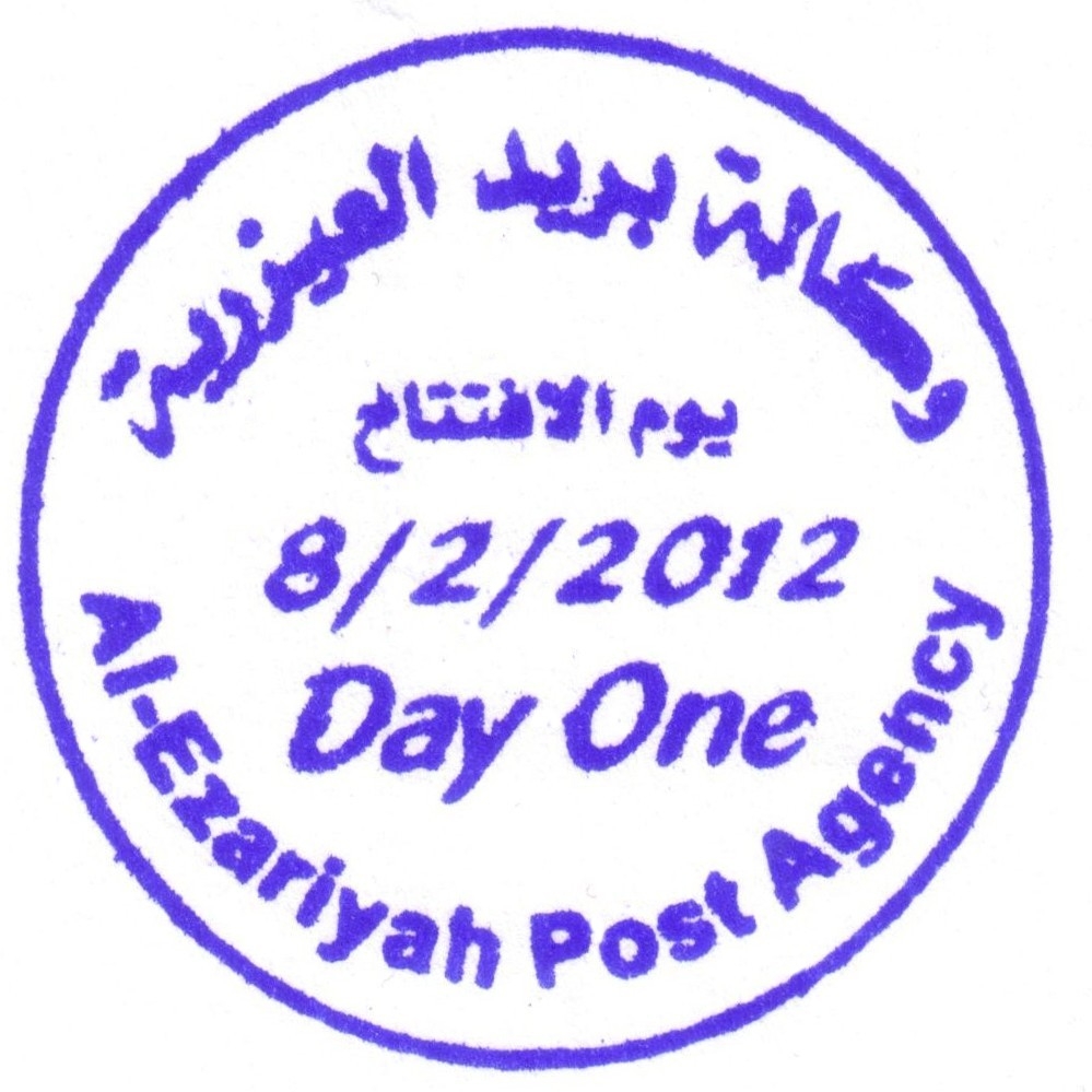
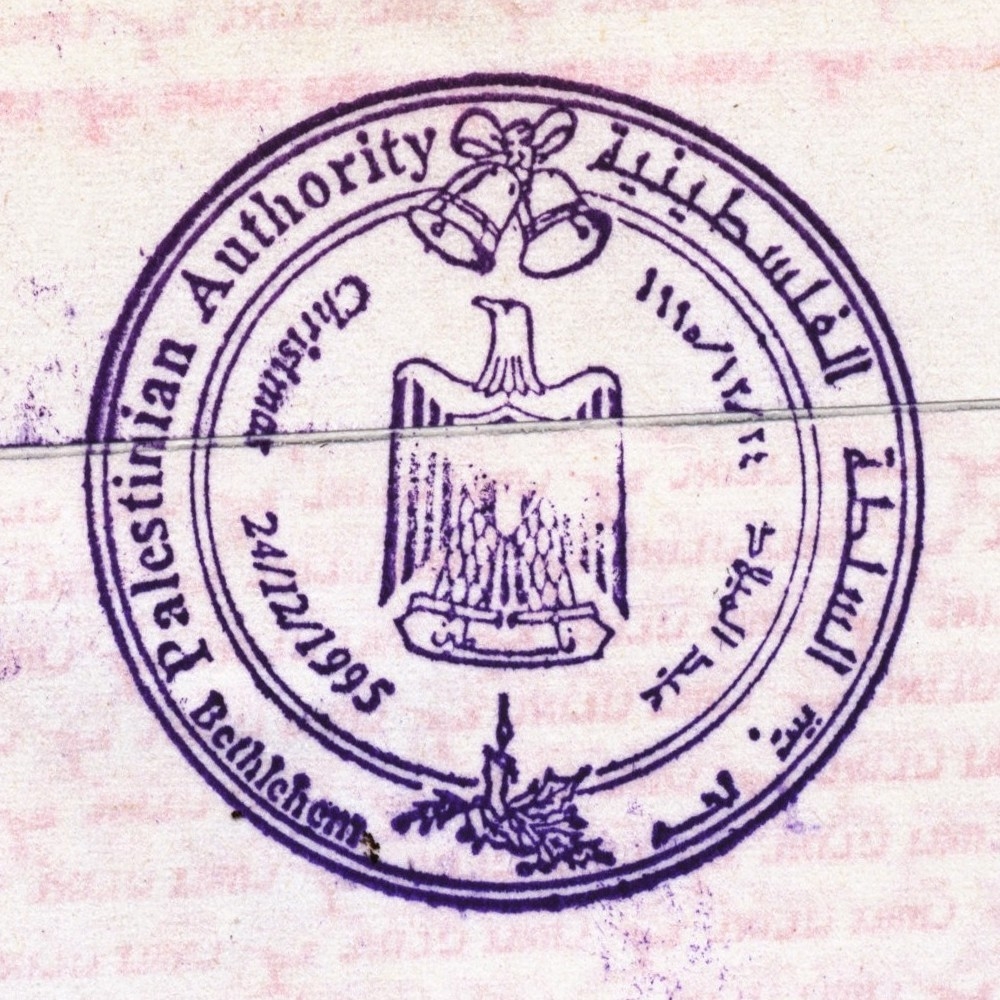
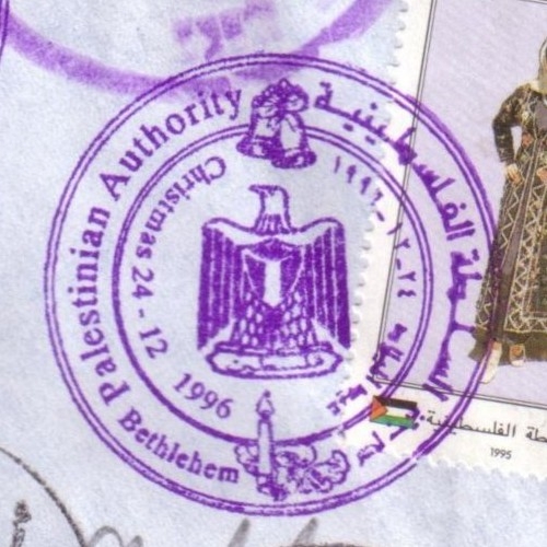
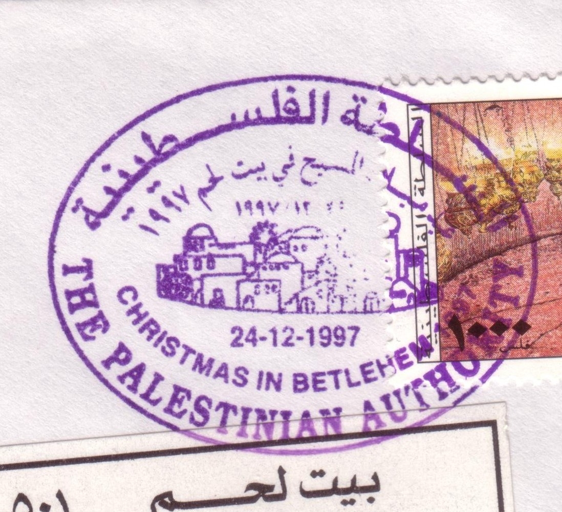
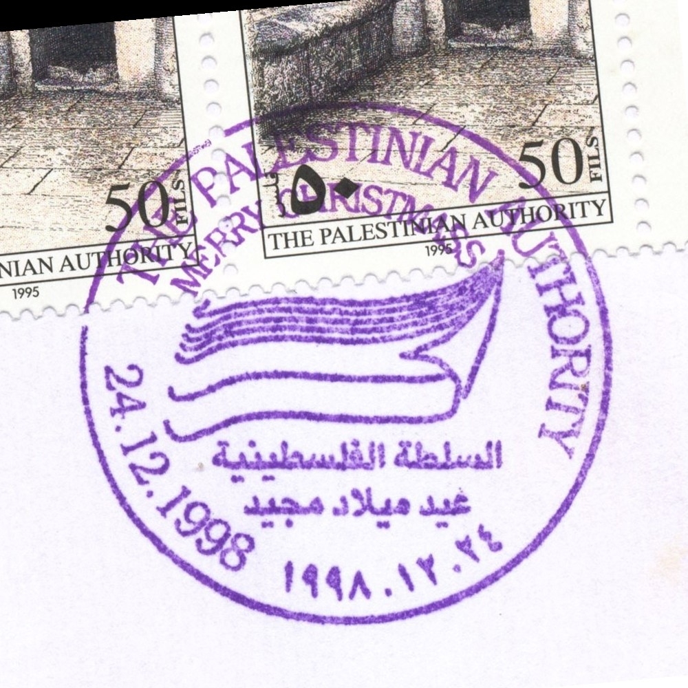
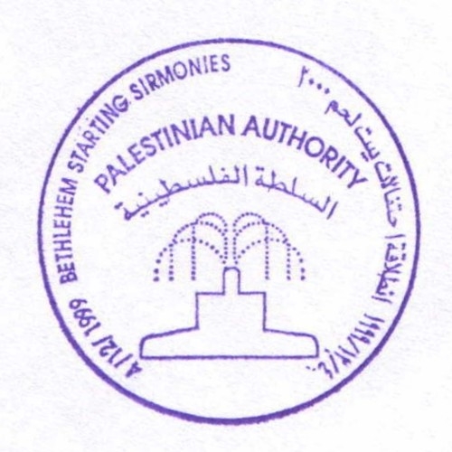
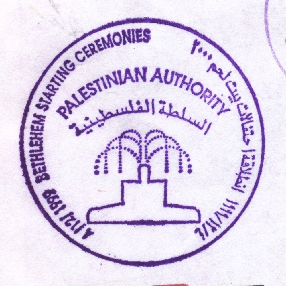
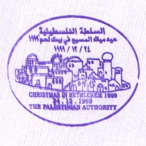
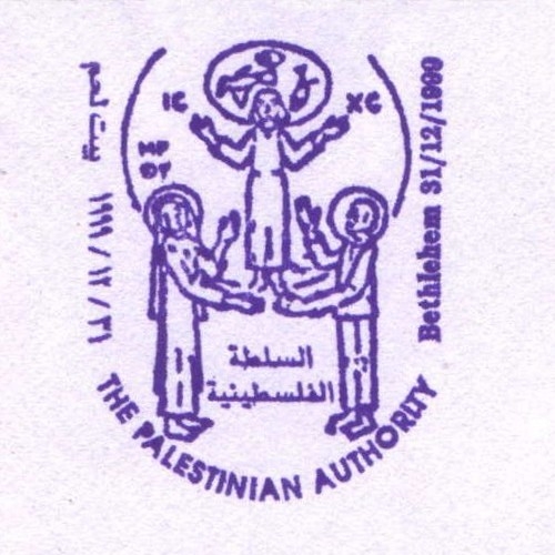
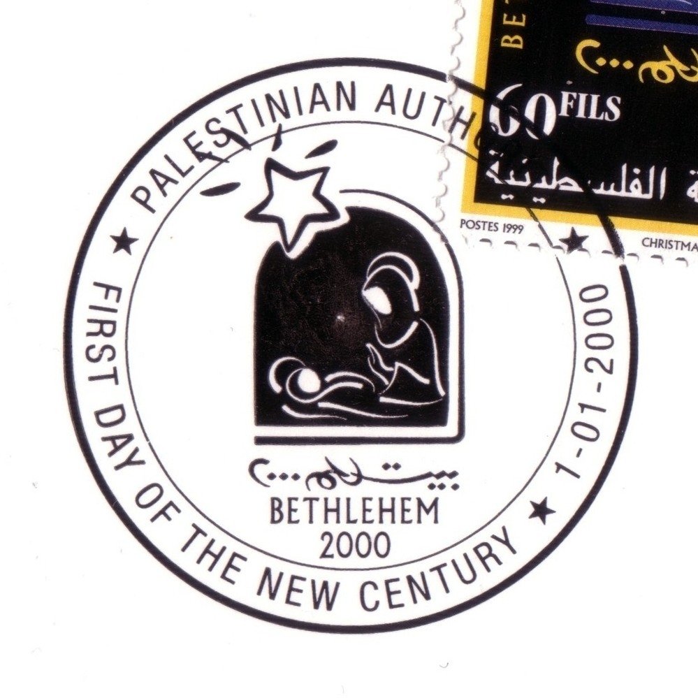
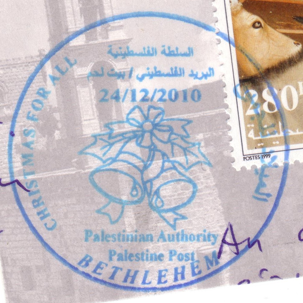
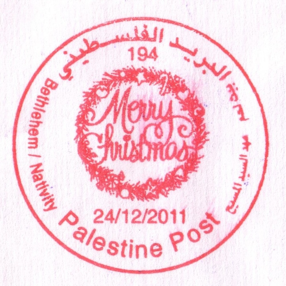
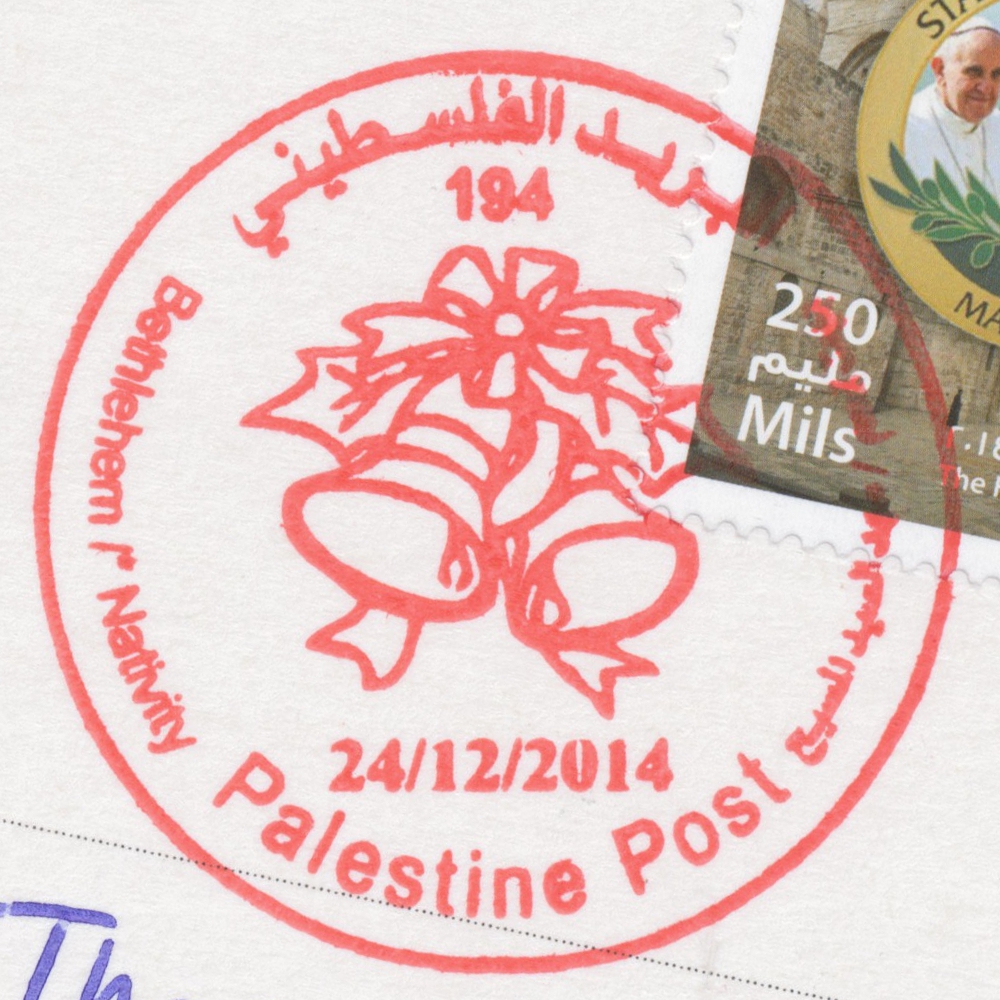
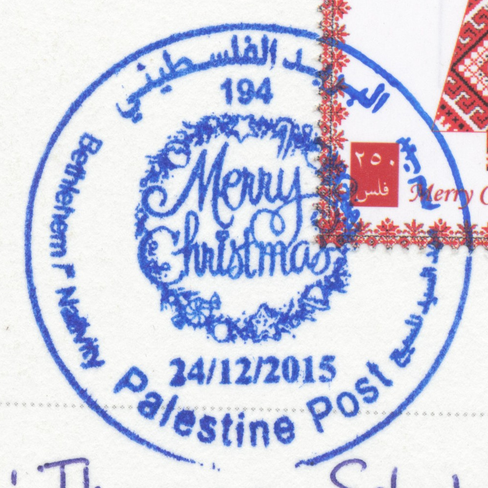
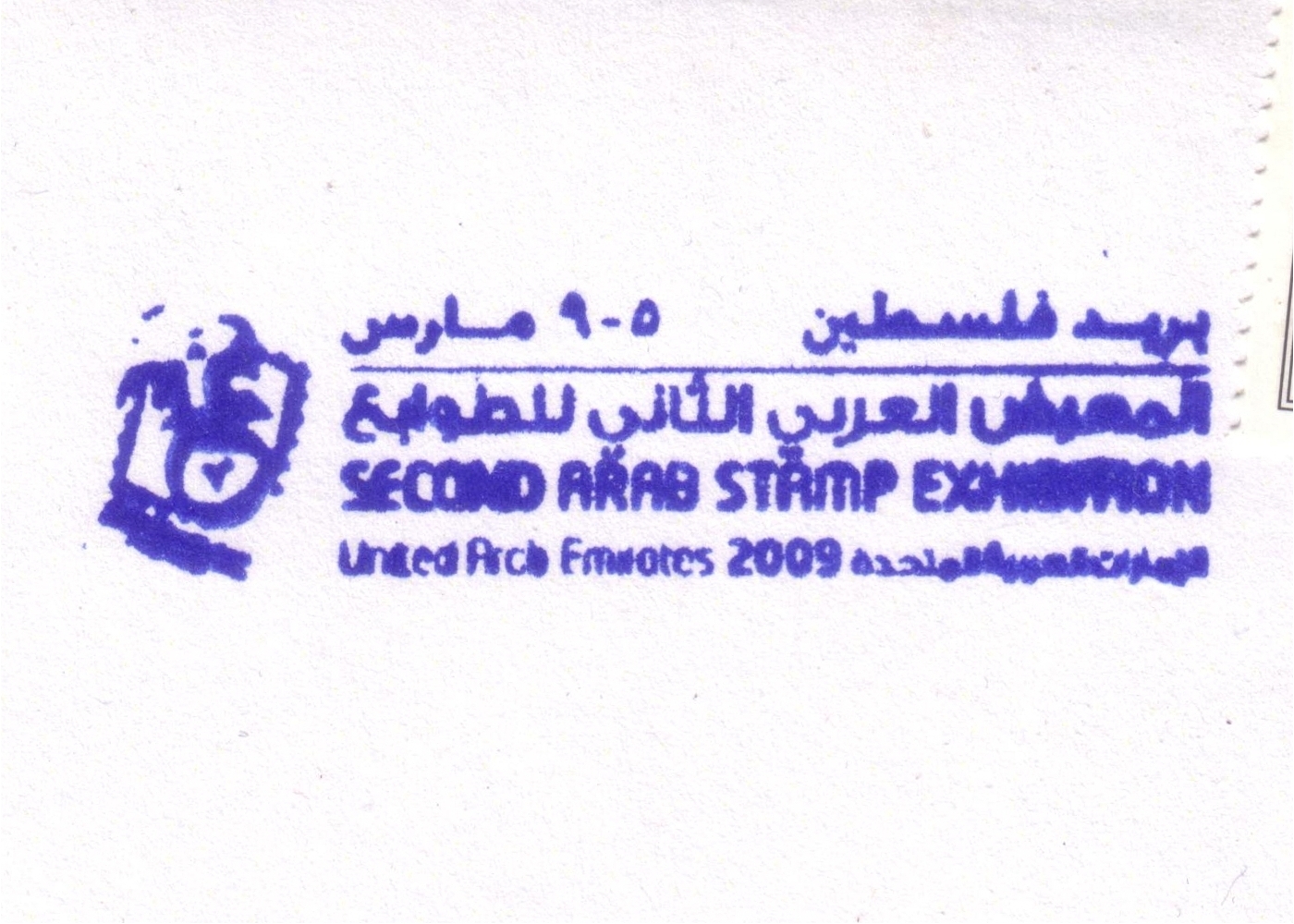
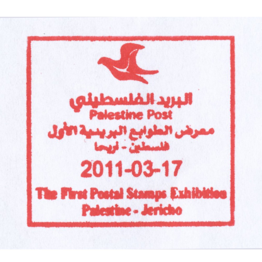
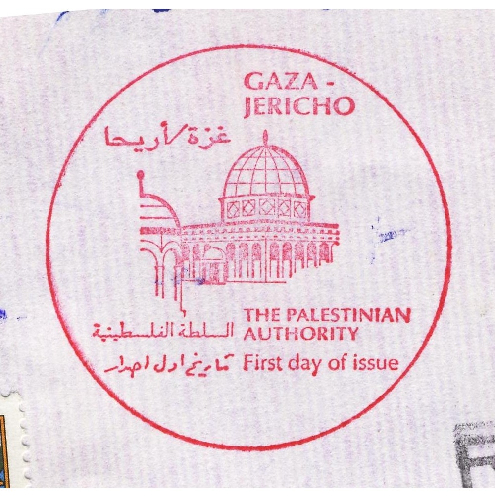
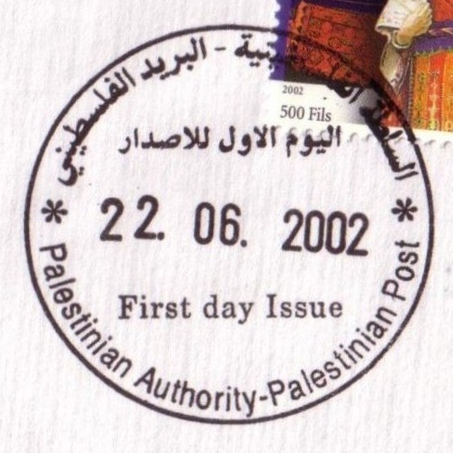
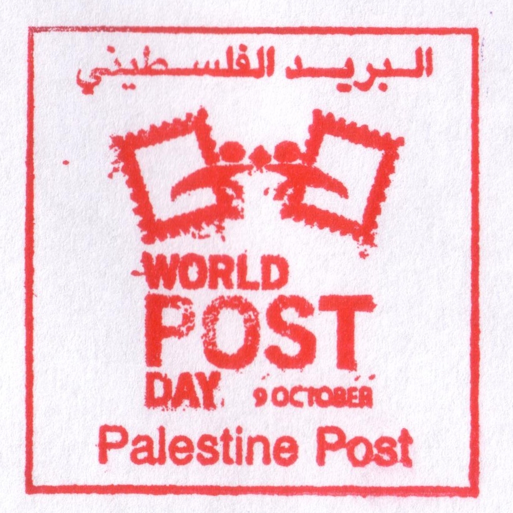
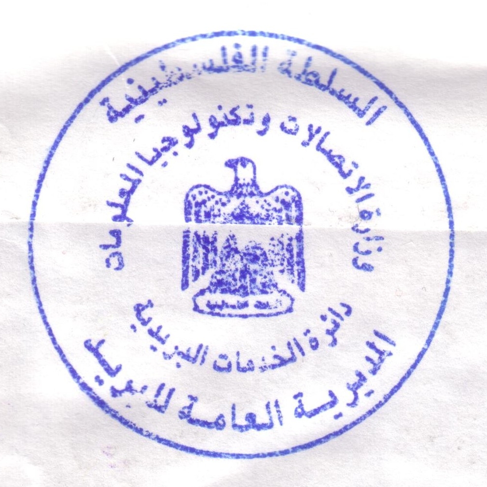
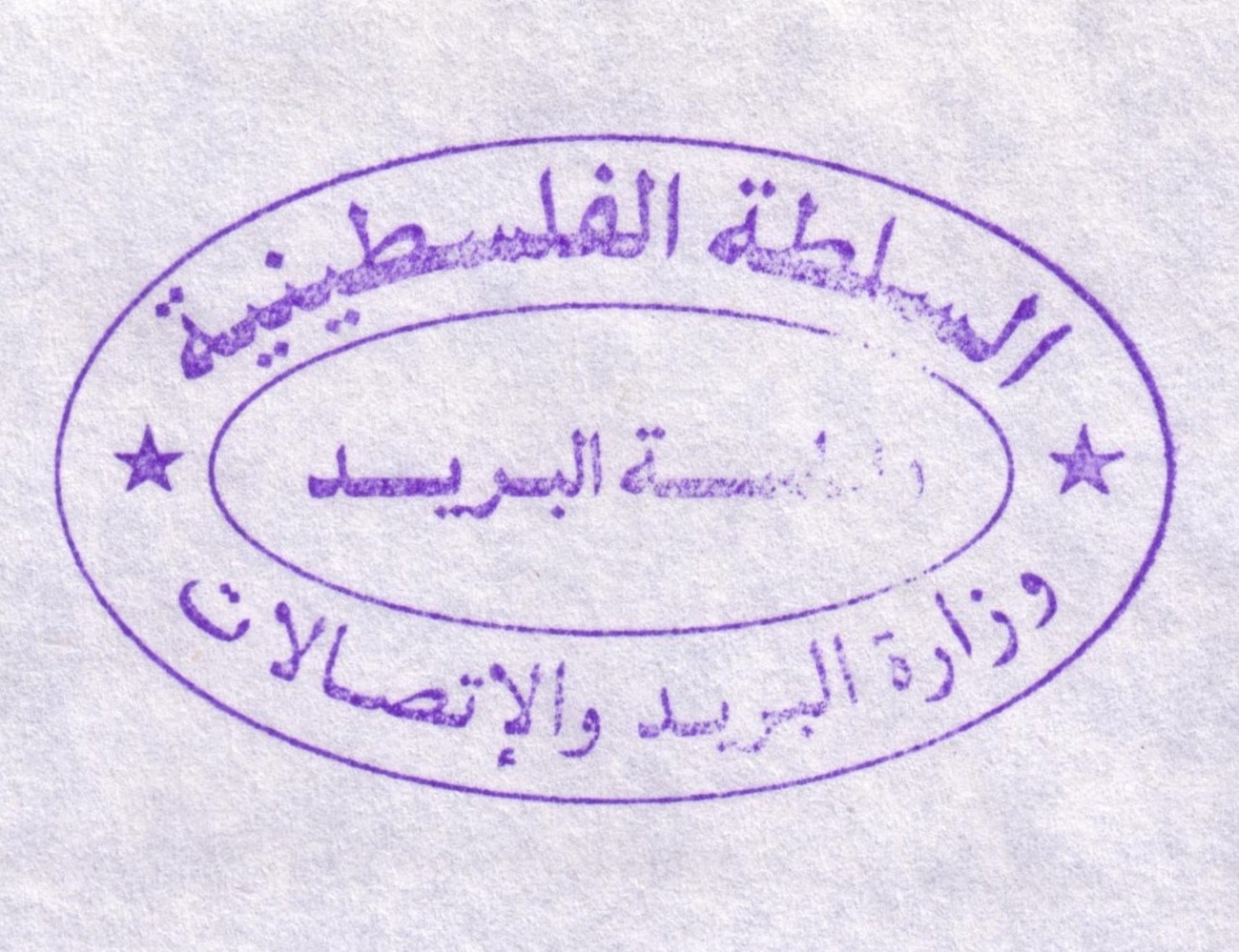
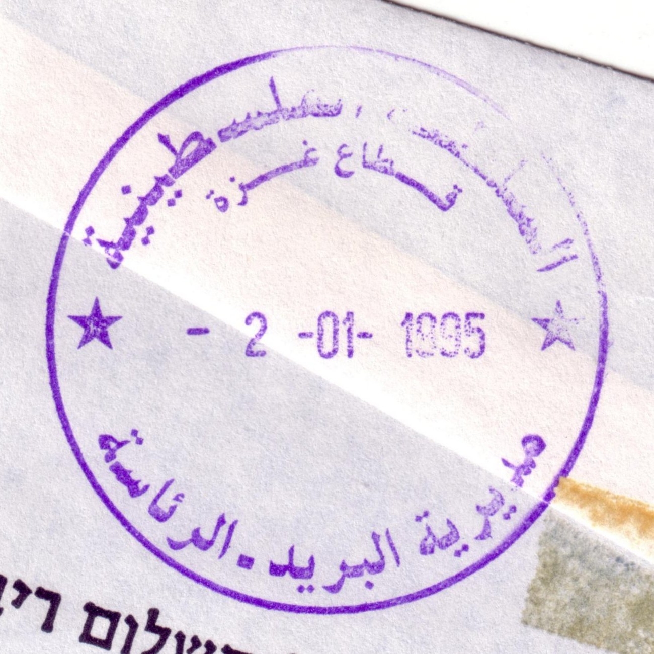
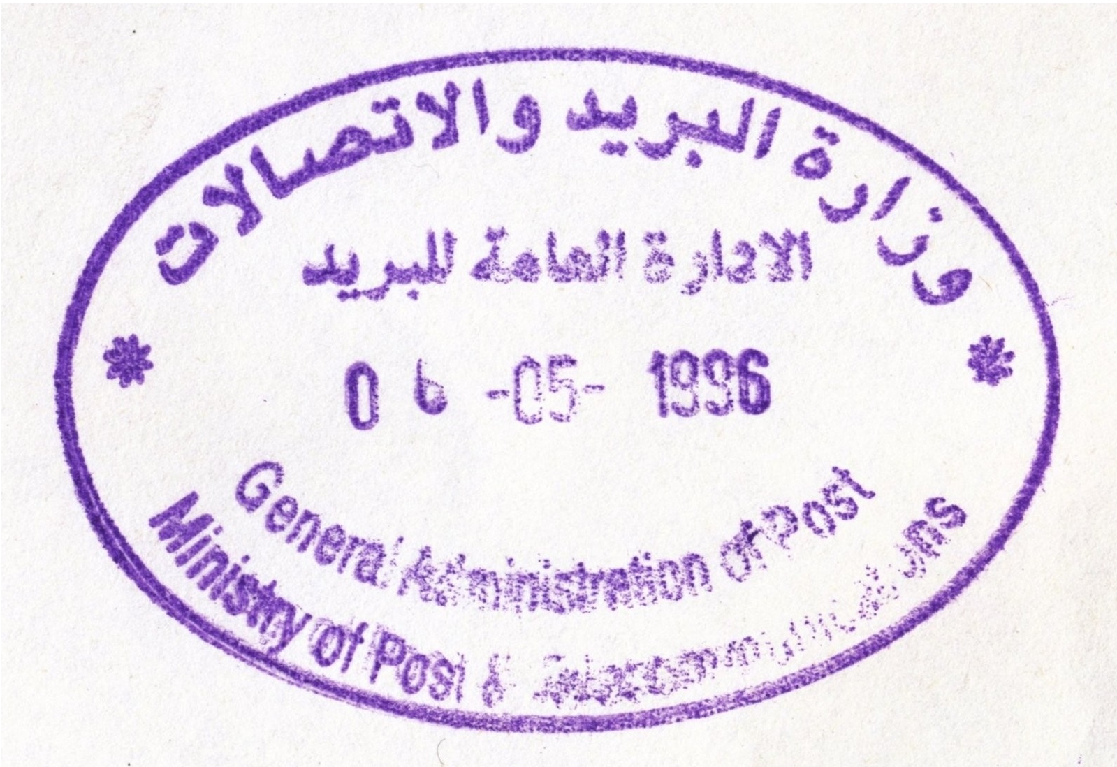
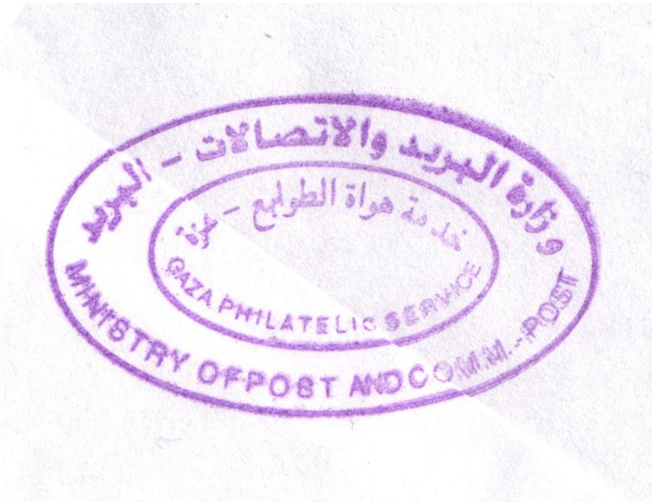
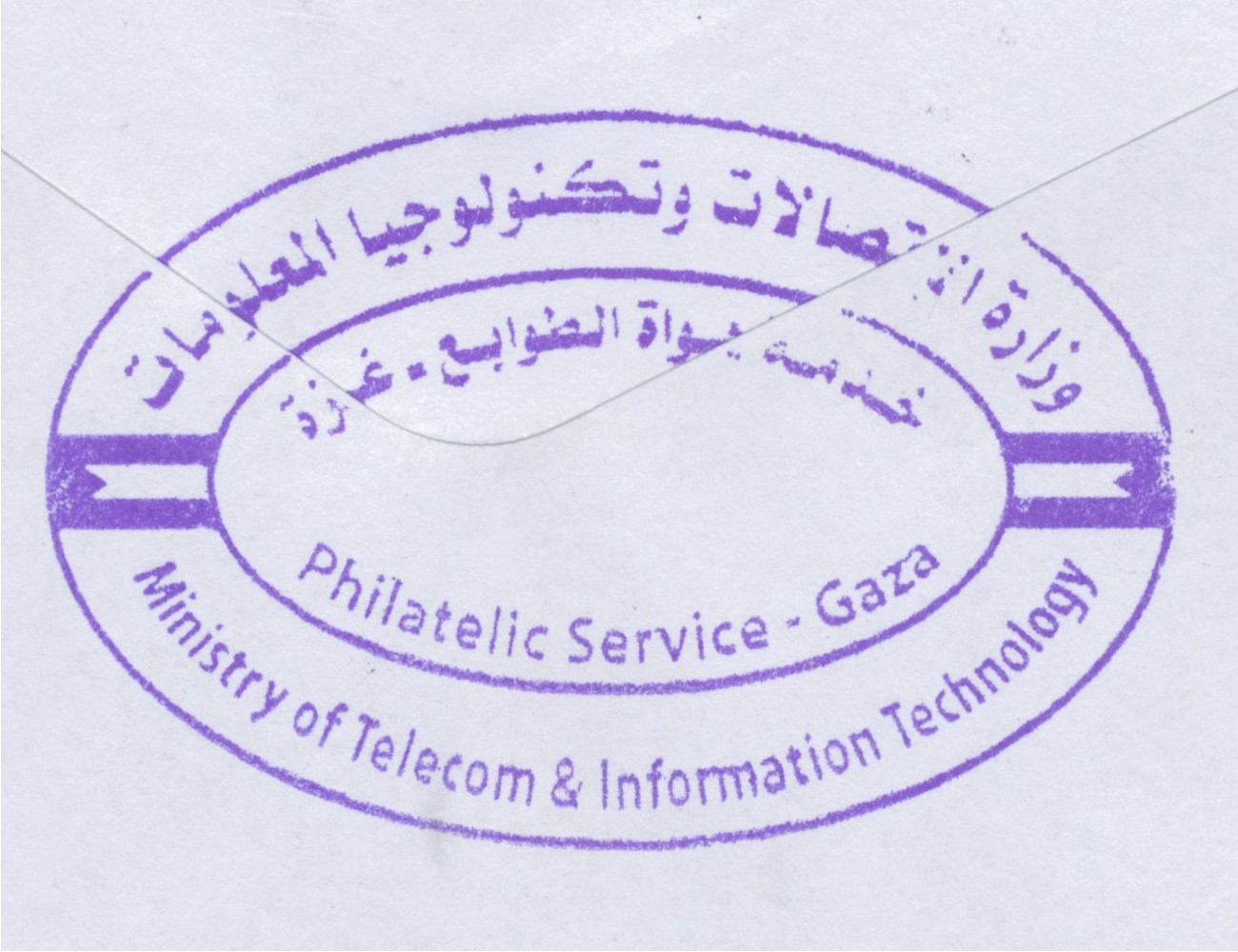
[Created 11.06.2005, last revised 20.07.2016]
[www.zobbel.de – Dipl.-Bibl.(FH) Tobias Zywietz – all rights reserved]
Imprint/Impressum – Datenschutzerklärung/Privacy Policy