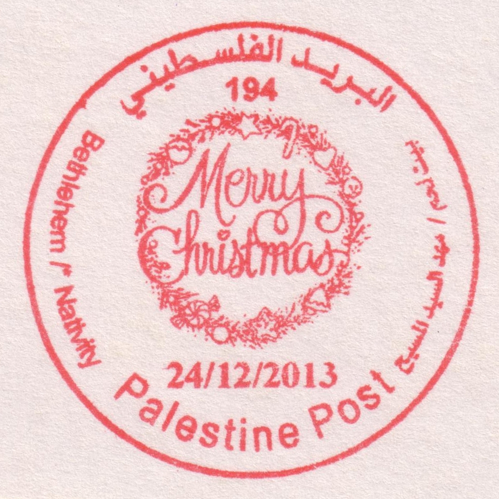
") ") | |||||||||||
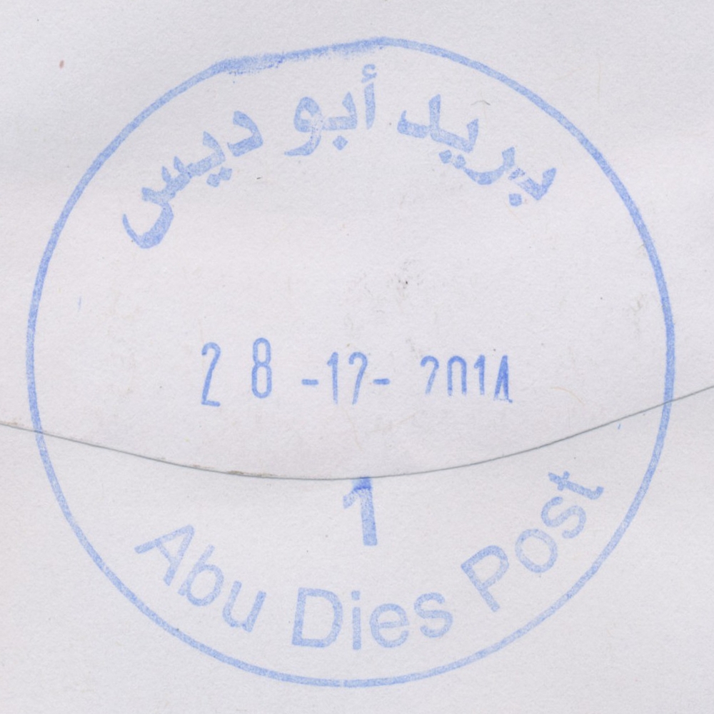
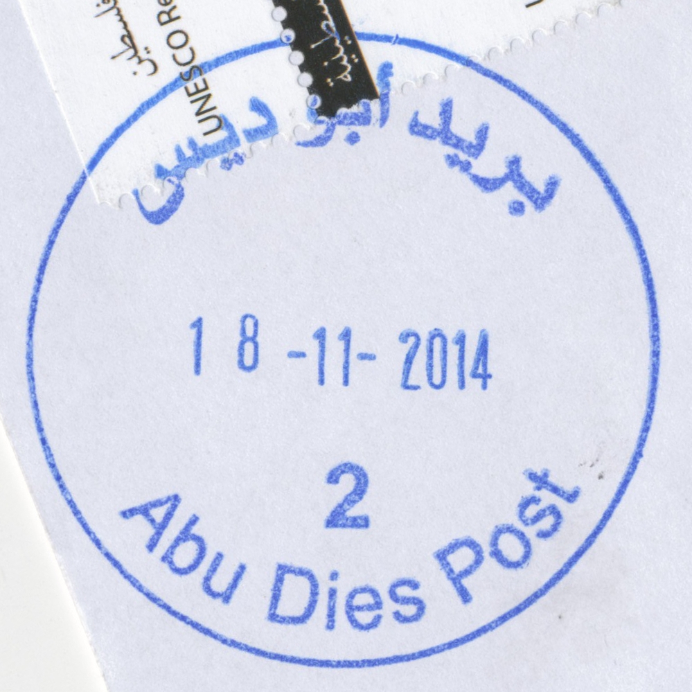
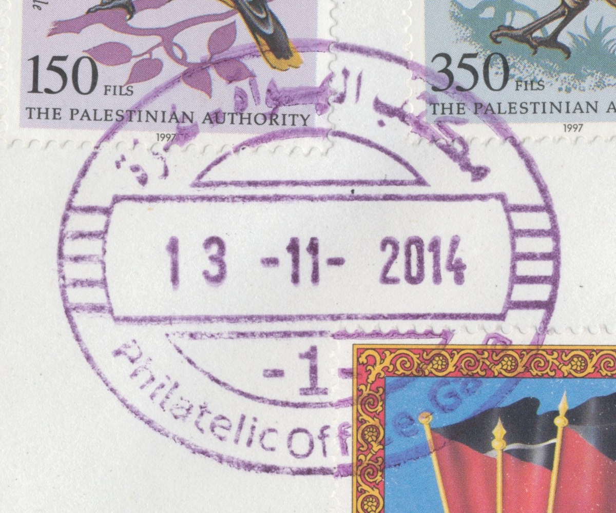
 Abu Dis © OpenStreetMap contributors, CC-BY-SA") | Abu Dis أبو ديس Abu Deis, Abu Dies | Pop.: 10,782 Govern.: Jer Opened: 13.11.2014 PO Number: 109 Postcode: 144 | |||||||||
| 31°45' N, 35°16' E OpenStreetMap Google Maps Wikipedia | City in Jerusalem governorate with 10,782 inhabitants (Census 2007) directly E of the Palestinian capital Jerusalem. It serves the al-Aizariya, as-Sawahira ash-Sharqiya and ash-Sheikh Sa'd areas with over 60,000 people. It replaces the PO al-Aizariya just to the N which closed on 26.08.2014. Duties were unofficialy performed from 27.08.2014 at Abu Dis. The official opening on 13.11.2014 was attended by minister Dr. Allam Moussa, the Prime Minister Rami Hamdallah, as well as postal and local officials. The post office is in the new adminsitrative centre (Interior Department). | ||||||||||
| |||||||||||
| |||||||||||
 abudiesP1_141228_0475")
 abudiesP2_141118_0476")
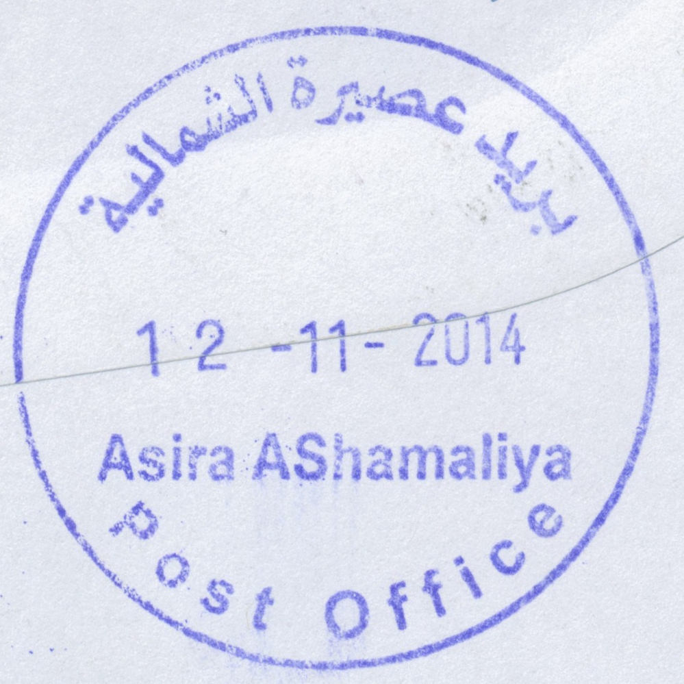
 Asira ash-Shamaliya © OpenStreetMap contributors, CC-BY-SA") | Asira ash-Shamaliya عصيرة الشمالية Asira Ashamaliya, 'Asira ash Shamaliya | Pop.: 7,556 Govern.: Nab Opened: 2005 PO Number: 308 PO Code: ASS Postcode: 430 | |||||||||
| 32°15' N, 35°16' E OpenStreetMap Google Maps Wikipedia | Small town just 6 km N of Nablus with 7,556 inhabitants (Census 2007, 1997: 5,794). Jordanian authorities operated a postal agency from 26.01.1963. | ||||||||||
| |||||||||||
 asiraashamaliyaPO_141112_0481")
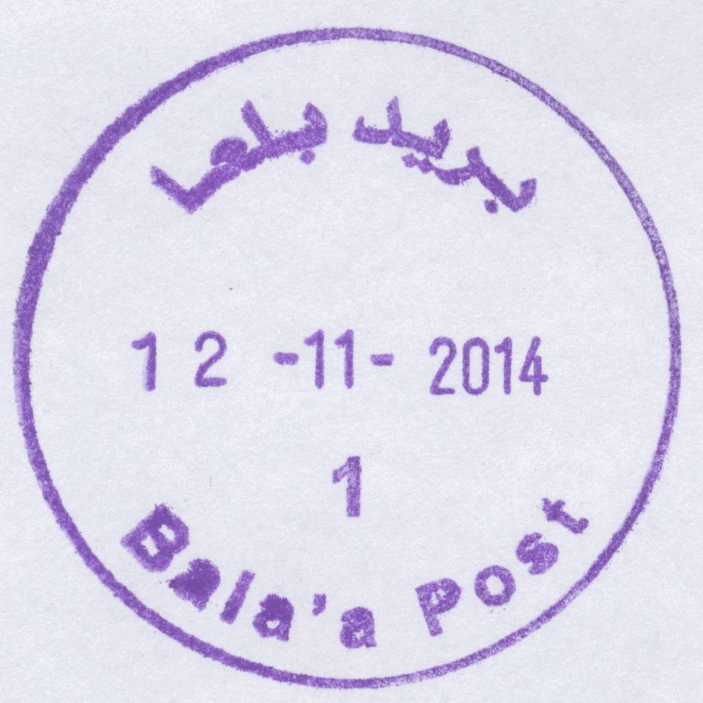
 Bala'a © OpenStreetMap contributors, CC-BY-SA") | Bala'a بلعا Balaa, Bal'a | Pop.: 6,604 Govern.: Tul Opened: 19.05.1998 PO Number: 810 Postcode: 322 | |||||||||
| 32°20' N, 35°07' E OpenStreetMap Google Maps Wikipedia | Agricultural town 8 km E of Tulkarm with Deir al Gusun to the NW and Anabta to the SE. Its population grew from 34,00 in 1967 and 5,453 in 1997 to 7,329 in the 2007 Census. Jordanian authorities operated a postal agency from 2.01.1963. The PNA office opened in 1998. | ||||||||||
| |||||||||||
 bala'aP1_141112_0480")
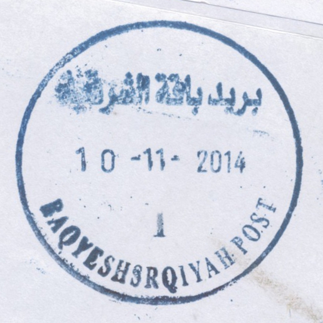
 Baqa esh Sharqiyah © OpenStreetMap contributors, CC-BY-SA") | Baqa esh Sharqiyah باقة الشرقية Baga Shargeia, Baqa Asharqya, Baqa ash Sharqiyam, Baqyehshrqiyah | Pop.: 4,101 Govern.: Tul Opened: 13.09.1997 PO Number: 807 Postcode: 316 | |||||||||
| 32°25' N, 35°04' E OpenStreetMap Google Maps Wikipedia | Municipality 16 km N of Tulkarm, its sister village Baqa al-Gharbiyeh (since 1949 under Israeli administration) lies about 3 km to the W. Population: 4,101 (Census 2007, 1997: 3,054). Adjacent offices are in Illar & Attil to the S and SE, and Qafen to the N. Jordanian authorities operated a postal agency from 11.11.1965. | ||||||||||
| |||||||||||
 baqaeshsharqiyahP1_141110_0479")
") ") | |||||||||||
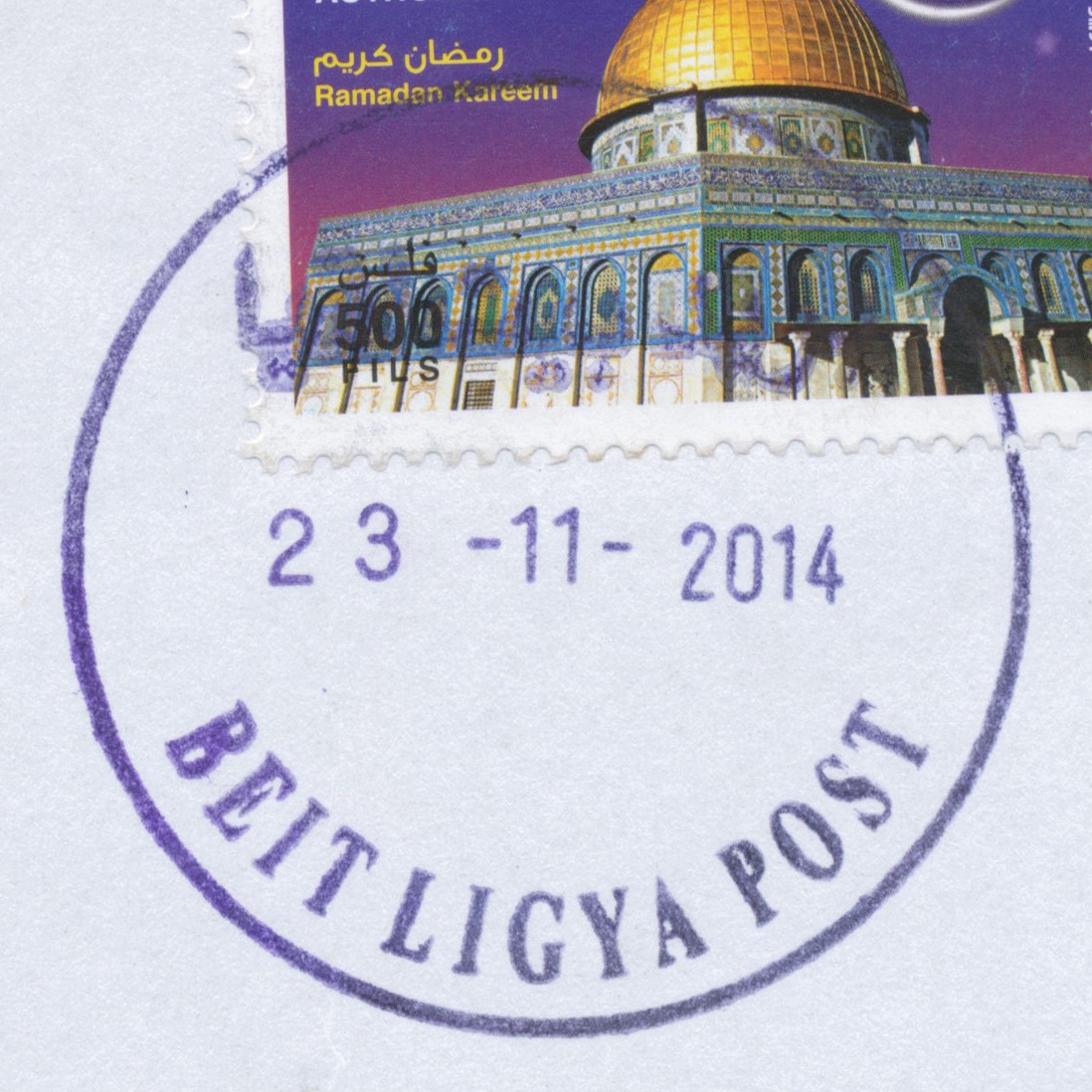
 Beit Liqya © OpenStreetMap contributors, CC-BY-SA") | Beit Liqya بيت لقيا Beit Liqya, Beit liqya, Beit Ligya | Pop.: 7,710 Govern.: Ram Opened: 2005 PO Number: 214 Postcode: 690 | |||||||||
| 32°52' N, 35°04' E OpenStreetMap Google Maps Wikipedia | Town about 14 km W of Ramallah. Its population rose from 5,706 in the 1997 Census to 7,710 in the 2007 Census. Nearest offices are Beitunya and Biddu to the E. The Post Office is oppsite the municipality and Abu al-Kukh Mosque. Jordanian authorities operated a postal agency between 9.10.1965 and 5.06.1967. | ||||||||||
| |||||||||||
 beitliqyaP_141123_0482")
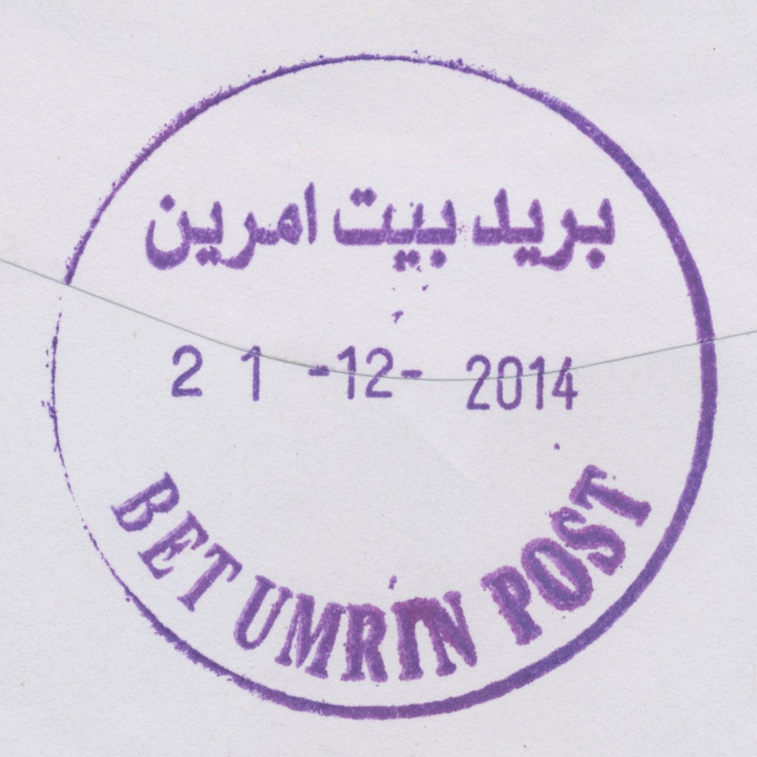
 Beit Umrin © OpenStreetMap contributors, CC-BY-SA") | Beit Umrin بيت إمرين Beit Amraen, Beit Imrin, Bet Umrin | Pop.: 2,821 Govern.: Nab Opened: 17.11.1997 PO Number: 306 Postcode: 442 | |||||||||
| 32°18' N, 35°13' E OpenStreetMap Google Maps Wikipedia | Village 18km NW of Nablus with a pupulation of 2,821 (2007 Census, 1997: 2,149). Geographically nearest PNA offices are Burqa to the W and Asira ash-Shamaliya to the SE. The office serves several villages incl. Sabastiya, Naqura, Ijnisina, and Yasid. The PNA post office is on the first floor of the village coucil buildung. Jordanian authorities operated a postal agency from 21.12.1965. | ||||||||||
| |||||||||||
 beitumrinP_141221_0489")
") ") | |||||||||||
 Biddu © OpenStreetMap contributors, CC-BY-SA") | Biddu بدّو Biddu | Pop.: 6,798 Govern.: Jer Opened: 22.06.2005 PO Number: 105 Postcode: 110 | |||||||||
| 31°50' N, 35°09' E OpenStreetMap Google Maps Wikipedia | Municipality in the J1 area of Jerusalem Governorate, W of Ber Nabala. Population figures: 1,444 (1961), 4,704 (1997), 6,798 (Census 2007). The office serves also Beit Duqqu, Beit 'Inan, Beit Surik, Qatanna, al-Qubeibah, Beit Ijaz, and al-Tira. Geographically nearest other PNA offices are Beitunya, Beit Liqya, and Ber Nabala. Jordanian authorities operated a postal agency between 27.06.1963 and (?)##. | ||||||||||
| |||||||||||
 BidduP_141221_0488")
| |||||||||||
") ") | |||||||||||
") | |||||||||||
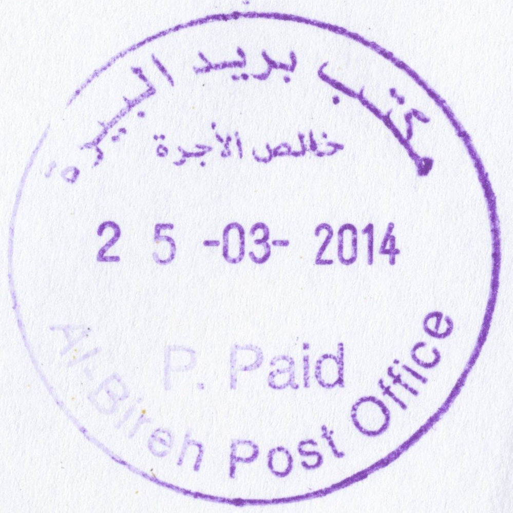
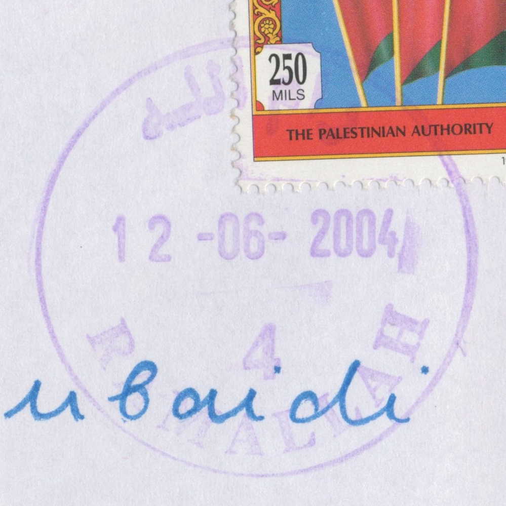
 Al Bireh © OpenStreetMap contributors, CC-BY-SA") | Al Bireh البيرة Al Biera, Al Bira, El Bira | Pop.: 38,202 Govern.: Ram Opened: 6.07.1952 PO Number: 202 Postcode: 610 | |||||||||
| 31°54' N, 35°13' E OpenStreetMap Google Maps Wikipedia | The largest city and capital of Ramallah & al-Bireh Governorate, just E of Ramallah itself, forming one contiguous conurbation. Population in Census 2007 was 38,202 (1997: 27,856, 1982: 13,037, 1945: ca. 3,000). The post office is in the "Palestine Post Building" (Directorate General of MTIT) on al-Muntazah street. An Ottoman office was first opened in 1910 . Jordanian authorities operated a post office (upgraded from a postal agency on 16.02.1956) between 6.07.1952 and 5.06.1967. A post office under control of the Israeli military occupation forces existed from 27.08.1967. | ||||||||||
| |||||||||||
 2009")
 2009")
 birehPO_PP_140325_0484")
") ") | |||||||||||
") ") | |||||||||||
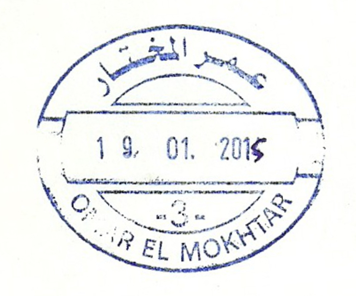
 Gaza, Omer El Mokhtar © OpenStreetMap contributors, CC-BY-SA") | Gaza, Omer El Mokhtar غزة - عمرالمختار Gaza, Omer El Mokhtar | Pop.: 409680 Govern.: Gaz Opened: 17.10.1996 PO Number: 909 Postcode: 850 | |||||||||
| 31°33' N, 34°27' E OpenStreetMap Google Maps Wikipedia | Governorate capital with a population of 409,680 (2006 mid-yearestimate). The first post office was opened in 1865 by the Ottoman authorities. A post office (New Gaza 5) under control of the Israeli military occupation forces existed from 9.04.1968. The city's main post office is in the MTIT building on Omar al-Mukhtar Street between Abu Khadra mosque and the municipal park. From 4.11.2012, the office moved temporaily to the Government Computer Complex building Abu Khadra. The PO was re-opened on 12.02.2013 with an official ceremony on 26.02.2013 (5.03.2013?). | ||||||||||
| |||||||||||
| |||||||||||
 gazaPhilOff1_141113_0483")
 gazaOmar3_150119_0491")
") | |||||||||||
") ") | |||||||||||
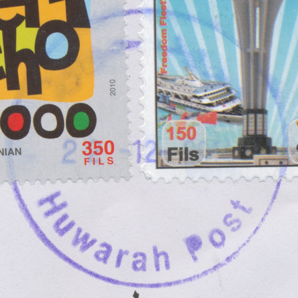
 Huwarah © OpenStreetMap contributors, CC-BY-SA") | Huwarah حوارة Hewwara, Huwwara | Pop.: 5,570 Govern.: Nab Opened: 15.11.1955 PO Number: 302 Postcode: 468 | |||||||||
| 32°09' N, 35°15' E OpenStreetMap Google Maps Wikipedia | Municipality 6 km south of Nablus with 5,570 residens (2007 Census, 1997: 4,327). The PNA post office is on main street between Arab Bank and Sheikh-Hussein-Centre. Nearest other offices (all to the S) are Kufel Haris, Salfit, and Qabalan. Jordanian authorities operated a post office (upgraded from postal agency on 1.10.1965) from 15.12.1955 A post office under control of the Israeli military occupation forces existed from 6.11.1967. | ||||||||||
| |||||||||||
 huwarahP_141222_0490")
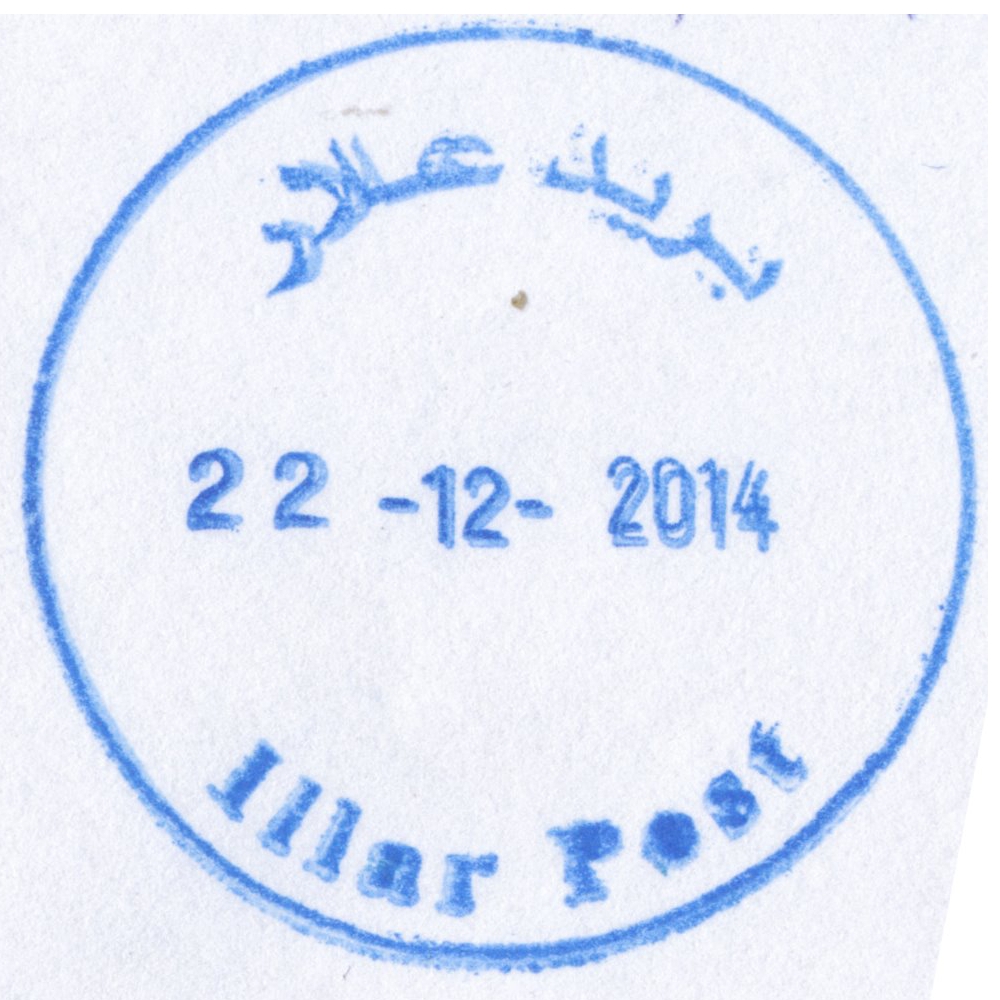
 Illar © OpenStreetMap contributors, CC-BY-SA") | Illar علار 'Illar | Pop.: 6,190 Govern.: Tul Opened: 2005 PO Number: 815 Postcode: 313 | |||||||||
| 32°22' N, 35°06' E OpenStreetMap Google Maps Wikipedia | Municipality about 10 km NE of the muhfaza Tulkarm with 6,190 residents in the 2007 Census (1997: 5,133). The PO is opposite town hall on the road to Zeita. Surrounding offices are Attil, Deir al Gusun, Baqa esh Sharqiyah, Kafr Rai, and Bala'a. Jordanian authorities operated a postal agency from 10.03.1966. | ||||||||||
| |||||||||||
 illarP_141222_0487")
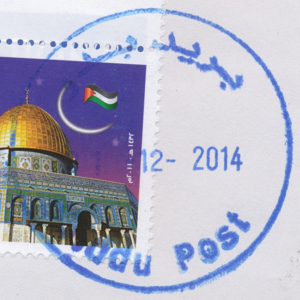
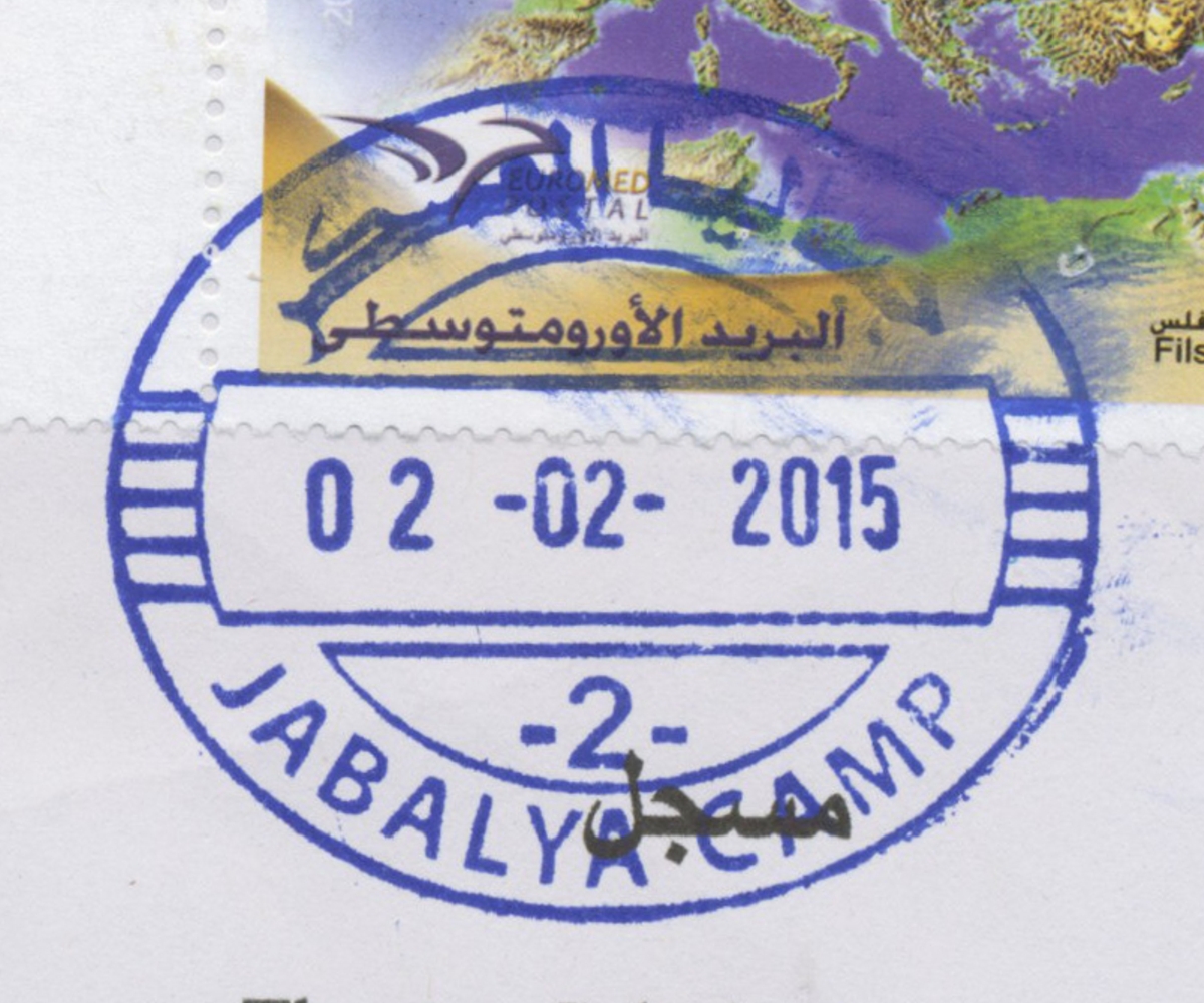
 Jabalya, Jabalya Camp © OpenStreetMap contributors, CC-BY-SA") | Jabalya, Jabalya Camp جباليا المعسكر Jabalia Camp, Jabalya Camp | Pop.: 93,455 Govern.: Gzn Opened: 21.02.1999 Postcode: 819 | |||||||||
| 31°32' N, 34°30' E OpenStreetMap Google Maps Wikipedia | Refugee camp, established in 1948, just N of Jabalia city in North Gaza Governorate. Residents in the 2006 mid-year estimate: 93,455, UNWRA estimates about 108,000 refugees in and around the actual camp. ## Egyptian office? 1962 | ||||||||||
| |||||||||||
 jabalyacamp2_150202_0493")
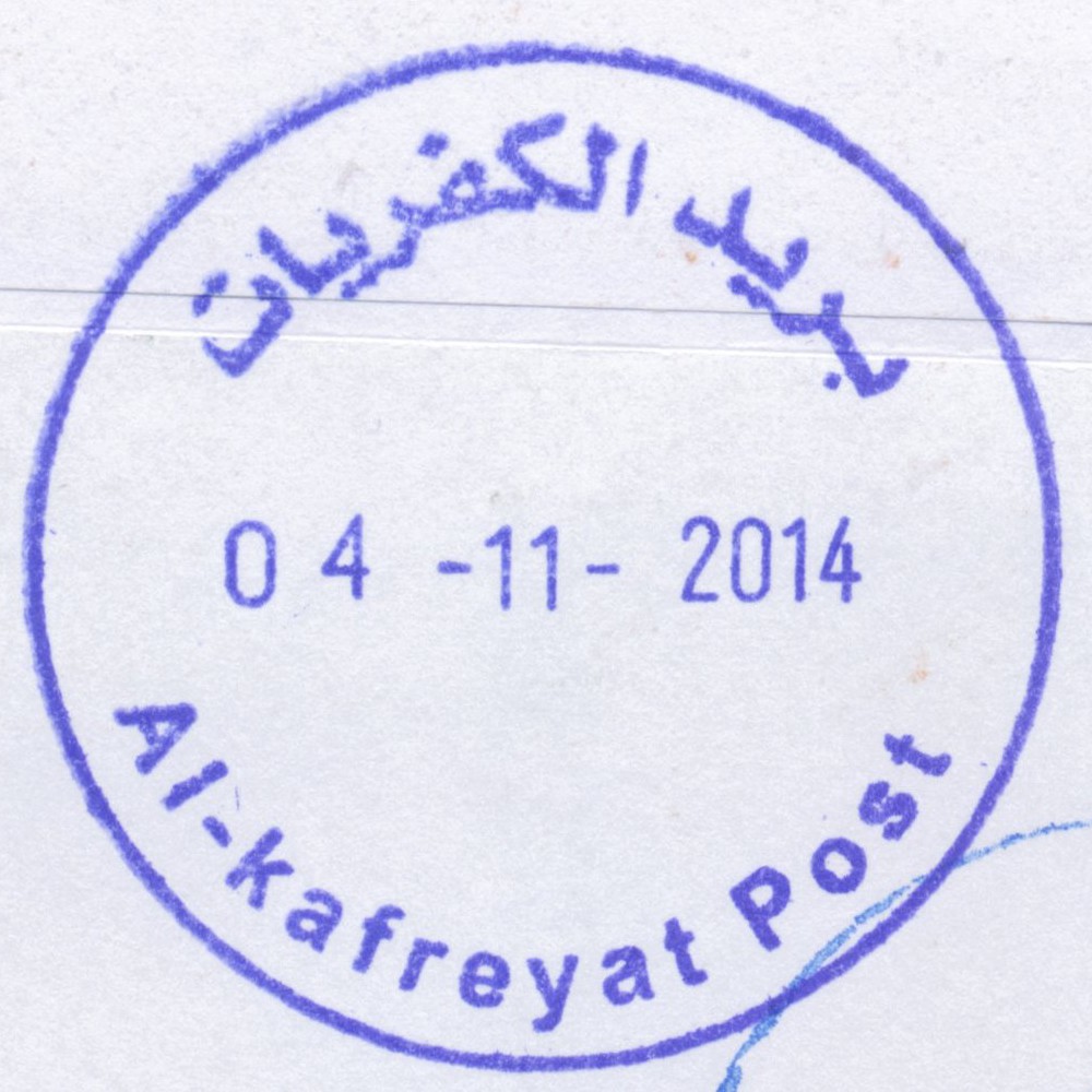
 Al Kafreyat © OpenStreetMap contributors, CC-BY-SA") | Al Kafreyat الكفريات Alkafreyat, Al-Kafreyat (Kafr Sur, Kafr 'Abbush, Kafr Zibad, Kafr Jammal, Kur, Ar Ras, Khirbet Jubara) | Pop.: 7,171 Govern.: Tul Opened: 9.03.2005 PO Number: 817 Postcode: 269 | |||||||||
| 32°14 N, 35°03 E OpenStreetMap Google Maps Wikipedia | Newly created municipality about 10 km S of the muhfaza Tulkarm consising of the villages Kafr Sur, Kafr 'Abbush, Kafr Zibad, Kafr Jammal, Kur, Ar Ras, and Khirbet Jubara. Its population rose between the 1997 and 2007 censuses from 5,793 to 7,171. The post office is on al-Amayere street halfway between Kafr Zibad and Kafr Sur. The surrounding offices are: Beit Lid, Kafr Kaddum, Hajja, and Azzun. Current postmaster (2011): Hussein Shaker. | ||||||||||
| |||||||||||
 alkafreyatP_141104_0478")
 Kafr Rai © OpenStreetMap contributors, CC-BY-SA") | Kafr Rai كفر راعي Kfer Raei, Kafr Ra'i | Pop.: 7,364 Govern.: Jen Opened: 6.03.2003 PO Number: 712 Postcode: 270 | |||||||||
| 32°23' N, 35°09' E OpenStreetMap Google Maps Wikipedia | Municipality, ca. 18 km SW of the muhfaza Jenin. The number of residents rose from 2,863m in 1961 to 5,824 in the 1997 Census, and to 7,364 in 2007. Geographically Kafr Rai is closely surrounded by offices in Baqa esh Sharqiyah, Arraba, Ajjab, Seilet el Thaher, Anabta, Bala'a, Deir al Gusun, and Attil. The current Post Office is on Main Street, between the Salhen shop and the Aalam pharmacy. Jordanian authorities operated a postal agency from 13.08.1963. | ||||||||||
| |||||||||||
 kafrrai_141223_0485")
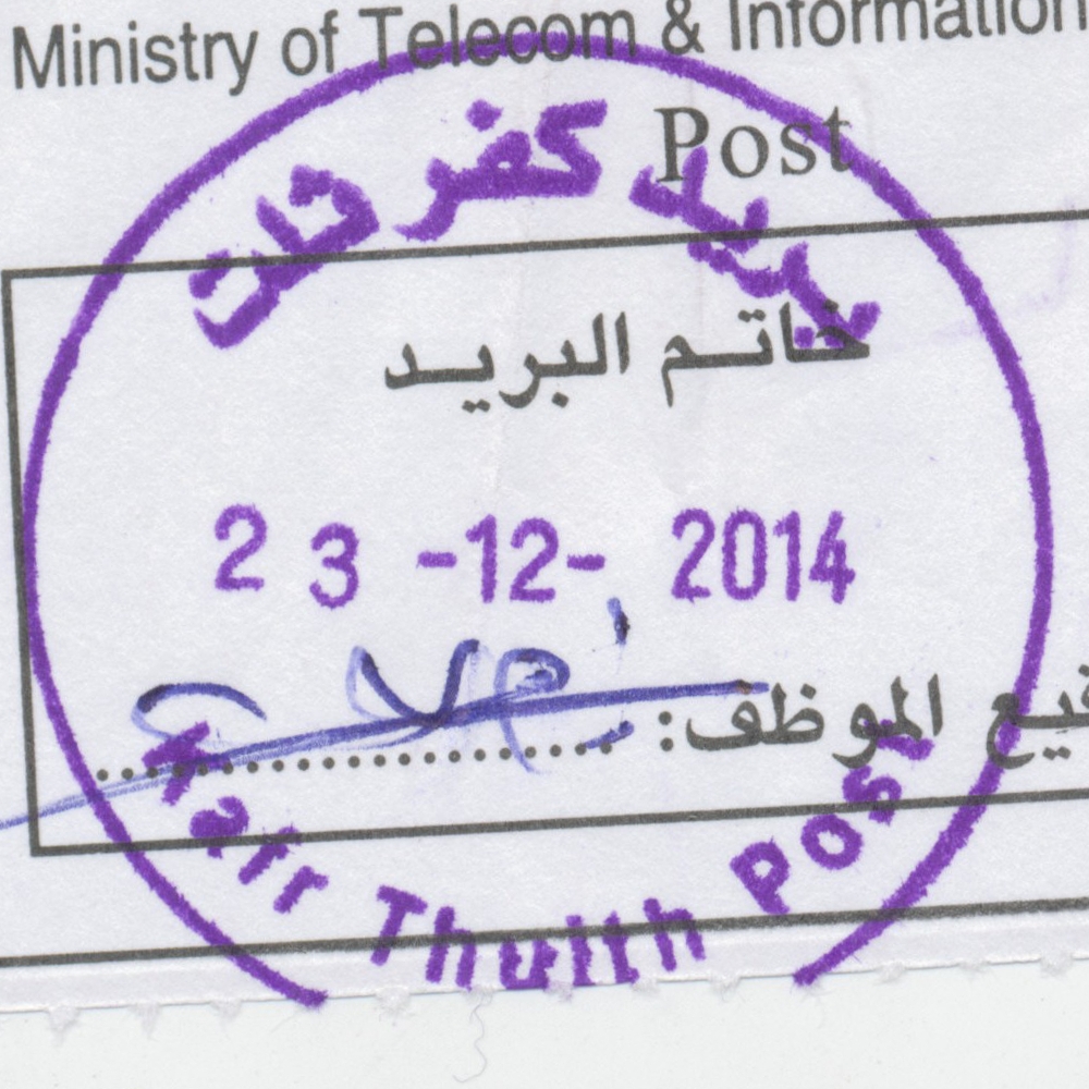
 Kafr Thulth © OpenStreetMap contributors, CC-BY-SA") | Kafr Thulth كفر ثلث Kafr Thulth | Pop.: 3,921 Govern.: Qal Opened: 2005 PO Number: 818 Postcode: 366 | |||||||||
| 32°03' N, 35°02' E OpenStreetMap Google Maps Wikipedia | Town about 8 km SE of Qalqilya. Population in Census 2007 was 3,921 (1997: 3,100). The office is on main street towards Bidya near Heteen Girls School. Nearest other offices are Azun to the N, Bidya to the S, and Habla to the W. Jordanian authorities operated a postal agency from 2.02.1966. | ||||||||||
| |||||||||||
 kafrthulthP_141223_0486")
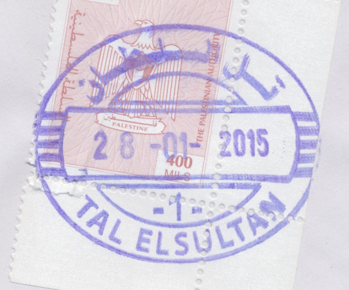
 Rafah, Tal El Soltan © OpenStreetMap contributors, CC-BY-SA") | Rafah, Tal El Soltan رفح - تل السلطان Tal El Soltan, Tal El Sultan, Canada Camp, Tall as Sultan Camp, Tel Al-Sultan Camp | Pop.: 24,418 Govern.: Raf Opened: 1.11.1995 Postcode: 970 | |||||||||
| 31°18' N, 34°15' E OpenStreetMap Google Maps Wikipedia | Refugee camp about 4 km NW of Rafah city centre and just N of Rafah camp. Population: 24,418 (2006 estimate; 1997 Census: 17,141). The post office is situated on al-Quds street opposite the al-Sultan medical centre near Talal bin-Rabah mosque. ## Egyp? -- | ||||||||||
| |||||||||||
 rafah2_150128_0492")
| |||||||||||
") ") | |||||||||||
 Ramallah © OpenStreetMap contributors, CC-BY-SA") | Ramallah رام الله Ramallah | Pop.: 27,460 Govern.: Ram Opened: 1905 PO Number: 201 Postcode: 600 | |||||||||
| 31°54' N, 35°12' E OpenStreetMap Google Maps Wikipedia | Seat of the PNA administration and most ministries. Ramallah forms an almost contiguous conurbation with al-Bireh (the Governorate muhfaza), Beitunia and further surrounding villages. The main POs is on al-Barid Street on the corner of Muntaza Street (Park St). Jordanian authorities operated a post office (district main PO) between 20.11.1948(exact date?) and 5.06.1967. A post office under control of the Israeli military occupation forces existed from 11.07.1967. | ||||||||||
| |||||||||||
")
 April 2010")
 ramall4_040612_0477")
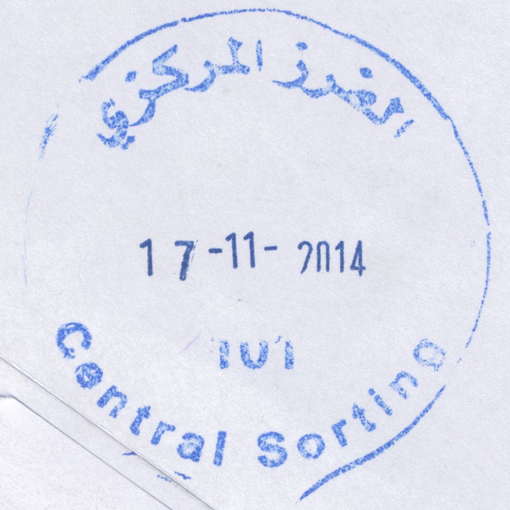
 Ramallah, Central Sorting © OpenStreetMap contributors, CC-BY-SA") | Ramallah, Central Sorting الفرز المركزي Ramallah, Central Sorting | Pop.: n/a Govern.: Ram Opened: 1997 PO Number: 101 Postcode: 600 | |||||||||
| 31°54' N, 35°13' E OpenStreetMap Google Maps Wikipedia | Central sorting facilty in the Directorate General, al-Muntazah street, in al-Bireh. | ||||||||||
| |||||||||||
 censort101_141117_0494")