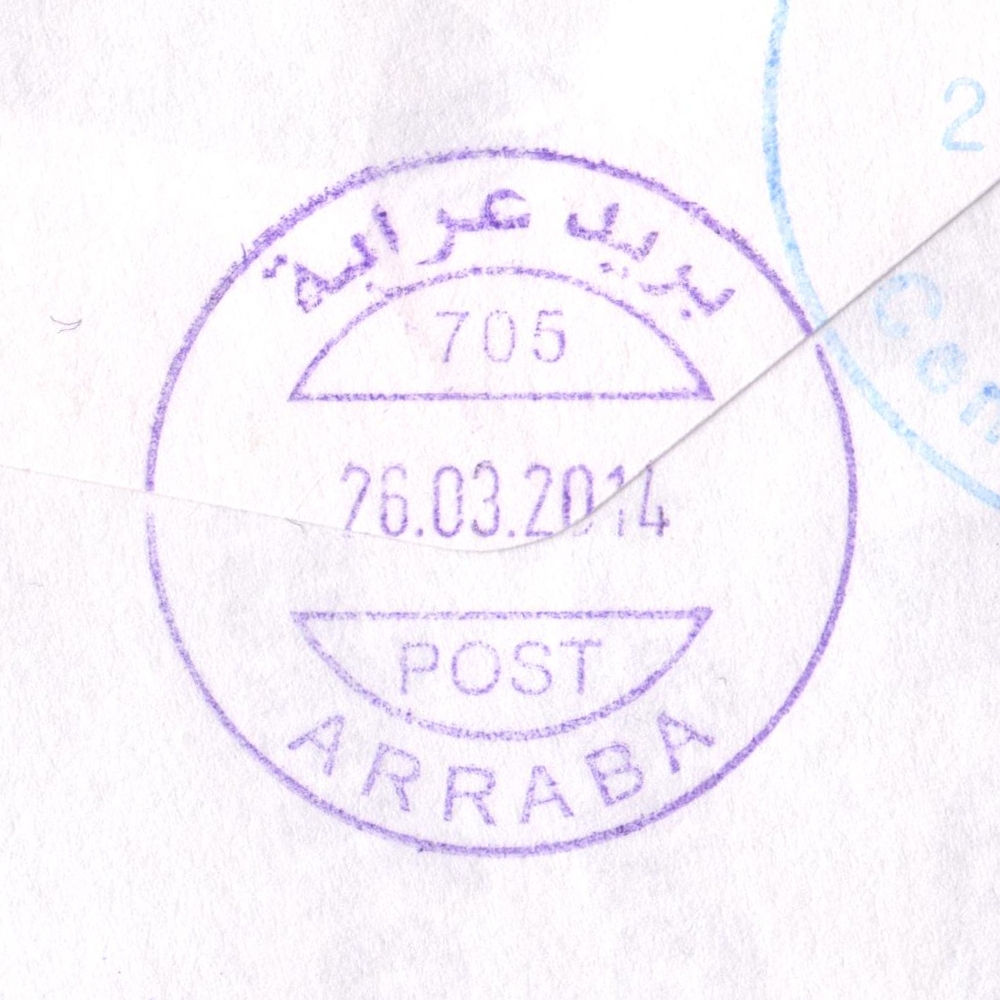
 Arraba © OpenStreetMap contributors, CC-BY-SA") | Arraba عرّابة Arraba, Arrabah, Arrabeh | Pop.: 9,920 Govern.: Jen Opened: 1972 PO Number: 705 Postcode: 260 | |||||||||
| 32°24' N, 35°12' E OpenStreetMap Google Maps Wikipedia | Agricultural town, 13km SW of the Governorate capital Jenin, with a population of 9,920 (Census 2007, 1945: 3,810, 1997: 7,453). Within a few kilometres the town is surrounded by (clockwise): Yaabad, Al Kafreyat, Bruqin, Qabatya, Ajja , and Kafr Rai. Jordanian authorities operated a post office (upgraded from a postal agency on 24.10.1966) from 19.12.1959. A post office under control of the Israeli military occupation forces existed from 17.04.1968. | ||||||||||
| |||||||||||
 arraba705_140326_0446")
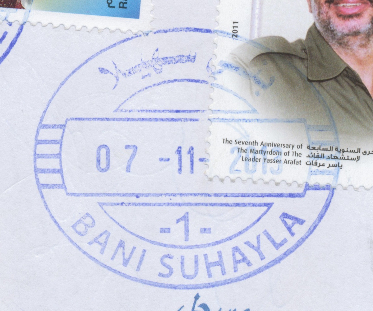
 Bani Suheyla © OpenStreetMap contributors, CC-BY-SA") | Bani Suheyla بني سهيله Bani Sehaela, Bani Suheila, Bani Suhayleh, Bani Suhayla | Pop.: 32,773 Govern.: Kha Opened: 1982 Postcode: 940 | |||||||||
| 31°21' N, 34°20' E OpenStreetMap Google Maps Wikipedia | City about 2 km E of Khan Yunis towards Abssan with a population of 32,773 (2006 estimate, 1997 Census: 23,016). The post office is situated on Al-Awda street near the Hamza mosque. A post office under control of the Israeli military occupation forces existed from 8.02.1968. | ||||||||||
| |||||||||||
 banisuheyla_131107_0460")
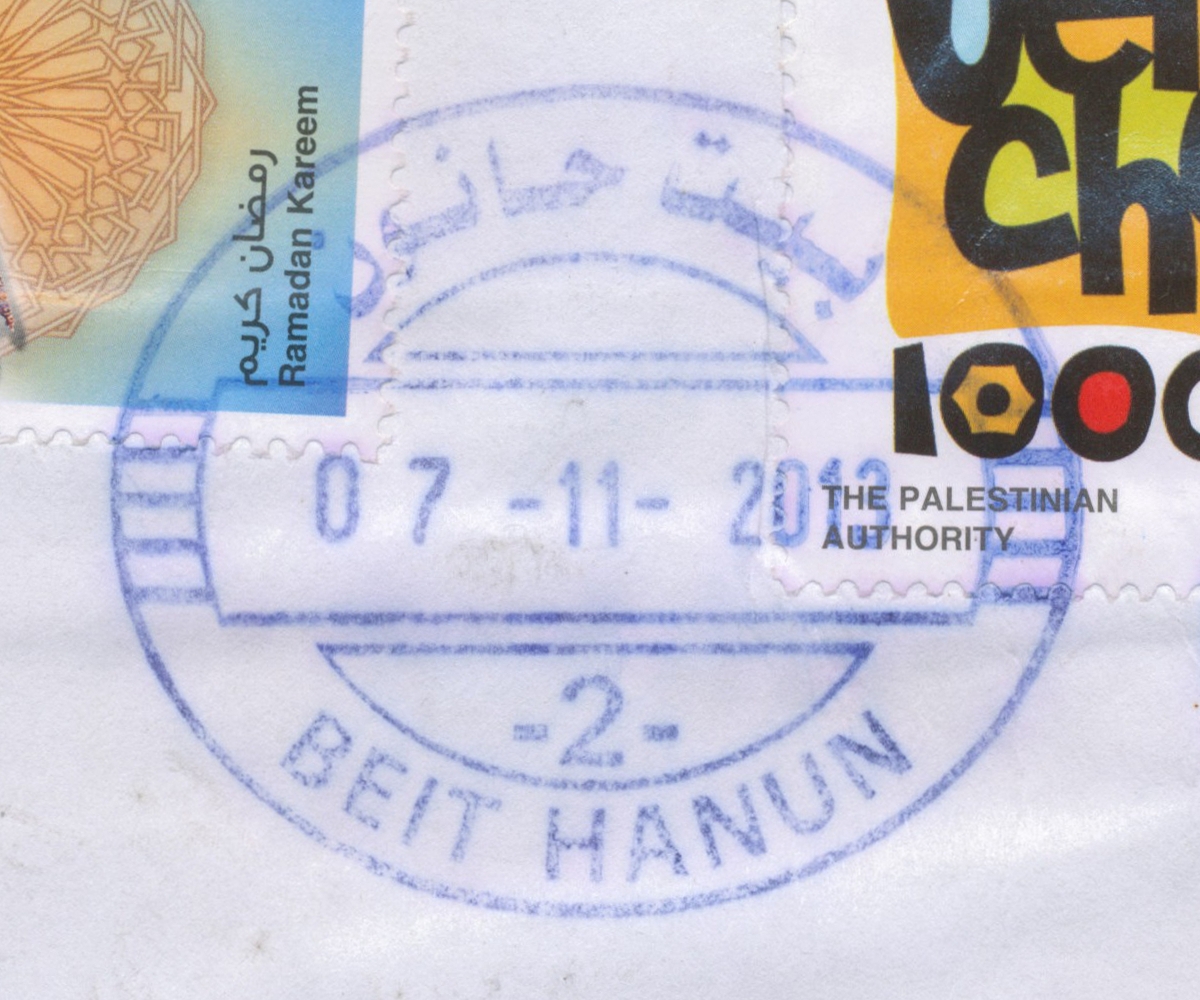
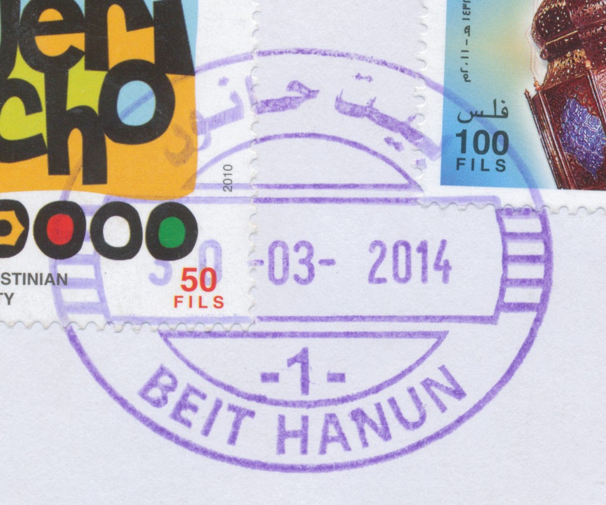
 Beit Hanun © OpenStreetMap contributors, CC-BY-SA") | Beit Hanun بيت حانون Beit Hanoun | Pop.: 32,187 Govern.: Gzn Opened: 1995 Postcode: 810 | |||||||||
| 31°32' N, 34°32' E OpenStreetMap Google Maps Wikipedia | City in the East of North Gaza Governorate, 5 km NE of Jabalya. There were 3,876 inhabitants in 1961, 20,780 in the 1997 Census, the 2006 midyear estimate is 32,187. Nearest other PNA post offices are in Jabalya Camp and Beit Lahia. A post office under control of the Israeli military occupation forces existed from 3.06.1973. The office moved to a newbuilt facility on 19.06.2011 (see MTIT) | ||||||||||
| |||||||||||
| |||||||||||
 beithanun2_131107_0463")
 beithanun1_140330_0465")
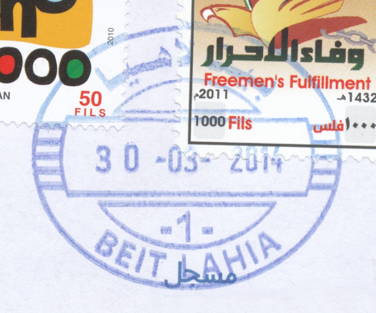
 Beit Lahia © OpenStreetMap contributors, CC-BY-SA") | Beit Lahia بيت لاهيا Beit Lahya, Beit Lahiya | Pop.: 59,540 Govern.: Gzn Opened: 1995 Postcode: 800 | |||||||||
| 31°33' N, 34°30' E OpenStreetMap Google Maps Wikipedia | City in North Gaza Governorate, about 3 km NE of Jabalya and next to Jabalya Camp. There were 38,441 inhabitants in the 1997 Census, the 2006 midyear estimate is 59,540. Nearest other PNA post offices are in Jabalya Camp and Beit Hanun. A post office under control of the Israeli military occupation forces existed from 3.06.1973. | ||||||||||
| |||||||||||
 beitlahia1_140330_0469")
") | |||||||||||
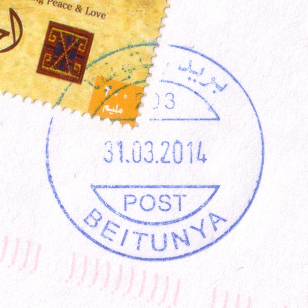
 Beitunya © OpenStreetMap contributors, CC-BY-SA") | Beitunya بيتونيا Betonia, Beituniya, Beitunia | Pop.: 19,761 Govern.: Ram Opened: 14.04.1963 PO Number: 203 Postcode: 630 | |||||||||
| 31°53' N, 35°10' E OpenStreetMap Google Maps Wikipedia | City about 3 km W of Ramallah with 19,761 inhabitants (2007 Census, 1997: 9,371). Jordanian authorities operated a post office (upgraded fronm a postal agency on 11.09.1965) between 14.04.1963 and 5.06.1967. A post office under control of the Israeli military occupation forces existed from 17.04.1968. The PNA office is next to the police station off Eissa Aleraqi street, just to the S of city hall. | ||||||||||
| |||||||||||
 beitunya203_140331_0445")
| |||||||||||||||
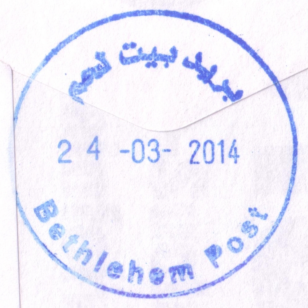
 Bethlehem © OpenStreetMap contributors, CC-BY-SA") | Bethlehem بيت لحم Beth Lehem, Beit Lahm | Pop.: 25,266 Govern.: Bet Opened: 1870 PO Number: 501 Postcode: 150 | |||||||||||||
| 31°42' N, 35°12' E OpenStreetMap Google Maps Wikipedia | Governorate capital with 25,266 inhabitants (Census 2007, 1997: 21,673) and a large Christian minority, dominated by tourism and trading. The post office is inbetween the municpal offices and Cairo-Amman Bank on the west side of Manger Square. The first post office in the city was opened by the Ottoaman authorities in 1870. An Egyptian office worked between 10.06.1948 and 11.10.1948. Jordanian authorities operated a post office (district main PO) between November 1948(exact date?) and 5.06.1967. A post office under control of the Israeli military occupation forces existed from 10.07.1967. | ||||||||||||||
| |||||||||||||||
 2006")
 2008")
 2008")
 April 2010")
 April 2010")
")
")
")
")

 bethlP_140324_0453")
| |||||||||||
") ") | |||||||||||
") | |||||||||||
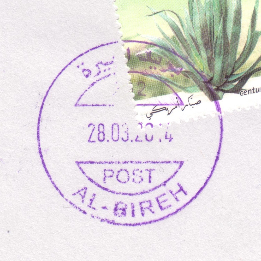
 Al Bireh © OpenStreetMap contributors, CC-BY-SA") | Al Bireh البيرة Al Biera, Al Bira, El Bira | Pop.: 38,202 Govern.: Ram Opened: 6.07.1952 PO Number: 202 Postcode: 610 | |||||||||
| 31°54' N, 35°13' E OpenStreetMap Google Maps Wikipedia | The largest city and capital of Ramallah & al-Bireh Governorate, just E of Ramallah itself, forming one contiguous conurbation. Population in Census 2007 was 38,202 (1997: 27,856, 1982: 13,037, 1945: ca. 3,000). The post office is in the "Palestine Post Building" (Directorate General of MTIT) on al-Muntazah street. An Ottoman office was first opened in 1910 . Jordanian authorities operated a post office (upgraded from a postal agency on 16.02.1956) between 6.07.1952 and 5.06.1967. A post office under control of the Israeli military occupation forces existed from 27.08.1967. | ||||||||||
| |||||||||||
 2009")
 2009")
 bireh202_140328_0457")
") | |||||||||||
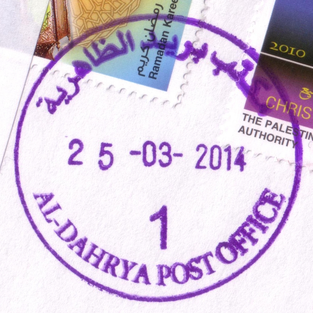
 Al Dahrya © OpenStreetMap contributors, CC-BY-SA") | Al Dahrya الظاهرية Al Thaherria, Adh Dhahiriya, Dahrya, ad-Dhahiriya, az-Zahiriya | Pop.: 28,776 Govern.: Heb Opened: 2.01.1971 PO Number: 404 Postcode: 790 | |||||||||
| 31°24' N, 34°58' E OpenStreetMap Google Maps Wikipedia | The third largest city in Hebron Governorate with 28,776 residents (Census 2007, 1997: 20,521), about 18 km SW of Hebron. Yatta to the E and Dura to the N are nearest other PNA offices. Jordanian authorities operated a postal agency between 13.02.1960 and 31.05.1967. A post office under control of the Israeli military occupation forces existed from 11.06.1974. | ||||||||||
| |||||||||||
 dahryaPO1_140325_0455")
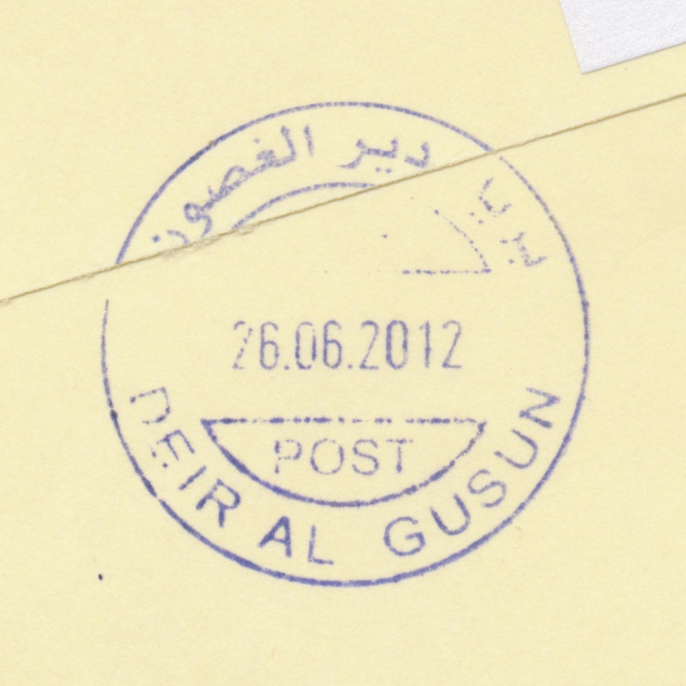
 Deir al Gusun © OpenStreetMap contributors, CC-BY-SA") | Deir al Gusun ديرالغصون Deir Alghesoon, Deir al-Ghusun | Pop.: 8,242 Govern.: Tul Opened: 1.06.1959 PO Number: 804 Postcode: 324 | |||||||||
| 32°21' N, 35°05' E OpenStreetMap Google Maps Wikipedia | Agricultural municipality in Tulkarm Governorate, 6 km NE of the muhfaza, with 8,424 inhabitants (Census 2007, 1997: 7055). Surrounding offices are Attil, Illar, Bala'a, and Tulkarm. Jordanian authorities operated a postal agency from 1.6.1959. A post office under control of the Israeli military occupation forces existed from 29.08.1967. | ||||||||||
| |||||||||||
 deiralgusun1_120626_0462")
") ") | |||||||||||
") ") | |||||||||||
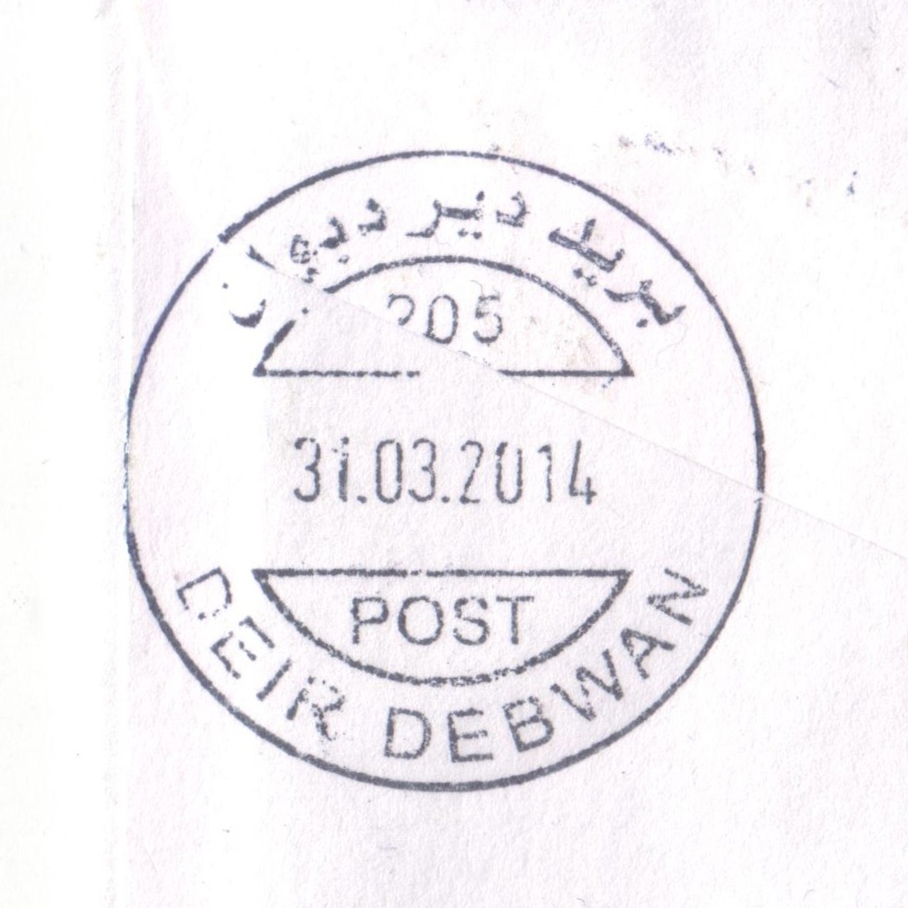
 Deir Debwan © OpenStreetMap contributors, CC-BY-SA") | Deir Debwan ديردبوان Deir Dibwan | Pop.: 5,252 Govern.: Ram Opened: 12.12.1960 PO Number: 205 PO Code: DRD Postcode: 640 | |||||||||
| 31°55' N, 35°16' E OpenStreetMap Google Maps Wikipedia | Trade-dominated city 7 km E of Ramallah. Population: 5,252 (Census 2007, 1997: 4,894). Jordanian authorities operated a post office (upgraded from a postal agency on 1.07.1963) between 12.12.1960 and 5.06.1967. A post office under control of the Israeli military occupation forces existed from 31.08.1967. | ||||||||||
| |||||||||||
 deirdebwan205_140331_0451")
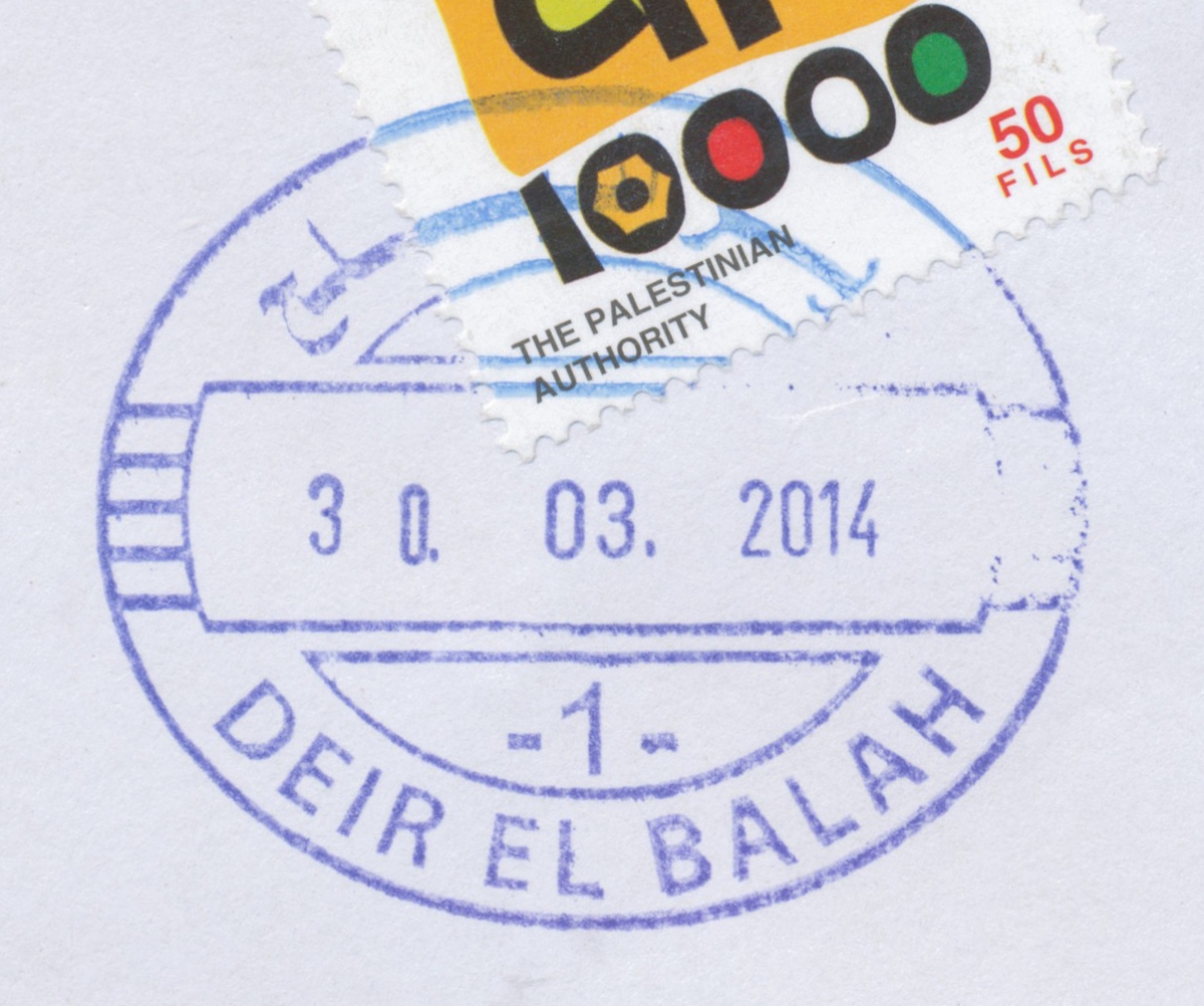
 Deir el Balah © OpenStreetMap contributors, CC-BY-SA") | Deir el Balah ديرالبلح Deir El Balah, Dir Elbalah, Deir Al-Balah | Pop.: 49,751 Govern.: Deb Opened: 1948 Postcode: 920 | |||||||||
| 31°25' N, 34°21' E OpenStreetMap Google Maps Wikipedia | Seat of the Governorate with 49,751 inhabitants in 2006 (mid-year estimate) and 42,839 in the 1997 Census. The neighbouring refugee camp has a further 12,004 residents. The post office is situated on al-Shuhadaa street opposite the Cairo-Amman bank. The town's first post office was opened in 1948 under Egyptian rule (TPO postmark). A post office under control of the Israeli military occupation forces existed from 20.07.1967. | ||||||||||
| |||||||||||
 direlbalah1_1403030_0466")
") | |||||||||||
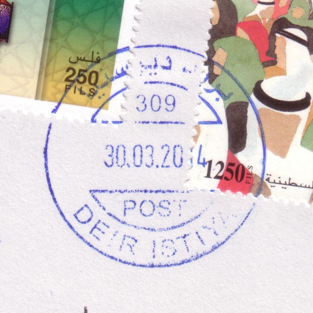
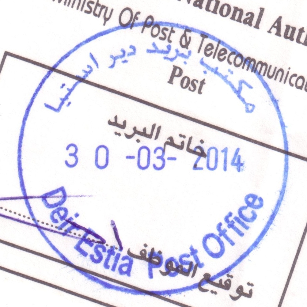
 Deir Istiya © OpenStreetMap contributors, CC-BY-SA") | Deir Istiya ديراستيا Deir Istiya, Deir Estia | Pop.: 3,146 Govern.: Sal Opened: 2005 PO Number: 309 Postcode: 388 | |||||||||
| 32°08' N, 35°08' E OpenStreetMap Google Maps Wikipedia | Agricultural village about 6 km NW of Salfit and 14 km SW of Nablus. Bidya is 6 km to the W. Population stnads at 3,146 (Census 2007, 1997: 2,802). Jordanian authorities operated a postal agency from 26.01.1963.. | ||||||||||
| |||||||||||
| |||||||||||
 deiristiya309_1403030_0458")
 deiristiyaPO_1403030_0459")
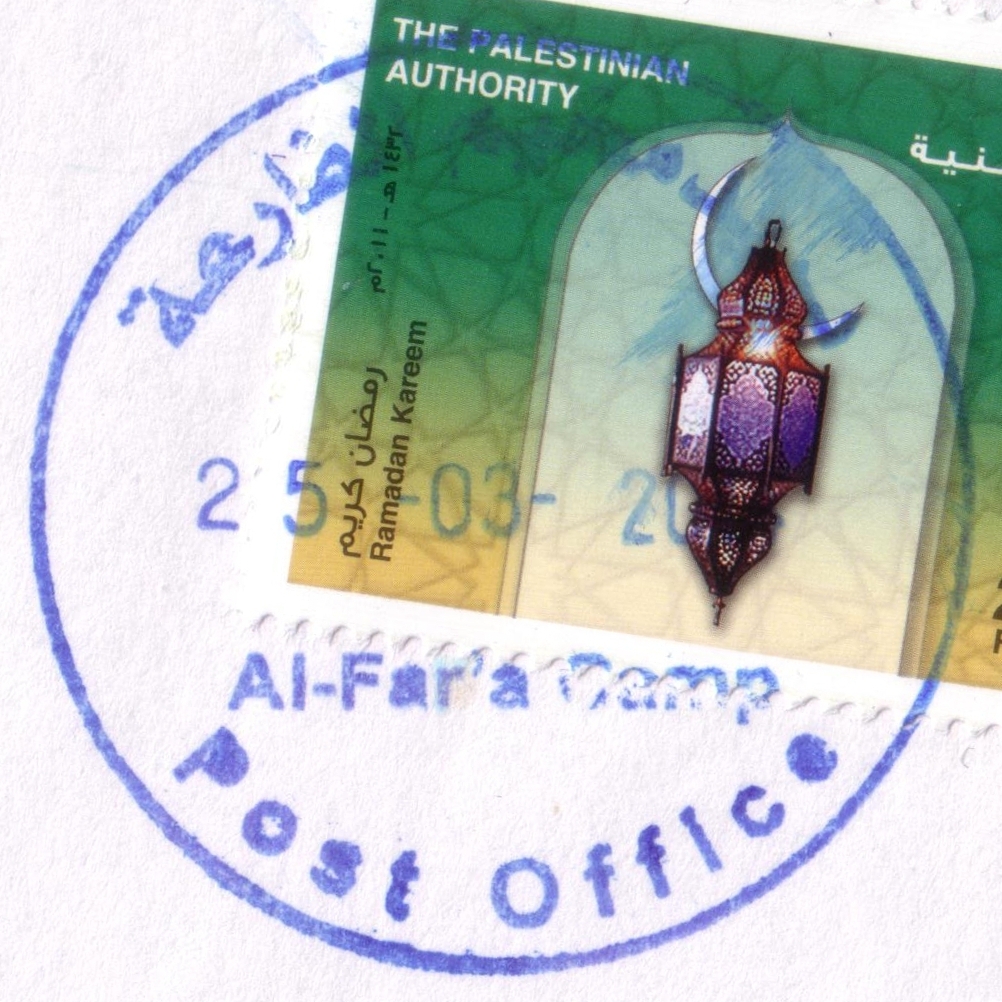
 Al Far'a Camp © OpenStreetMap contributors, CC-BY-SA") | Al Far'a Camp مخيم الفارعة El Far'a Camp, Mukhayyam al-Fari'ah | Pop.: 5,712 Govern.: Tub Opened: 27.06.1905 PO Number: 713 Postcode: 519 | |||||||||
| 32°17' N, 35°20' E OpenStreetMap Google Maps Wikipedia | Refugee camp situated between the Governorate capital Tubas to the NE and Asira ash-Shamaliya (in neighbouring Nablus Governorate) to the SW. Population according to the PCBS 2007 Census is 5,712, while 5,472 refugees were registered with UNRWA (1997: 4,367). The Post Office is situated on the southern entry to the camp, on the main road Tubas--Nablus. Jordanian authorities operated a postal agency from 3.05.1962. | ||||||||||
| |||||||||||
 alfar'aCampPO_140325_0456")
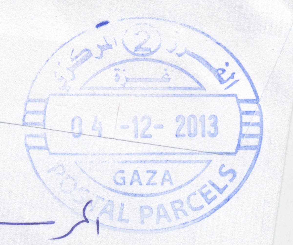
 Gaza, Central Sorting © OpenStreetMap contributors, CC-BY-SA") | Gaza, Central Sorting غزة - الفرزالمركزي Gaza, Central Sorting | Pop.: n/a Govern.: Gaz Opened: - Postcode: 860 | |||||||||
| 31°33' N, 34°27' E OpenStreetMap Google Maps Wikipedia | Central sorting facilty, situated in the Omar al-Mukhtar office. | ||||||||||
| |||||||||||
 gazapostalparcels2_131204_0470")
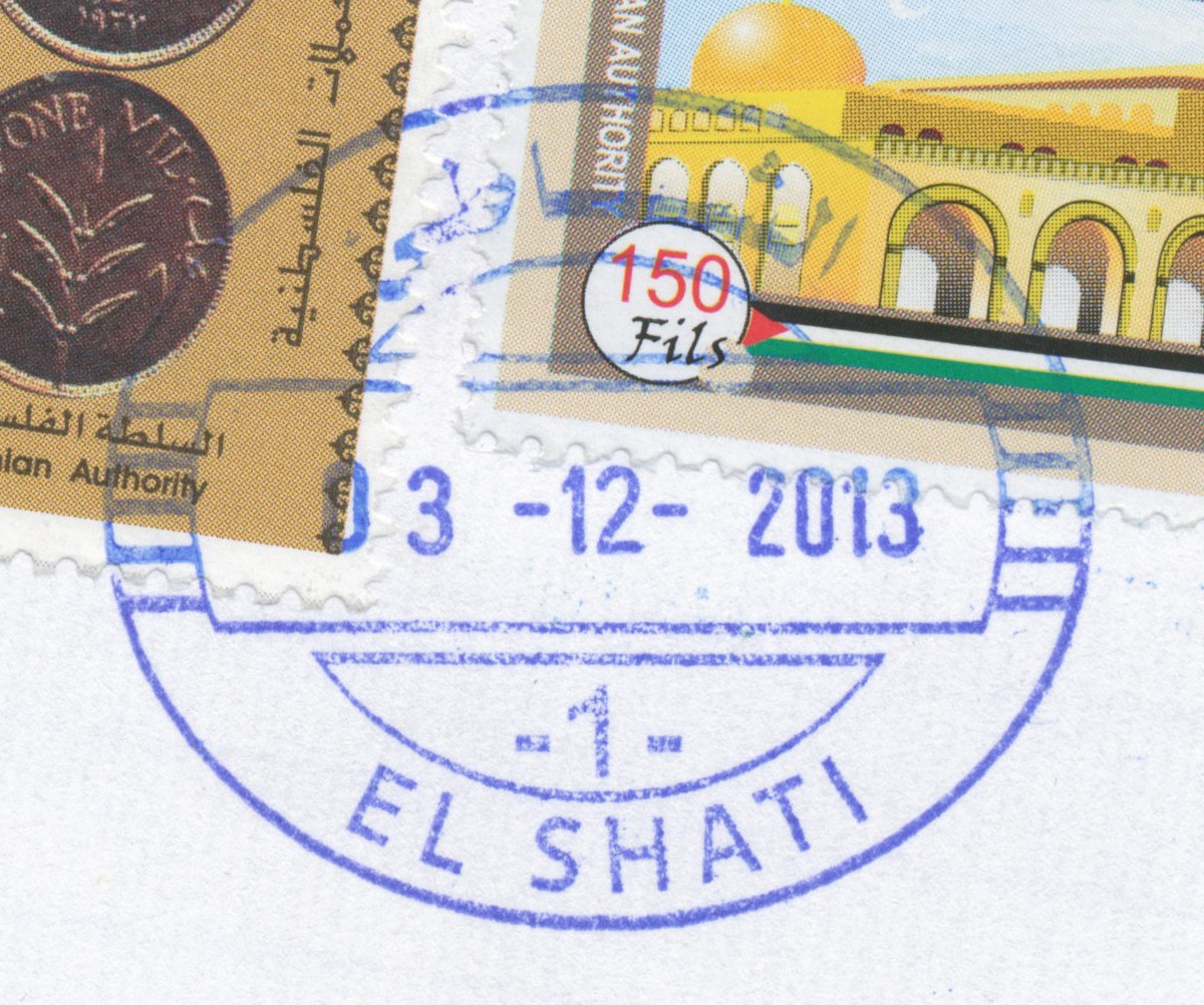
.jpg "post offices in Palestine: area map for (52) Gaza, Rimal (el-Shati) © OpenStreetMap contributors, CC-BY-SA") | Gaza, Rimal (el-Shati) غزة - مخيم الشاطىﺀ Gaza, Rimal, Alremal, Al Remal, El Shati, el-Shati Camp, Ash Shati' Camp | Pop.: n/a Govern.: Gaz Opened: 5.05.1905 Postcode: 849 | |||||||||
| 31°32' N, 34°27' E OpenStreetMap Google Maps Wikipedia | El-Shati is a refugee camp, also known as 'Beach Camp' to the N of Rimal district. Official 2006 estimate of its poluation is 87,158: UNRWA notes 82,000 registered refugees. An Egyptian office existed from 1952. A post office (Gaza Shati Camp 7) under control of the Israeli military occupation forces existed from 7.06.1973. | ||||||||||
| |||||||||||
 gazaShati_131203_0471")
") | |||||||||||
") ") | |||||||||||
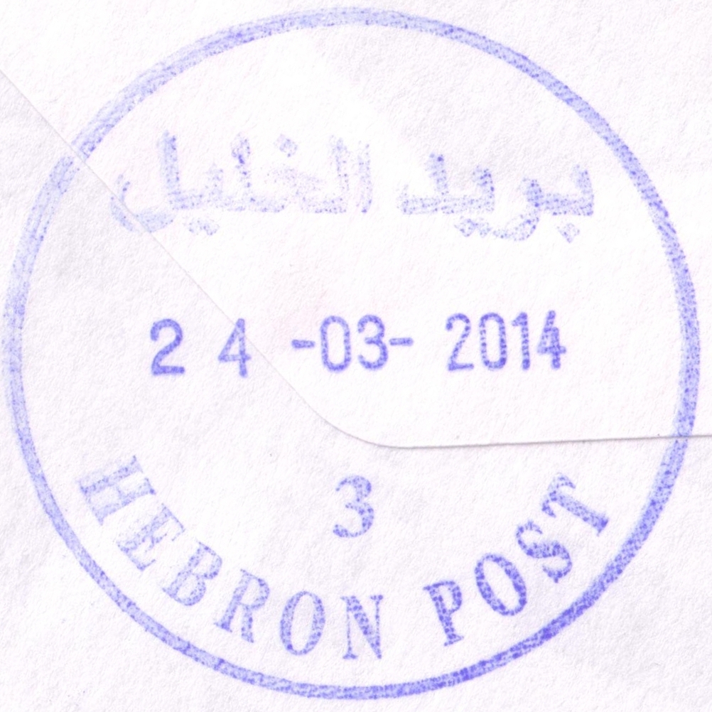
 Hebron © OpenStreetMap contributors, CC-BY-SA") | Hebron الخليل Hebron (Al Khalil) | Pop.: 163,146 Govern.: Heb Opened: 1870 PO Number: 401 Postcode: 706 | |||||||||
| 31°32' N, 35°06' E OpenStreetMap Google Maps Wikipedia | Major city and muhfaza. Population rose between 1997 and 2007 censuses from 119,093 to 163,146. The town's first post office was opened in 1870 under Ottoman control. Under Egyptian control, an office existed from 27.09.1948 to 23.02.1949. Jordanian authorities operated a post office (district main PO) between 23.06.1949 and 5.06.1967. A post office under control of the Israeli military occupation forces existed from 9.07.1967. The current PNA office is on Malik al-Faisal street | ||||||||||
| |||||||||||
 hebronP3_140324_0454")
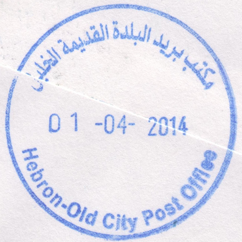
 Hebron, Old City © OpenStreetMap contributors, CC-BY-SA") | Hebron, Old City البلدة القديمة الخليل Hebron, Old City | Pop.: n/a Govern.: Heb Opened: - PO Number: 413 Postcode: 700 | |||||||||
| 31°31' N, 35°06' E OpenStreetMap Google Maps Wikipedia | Announced in July 2011 (see PalPost) this new office in the Old City of Hebron was opened on ?.07.2011 by the Minister of Post, the governor and other dignitaries, as part of a wider plan to position PNA government offices in the Old City to strengthen legitimate claims in this frontline district. | ||||||||||
| |||||||||||
 hebronoldcity_140401_0474")
") ") | |||||||||||
") | |||||||||||
 | |||||||||||
 Nablus © OpenStreetMap contributors, CC-BY-SA") | Nablus نابلس Nablus | Pop.: 126,132 Govern.: Nab Opened: 13.02.1865 PO Number: 301 Postcode: 400 | |||||||||
| 32°13' N, 35°16' E OpenStreetMap Google Maps Wikipedia | Governorate capital with 126,132 inhabitants (Census 2007, 1997: 100,034). The first post office in the city was operned in 1865 by the Ottoman authorities. Jordanian authorities operated a post office (district main PO) from (?)##. A post office under control of the Israeli military occupation forces existed from 13.07.1967, a 'Nablus Market Branch' (pmk: 'Nablus 3') opened 16.06.1971 but closed 31.03.1973. The current main office is on King Faisal road, next to PalTel and municipal offices. | ||||||||||
| |||||||||||
| |||||||||||
 nablus4_140325_0452")
 nablus3_140325_0464")
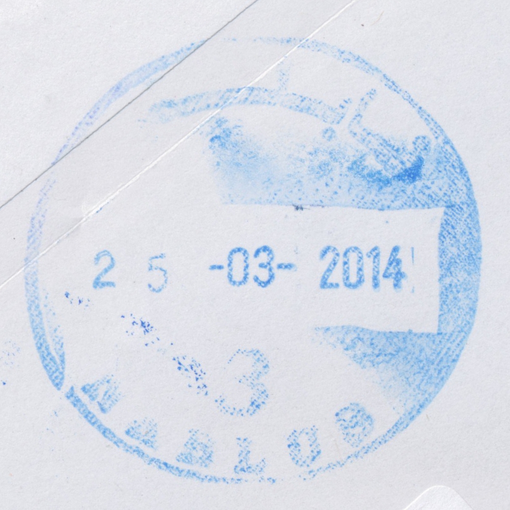
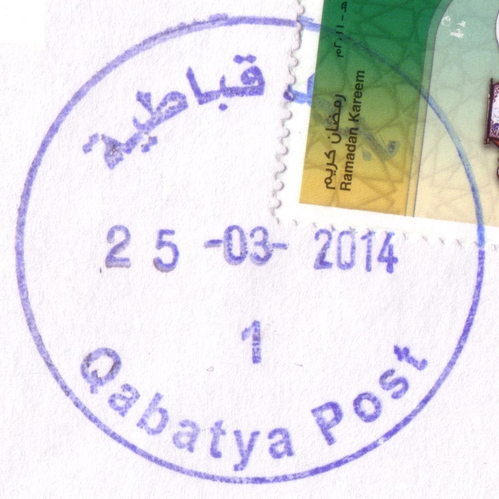
 Qabatya © OpenStreetMap contributors, CC-BY-SA") | Qabatya قباطية Qabatya, Qabatiya, Qabatia | Pop.: 19,197 Govern.: Jen Opened: 22.03.1976 PO Number: 702 Postcode: 220 | |||||||||
| 32°25' N, 35°17' E OpenStreetMap Google Maps Wikipedia | Town 5 km S of Jenin with a resident population that rose from 14,684 to 19,197 between the 1997 and 2007 Censuses. The office is in municipality buidings on Abu-Zaid street. Jordanian authorities operated a postal agency from 1.08.1963. A post office under control of the Israeli military occupation forces existed from 22.03.1976. Nearest other offices are Arraba and Zababdeh. | ||||||||||
| |||||||||||
 qabatya1_140325_0447")
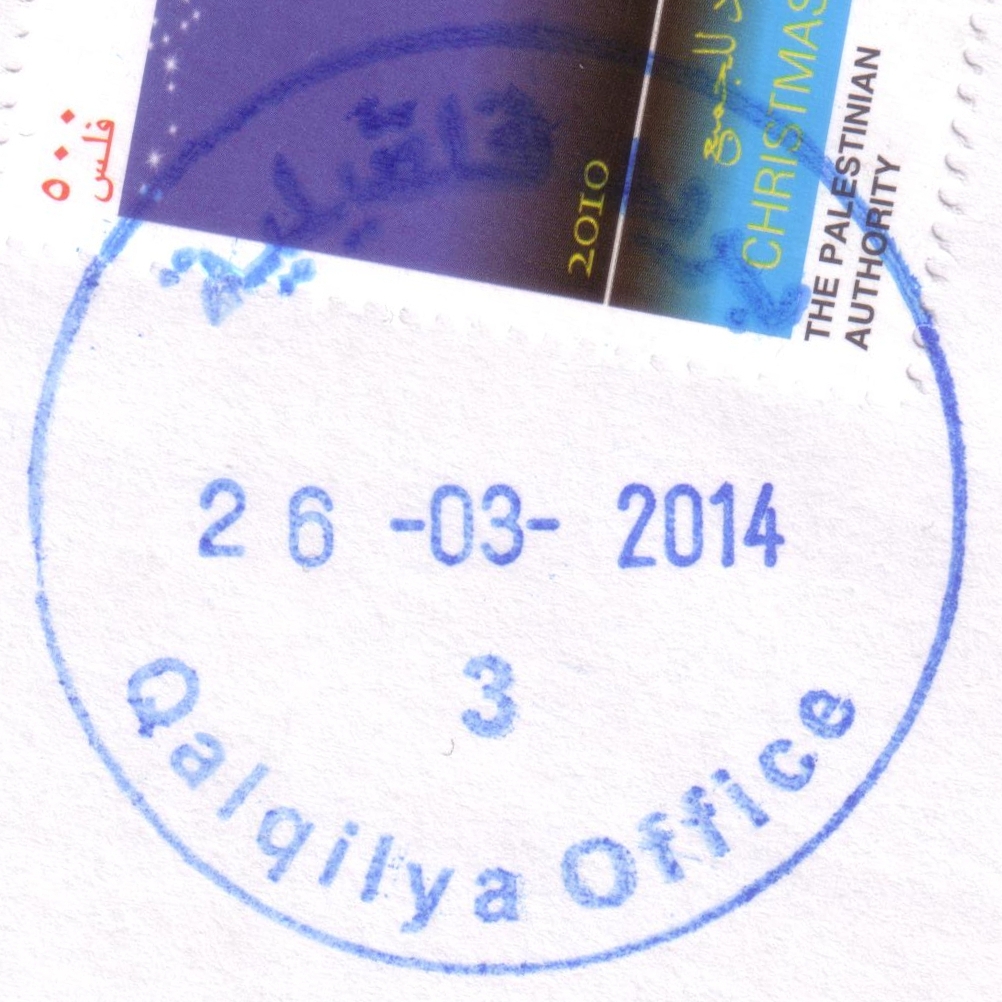
 Qalqilya © OpenStreetMap contributors, CC-BY-SA") | Qalqilya قلقيلية Qalqilia, Qalqiliya, Qulqilya, Qalqilyah | Pop.: 41,739 Govern.: Qal Opened: 1951 PO Number: 802 Postcode: 340 | |||||||||
| 32°11' N, 34°58' E OpenStreetMap Google Maps Wikipedia | Governorate muhfaza with 41,729 residents in 2007 (1997: 31,753) almost entrirely surrounded by the Apartheid Wall. The office is in the Nazzal neighbourhood near al-Quds Open University's study center on Nablus street. Jordanian authorities operated a post office from 1951. A post office under control of the Israeli military occupation forces existed from 21.08.1967. | ||||||||||
| |||||||||||
 qalqilya3_140326_0448")
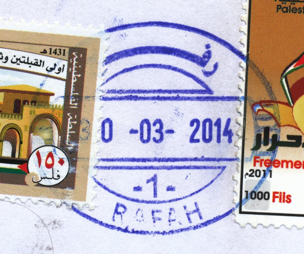
 Rafah © OpenStreetMap contributors, CC-BY-SA") | Rafah رفح Rafah | Pop.: 71,003 Govern.: Raf Opened: 1948 Postcode: 980 | |||||||||
| 31°16' N, 34°16' E OpenStreetMap Google Maps Wikipedia | Governorate capital, the city itself has a population of 71,003, with Rafah camp adding a further 59,983 (2006 PCBS estimates, both aggregated: 130,986, 1997 Census: 91,931). The post office is situated on Omar bin al-Khataab street between al-Masri tower and city hall. An Egyptian office operated here from 1948--1967. A post office under control of the Israeli military occupation forces existed from 23.07.1967. | ||||||||||
| |||||||||||
 rafah1_140330_0467")
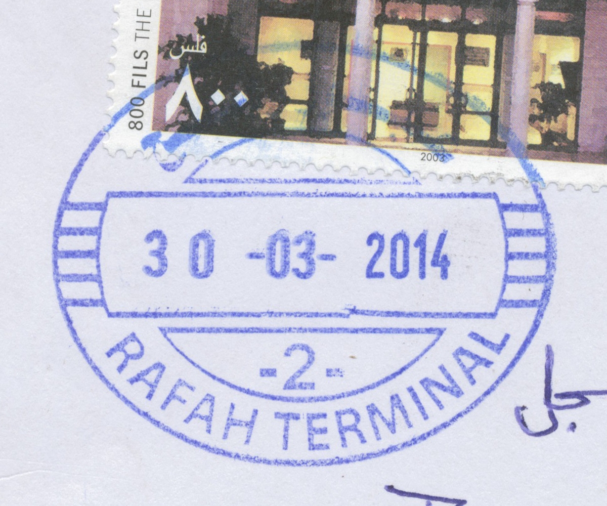
 Rafah, Terminal © OpenStreetMap contributors, CC-BY-SA") | Rafah, Terminal عبور رفح Rafah, Terminal Rafah, Al Awda Crossing, Alawda Crossing, Rafah Crossing | Pop.: n/a Govern.: Raf Opened: 1.10.1995 Postcode: 980 | |||||||||
| 31°15' N, 34°16' E OpenStreetMap Google Maps Wikipedia | Border office at the Rafah Crossing, serving travellers to and from Egypt. First opened in 1995. A planned post office in the nearby airport has apparently never operated. | ||||||||||
| |||||||||||
 rafahterminal2_140330_0468")
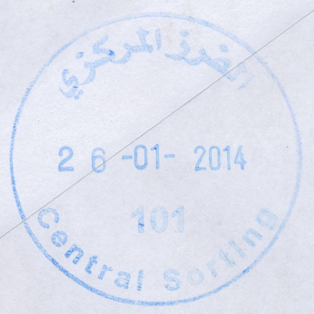
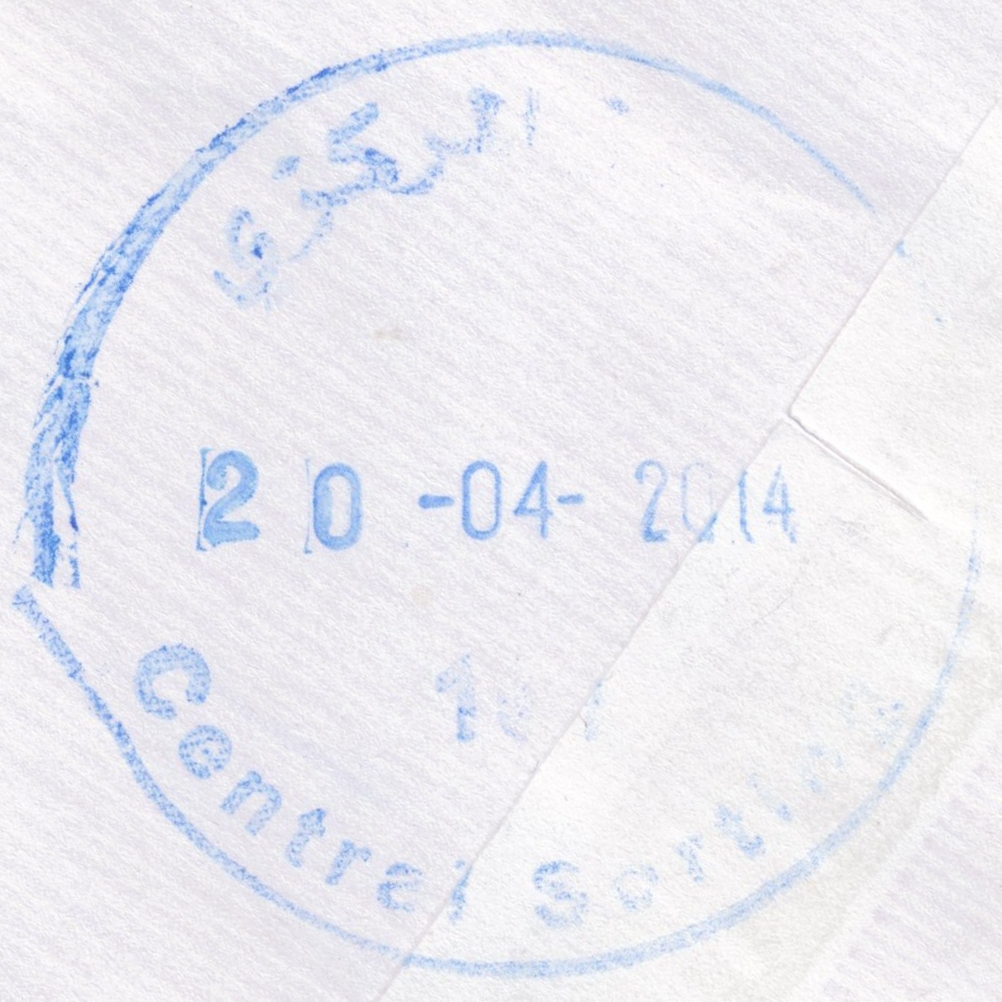
 Ramallah, Central Sorting © OpenStreetMap contributors, CC-BY-SA") | Ramallah, Central Sorting الفرز المركزي Ramallah, Central Sorting | Pop.: n/a Govern.: Ram Opened: 1997 PO Number: 101 Postcode: 600 | |||||||||
| 31°54' N, 35°13' E OpenStreetMap Google Maps Wikipedia | Central sorting facilty in the Directorate General, al-Muntazah street, in al-Bireh. | ||||||||||
| |||||||||||
| |||||||||||
 censort101_140126_0461")
 censort101_140420_0473")
 April 2010") | |||||||||||
") ") | |||||||||||
") ") | |||||||||||
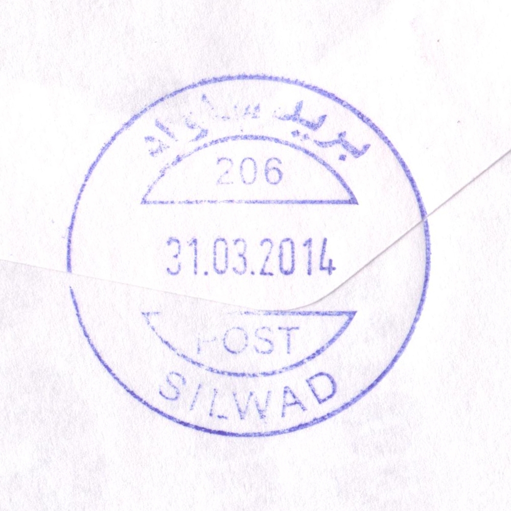
 Silwad © OpenStreetMap contributors, CC-BY-SA") | Silwad سلواد Selwad | Pop.: 6,123 Govern.: Ram Opened: 4.02.1976 PO Number: 206 Postcode: 650 | |||||||||
| 31°59' N, 35°16' E OpenStreetMap Google Maps Wikipedia | Municipality in Ramallah & al-Bireh Governorate about 10 km NE of the muhfaza. Population rose frim 5,121 to 6,123 beteen the 1997 and 2007 censuses. Jordanian authorities operated a postal agency between 17.03.1962 and 5.06.1967. A post office under control of the Israeli military occupation forces existed from 4.02.1976. The PNA post office is in town hall (municipality building). Nearest other offices are al-Taybeh, al-Mazra aesh-Sharqiya, and Bir Zeit. | ||||||||||
| |||||||||||
 silwad206_140331_0450")
 April 2010") | |||||||||||
") ") | |||||||||||
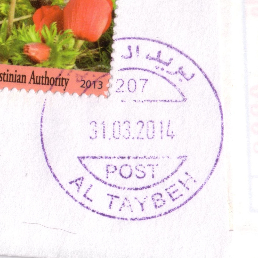
 Al Taybeh © OpenStreetMap contributors, CC-BY-SA") | Al Taybeh الطيبة Al Taiba, Ataybeh, At Tayba | Pop.: 1,452 Govern.: Ram Opened: 6.03.1960 PO Number: 207 Postcode: 464 | |||||||||
| 31°57' N, 35°18' E OpenStreetMap Google Maps Wikipedia | Christian village 11 km NE of the Ramallah/al-Bireh conurbation with only 1,452 inhabitants (2007 Census, 1997: 1,496). Jordanian authorities operated a post office (upgraded from a postal agency on 4.09.1965) between 6.03.1960 and 5.06.1967. A new building was erected in 2009 on the main road just N of al-Lateen church. Silwad is 3 km to the W, with al-Mazra aesh-Sharqiya further to the N and Deir Debwan to the S. | ||||||||||
| |||||||||||
 taybeh207_140331_0444")
 Tubas © OpenStreetMap contributors, CC-BY-SA") | Tubas طوباس Tobas, Toubas | Pop.: 16,154 Govern.: Tub Opened: 1952 PO Number: 305 Postcode: 500 | |||||||||
| 32°19' N, 35°22' E OpenStreetMap Google Maps Wikipedia | Governorate muhfaza with 16,154 residents in the 2007 Census, up 37% from the previous census in 1997 (11,760). Jordanian authorities operated a post office (upgraded from a postal agency on 11.6.1960) from 1952(?)##. The office continues in the same building on Main Street (near the municipality), together with the PalTel offices. The nearest post office in the Governorate is al-Far'a Camp 4 km to the SW with al-Zababdeh 8 km towards Jenin in the N. A post office under control of the Israeli military occupation forces existed from 24.08.1967. | ||||||||||
| |||||||||||
 tubasPO1_140325_0449")
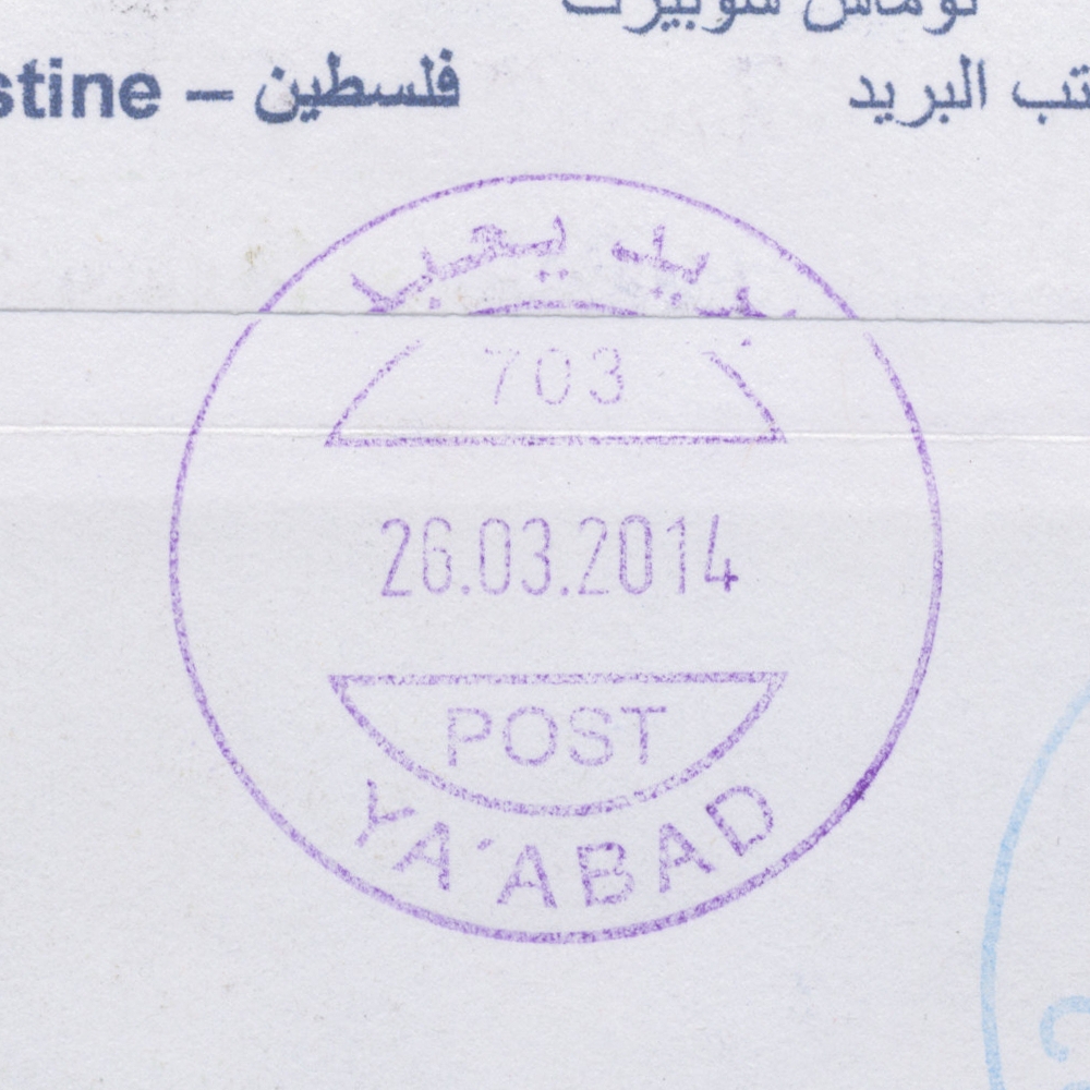
 Yaabad © OpenStreetMap contributors, CC-BY-SA") | Yaabad يعبد Yabod, Yabad, Ya'bad | Pop.: 13,640 Govern.: Jen Opened: 1963 PO Number: 703 Postcode: 250 | |||||||||
| 32°27' N, 35°10' E OpenStreetMap Google Maps Wikipedia | Agricultural town 13 km W of Jenin. Between the 1997 and 2007 censuses its population increased from 10,756 to 13,640. The office is opposite the municipality building. Jordanian authorities operated a post office (upgraded from a postal agency on 11.07.1960) from (?) . A post office under control of the Israeli military occupation forces existed from 3.09.1967.Surrounding office include al-Kafreyat, Arraba, Baqa esh-Sharqiyah, and Qafen. | ||||||||||
| |||||||||||
 yaabad703_140326_0472")

