") | |||||||||||
") ") | |||||||||||
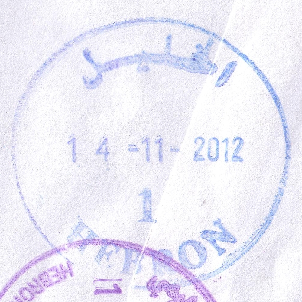
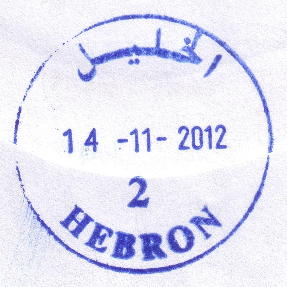
 Hebron © OpenStreetMap contributors, CC-BY-SA") | Hebron الخليل Hebron (Al Khalil) | Pop.: 163,146 Govern.: Heb Opened: 1870 PO Number: 401 Postcode: 706 | |||||||||
| 31°32' N, 35°06' E OpenStreetMap Google Maps Wikipedia | Major city and muhfaza. Population rose between 1997 and 2007 censuses from 119,093 to 163,146. The town's first post office was opened in 1870 under Ottoman control. Under Egyptian control, an office existed from 27.09.1948 to 23.02.1949. Jordanian authorities operated a post office (district main PO) between 23.06.1949 and 5.06.1967. A post office under control of the Israeli military occupation forces existed from 9.07.1967. The current PNA office is on Malik al-Faisal street | ||||||||||
| |||||||||||
| |||||||||||
 hebron1_121114_0405")
 hebron2_121114_0406")
") | |||||||||||
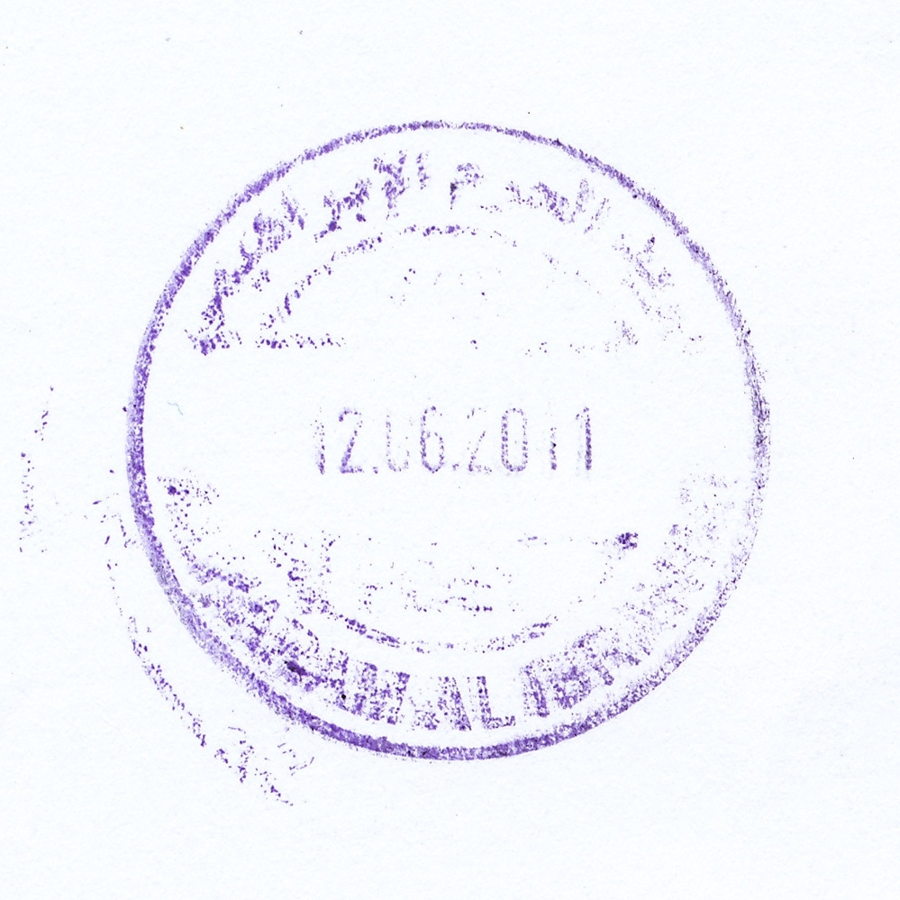
 Hebron, Haram Ibrahimi © OpenStreetMap contributors, CC-BY-SA") | Hebron, Haram Ibrahimi الخليل - الحرم الابراهيمي Hebron, Al Haram Al Ibrahimi | Pop.: n/a Govern.: Heb Opened: 10.02.2002 PO Number: 409 Postcode: 703 | |||||||||
| 31°31' N, 35°07' E OpenStreetMap Google Maps Wikipedia | Just SE of Hebron city centre, site of the Ibrahimi mosque (Tomb of the Patriarchs). | ||||||||||
| |||||||||||
 hebronHI1_110612_0407")
| |||||||||||||||
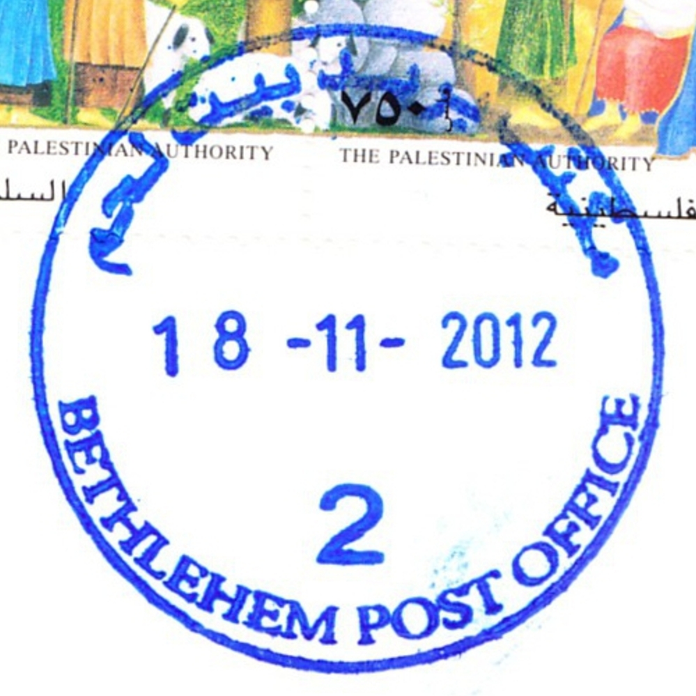
 Bethlehem © OpenStreetMap contributors, CC-BY-SA") | Bethlehem بيت لحم Beth Lehem, Beit Lahm | Pop.: 25,266 Govern.: Bet Opened: 1870 PO Number: 501 Postcode: 150 | |||||||||||||
| 31°42' N, 35°12' E OpenStreetMap Google Maps Wikipedia | Governorate capital with 25,266 inhabitants (Census 2007, 1997: 21,673) and a large Christian minority, dominated by tourism and trading. The post office is inbetween the municpal offices and Cairo-Amman Bank on the west side of Manger Square. The first post office in the city was opened by the Ottoaman authorities in 1870. An Egyptian office worked between 10.06.1948 and 11.10.1948. Jordanian authorities operated a post office (district main PO) between November 1948(exact date?) and 5.06.1967. A post office under control of the Israeli military occupation forces existed from 10.07.1967. | ||||||||||||||
| |||||||||||||||
 2006")
 2008")
 2008")
 April 2010")
 April 2010")
")
")
")
")

 bethlPO2_121118_0408")