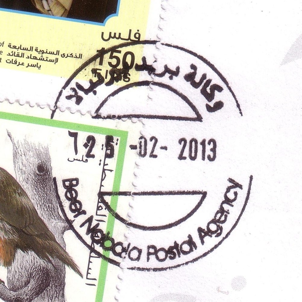
 Ber Nabala © OpenStreetMap contributors, CC-BY-SA") | Ber Nabala بيرنبالا Beir Nbala, Bir Nabala, Beer Nabala | Pop.: 4,817 Govern.: Jer Opened: 22.09.2001 PO Number: 107 Postcode: 121 | |||||||||
| 31°51' N, 35°12' E OpenStreetMap Google Maps Wikipedia | Municipality in the J1 area of Jerusalem Governorate, right inbetween Biddu and al-Ram, just S of Qalandia. The village has 4,817 inhabitants according to the 2007 Census (1997: 4,499, 1987: 1,385, 1961: 580). Jordanian authorities operated a postal agency between 13.01.1966 and 1.06.1967. The current post office is in town hall (a post box is opposite, a new building is planned since 2008) and serves also the surrounding villages al-Jib, Judeira, Qalandia, and Beit Hanina. In March 2012 is was announced that the post office and its staff would transfer to the control of the municipal council and change status to a postal agency. The Postal Agency opened on 25.02.2013. | ||||||||||
| |||||||||||
 bernabalaPA_130225_0418")
| |||||||||||||||
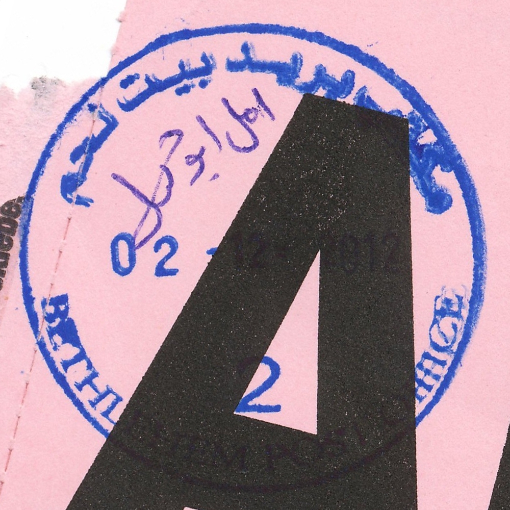
 Bethlehem © OpenStreetMap contributors, CC-BY-SA") | Bethlehem بيت لحم Beth Lehem, Beit Lahm | Pop.: 25,266 Govern.: Bet Opened: 1870 PO Number: 501 Postcode: 150 | |||||||||||||
| 31°42' N, 35°12' E OpenStreetMap Google Maps Wikipedia | Governorate capital with 25,266 inhabitants (Census 2007, 1997: 21,673) and a large Christian minority, dominated by tourism and trading. The post office is inbetween the municpal offices and Cairo-Amman Bank on the west side of Manger Square. The first post office in the city was opened by the Ottoaman authorities in 1870. An Egyptian office worked between 10.06.1948 and 11.10.1948. Jordanian authorities operated a post office (district main PO) between November 1948(exact date?) and 5.06.1967. A post office under control of the Israeli military occupation forces existed from 10.07.1967. | ||||||||||||||
| |||||||||||||||
 2006")
 2008")
 2008")
 April 2010")
 April 2010")
")
")
")
")

 bethlPO2_121202_0413")
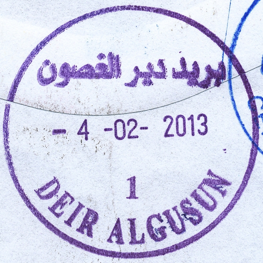
 Deir al Gusun © OpenStreetMap contributors, CC-BY-SA") | Deir al Gusun ديرالغصون Deir Alghesoon, Deir al-Ghusun | Pop.: 8,242 Govern.: Tul Opened: 1.06.1959 PO Number: 804 Postcode: 324 | |||||||||
| 32°21' N, 35°05' E OpenStreetMap Google Maps Wikipedia | Agricultural municipality in Tulkarm Governorate, 6 km NE of the muhfaza, with 8,424 inhabitants (Census 2007, 1997: 7055). Surrounding offices are Attil, Illar, Bala'a, and Tulkarm. Jordanian authorities operated a postal agency from 1.6.1959. A post office under control of the Israeli military occupation forces existed from 29.08.1967. | ||||||||||
| |||||||||||
 deiralgusun1_130204_0415")
") | |||||||||||
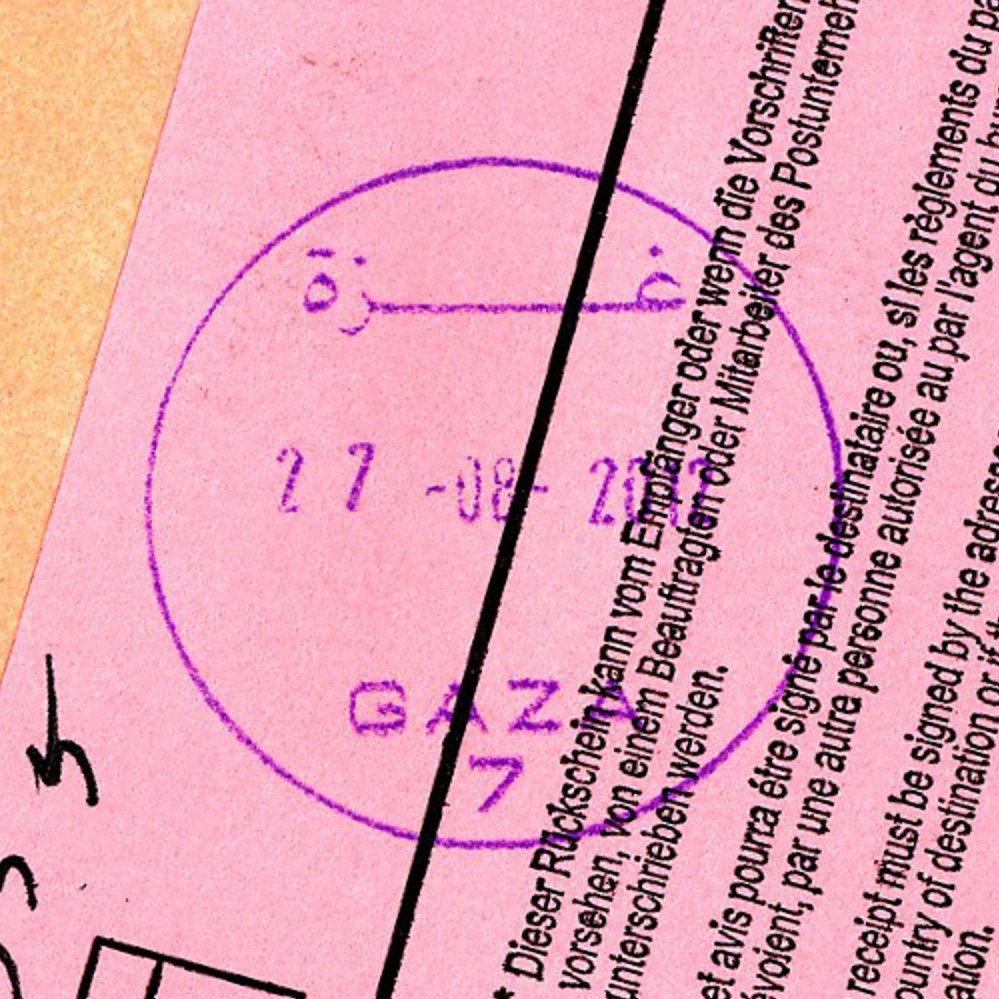
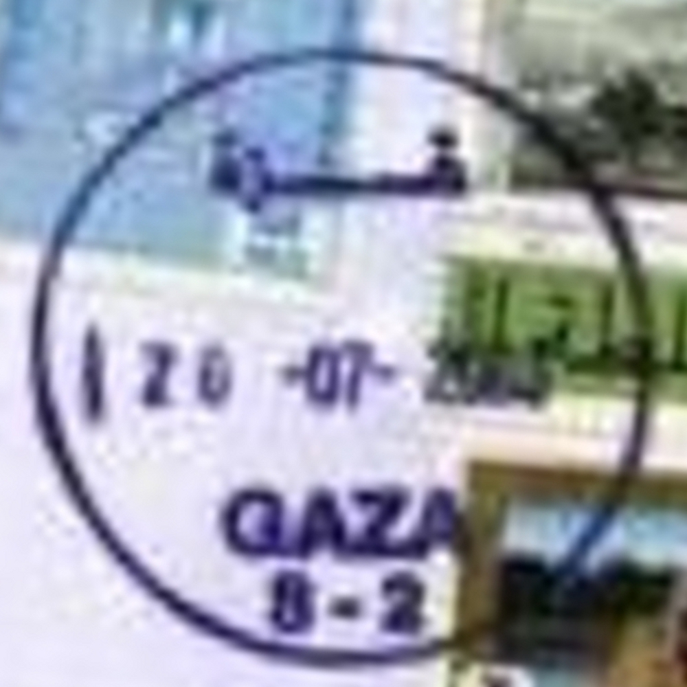
 Gaza, Omer El Mokhtar © OpenStreetMap contributors, CC-BY-SA") | Gaza, Omer El Mokhtar غزة - عمرالمختار Gaza, Omer El Mokhtar | Pop.: 409680 Govern.: Gaz Opened: 17.10.1996 PO Number: 909 Postcode: 850 | |||||||||
| 31°33' N, 34°27' E OpenStreetMap Google Maps Wikipedia | Governorate capital with a population of 409,680 (2006 mid-yearestimate). The first post office was opened in 1865 by the Ottoman authorities. A post office (New Gaza 5) under control of the Israeli military occupation forces existed from 9.04.1968. The city's main post office is in the MTIT building on Omar al-Mukhtar Street between Abu Khadra mosque and the municipal park. From 4.11.2012, the office moved temporaily to the Government Computer Complex building Abu Khadra. The PO was re-opened on 12.02.2013 with an official ceremony on 26.02.2013 (5.03.2013?). | ||||||||||
| |||||||||||
| |||||||||||
 gaza7_120827_412")
 gaza8-2_050720_0409")
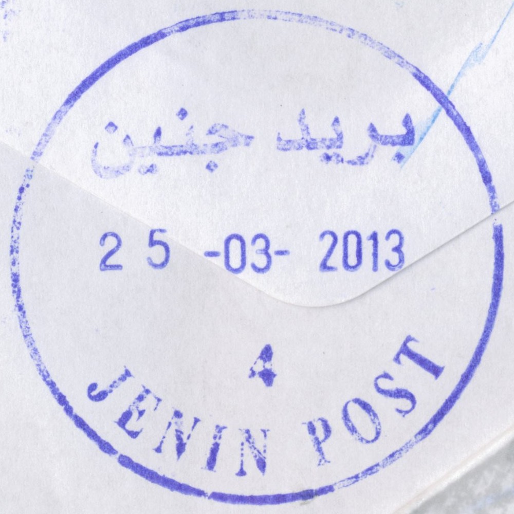
 Jenin © OpenStreetMap contributors, CC-BY-SA") | Jenin جنين Jenin | Pop.: 39,004 Govern.: Jen Opened: 1904 PO Number: 701 Postcode: 200 | |||||||||
| 32°28' N, 35°18' E OpenStreetMap Google Maps Wikipedia | City with adjacent refugee camp (established in 1953), muhfaza, with a population of 49,375 (39,004+10,371) according to the 2007 Census, whereas in 1997 it stood at 35,754 (26,650 + 9,104). The first PO was opened by Ottoman authorities in 1904. Jordanian authorities operated a post office (district main PO) from ### and also a postal agency existed in Jenin Camp from 21.08.1966. A post office under control of the Israeli military occupation forces existed from 17.07.1967. | ||||||||||
| |||||||||||
 jeninP4_130325_0417")
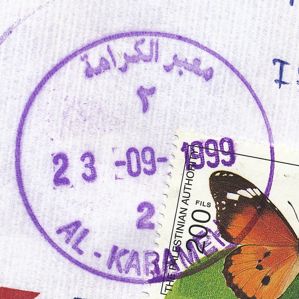
 Al Karameh © OpenStreetMap contributors, CC-BY-SA") | Al Karameh معبر الكرامة Karama Crossing, Al Karameh, Terminal Al Karameh | Pop.: n/a Govern.: Ari Opened: 25.03.1999 PO Number: 602 Postcode: 589 | |||||||||
| 31°52' N, 35°32' E OpenStreetMap Google Maps Wikipedia | Border office near Allenby Bridge (a.k.a. Karameh or King Hussein Bridge) serving travellers to and from Jordan. A post office under control of the Israeli military occupation forces existed from 15.07.70 as 'Gesher Allenby'. Opened in 1999, the PNA office was closed between September 2001 and July 2007. In 1918 the British-built Allenby bridge replaced the older Ottoman bridge, the current structure was built in the 1990s. | ||||||||||
| |||||||||||
 karameh2_990923_0410")
 2006") | |||||||||||
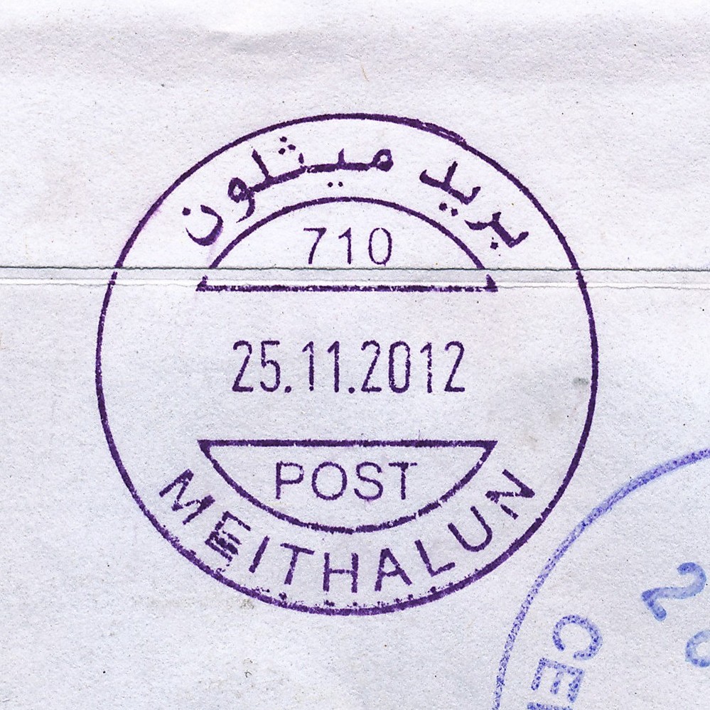
 Meithalun © OpenStreetMap contributors, CC-BY-SA") | Meithalun ميثلون Maythelon, Meithalon | Pop.: 6,955 Govern.: Jen Opened: 6.03.2003 PO Number: 710 Postcode: 290 | |||||||||
| 32°21' N, 35°16' E OpenStreetMap Google Maps Wikipedia | Town in Jenin Governorate, 13 km equidistant to Nablus in the S and Jenin in the N. Population was 6,955 in the 2007 Census (1997: 5,218). The PO is in the municipality buiding (town hall). Jordanian authorities operated a postal agency from 26.03.1963. | ||||||||||
| |||||||||||
 meithalun701_121125_0411")
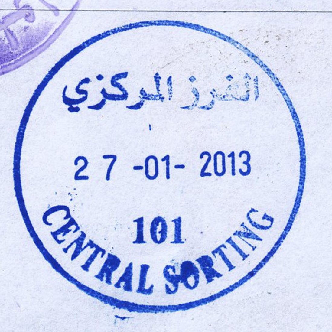
 Ramallah, Central Sorting © OpenStreetMap contributors, CC-BY-SA") | Ramallah, Central Sorting الفرز المركزي Ramallah, Central Sorting | Pop.: n/a Govern.: Ram Opened: 1997 PO Number: 101 Postcode: 600 | |||||||||
| 31°54' N, 35°13' E OpenStreetMap Google Maps Wikipedia | Central sorting facilty in the Directorate General, al-Muntazah street, in al-Bireh. | ||||||||||
| |||||||||||
 censort101_130127_0414")
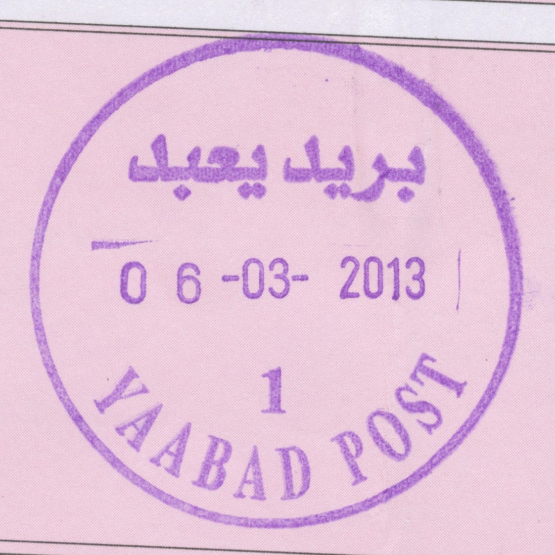
 Yaabad © OpenStreetMap contributors, CC-BY-SA") | Yaabad يعبد Yabod, Yabad, Ya'bad | Pop.: 13,640 Govern.: Jen Opened: 1963 PO Number: 703 Postcode: 250 | |||||||||
| 32°27' N, 35°10' E OpenStreetMap Google Maps Wikipedia | Agricultural town 13 km W of Jenin. Between the 1997 and 2007 censuses its population increased from 10,756 to 13,640. The office is opposite the municipality building. Jordanian authorities operated a post office (upgraded from a postal agency on 11.07.1960) from (?) . A post office under control of the Israeli military occupation forces existed from 3.09.1967.Surrounding office include al-Kafreyat, Arraba, Baqa esh-Sharqiyah, and Qafen. | ||||||||||
| |||||||||||
 yaabadP1_130306_0416")